
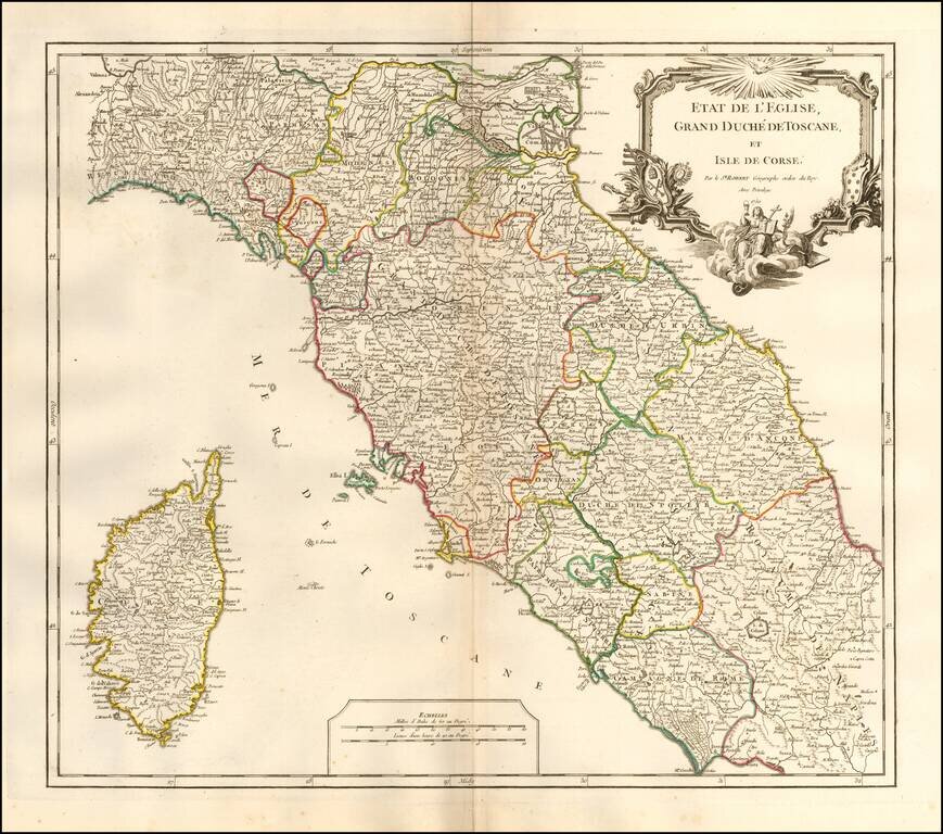
Interesting regional map of Central Italy, Tuscany and Corsica, from an early edition of DeVaugondy's Atlas Universel. Includes towns, mountains, rivers, lakes and a host of other details. De Vaugondy's Atlas Universel was one of the most...
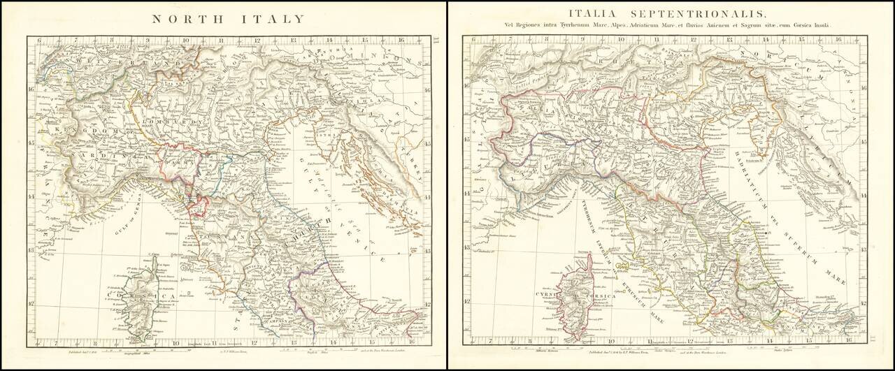
Interesting pair of maps of the northern part of Italy and Corsica, showing the ancient and modern features. The pair of maps was prepared by Arrowsmith in an atlas intended to provide a comparison of ancient and modern regions.
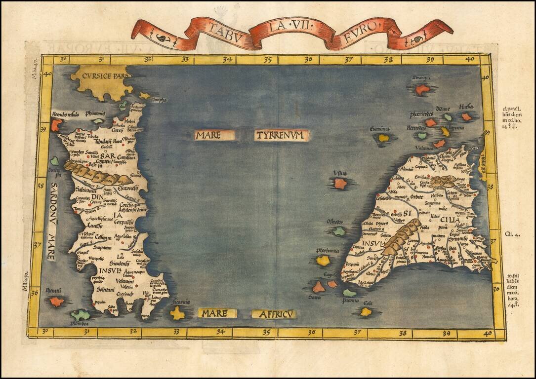
Nice example of the 1525 edition of Lorenz Fries map of Sicily and Sardinia. First published in Strasbourg by Johannes Gruninger in 1522, Fries map is based upon Waldseemuller's map of 1513.
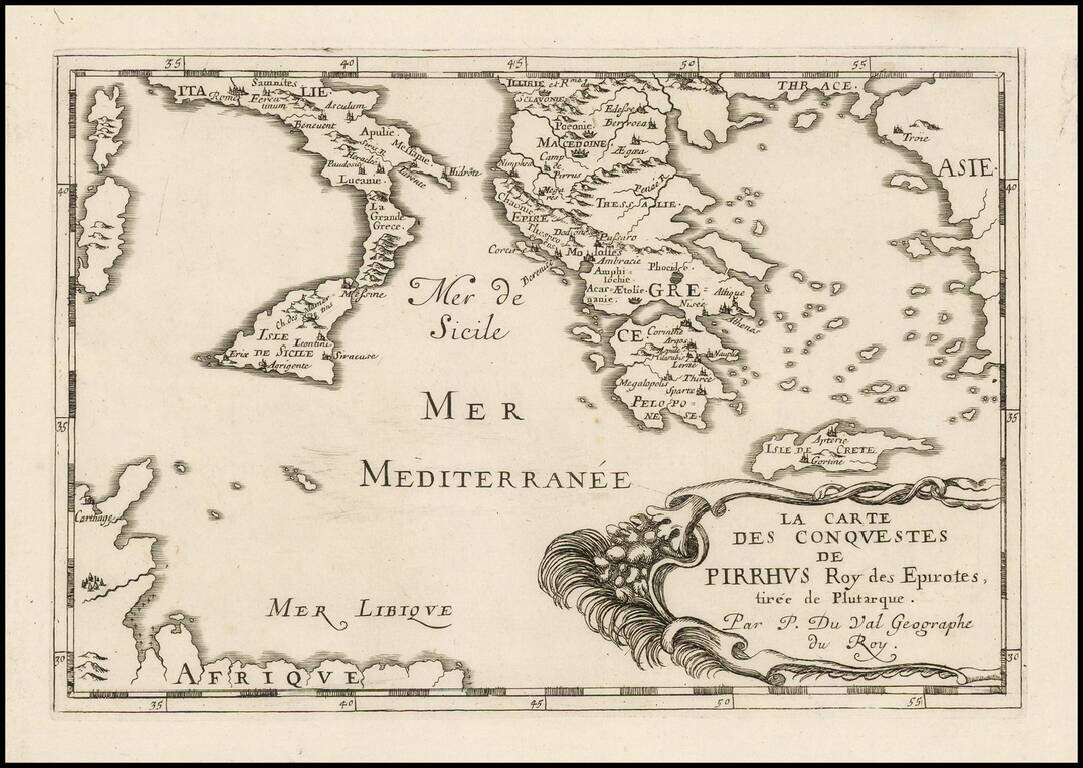
Antique engraved map of the conquests of Pyrrhus of Epirus, covering Greece, Southern Italy, and Sicily. The map was published in Paris in 1660 by Pierre Du Val.
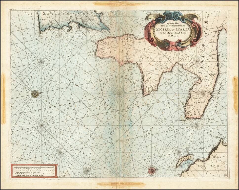
Fine chart of the Mediterranean coastline Southern Italy and southern part of Sicily, which appeared in Volume 1 of Coronelli's Corso Geographico, published in Venice. The sea chart would appear to be the chart originally issued in 1663 by Francesco...
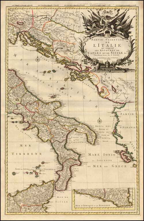
A fine example of Pieter Mortier's map of Eastern Italy which includes the Kingdoms of Naples and Sicily. The map details the surrounding areas of Italy such as the Dalmatian Islands in the Adriatic, the Aeolian Islands north of Sicily in the...
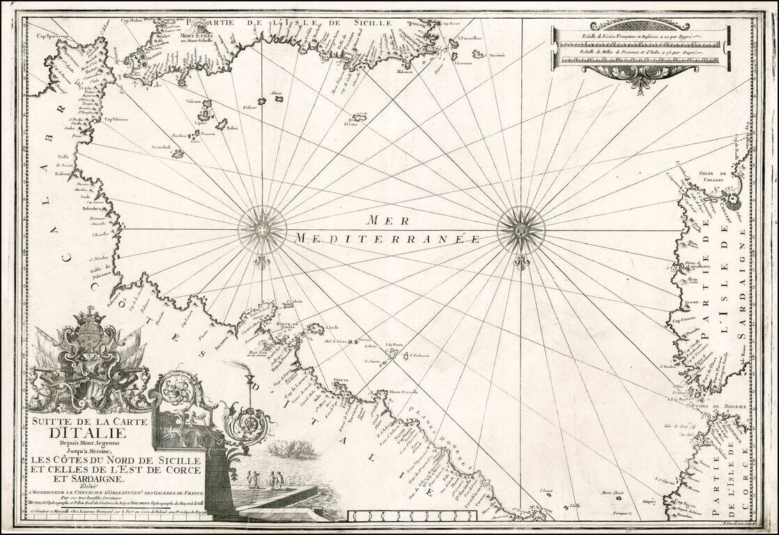
Striking chart of the Southern Italian Mediterranean coastline, from Mt. Argentate and Plages Romenes to the south tip of Calabria, north coast of Sicily, east coat of Sardinia and southeast coast of Corsica. Nice example of this scarce chart, one of...
Decorative map of Sicily with title cartouche and ornate picture frame border surrounding the map. Shows counties, towns, rivers, lakes, islands, etc. Nice example of a deluxe edition of Brion's maps, which were also offered with plain borders.
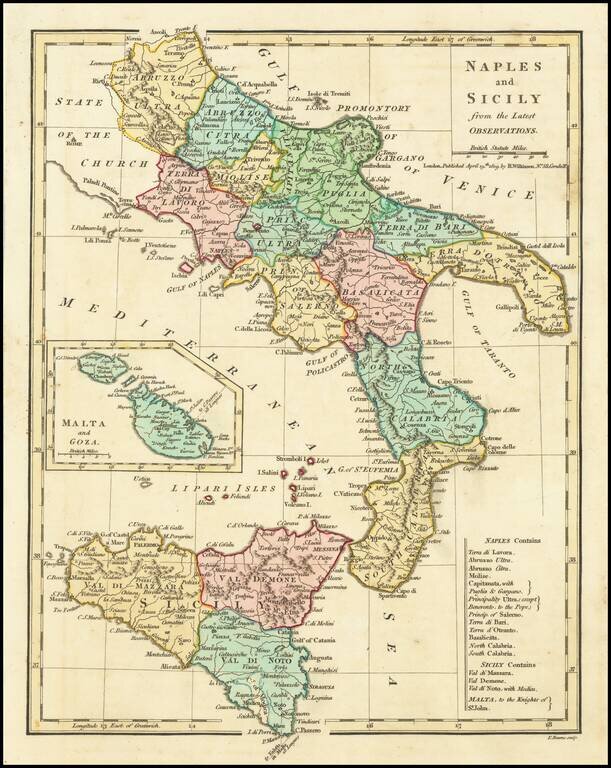
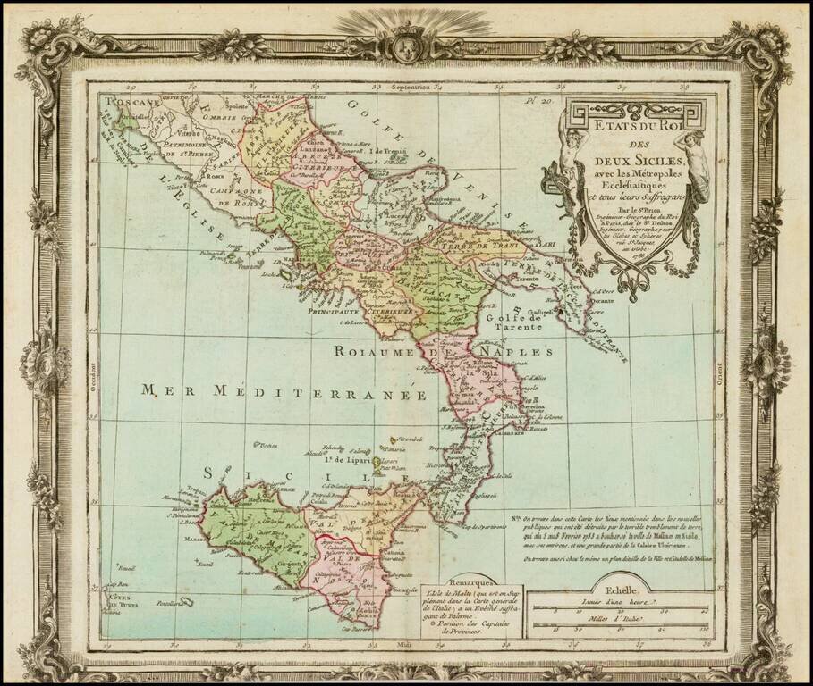
Excellent map of Southern Italy and Sicily extending North to Abruzzo Ultra, Citra and Terra Di Lavorao and showing all of Sicily. Nice detailed inset of Malta and Goza. Includes a number of place names and is colored by kingdoms. Large key shows the...
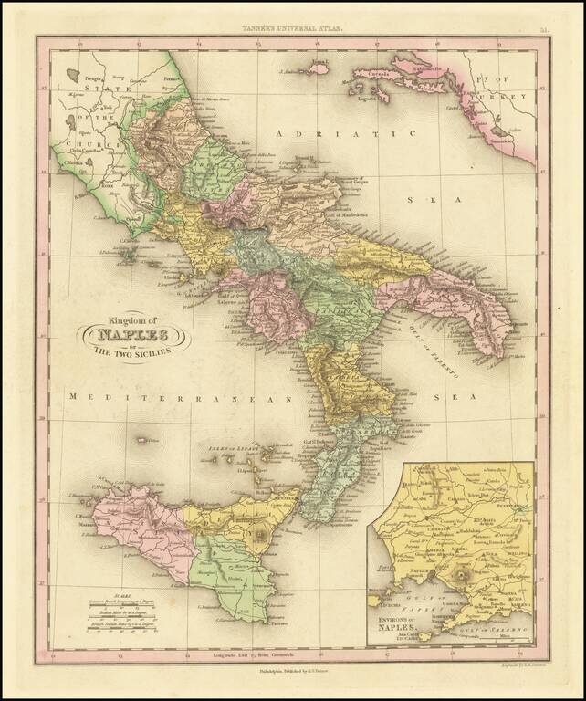
Interesting map of Naples and Sicily, divided into regions. Shows towns, rivers, roads, lakes, mountains, volcanoes, islands, bays, etc. Large inset of the Naples region. This map is from an early edition of Tanner's New Universal Atlas, first issued...
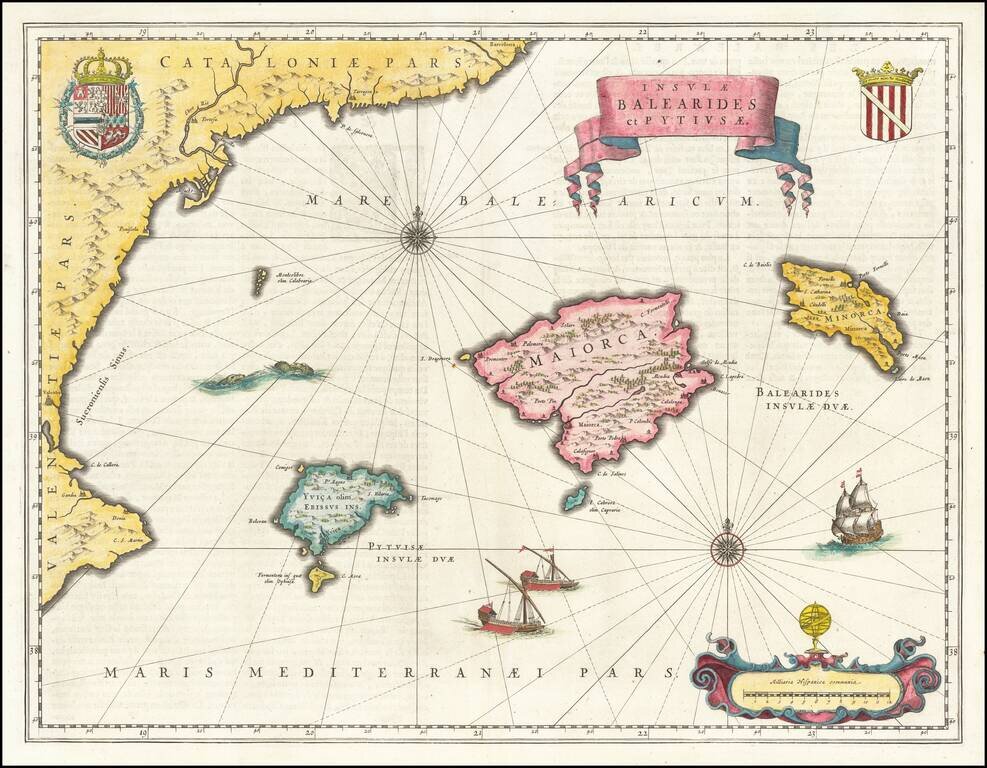
A beautiful map of the islands of Majorca, Minorca, and Ibiza, along with the contiguous Catalan Coastline. The map appeared in Blaeu's Atlas Novus. Includes sea monsters, ships, royal coats of arms, and an elegant title scroll.
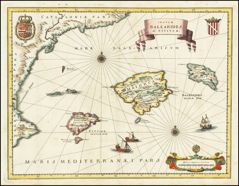
A beautiful map of the islands of Majorca, Minorca, and Ibiza, along with the contiguous Catalan Coastline. The map is based upon a larger map which appeared in Blaeu's Atlas Novus. Includes Sea monsters, ships, royal coats of arms, and an elegant...
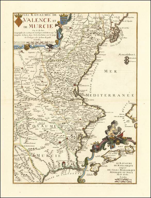
Detailed map of Valencia and Murcia, with a large decorative inset of the Balearic Islands. Includes 2 coats of arms in the title cartouche. Includes excellent detail, including the inset of the Balearic islands, which shows many place names and a...
![[Majorca] Ergebung der auf dem Mittellandischen Meer gelegenen Balearischn Insul Maiorica](/map/small/46077.jpg)
Admiral John Leake's Attack on Majorca Finely executed engraved map and naval battle scene, depicting the September 1706 Seige of Majorca by the British Fleet under the command of Sir John Leake. The siege was part of the War of the Spanish...
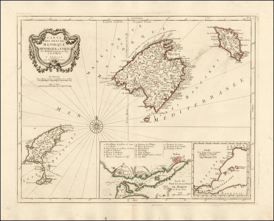
Nice example of the Paolo Santini edition of Nicolas Bellin's map of the Balearic Islands. Includes a map of Mahon Harbour and the position of the islands against the coast of Spain. A fine highly detailed map of Majorca, Menorca and Ibiza.
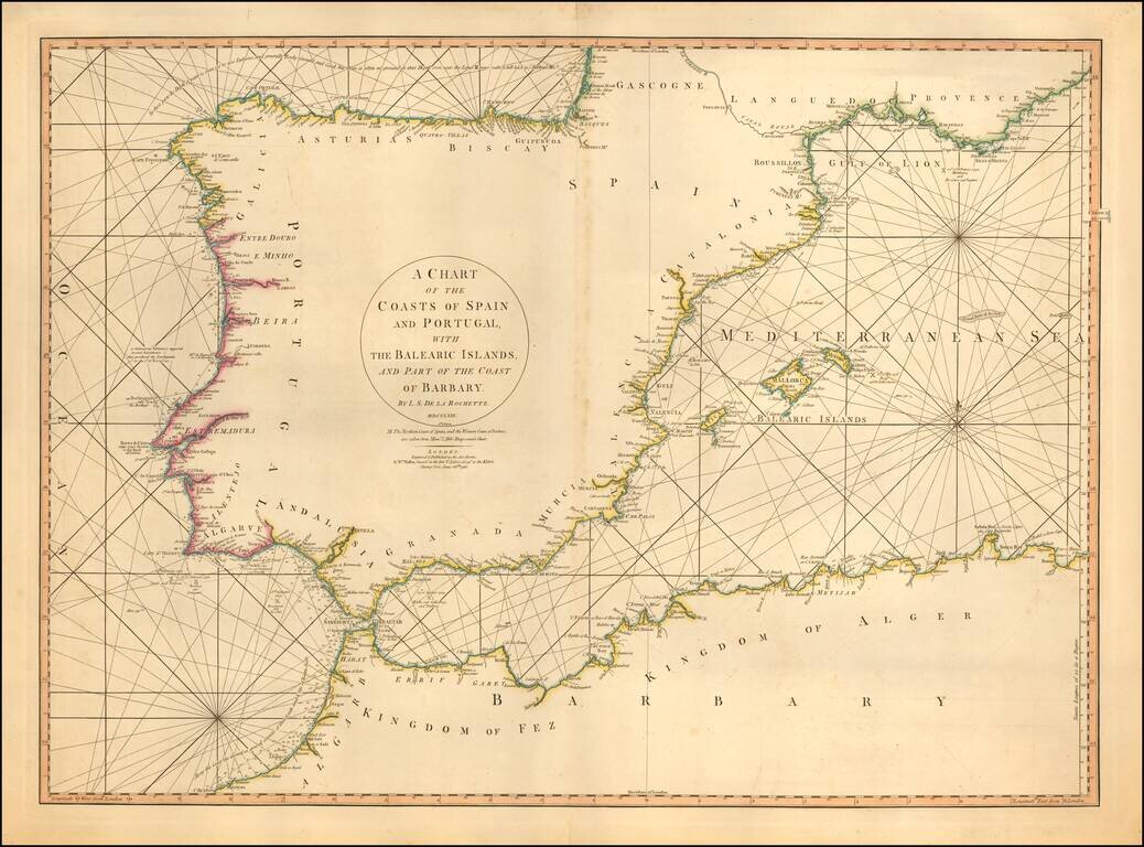
Detailed sea chart of the Balearic Islands, Spain, and Portugal. The chart extends to Provence and much of the Barbary coast to Bona. Good detail along coastal areas including the Straits of Gibraltar.