
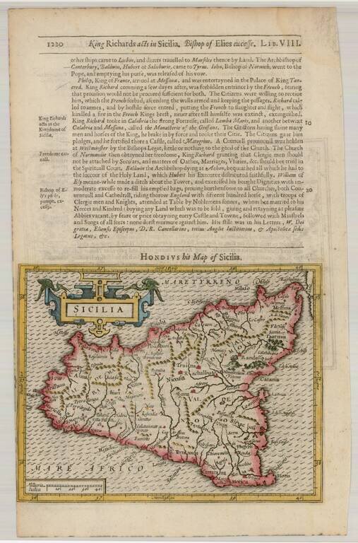
Detailed and attractive map of Sicily with a large cartouche. From the 1625-26 edition of Purchas His Pilgrims, one of the seminal early 17th Century English Language travel works. On a 13 x 9 inch sheet with English text, front and back.
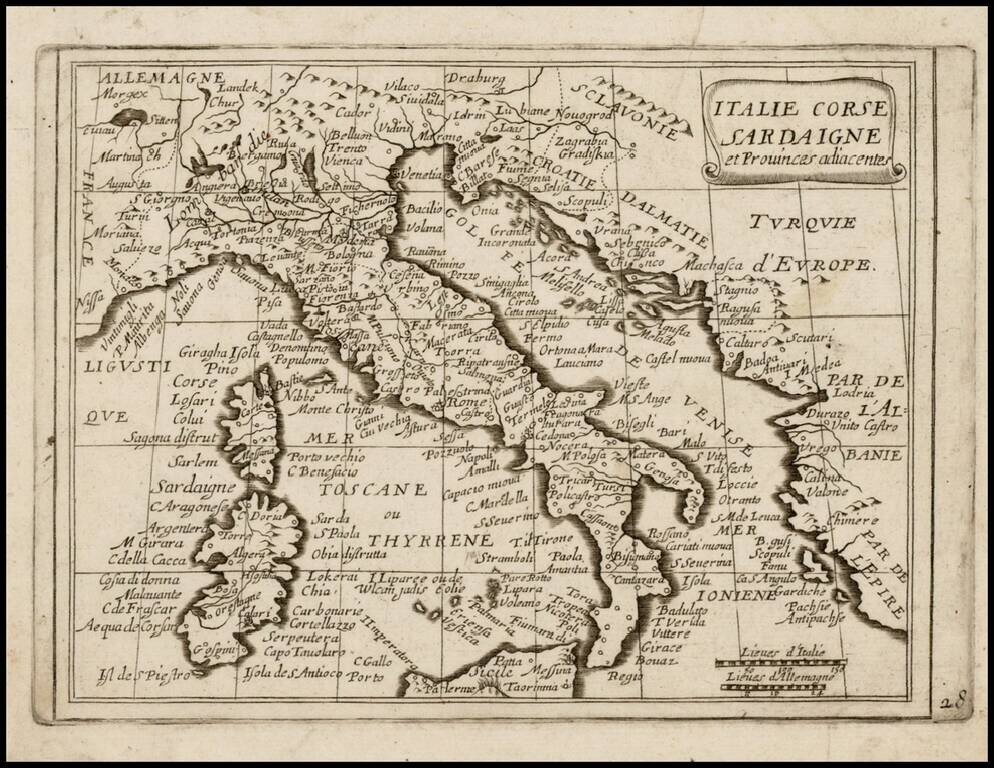
Rare map of Italy, Corsica and Sardinia, which appeared in Picart's Tresor des carte Geographiques, published in Paris. Picart's map is based upon Jansson's map of the same region, published in his Atlas Minor in 1628. The first French version of the...
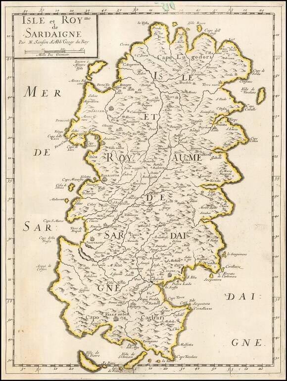
Nicolas Sanson's engraved map of Sardinia, published in Paris in 1658.
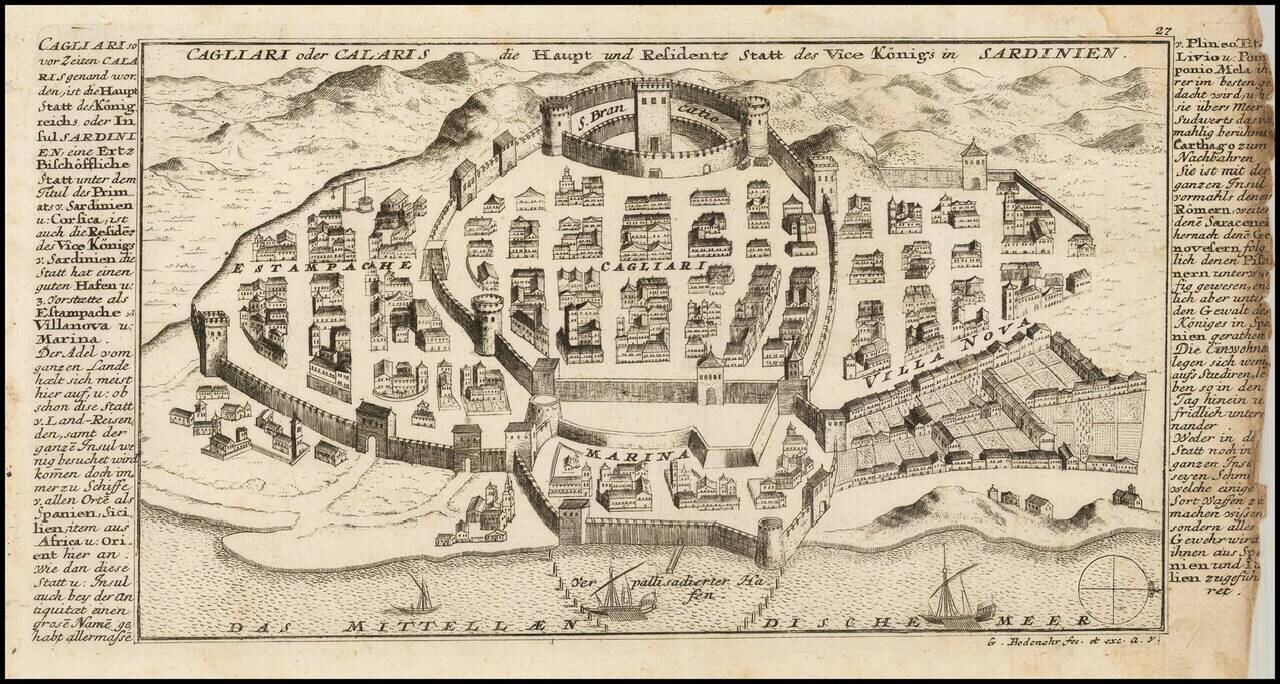
Detailed view and plan the town, harbor and fortifications of Cagliari, one of the capital cities of Sardinia, published by Gabriel Bodenehr.
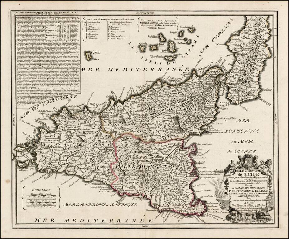
Early edition of Nolin's rare large format map of Sicily. Nolin's map is dedicated to Filipo V. The basic configuration and place names follow the map of Giacomo Cantelli. A later edition, with lengthy text annotation in the upper left corner,...
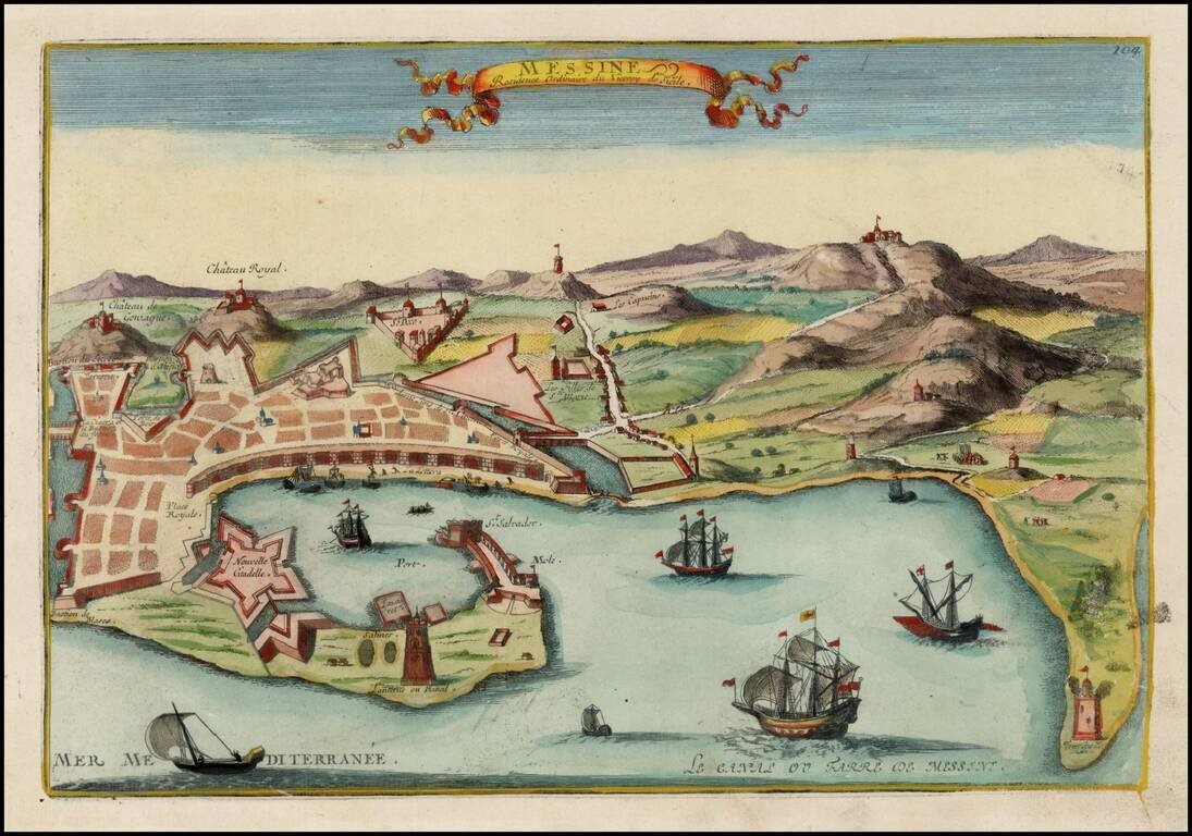
Detailed view of Messina, the residence of the Viceroy of Sicily. From De Fer's Atlas Curieux.
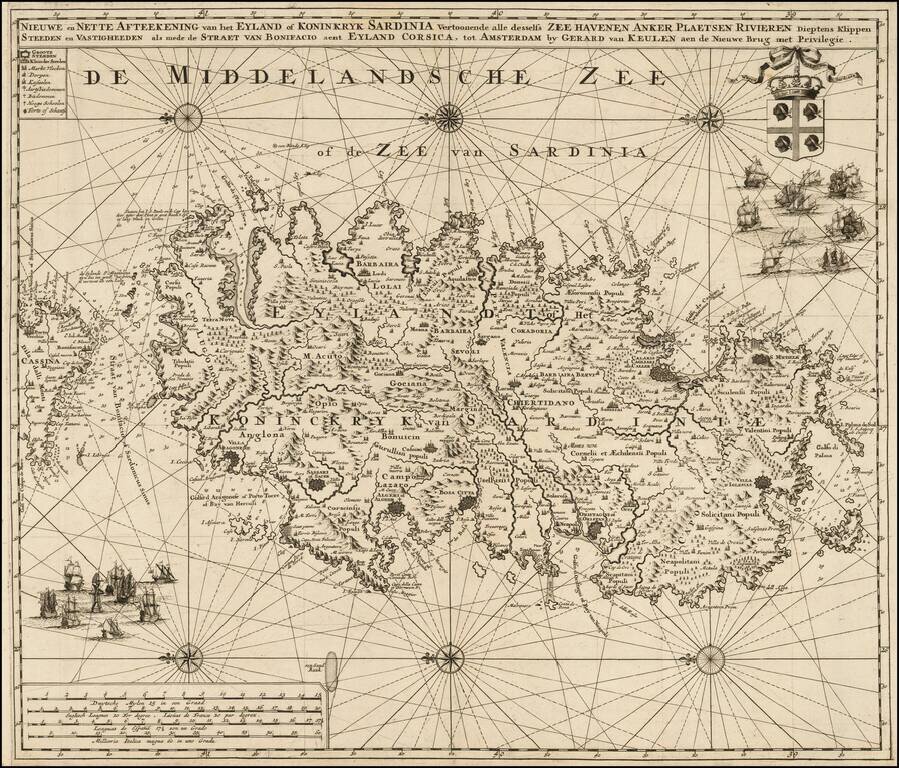
Highly detailed large format sea chart of Sardinia, including multiple sailing ships, compass roses, decorative cartouche, coat of arms, etc. Rare and decorative sea chart of Sardinia oriented to the East, which rarely appears on the market and even...
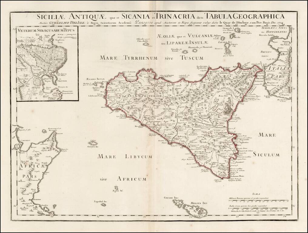
Scarce map of Ancient Sicily, with a large inset of Syracuse, originally published by Guillaume De L'Isle in 1714. Detailed map of ancient Sicily, showing roads, mountains, rivers, towns, harbors, smaller islands, etc. Extends south to Malta. Shows...
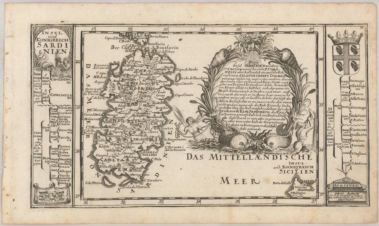
Detailed map of Sardinia, with an elaborate cartouche and coats of arms. The Bodenehr family of engravers and publishers of Augsburg began with Johannes Georg Bodenehr (1631 - 1704), a publisher of atlases and geographical books. His son Gabriel...
![Partie Meridionale du Royaume De Naples ou se trouvent La Calabre et L'Isle et Royaume de Sicile . . . 1779 [with] Supplement pur L'Isle De Malte](/map/small/35618.jpg)
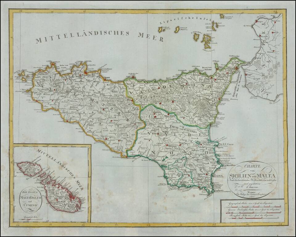
Striking map of Sicily, Naples and contiguous islands, with a large inset of Malta, published in Venice. Includes towns, mountains, rivers, lakes and a host of other details. Decorative cartouche. Santini's maps are largely based upon De Vaugondy's...
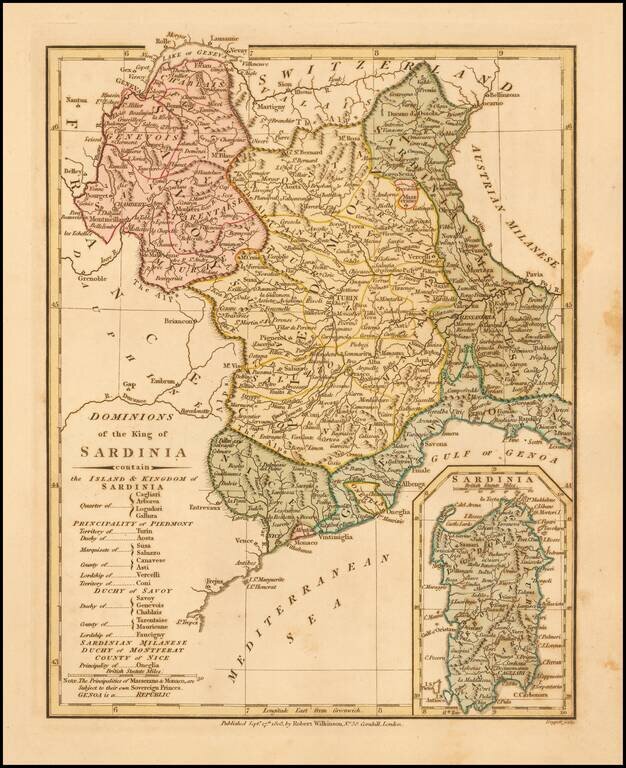
Detailed map of the Kingdom of Sardinia, with a large inset of the Island of Sardinia. Includes Savoy, Aosa, Novarese, Canavese, the Province of Turin, Province of Pignerol, Marquesat of Susa, Province of Alba, Province of Coni, States of Genoa,...
Rare early 19th Century map of Sicily and large inset map of Malta. Shows excellent detail in the interior of the Islands, including political subdivisions, topography and the location of Volcanoes on Sicily. This is the first time we have ever seen...
![[Map of Italy] Карта Италіи](/map/small/66941.jpg)
Detailed and very rare Russian-language map of Italy, Sicily, Corsica and Sardinia, published in Saint Petersburg in 1836. Rarity The map is very scarce. We have been unable to find any other examples in sales databases, libraries and archives, nor...
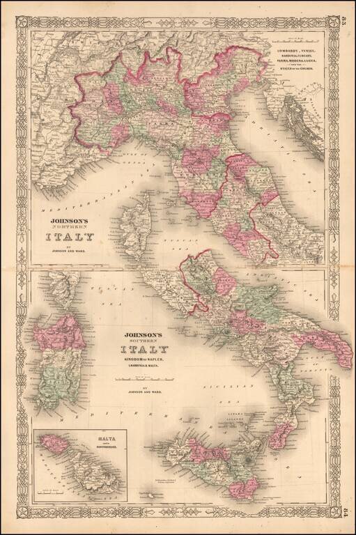
Interesting map of Italy, which appeared in the later editions of Johnson's New Family Atlas of the World. Shows early railroads, among other details.
![(Siena, Corsica, etc.) Senensis Ditionis Accurata Descrip [and] Corsica [and] Marcha Anconae Olim Picenum. 1572](/map/small/44502.jpg)
Fine old color example of Ortelius' maps of Corsica, part of Tuscany and the Tuscan Sea (Siena, etc.) and the Ancona region, Ortelius' Theatrum Orbis Terrarum, the first modern atlas of the world.
![[Corsica, Sardinia, Northern Italy]](/map/small/56055.jpg)
Striking large and highly detailed map of the North part of Italy, with Corsica and Sardinia.