
![Natolia, quae olim Asia Minor [shows Cyprus]](/map/small/71119.jpg)
Fine original hand-color example of Blaeu's decorative map of Asia Minor, showing Turkey, Cyprus and the Islands in the Aegean. This attractive map shows all of Turkey, Cyprus, and the Aegean Islands to a relatively high degree of accuracy. At the...
![Natolia, quae olim Asia Minor [shows Cyprus]](/map/small/40634.jpg)
Jan Jansson's decorative engraved map of Asia Minor, showing Turkey, Cyprus, and the Islands in the Aegean. This attractive map shows all of Turkey, Cyprus and the Aegean Islands to a relatively high degree of accuracy. At the time the entire region...
![Turcicum Imperium . . . [shows Cyprus]](/map/small/69623.jpg)
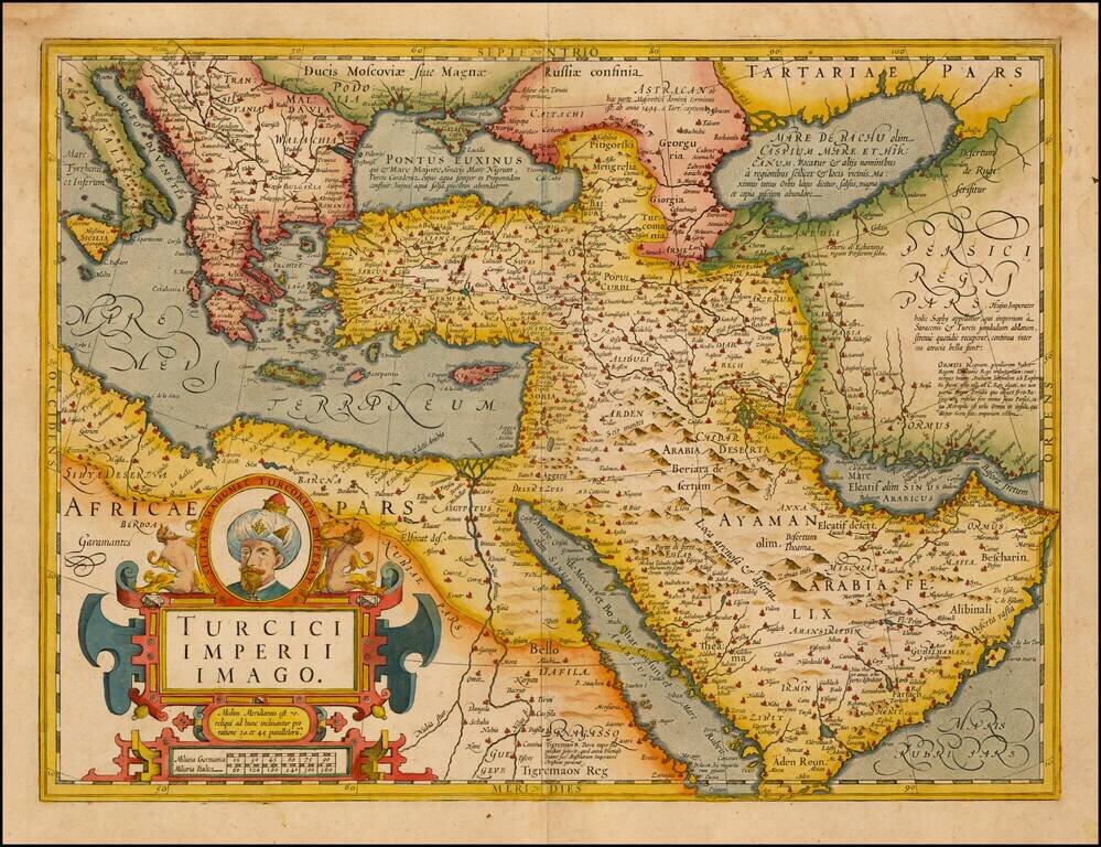
Decorative example of Blaeu's map of the Turkish Empire, based upon Blaeu's map of a similar title. Extends from Sicily and Italy in the west, to the Black and Caspian Seas in the north, and the Gulf of Aden, Red Sea and Saudi Arabia peninsula in the...
![Asia Minor [Shows Cyprus]](/map/small/43185.jpg)
Very rare map of Cyprus and Asia Minor by Phillipe de la Rue. While we were able to locate examples of the map issued by Covens & Mortier in the 18th Century, this map appears to be very rare.
![Turkey in Asia [Shows Cyprus]](/map/small/67948.jpg)
Detailed map of Asia Minor, Cyprus, Syria, Armenia, Al-Jesira, Irak, Kurdistan and Azerbijan. Shows towns, islands, rivers, mountains, gulfs, bays, etc. Includes Cyprus and a large insets of the Environs of Constantinople. Nice ethnic detail, with...
![Asia Minor [shows Cyprus]](/map/small/44708.jpg)
Striking full color example of Tallis' map of the region bounded by the Black Sea, Mediterranean, Aleppo and Diyar-Bekr, including a nice large Cyprus Vignettes of Olympus, Rhodes, a sailing vessel and Turkish costumes. Engraved for R. Montgomery...
Fine Map of the Ottoman Empire from the Mercator-Hondius Atlas Striking example of this map of the Ottoman Empire, showing their territories in the Balkans, Anatolia, the Levant, the Arabian Peninsula, and North Africa. It was published by Henricus...
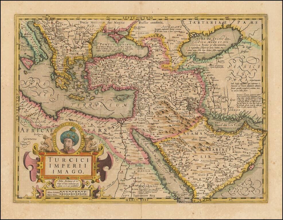
Fine Map of the Ottoman Empire from the Mercator-Hondius Atlas Striking example of this map of the Ottoman Empire, showing their territories in the Balkans, Anatolia, the Levant, the Arabian Peninsula, and North Africa. It was published by Henricus...
![Tabula Aphricae II [shows Sicily and Sardinia]](/map/small/47363.jpg)
16th Century Italian cartography of Sicily, Sardinia, and North Africa based on Ptolemy. Striking example of Magini's map of North Africa, based upon Ptolemy. Shows part of the Mediterranean, including Sicily and Sardinia. Three sea monsters and an...
![A New & Accurate Map of the Western parts of Barbary Containing Fez, Morocco, Algiers . . . [and] A New & Accurate Map of the Eastern parts of Barbary . . .[Shows Cyprus]](/map/small/67838.jpg)
Two engraved maps on one sheet showing the Mediterranean, with a focus on North Africa. The upper map extends from the Atlantic to "Tripoly," while the lower map extends from Tunisia to the Holy Land. In addition to the many states of North Africa,...
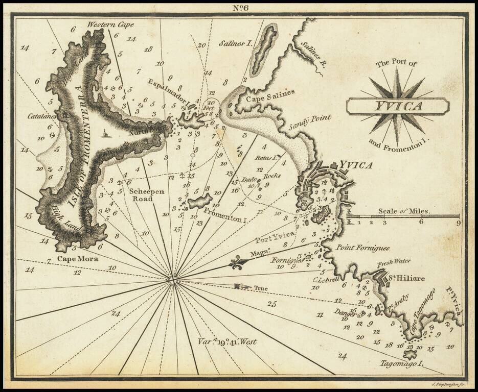
Very scarce miniature engraved chart of the town of Ibiza, on the Balearic Island of Ibiza. This is possibly the first English printed chart of the famous Spanish port city of Ibiza, now so well known for its world-class nightlife. The chart...
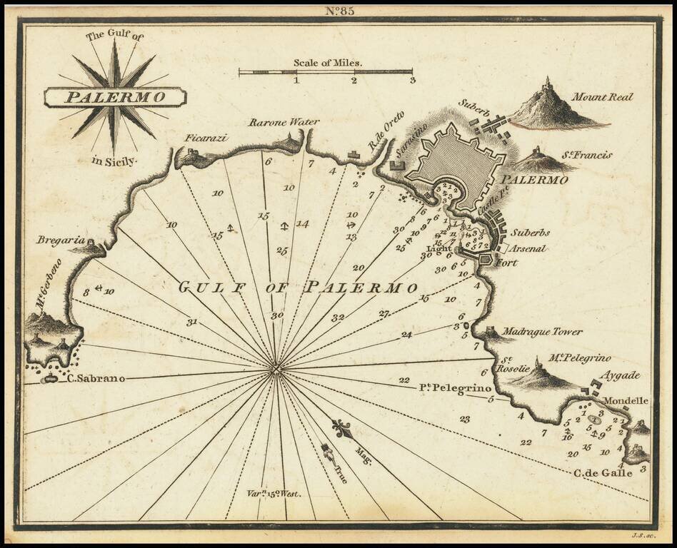
Rare chart of Palermo, published by William Heather in London. The chart is oriented with southwest at the top. It includes soundings, some topographical features, anchorages, and currents. Palermo is shown, along with several mountains. Rarity...
![Elba [and] Sicilia](/map/small/65810.jpg)
Fine example of Munster's map of the Island of Sicily (with Elba on the verso, from and early edition of Munster's Cosmographia. Munster's Cosmographia was one of the most influential works of the 16th Century. The work was first issued in 1545 and...
![Africa Minor Nova Tabula [shows Malta]](/map/small/59626.jpg)
Nice example of Gastaldi's map of the Northern portion of Africa, based on Ptolemy. Shows the region from Malta in the Mediterranean to Ethiopia, the Benin River, Libya, Numidia and the Gulf of Zimair. Giacomo Gastaldi is considered as the foremost...
![[Port Mahon, Menorca] Plan de la Fortification Fait par les Anglois sur la Fort St. Philippo Situe a Lembouchire du Port de Mahon dans l'Isle de Minorque.](/map/small/59725.jpg)
Extremely Rare Map of Fort St. Philip in Minorca Rare, fine map of Fort St. Philip (Castle of St. Philip) and the surrounding area in Port Mahón, Minorca, by Peter Schenk. The sharply-geometric star fort sits at the center of the map and is...
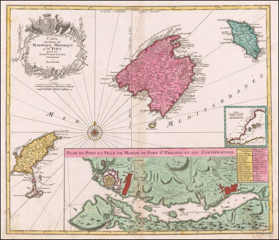
Striking map of the Balearic Islands, with a large plans of the Harbor and Town of Mahon. The map includes a striking coat of arms and windrose.