
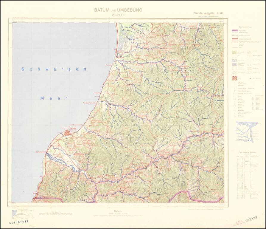
Four-sheet color-printed topographical map of the Adjarian Autonomous Soviet Socialist Republic and neighboring regions, prepared for strategic use by the General Staff of the German Army. The map is based on a 1917 German General Staff map. The area...
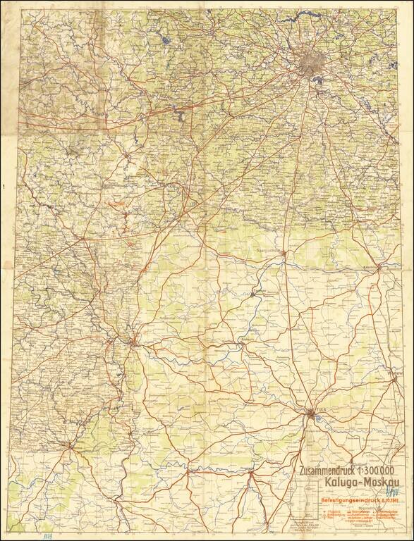
The Scene of the Wehrmacht Defeat Outside Moscow. Rare German plan of military positions and strategic landmarks between Kaluga and Moscow, published on the 8th of October, 1941, during the Battle of Moscow. The map shows the front as it existed in...

Map of the Russian Front Published in the British Empire Fascinating WWII broadside propaganda map, published in India, in order to keep the local populous informed about the War. The map illustrates the Russian Front, from the Caucus Mountains and...
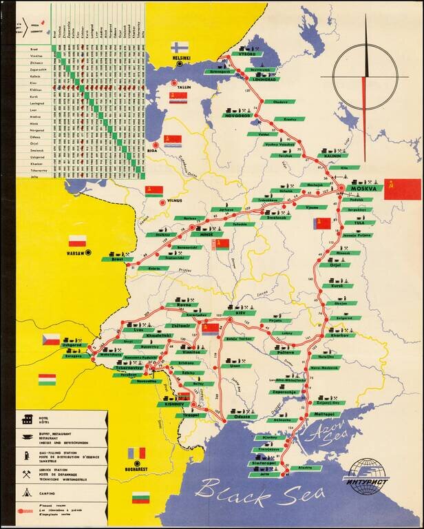
Decorative tourist map of Russia, showing the bus lines throught the country. An interesting Soviet era tourist item.
![[Pictographic Map of Moscow] Moscou.](/map/small/37917.jpg)
An attractive and engaging 1950s pictographic map of Moscow, showing the Soviet capital's main sites during the height of the Cold War. This interesting map provides a rare Western-language pictographic map of Moscow, then the capital of the Soviet...
![[Soviet Union] Our Country -- From Wooden Plough To Sputnick](/map/small/47092.jpg)
Fascinating Soviet map and promotional brochure, prepared for the USSR Section of the Brussels Universal and International Exhibition, 1858. The map shows the Russians at the North Pole and prosperously exploiting their bountiful natural resources....
![ЛЕНИНГРАД СПУТНИК ТУРИСТА [Leningrad Tourist Companion]](/map/small/54850.jpg)
Attractive color-printed Soviet tourist map of Leningrad (present-day St. Petersburg) published by the Soviet Navy. The map features parks and landmarks, the latter of which are shown pictorially. The map is in Russian.
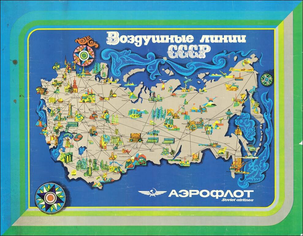
Attractive modernist travel poster issued by Aeroflot, the official national airline of the Soviet Union. The map highlights exclusively domestic routes within the Soviet Union. Interestingly, though not particularly unusual for the time, the routes...
![[Moscow. Motorist's companion. Schematic plan of the main streets and highways of the capital] Москва Схематический План Основных улиц и Магистралей Столицы](/map/small/70244.jpg)
Vintage map of Moscow focusing on automobile infrastructure at the end of the 1960s. The map shows some of the development of the city's automobile infrastructure: 105 gas stations, 32 official parking spots, a dozen of car repairs, and a small number...
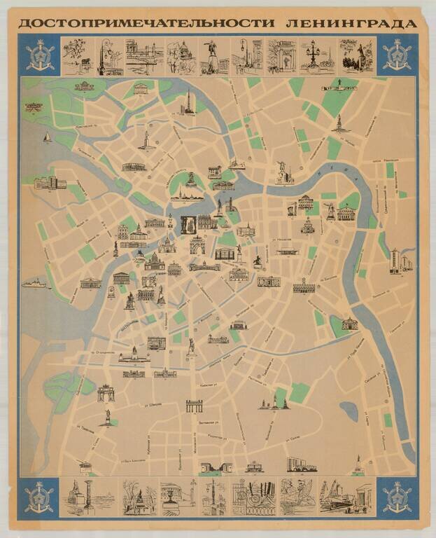
Fine Soviet-era pictorial tourist map of Leningrad (St. Petersburg), published in the former Soviet Union. The map illustrates over 90 points of interest, with 16 inset views at the top and bottom of the map. Extensive descriptive text and additional...
![Курская битва (Battle of Kursk) [Russian Educational Wall Map -- 1943]](/map/small/46011.jpg)
Fascinating Russian Educational Wall Map, illustrating and describing the Battle of Kursk in the Summer of 1943, with a vignette from the Battle. This map was likely used for teaching purposes, to Russian High School aged students, in the 1970s. The...
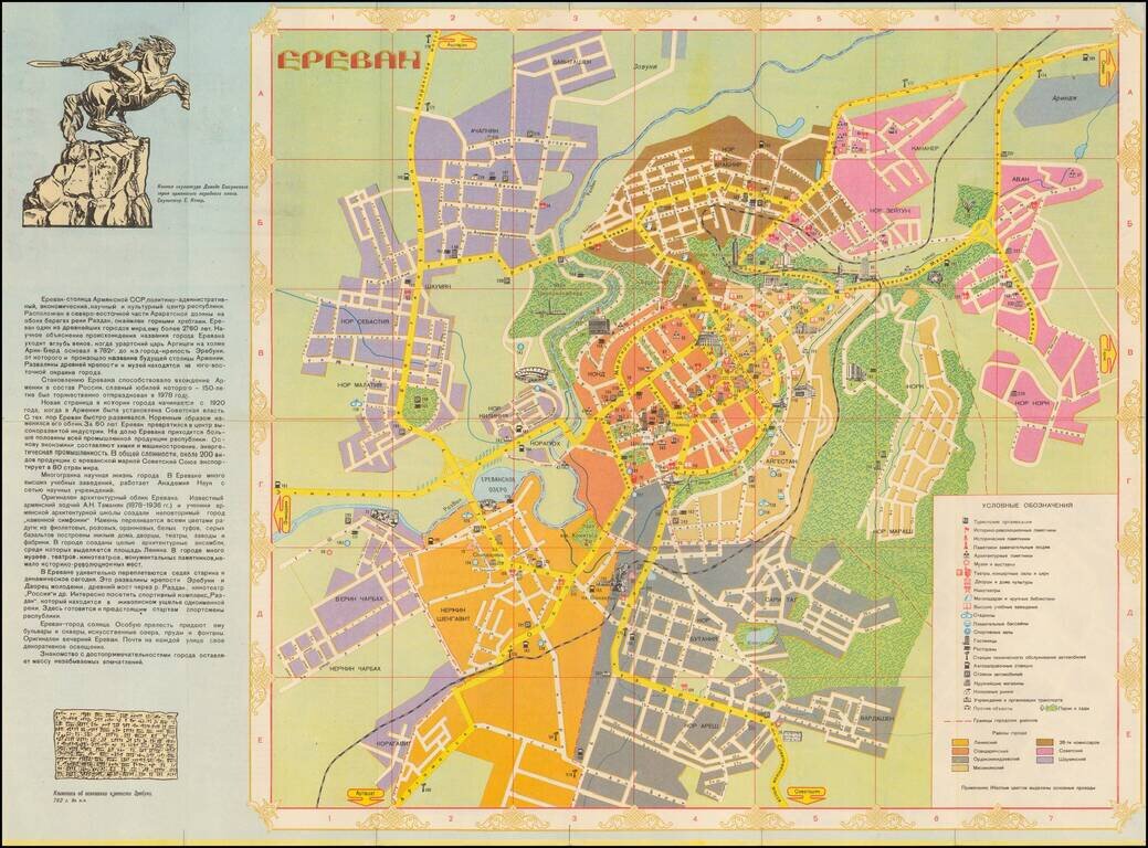
Beautiful color-printed Soviet-era map of Yerevan, then-capital of the Armenian SSR. This is a somewhat typical Soviet era tourist map, highlighting the major parks, and neighborhoods of Yerevan. It includes a panel on the history of the city, and on...
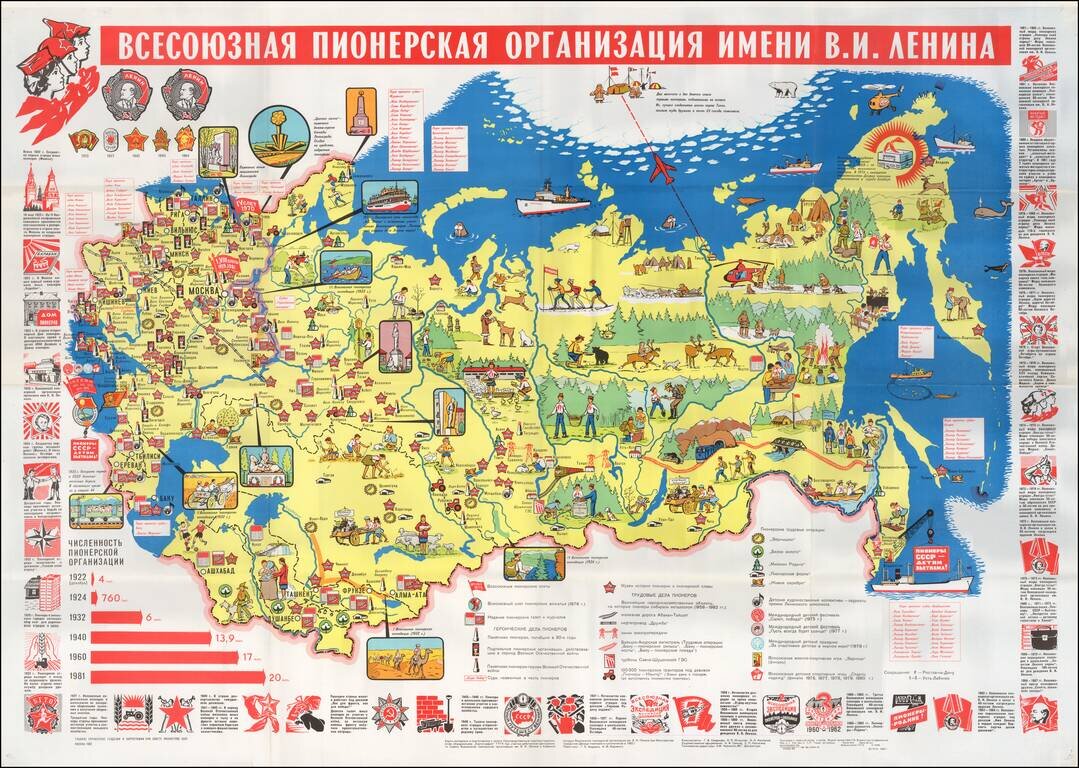
A Propaganda Map for Soviet Children -- The Soviet Boys and Girls Scouts Educational/Propaganda map of the Soviet Union (including Baltic & Southern republics) showing the State border, key cities, pioneer museums and large construction projects...
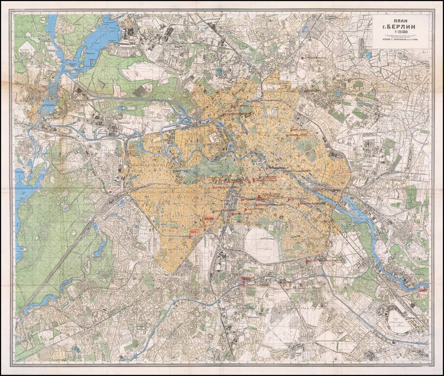
Mapping the Soviet Propaganda Machine in Occupied Berlin. Color-printed folding map of Berlin, issued by the Soviet government in 1945. This example is substantially enhanced with early (circa Spring 1945) manuscript notations of major printing and...
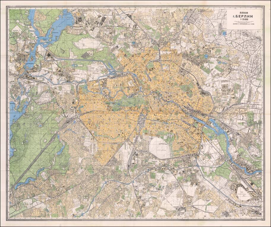
The Official Soviet Map Used in the Battle of Berlin, April 1945. Color-printed folding map of Berlin, issued by the Soviet Union in 1945. In many cases, these maps were carried into Berlin by front-line Red Army troops. The map was issued in...