
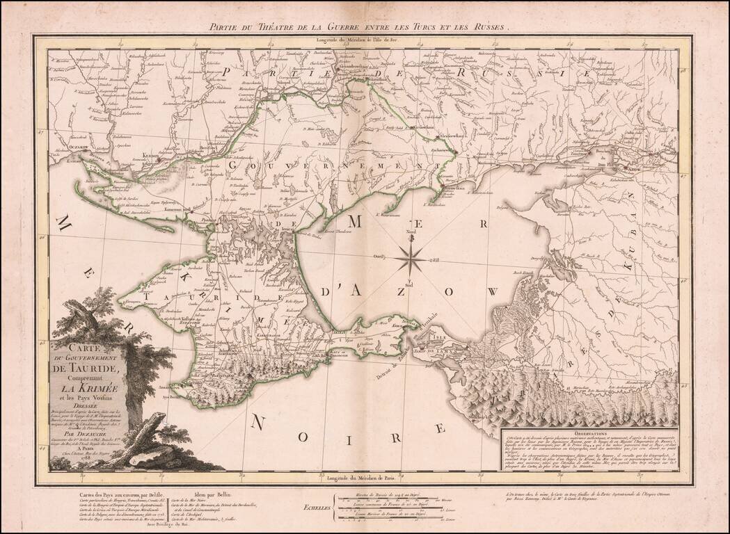
Dezauche's map illustrates the theater of the Russo-Turkish War that began in 1787, one year before the publication of the map. At the end of the previous Russo-Turkish War, Russia had annexed the Crimean Khanate, but the Ottomans sought to regain the...
![[Plan of Moscow] Plan stolichnago goroda Moskvy](/map/small/37809.jpg)
A very rare first edition of Ivan Marchenkov's decorative large-format map of Moscow, the most important printed plan of the city issued during the second half of the 18th Century. Ivan Marchenkov's masterly plan is the finest map of Moscow to appear...
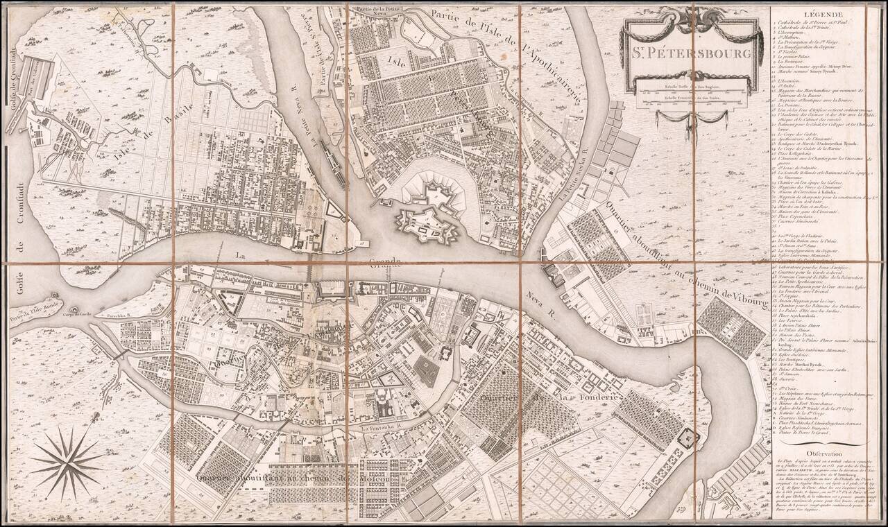
Scarce separately published example of Tardieu's scarce plan of the City of St. Petersburg. Tardieu's plan is based upon a larger plan, first prepared in 1753 for the Russian Academy of Sciences & Arts. The key at the right lists 79 places of...
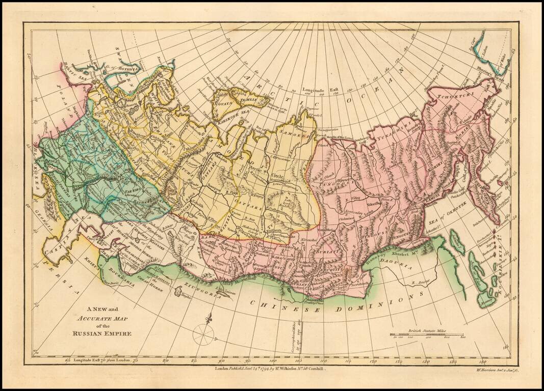
Interesting map of the Russian Empire, extending from the Baltic and the Caspian Seas in the West to the Bering Straits, Kamtchatka and the Sea of Okhotsk in the East. Shows towns, rivers, mountains, lakes, etc. Striking original wash colors. Robert...
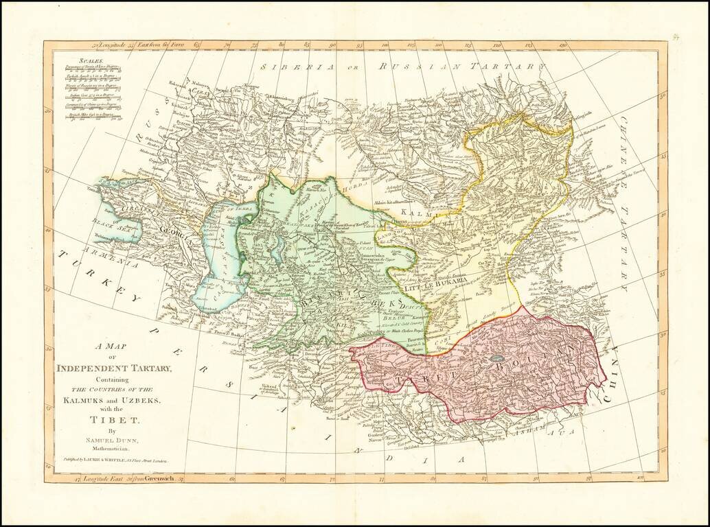
Detailed regional map, extending from European Russia and the Caspian Sea to Chinese Tartary. Nice detail in Tibet, Bukaria, and the Mountainous regions of western China. From Dunn's New Atlas or Mundane System of Geography.
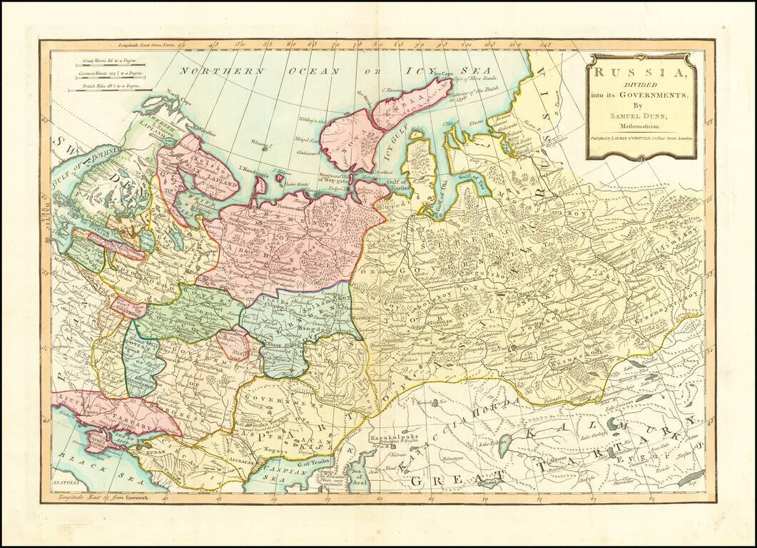
Finely colored map of Russia and its political divisions. Includes towns, mountains, rivers, lakes, islands, etc. From Dunn's New Atlas or Mundane System of Geography.
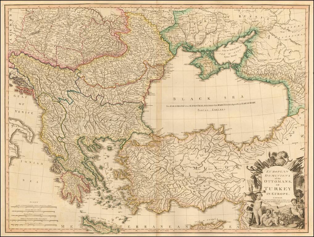
Large detailed Faden map of the region bounded by Greece and the Ionian Sea, the Ukraine, the Gulf of Venice, Asia Minor and the northern coast of Cyprus. Extremely detailed. The map shows the Ottoman Empire, circa 1720 and includes an ornate...
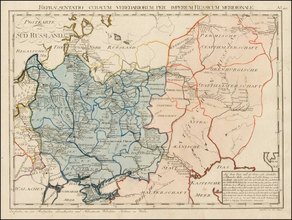
Rare postal map of Ukraine and Southern Russia, which appeared in Von Reilly and Kuhn's Atlas Universae rei veredariae bilinguis ... Allgemeiner Postatlas von der ganzen Welt . . . , published in Vienna in 1799. Von Reilly & Kuhn's atlas is the...
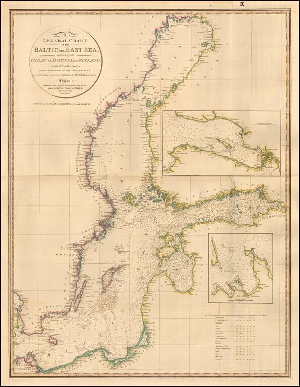
Highly detailed chart of the Baltic and contiguous coasts, from Faden's general atlas. Includes detailed insets of the areas around Revel and St. Petersburg. One of the most detailed general charts of the Baltic to appear in an English Commercial...
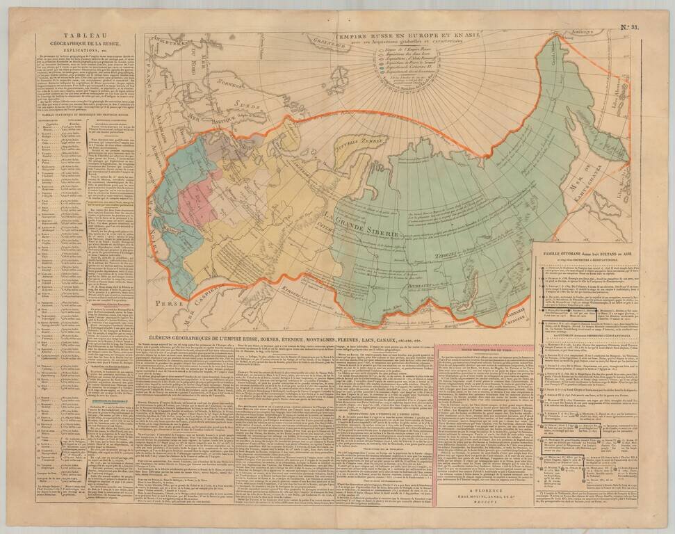
Rare Florentine map of Russia with original color showing the growth of the empire under the major rulers. Includes numerous notations and explanations. Panels of text describe the history and geography of the region. Side includes text panels. This...
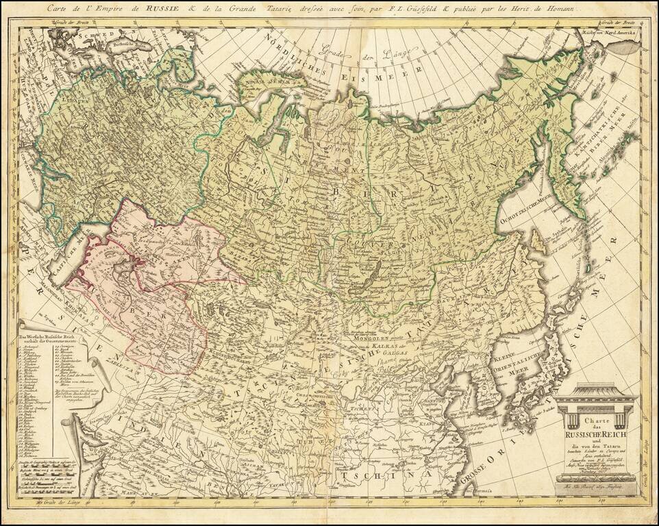
Rare late edition of this detailed map of the whole of Russia and parts of China and Central Asia. Interesting and highly detailed. This is the first time we have seen this state of the map.
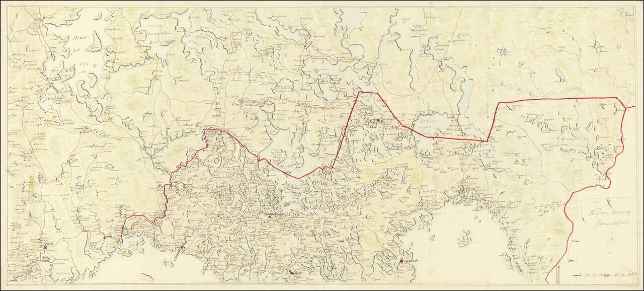
Imperial Russian Manuscript Map of the Russia-Finland Border, circa 1810. Pavlovsk Palace Library Provenance. Large Imperial Russian manuscript map of the Russia-Finland border as it existed between 1743 and 1812. The Russian side of the border...
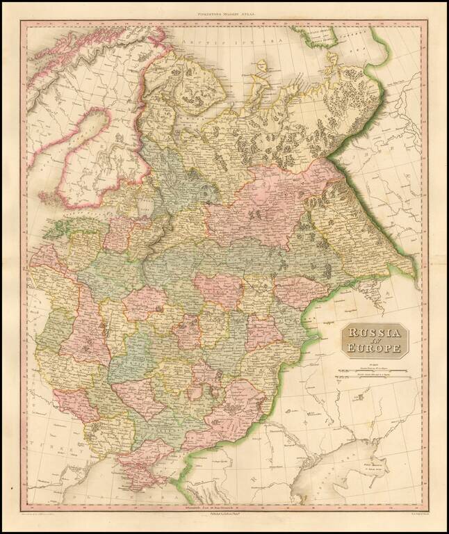
Highly detailed map of European Russia. Highly detailed regional map, one of the best regional maps of the area to appear in an English Atlas during the period. Pinkerton's now rare elephant folio atlas is one of the best engraved works of the period....
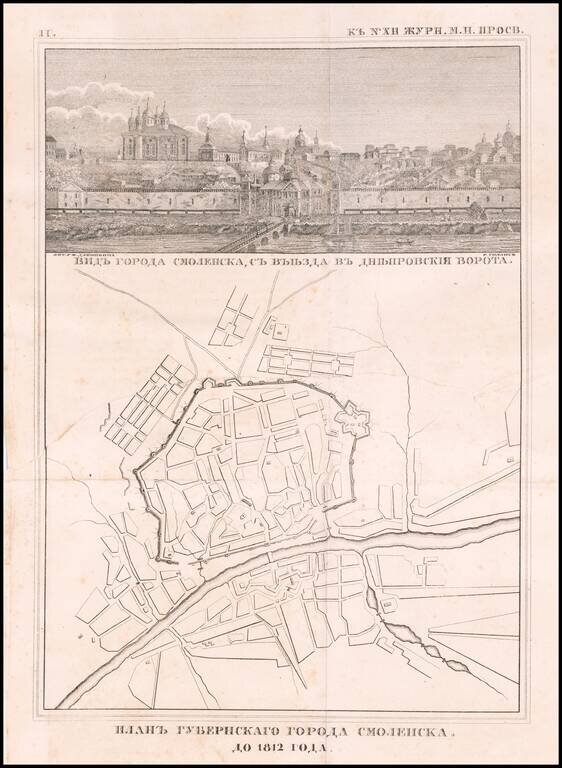
Rare engraved map of Smolensk on the Russian border with Belarus, published in 1812. Above the map is a view of the city titled "Видъ города смоленска, съ въезда въ днепровския ворота." (View of the City...
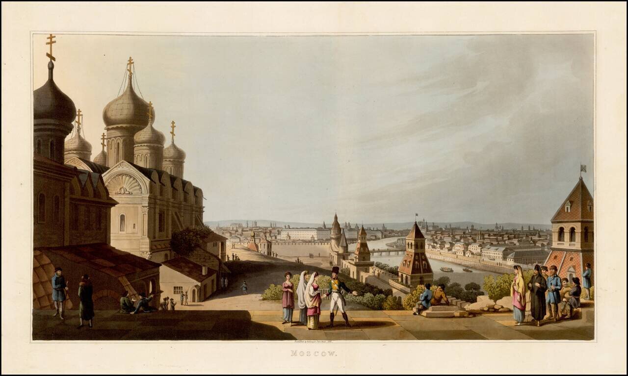
Fine colored acquatint view of Moscow, published by Robert Bowyer in London in 1816, from An Illustrated Record of Important Events in the Annals of Europe, During the Years 1812, 1813, 1814 & 1815, Comprising a series of Views of Paris, Moscow,...
![[Plan of the City of Pskov with its suburban settlements] Планъ Города Пскова...](/map/small/67397.jpg)
Scarce Russian Military Topograhers map of the city of Pskov, issued in 1821. The map includes a 25-item list of the streets of the city (at the right edge), a 17-item list of city gates (upper-left), and an extensive key at the bottom listing seven...