Map size in jpg-format: 65.6684MiB
Click to open in high resolution (open in new tab).
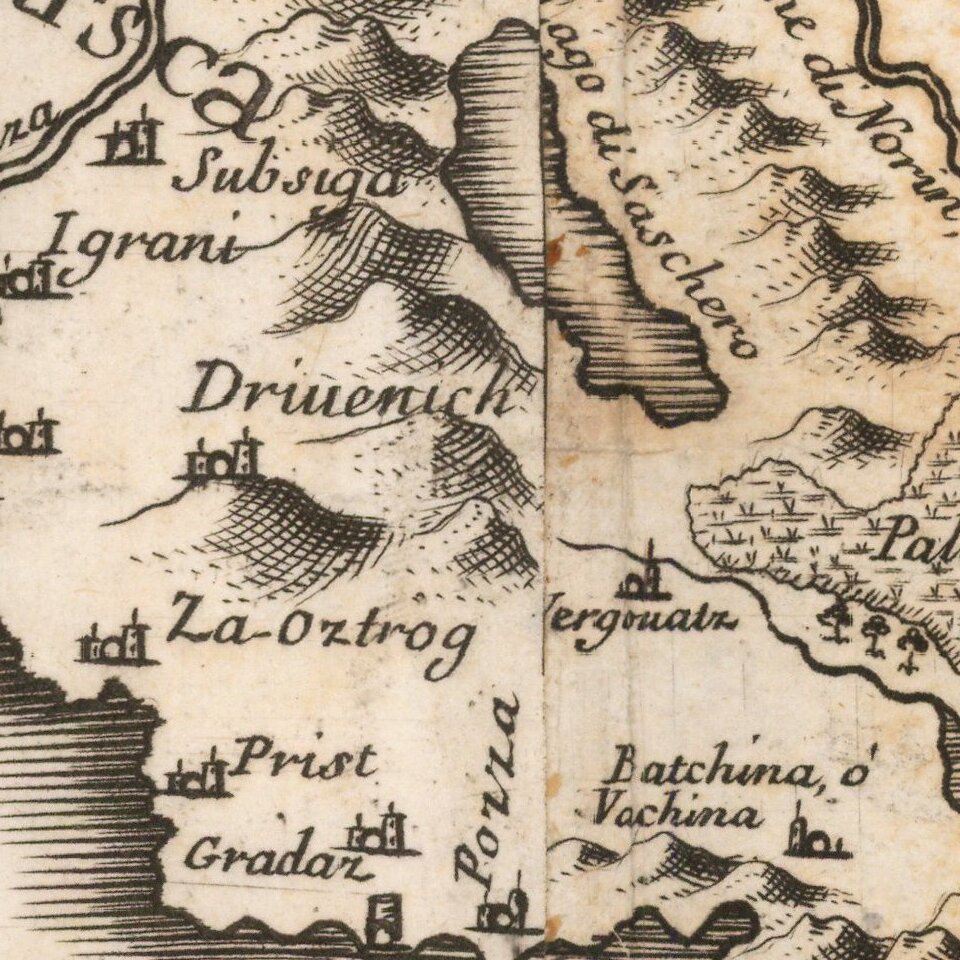
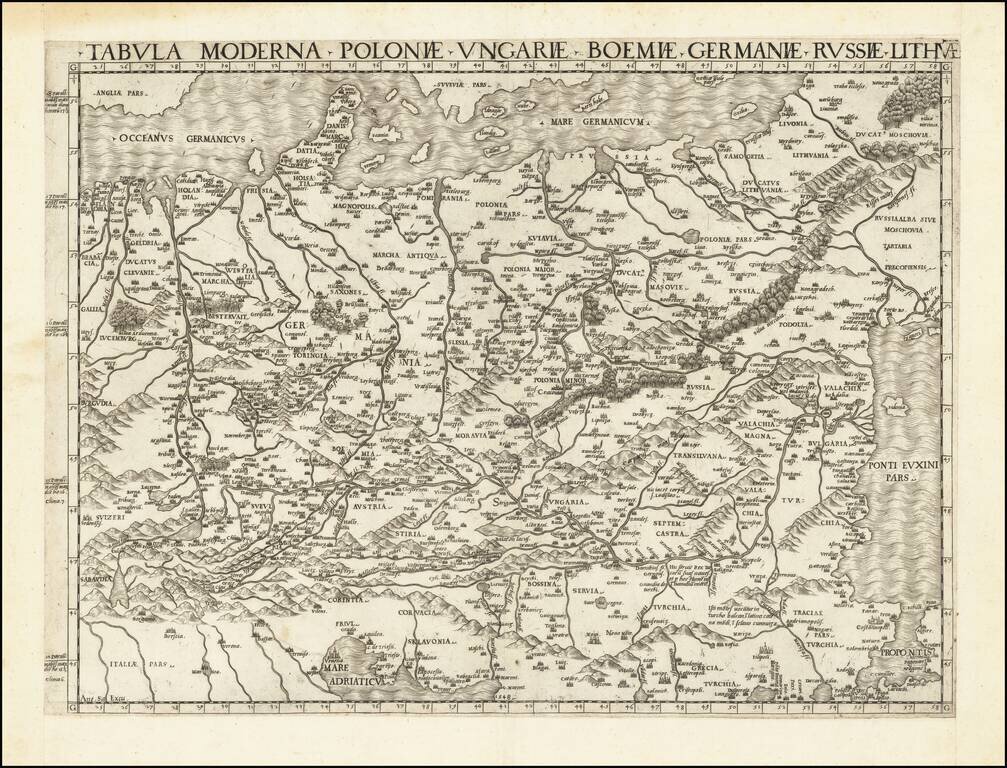
The Cantelli-Rossi map of Croatia, Bosnia-Herzegovina and Montenegro
Highly detailed map of the Adriatic Coastline, from Montenegro in the south to the coast of central Croatia (Zadar, etc.), and covering a large part of Bosnia-Herzegovina.
Shows administrative divisions, cities, towns, landmarks, churches, forests, rivers and mountains. Includes note, list of ancient and modern names and dedication text "All'Illmo. et Raymo. Sigre. Monaigr. Lorenzo Casoni Secretario della Cifra di N.S. Papa Innocenzo XI ... Gio. Iacomo de Rossi."
Giacomo Cantelli da Vignola (1643 - 1695) was an important Italian cartographer and engraver active in 17th century Modena. Cantelli da Vignola is best known for pioneering the Italian style of fine bold engraving that would eventually be embraced and expanded upon by Vincenzo Coronelli. Vignola based his maps not just on earlier maps, but also upon the accounts prepared by travelers and merchants of journeys to foreign lands.
Marković ( Descriptio Croatiae ) notes that Cantelli is the most important mapmaker of the Croatian region.
Giacomo Giovanni Rossi (1627-1691) was an Italian engraver and printer. He worked in Rome, the heir to an important printing business founded by his father, Giuseppe de Rossi (1570-1639). Giuseppe began the press in 1633 and Giovanni and his brother, Giandomenico (1619-1653) took it over upon his death. The brothers expanded the business and by the mid-seventeenth century it was the best-known printing house in Rome.
For his maps, Giovanni worked with Giacomo Cantelli da Vignola. They produced the Atlas Mercurio Geografico. The first edition is undated, but the second was issued in 1692, a year after Giovanni’s death. The maps were by Cantelli. The firm also published maps based on those of Nicolas Sanson.
Later, the business passed to Lorenzo Filippo (1682-?). By 1738, the firm was known as Calcografia Camerale, then, from 1870 to 1945, as the Regia Calcografica. Today, the firm is still in business and is called Calcografia Nazionale. It operates as a free museum and offers one of the best collections of prints and plates in the world.
If you are a student, write to us in telegram: @antiquemaps and indicate what material you need and for what work you need a map in high detail. We are ready to provide material on special terms. For students only!