logo

1959. The Philatelic Institute's Stamp Map of the United States . . .

  • The Philatelic Institute's Stamp Map of the United States . . .

The Philatelic Institute's Stamp Map of the United States . . . information:

Year of creation: 
Resolution size (pixels): 
 20463x13007 px
Disk Size: 
 63.5591MiB
Number of pages: 
 1
Place: 
 Cambridge
Author: 

Print information. Print size (Width x height in inches):
Printing at 72 dpi 
  284.21 х 180.65
Printing at 150 dpi 
 136.42 х 86.71
Printing at 300 dpi 
 68.21 х 43.36

An example of detailing the file of this map of in a printable high-resolution:

Click to open in high resolution (open in new tab).
Attention! this is just the central piece (central area 960x960 px) of the map file!
This is an example, so that you can see and study the level of detail of a given map. The entire Map will be fully available after payment!

The Philatelic Institute's Stamp Map of the United States . . .

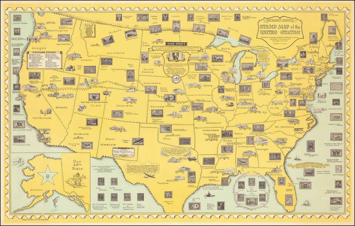
Scarce 1959 edition of Ernest Dudley Chase's stamp map, published for the Philatelic Institute.

The map includes images of US Postage stamps arrayed across the states, many placed thematically based upon the places to which they correspond historically.

A large inset of Alaska includes a star with a note "place stamp here."

Other historical vignettes around the map depict famous events and persons in American History.

Rarity

This state of the map is very rare on the market.


Special conditions for students!

If you are a student, write to us in telegram: @antiquemaps and indicate what material you need and for what work you need a map in high detail. We are ready to provide material on special terms. For students only!

Item information:

Year of creation:
Size:
20463x13007 px
Disk:
63.5591MiB
Number of pages:
1
Place:
Cambridge
Author:
Ernest Dudley Chase.
$21.99

Related item