Map size in jpg-format: 96.2675MiB
Click to open in high resolution (open in new tab).
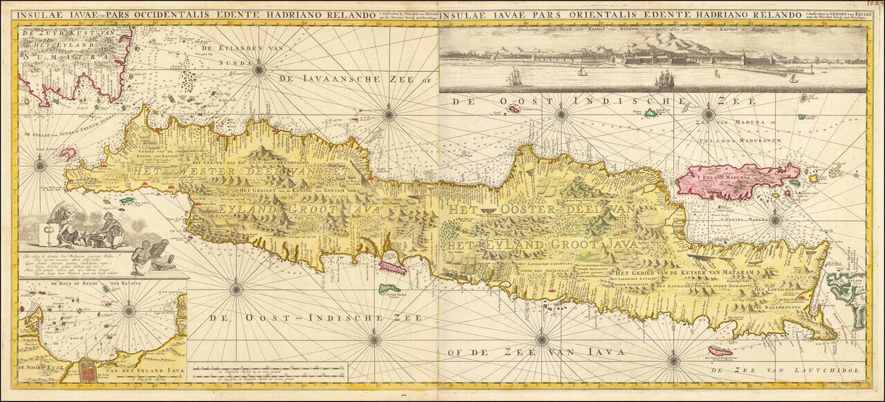
An Exceptional Sea Chart of Java
Rare and highly decorative sea chart of the island of Java and contiguous islands, published by Gerard Van Keulen.
The chart covers Java and immediate islands from the tip of Sumatra to Bali, along with ten decorated compass roses, rhumb lines, and a decorative cartouche. The two charts, which contain hundreds of depth soundings, are joined to make one chart of the whole of Java.
Includes a detailed plan of the harbor of Batavia in the lower left and a striking panoramic view of Batavia and the Bangor Mountains from Batavia Roads at the top right of the chart.
This is the second state of the map. The earlier state includes a decorative cartouche at the lower right, but does not include either the inset of the harbor or the profile view. This second state was issued in Volume VI of Van Keulen's De Nieuwe Groote Ligtende Zee-Fakkel, 't Vyfde Deel of 1753.
The map is quite rare on the market, especially in such exceptional color.
If you are a student, write to us in telegram: @antiquemaps and indicate what material you need and for what work you need a map in high detail. We are ready to provide material on special terms. For students only!

![[Sunda and Lilliput, etc. from Gulliver's Travels]](/map/small/54927.jpg)
