Map size in jpg-format: 11.4179MiB
Click to open in high resolution (open in new tab).
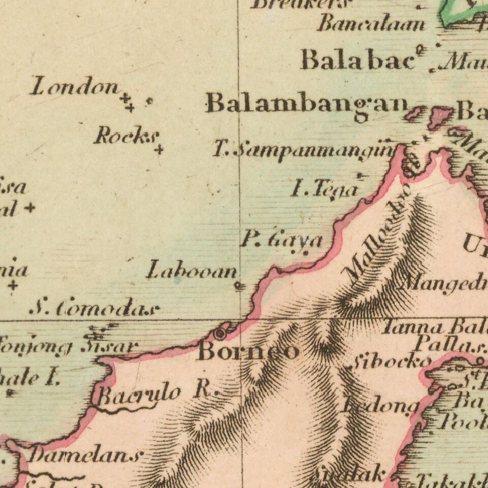
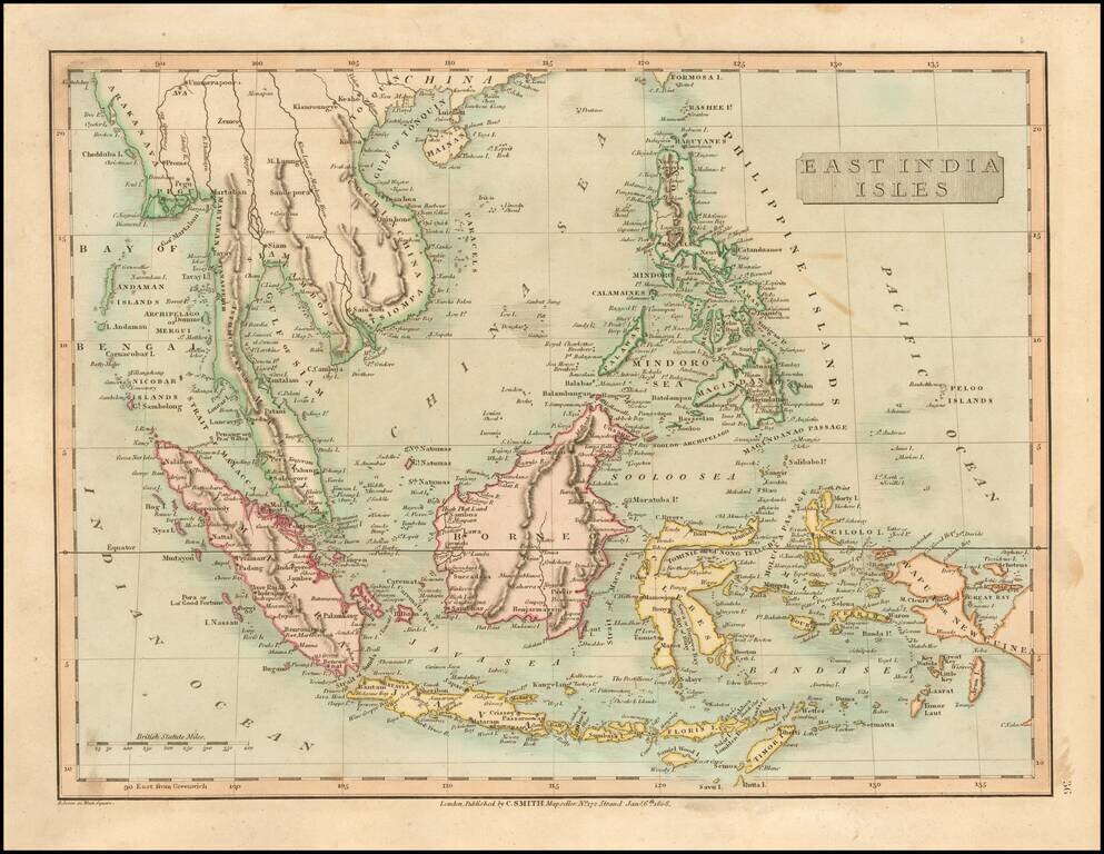
Detailed map of SE Asia, centered on Borneo. Extends from the Gulf of Tonquin and the southern tip of Formosa to Papua or New Guinea, Mimor, Java and Sumatra.
Excellent detail. Shows towns, rivers, mountains, islands, etc. From Smith's General Atlas. Nice topographical detail.
If you are a student, write to us in telegram: @antiquemaps and indicate what material you need and for what work you need a map in high detail. We are ready to provide material on special terms. For students only!
![[Signed Political Satire Artwork] Vietnam ... Vietnam ... Vietnam ...](/map/small/68726.jpg)
![[Martin Behaim Globe / Book] Pars Globi terrestris Ao. 1492 a Martino Behaim Equite Lusitano Norimbergae confecti Delineavit Christoph. Theoph de Murr 1778 (bound with:) Diplomatische Geschichte des Portugesischen berühmten Ritters Martin Behaims](/map/small/68828.jpg)
![Il Disegno Della Terza Parte Dell' Asia [Gastaldi's Wall Map of SE Asia with extra panels!]](/map/small/30554hbp.jpg)