
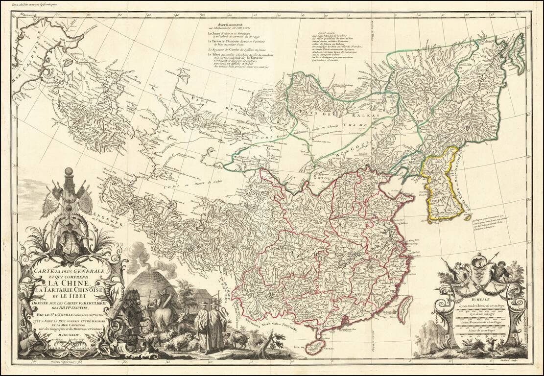
First edition of D'Anville's map of China, the finest printed map of the Middle Kingdom published in Europe during the 18th Century. J.B.B. D'Anville's groundbreaking map of the Middle Kingdom, an important and geographically progressive depiction of...
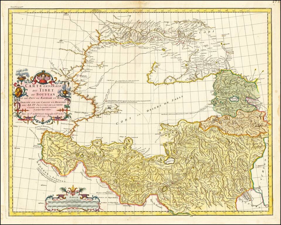
First Euopean Map of Tibet Fine old color example of the first European map of Tibet, first issued in 1737 by D'Anville. Much of the interior is captioned "Gobi ou Desert De Sable" (Gobi, or Sandy Desert) and several rivers are shown "lost" in the...
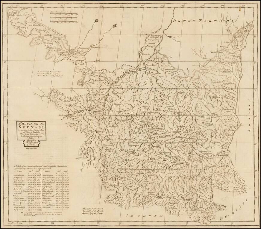
The Province of Shen-Si. Nice example of the English edition of Du Halde's map of the Province of Shen-Si. Includes a table of latitudes and longitudes and an explanation of place names. The prefix 'FU' denotes a city of the first rank; 'Chew', a...
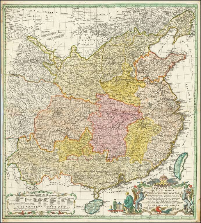
Homann Heirs edition of D'Anville's map of China, the most important printed map of the Middle Kingdom published in Europe during the 18th Century. Finely engraved German edition of J.B.B. d'Anville's groundbreaking map of the Middle Kingdom, an...
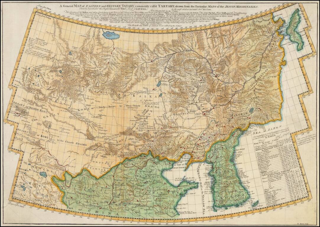
Scarce English Language edition of Jean Baptiste du Halde's map of Tartary, China and Korea. Fine example of D'Anville's map of the region from Korea to the Gobi Desert, centered on Mongolia and Korea. Highly detailed throughout. Engraved by...
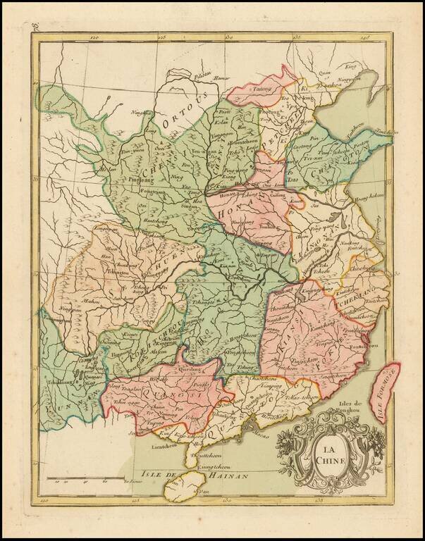
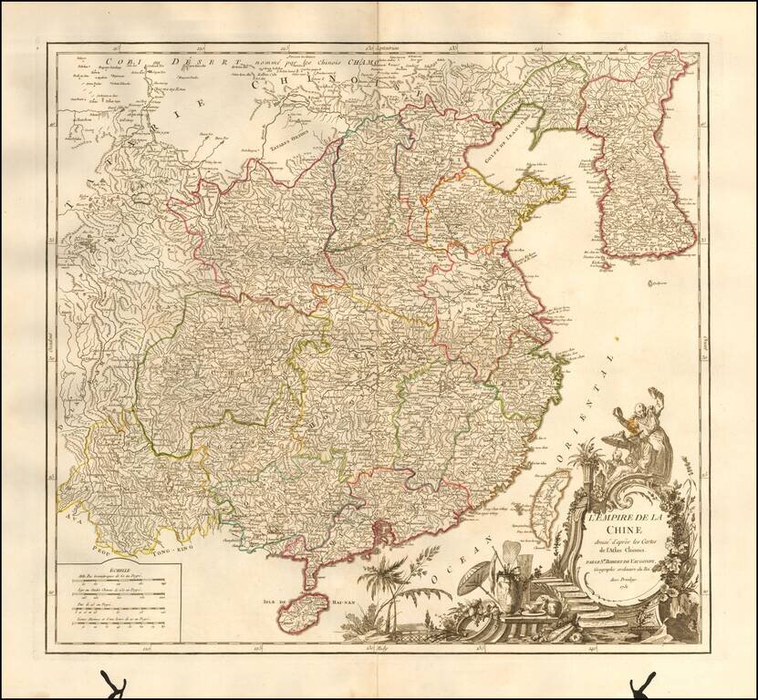
Detailed antique map of China by George Louis Le Rouge. The map is hand-colored by provinces.
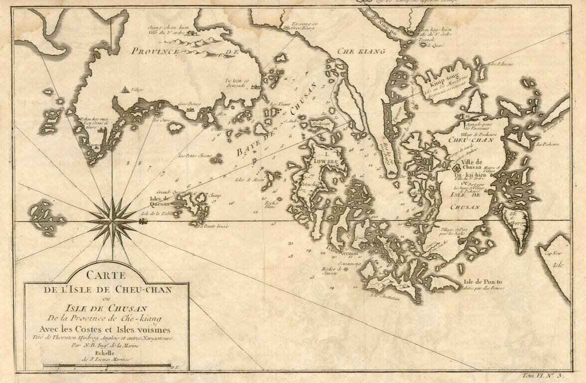
Detailed map of the area east of Ningbo in the Chinese province of Chekiang, located across the bay from Shanghai. The compass rose orients the chart with north to the right.
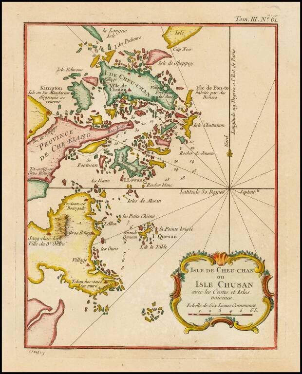
Detailed map of the area east of Ningbo in the Chinese province of Chekiang, located across the bay from Shanghai.
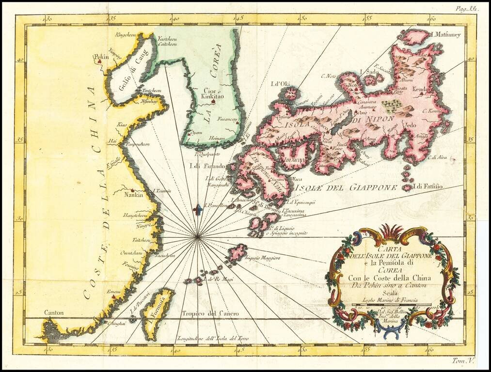
Italian edition of Bellin's regional map, showing Japan, the Korean Peninsula and China, including Canton and the Island of Formosa. Decorative cartouche and Rhumb lines.
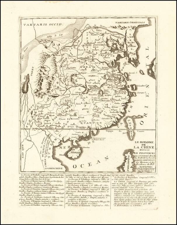
An Unrecorded Jesuit Map of China Rare Jesuit map of China, published in Paris by Longchamps. The map gives extensive details regarding China's provinces, major cities, families, colleges, temples, churches and Missions. The ending note discusses the...
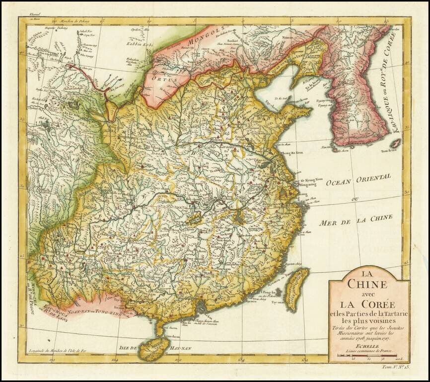
Detailed map of China and Korea, based upon the reports of Jesuit Missionaries between 1708 and 1717.
Striking large format map of China & Korea, from De Vaugondy's Atlas Universel. Includes a large and detailed Formosa. Beautifully colored by province, with a striking full-color cartouche. Includes the Island of Taiwan or Formosa.
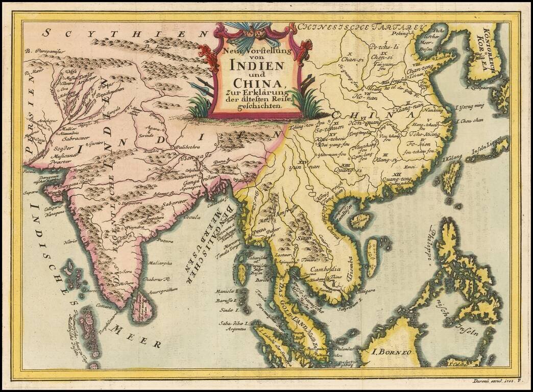
Rare regional map, extending from Korea and the Philippines to India and the Maldives. The map is apparently quite rare, as we can find no records for the map or its maker.
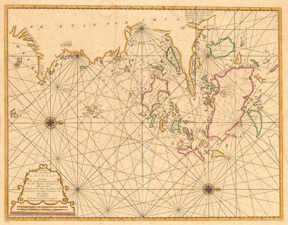
From the Secret Atlas! Nice example of this extremely rare sea chart of the area around Ningbo, Zhoushan and Mount Putuo (Powto) in the Zheijang Province of China, at the mouth of the Yangtze Delta, just south of Shanghai, from the Dutch East India'...
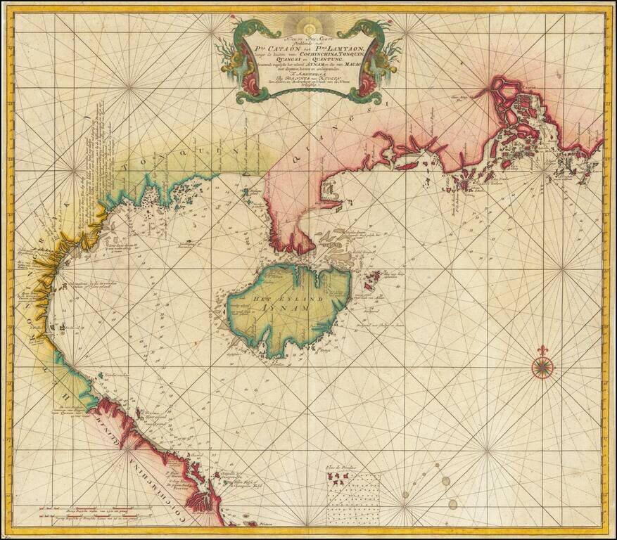
Canton, Macao & Hong Kong etc. -- The VOC Secret Atlas The chart was made for and used by the VOC (Dutch East India Company) for navigation and trading, with a compass rose with rhumb lines, depth indications and other relevant navigational...
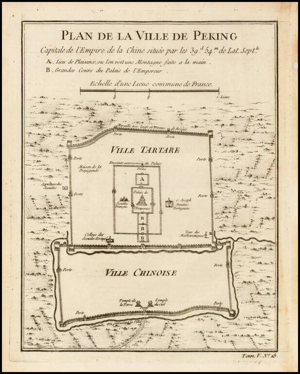
Finely engraved plan showing the walls, gates and inner details of the city of Peking (Beijing). The city is divided into the Ville Tartare and Ville Chinoise, with Emperor's Place and French Jesuit and Portuguese Jesuit missions shown in the Ville...