Map size in jpg-format: 1.60862MiB
Click to open in high resolution (open in new tab).
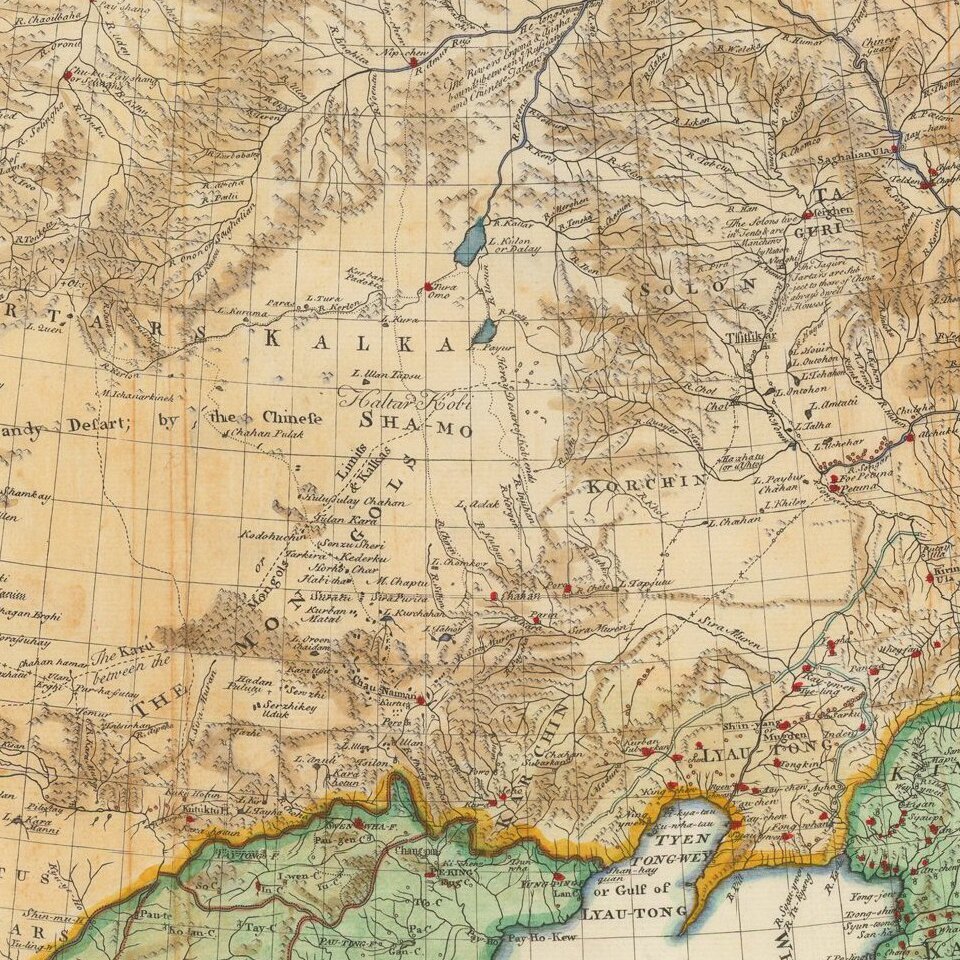
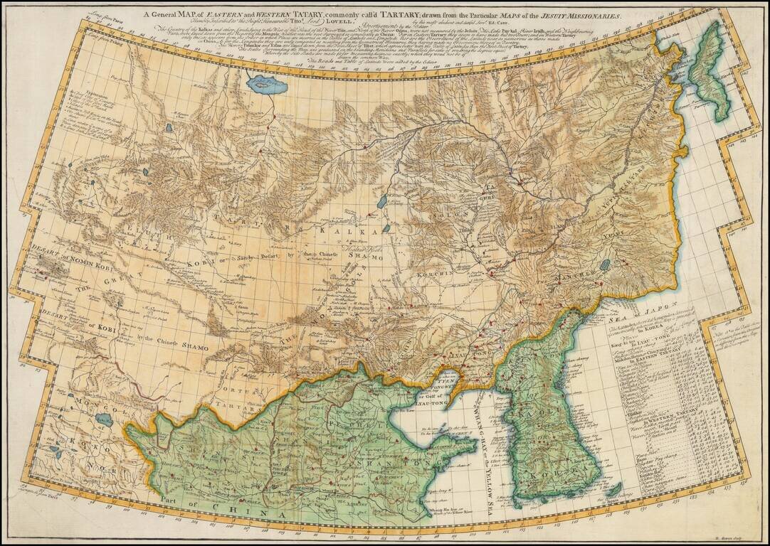
Scarce English Language edition of Jean Baptiste du Halde's map of Tartary, China and Korea.
Fine example of D'Anville's map of the region from Korea to the Gobi Desert, centered on Mongolia and Korea. Highly detailed throughout. Engraved by Delahaye.
Includes a nice treatment of Korea, Japan and China, along with a detailed chart explaining the subdivisions within Tartary.
The map was engraved by Emanuel Bowen, this is from an English Edition of Du Halde's Descriptions De La Chine.
The Qing Emperor Kangxi commissioned a ground of Jesuit surveyors to chart his kingdom from 1708 to 1716. The resulting maps were published as the Kangxi Atlas (1718-19), and the information contained on its woodcut maps would not be superseded for well over a century.
The leading French cartographer Jean-Baptiste Bourguignon D'Anville (1697-1782), acquired copies of the Kangxi maps and devised his own interpretations, first printed in Jean-Baptiste Du Halde's Description Geographique … de la Chine (Paris, 1735).
If you are a student, write to us in telegram: @antiquemaps and indicate what material you need and for what work you need a map in high detail. We are ready to provide material on special terms. For students only!
![[Martin Behaim Globe / Book] Pars Globi terrestris Ao. 1492 a Martino Behaim Equite Lusitano Norimbergae confecti Delineavit Christoph. Theoph de Murr 1778 (bound with:) Diplomatische Geschichte des Portugesischen berühmten Ritters Martin Behaims](/map/small/68828.jpg)
![Il Disegno Della Terza Parte Dell' Asia [Gastaldi's Wall Map of SE Asia with extra panels!]](/map/small/30554hbp.jpg)
![Chinae, olim Sinarum regionis nova descriptio. auctore Ludouico Georgio. [English Edition!]](/map/small/71123.jpg)