
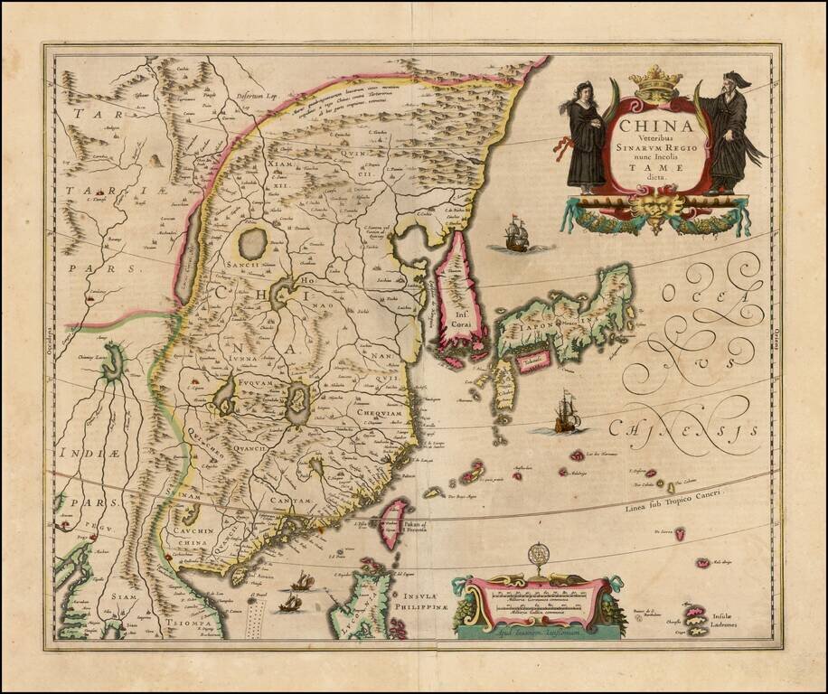
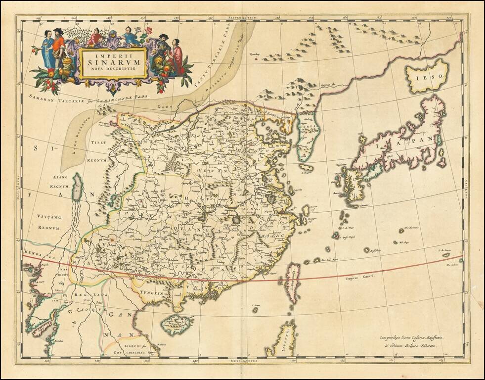
Decorative map of China, Japan and Korea and includes the north portion of the Philippines from Jansson's Novus Atlas. The map depicts the eastern part of China (bounded in the west by the Great Wall), Korea as an island and the three main islands of...
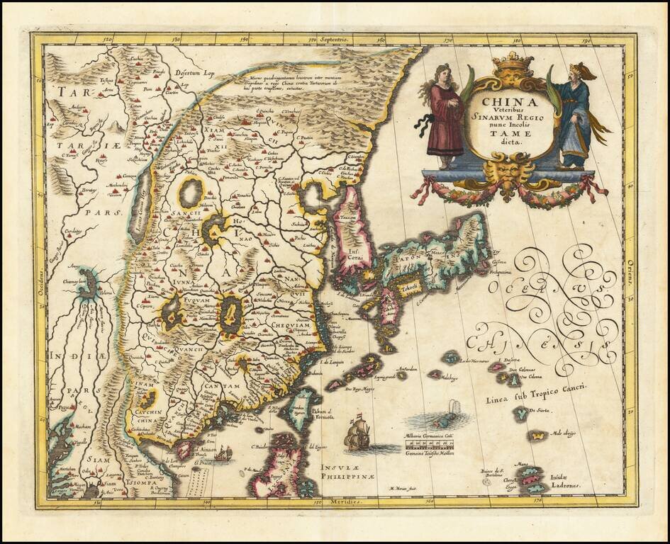
Decorative map of China, Japan, the Island of Korea, and the northern part of Luzon. Notes Pakan al I. Formosa Sailing ships and decorative cartouche. A very detailed and highly decorative map, based upon Blaeu's map of the same title.
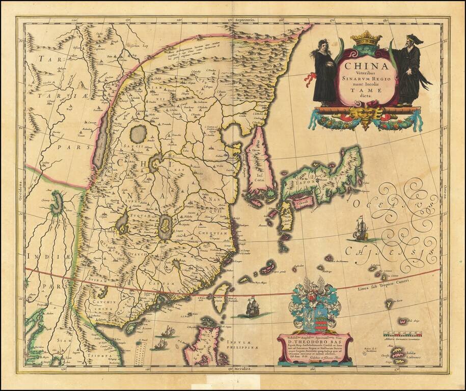
Blaeu's First Map of China Decorative map of China, Japan, Korea and including the north portion of the Philippines. The map depicts the eastern part of China (bounded in the west by the Great Wall), Korea as an island, and the three main islands of...
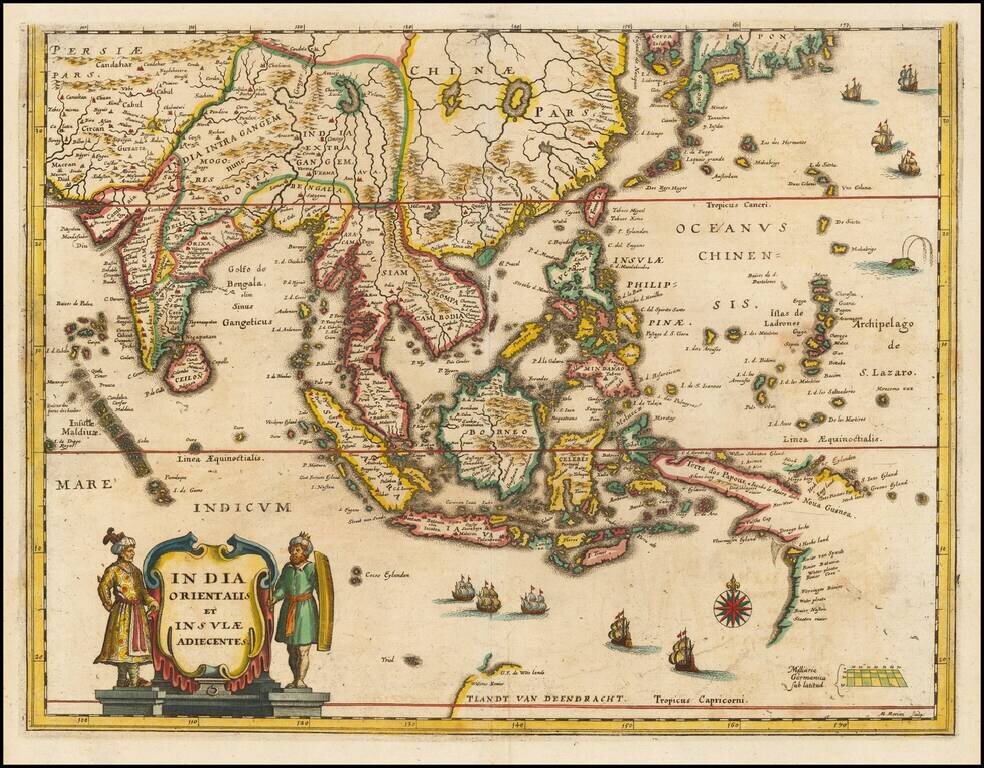
Southeast Asia with an Early Depiction of Northwestern Australia Based on Gerrit Frederikszoon de Witt's Discoveries in 1628 Scarce decorative map of Southeast Asia, China, India, the Philippines and western Oceana, along with the newly discovered...
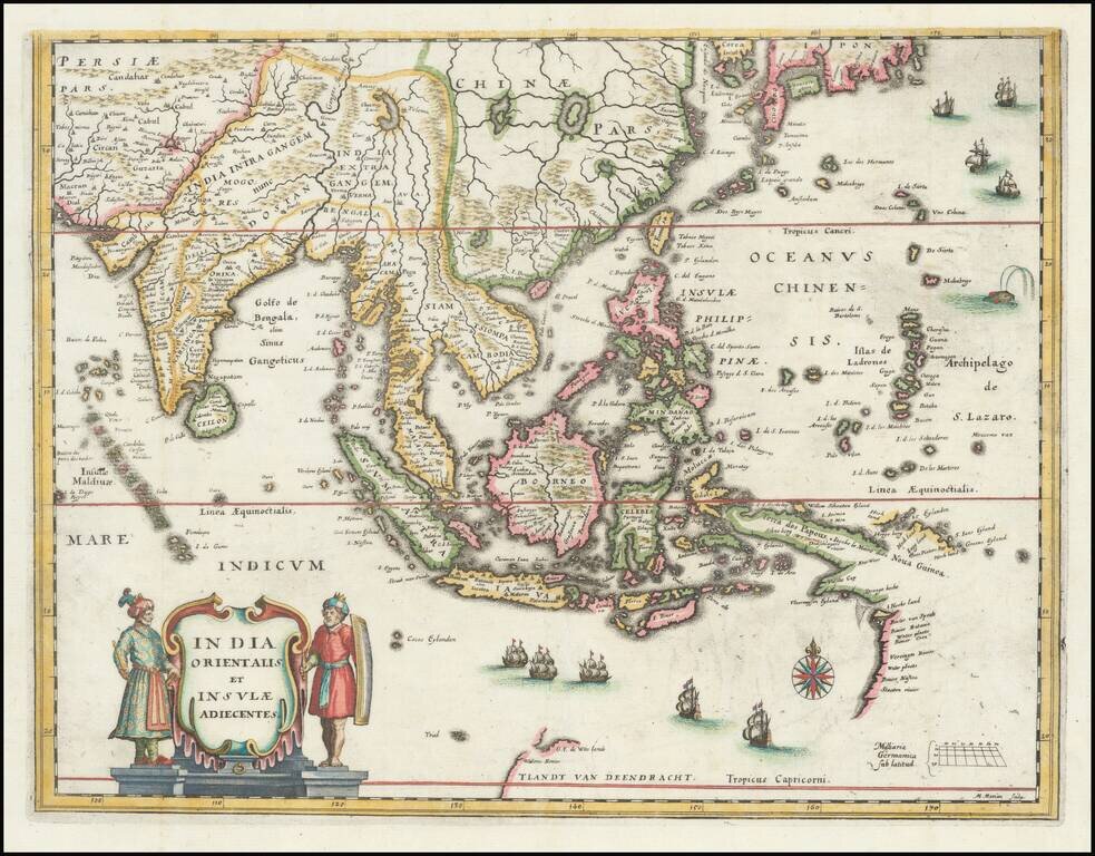
Southeast Asia with an Early Depiction of Northwestern Australia Based on Gerrit Frederikszoon de Witt's Discoveries in 1628 This is a scarce decorative map of Southeast Asia, China, India, the Philippines, and western Oceania. Perhaps the most...
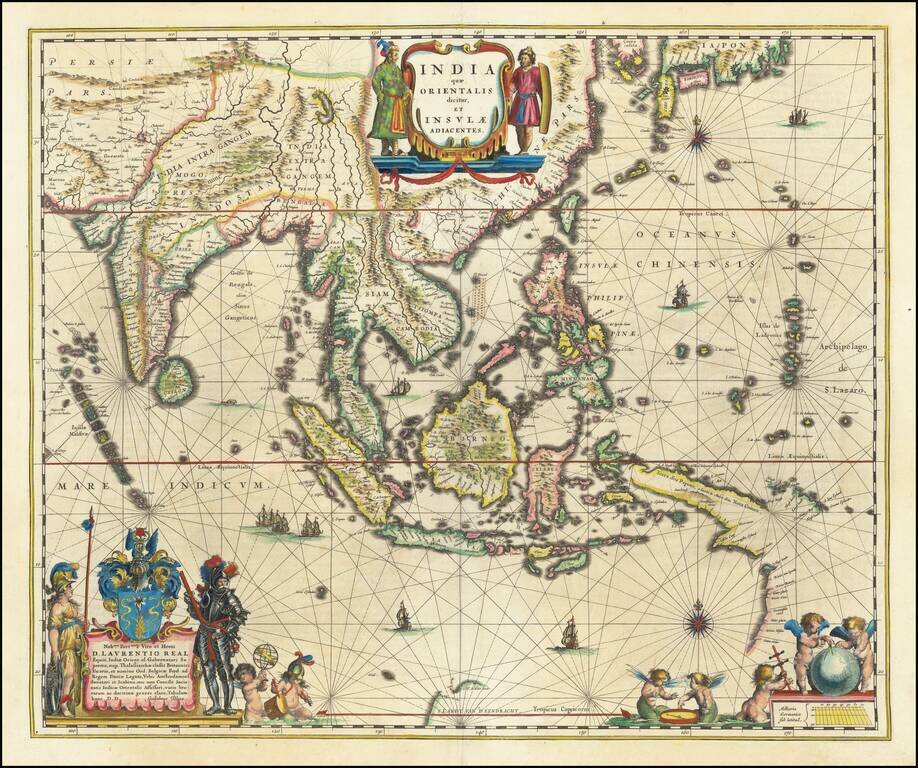
Blaeu's Detailed Map of Southeast Asia Showing Earliest Dutch Voyages to Encounter Australia Wide margined, old color example of Blaeu's map of Southeast Asia, extending from India to Tibet to Japan to New Guinea. The map is richly embellished and is...
![[Hangchow] Xuntien alias Quinzay](/map/small/69890.jpg)
Scarce early and unusual plan of the Chinese city of Quinzay [Hangchow], based upon the magnificent account given by Venetian Marco Polo in the late 12th Century of the great city of Quinzay. Quinzay is derived from the Chinese name King-sze meaning...
![Les Isles Philippines Molucques et de la Sonde . . . 1654 [Includes Taiwan & Singpore]](/map/small/50422.jpg)
Sanson's Map of the Philippines, &c. Early map of the region bounded by Taiwan in the north, Cambodia, the Straits of Malaca, Sumatra the Northwest Coast of Australia and the Ladrones, centered on the Philippines. One of the earliest maps of the...

The First European Printed Map of Hong Kong Region -- Guangzhou, & Macao Fine example of Blaeu's map of the Canton or Guangdong Province, including Hong Kong, Guangzhou and Macao. Includes the Pearl River Delta and the Island of Hainan. The map...
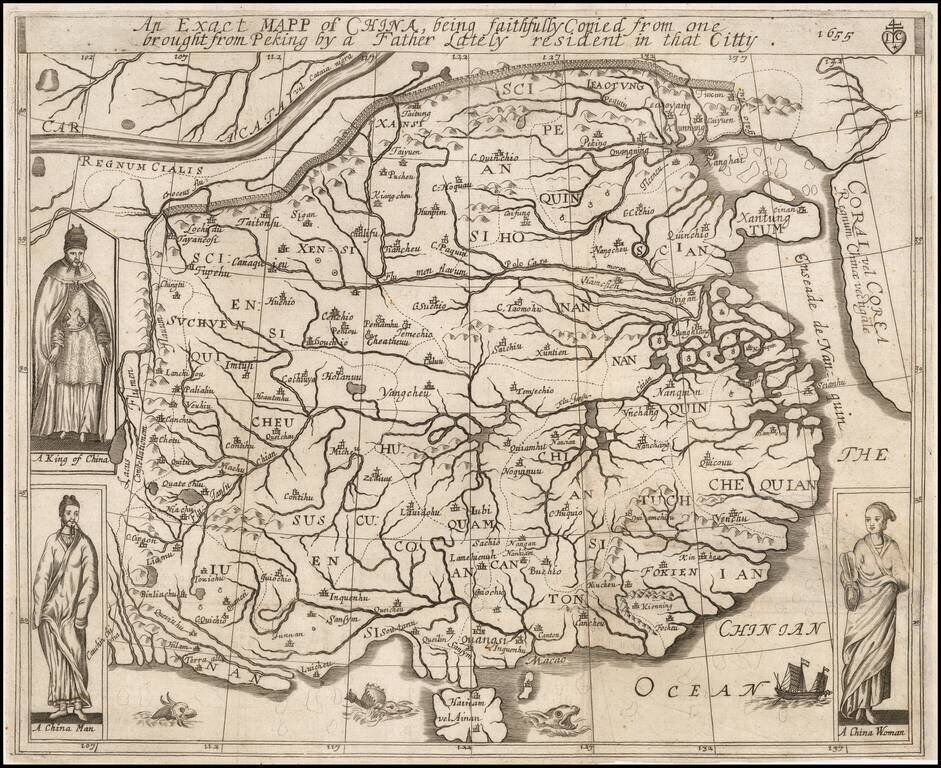
A Rare Early English Map of China Drawn From Chinese Sources Alvarez de Smedo's map of China is one of the earliest maps of China published in Europe, derived directly from Chinese sources. This rare and important early English map is based upon...
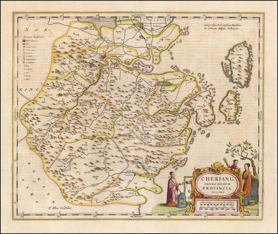
Nice old color example of Blaeu's map of the Chekiang region, including the cities of Shanghai, Hangzhou and Ningpo and the sacred islands. Decorative map of the province, based on the maps of Jesuit missionary Martino Martini, the map features many...
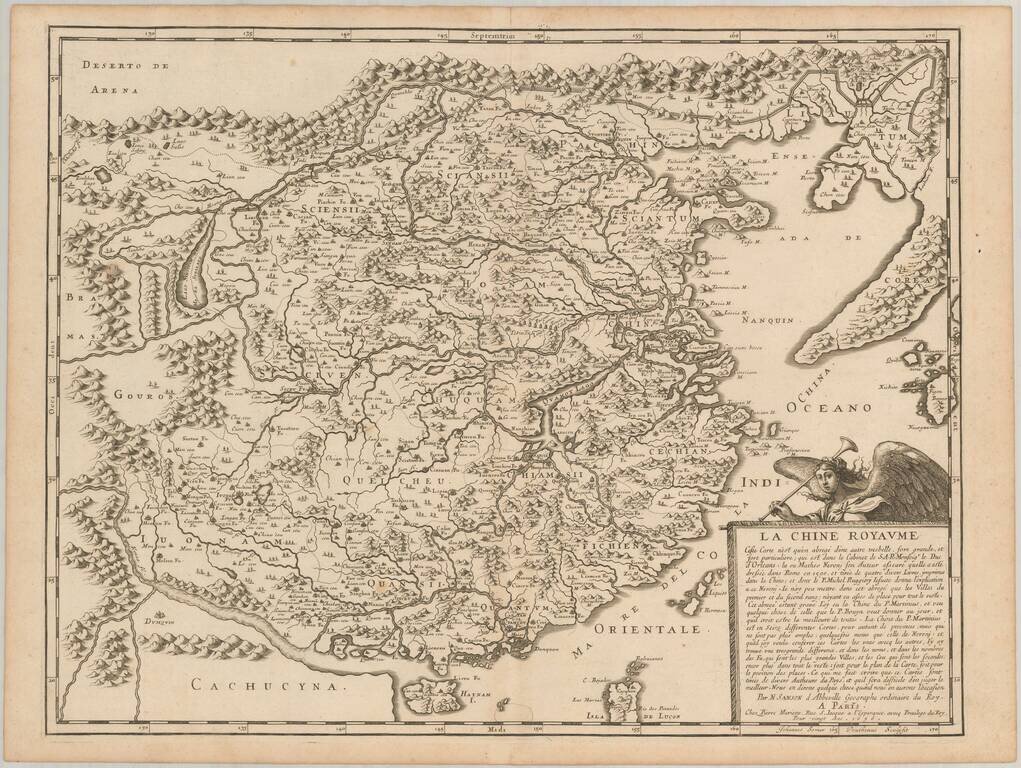
Nice example of Blaeu's map of China, from the Atlas Sinensis. A important general map of China, Korea and Japan, published by Joan Blaeu in the Jesuit Martino Martini's Atlas Sinensis , the first western atlas of China. The map Incorporates the...
First state of Sanson's scarce map of China and Korea, first published in 1656. This important and attractive French map of China is based on an indigenous Chinese map copied by Jesuit, Matteo Ricci, and brought back to Rome in 1590 by his fellow...
![Reys-Kaerte Vande Ambassade Der Nederlantse Oost Indise Compagnie door China aen den Grooten Tartersen Cham der Johan Nieuhoff . . . [title repeated in French, Latin & German]](/map/small/58896.jpg)
An Early Dutch Map of China From VOC Sources Important early map of China, which accompanied Johann Nieuhoff's important account of his travels in China, one of the earliest non-Jesuit accounts of the region. Johann Nieuhoff was the official...
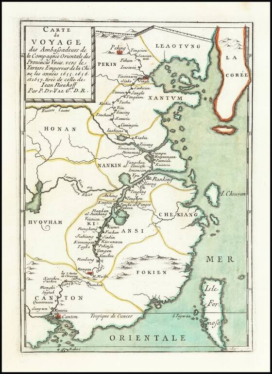
Scarce map of China, extending from Beijing, Korea and the Great Wall of China in the north to Canton, Macao and Formosa. The map illustrates the Dutch expedition to China led by Johan Nieuhof in 1655-57. In the first half of the 17th century, the...
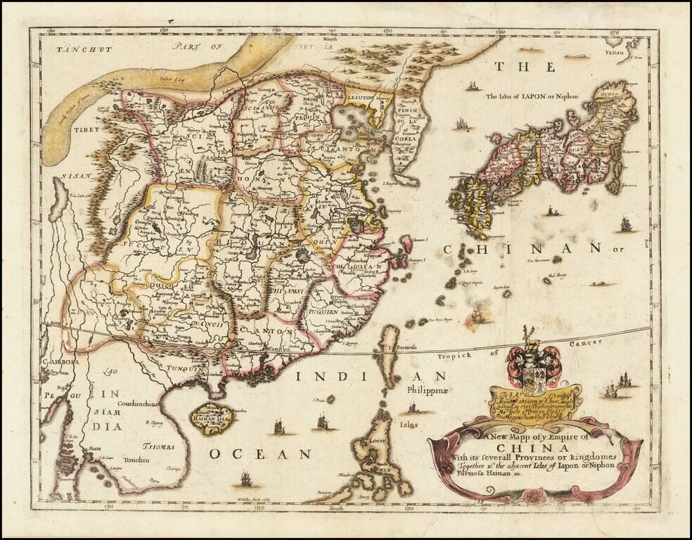
Rare Second State of Richard Blome's Map of China. Finely colored example of Richard Blome's scarce early map of China, with coat of arms and dedication to the London Lawyer Thomas Robinson. Unlike most of Blome's maps, the present map is based upon...