Map size in jpg-format: 64.6397MiB
Click to open in high resolution (open in new tab).
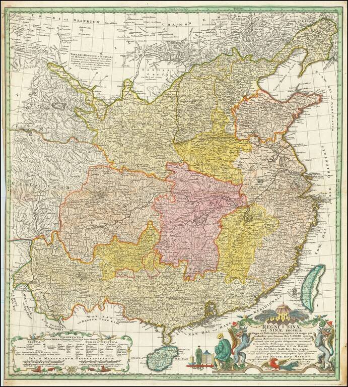
Homann Heirs edition of D'Anville's map of China, the most important printed map of the Middle Kingdom published in Europe during the 18th Century.
Finely engraved German edition of J.B.B. d'Anville's groundbreaking map of the Middle Kingdom, an important and geographically progressive depiction of China. Innumerable towns are noted and provincial boundaries and river systems are delineated. The areas to the north of China include Mongolia with the Great Gobi Desert and Manchuria (the ancestral home of China's ruling Qing Dynasty).
The Qing Emperor Kangxi commissioned a ground of Jesuit surveyors to chart his kingdom from 1708 to 1716. The resulting maps were published as the Kangxi Atlas (1718-19), and the information contained on its woodcut maps would not be superseded for well over a century.
The leading French cartographer Jean-Baptiste Bourguignon D'Anville (1697-1782), acquired copies of the Kangxi maps and devised his own interpretations, first printed in Jean-Baptiste Du Halde's Description Geographique … de la Chine (Paris, 1735).
If you are a student, write to us in telegram: @antiquemaps and indicate what material you need and for what work you need a map in high detail. We are ready to provide material on special terms. For students only!
![[Martin Behaim Globe / Book] Pars Globi terrestris Ao. 1492 a Martino Behaim Equite Lusitano Norimbergae confecti Delineavit Christoph. Theoph de Murr 1778 (bound with:) Diplomatische Geschichte des Portugesischen berühmten Ritters Martin Behaims](/map/small/68828.jpg)
![Il Disegno Della Terza Parte Dell' Asia [Gastaldi's Wall Map of SE Asia with extra panels!]](/map/small/30554hbp.jpg)
![Chinae, olim Sinarum regionis nova descriptio. auctore Ludouico Georgio. [English Edition!]](/map/small/71123.jpg)