
![[ Hong Kong / Macao / Canton ] Iunnan, Queicheu, Quangsi et Quantun, Provinciae Regni Sinensi Praefecturae dictae](/map/small/55800.jpg)
Fine example of the Valk and Schenk edition of Jansson's regional map of China, including the Hong Kong - Macao Region . A beautifully engraved map of Southern China covering Hainan and the Pearl River Delta with Macao and the islands around...
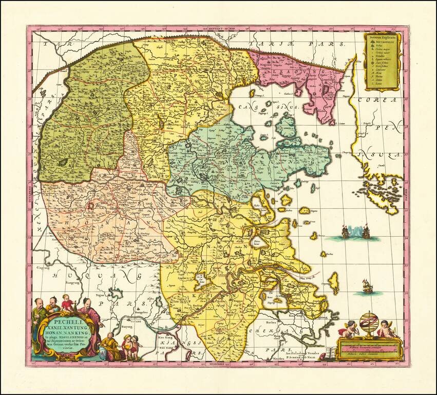
Scarce Valk & Schenk edition of Jan Jansson's highly decorative map of northeastern China and Korea. The present map is very geographically advanced for its time and depicts the provinces of Hebei (Pecheli), Shanxi (Xansi), Shandong (Xantung),...
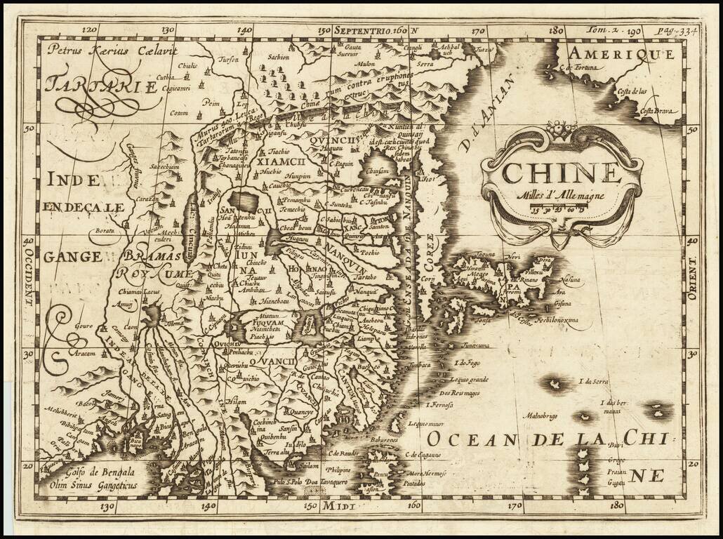
A Rare Variant! Rare early map of China, published by Martineau du Plessis in Paris. The map is printed from a copper plate originally engraved by Petrus Kaerius (Peter Vander Keere) Johannes Cloppenburg's Atlas Sive Cosmographie in 1730. This state...
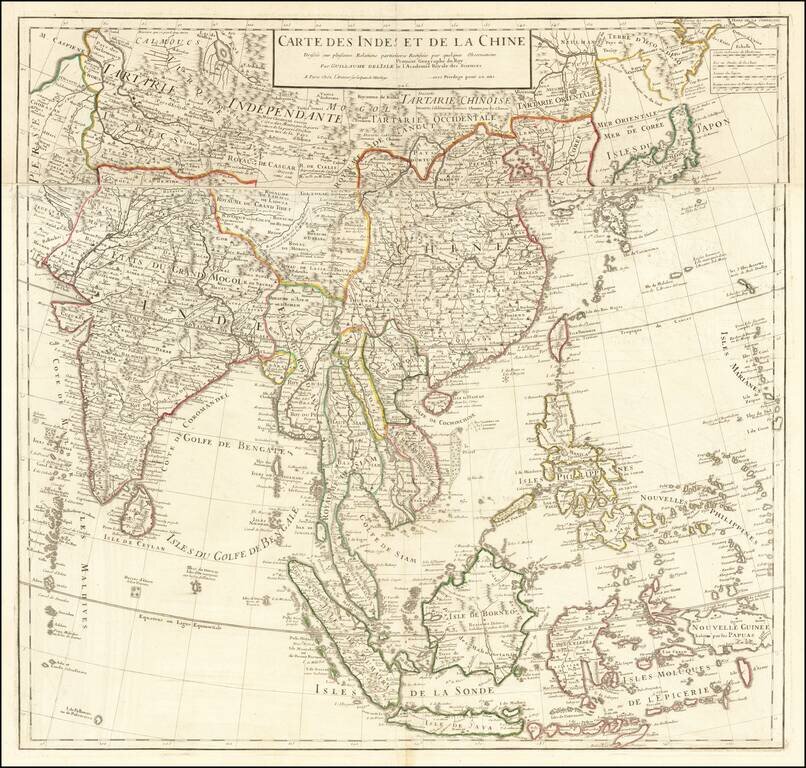
De L’Isle’s Detailed Map of Eastern Asia Updated example this noteworthy map of East Asia and the Indian subcontinent published by France’s foremost eighteenth-century cartographer, Guillaume De L’Isle. The map was foundational; it was...
Interesting map showing the region of northeastern India, Nepal, Bhutan, Assam and Bangladesh. At center is the imaginary Chiamaeus Lacus with four huge rivers flowing south into Bangladesh and Burma. Decorated with a pictorial title cartouche of a...
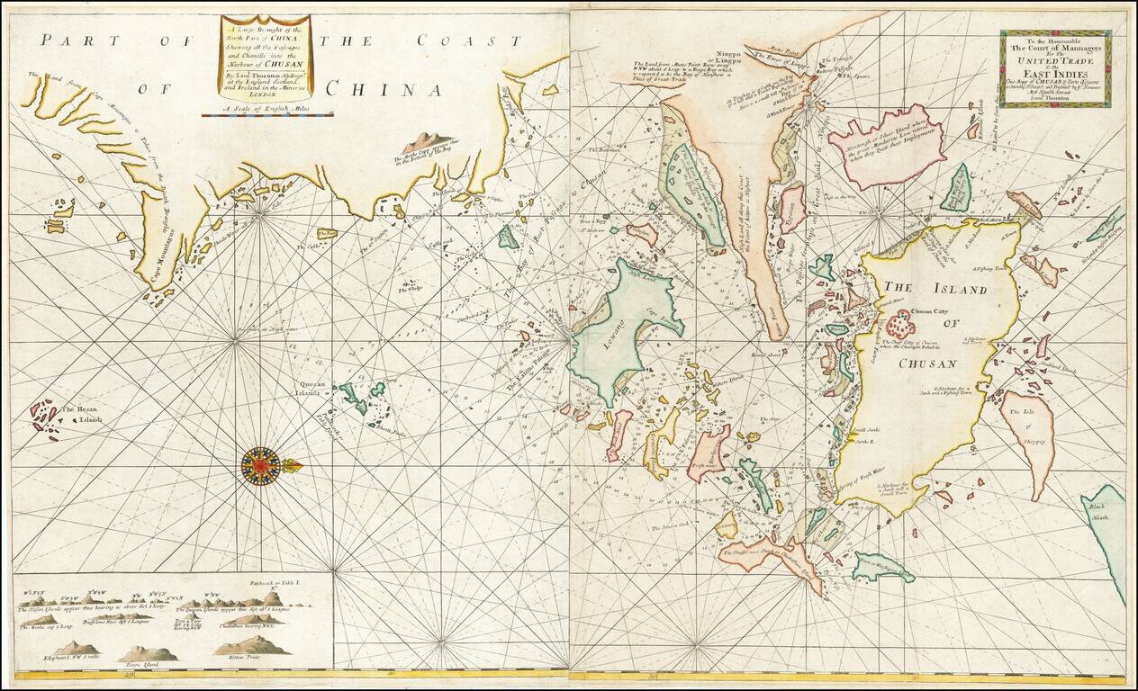
Rare early English sea chart of China's Zhejiang Province, which appeared in an early edition of the The English Pilot: Third Book. The map shows the area around Zhoushan, including Ningbo, Hangzhou and the area just to the south of Shanghai. This...
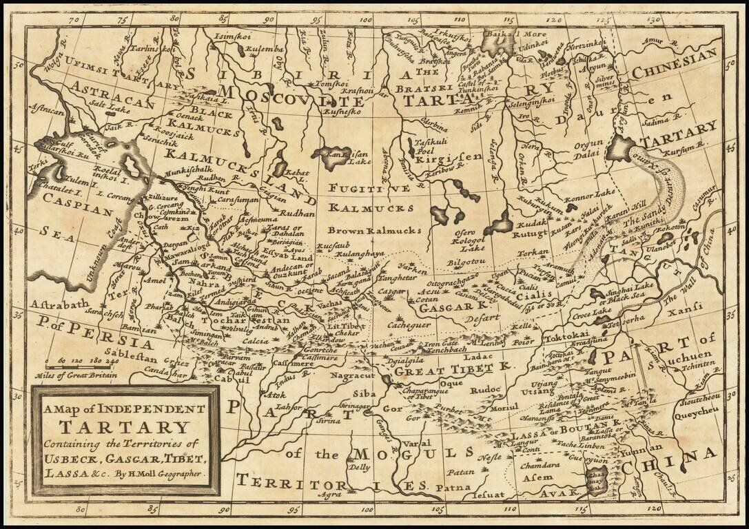
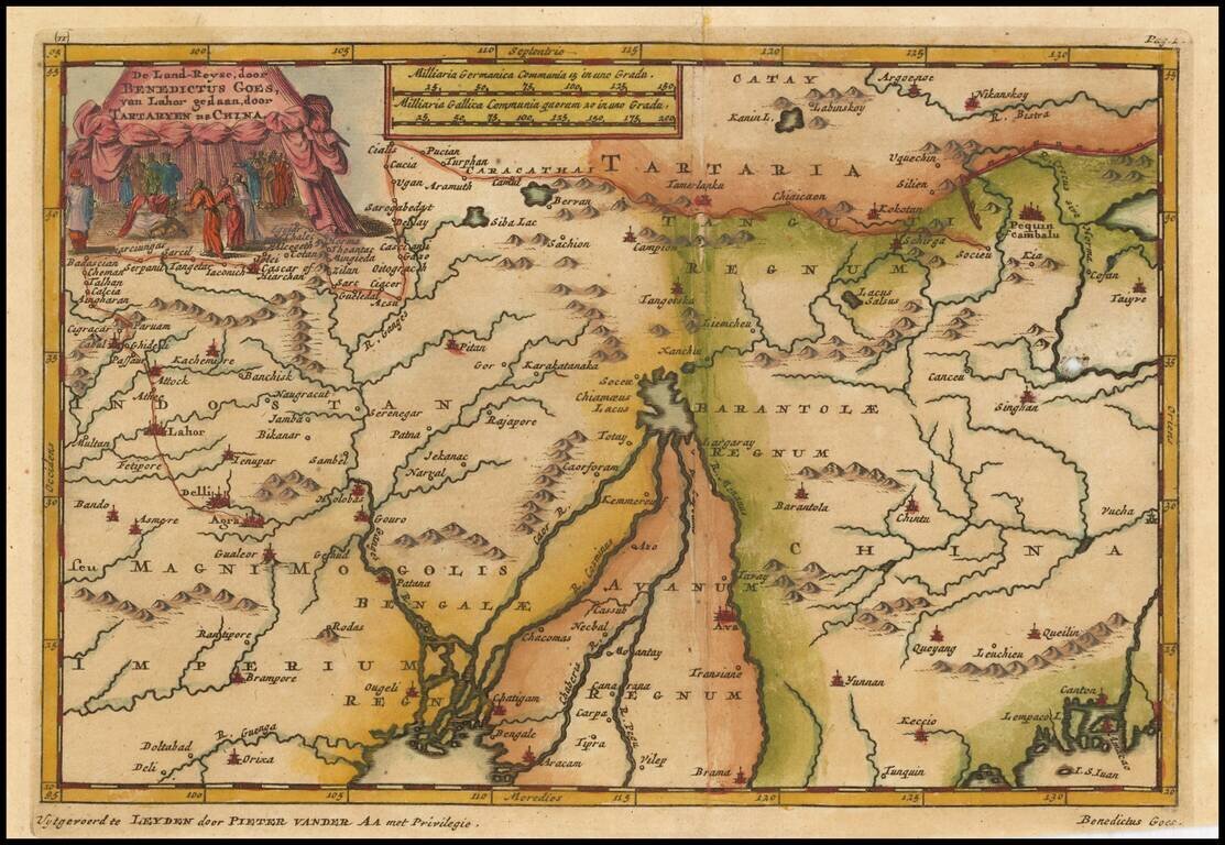
Scarce map of Central Asia, Tibet, Mongolia, Usbeck, etc. The map covers the region from the Caspian Sea to the Great Wall of China. The region is mostly the domain of the Kalmyk people with various areas denoted for Black Kalmucks, Fugitive Kalmucks,...
Finely colored example of this early map of China and Korea, which appeared in Vander Aa's Nouveau Theatre du Monde. The map reaches from the Royaume de Coree (Korea) in the east to Siam in the south, showing the islands of Formosa and Hainan....
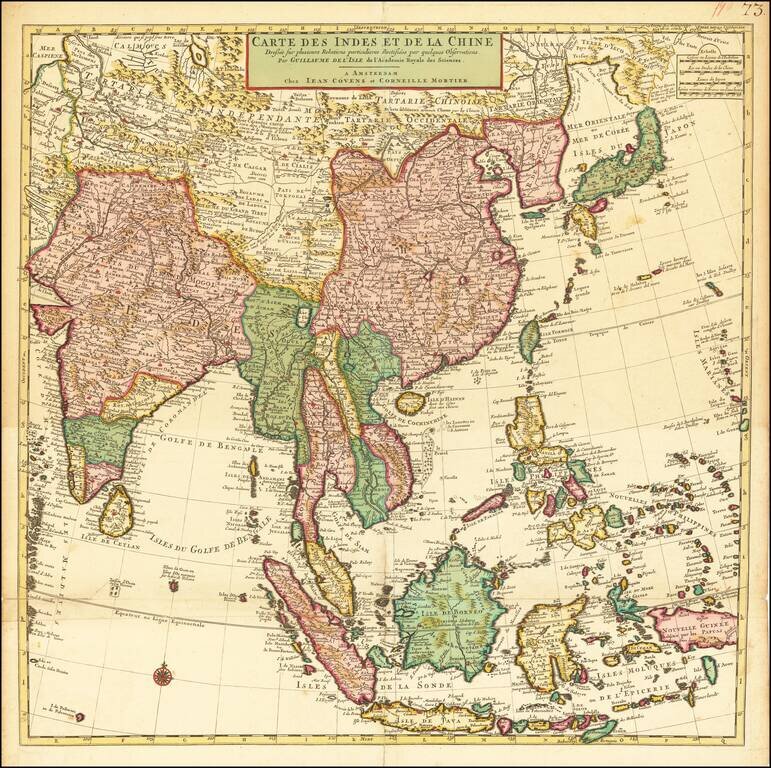
Fine, Detailed Map of Eastern Asia Notable example of this meticulously-drawn map of East Asia and the Indian subcontinent published in Amsterdam. The map is based upon the earlier work of the famed geographer Guillaume De L'Isle. It covers much of...
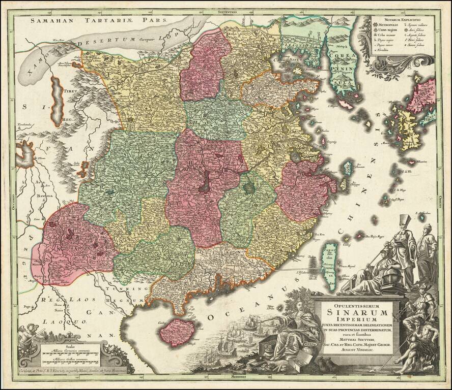
Striking and highly detailed map of China, colored by provinces, published by Seutter in Augsburg, circa 1730. The map extends from southern China to Korea, which is shown as a peninsula and includes southern Japan and Taiwan. The elaborate cartouch...
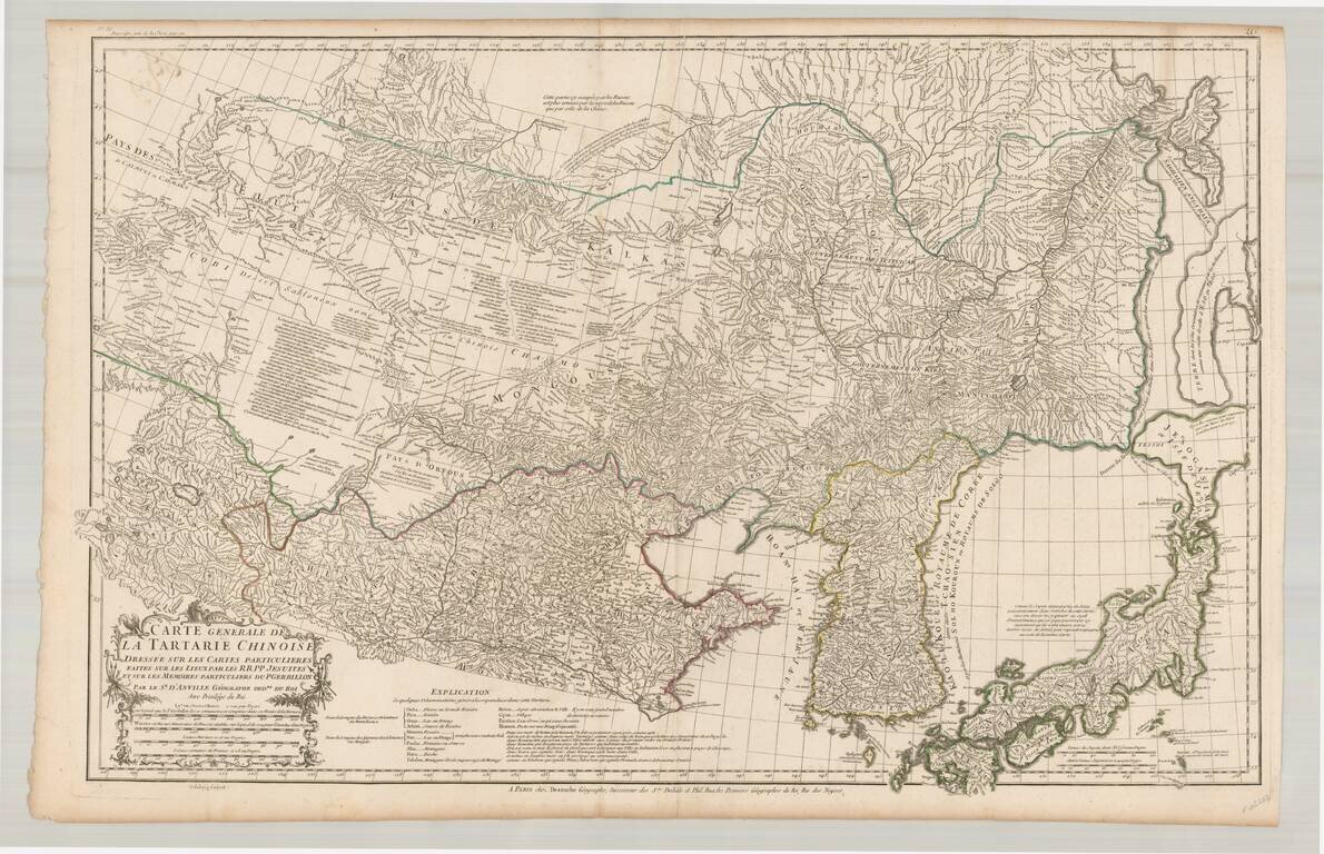
Fine example of the rare JA Dezauche edition of D'Anville's map of the region from Japan to the Gobi Desert, centered on Mongolia and Korea, from D'Anville's Atlas of China. Includes a nice treatment of Korea, Japan and China, along with a detailed...
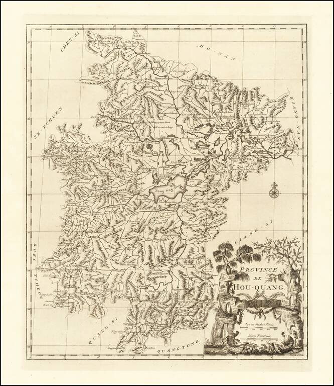
Fine example of D'Anville's map of the Hubei Region. Shows the source of the Yang-tse -Kiang River in Lake Tong-ting-Hou, along with the regional capital city of Wuhan (called Ou-Tchang-Fou) on this map. D'Anville's map appeared in du Halde's...
![[Tibet] Carte Generale Du Tibet ou Bout-Tan Et Des Pays De Kashgar Et Hami Dressee Sur Les Cartes Et Memoires Des RR PP Jesuits De La Chine . . .](/map/small/43409.jpg)
Fine example of the Dezauche edition of the first European map of Tibet, first issued in 1737 by D'Anville. Much of the interior is captioned "Gobi ou Desert De Sable" (Gobi, or Sandy Desert) and several rivers are shown "lost" in the sands. There are...
![[Shanghai, Hangzhou, Suzhou, Nanjing] Province De Kiang-Nan](/map/small/33770.jpg)
Decorative map of the Kiang-Nan Province, centered on the Yangtze River. D'Anville's map covers much of the modern Jiangsu Province and Shanghai Municipality. Based on Jesuit sources, D'Anville's maps remained the definitive European rendering of...
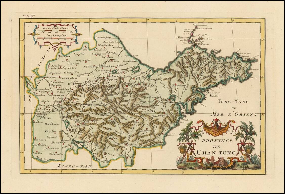
Striking full color example of D'Anville's map of the Shandong Province, from Du Halde's Nouvel atlas de la Chine, de la Tartarie chinoise et du Thibet. D'Anville used maps prepared by Jesuit missionaries and commissioned by Emporer-Kanyx, who in...
![[Guandong and Hainan, China] Province De Quang-Tong](/map/small/57106.jpg)
First Accurate Western Map of Guangdong and Hainan, China Finely-wrought map of the southern Chinese provinces of Guangdong and Hainan, by French geographer and cartographer Jean Baptiste Bourguignon d’Anville. Considered the first accurate map of...