
![[China] 古今地舆全圖 / Full Modern and Ancient Map](/map/small/62437kb.jpg)
A Rare and Important Discovery -- The First Map of China Published For Commercial Use and Sale Mingjie Liu's (刘明杰) (1857 - 1911) important 1892 (Guangxu 18) Qing Era xylographic (woodcut) map of China is the earliest known example of what is...
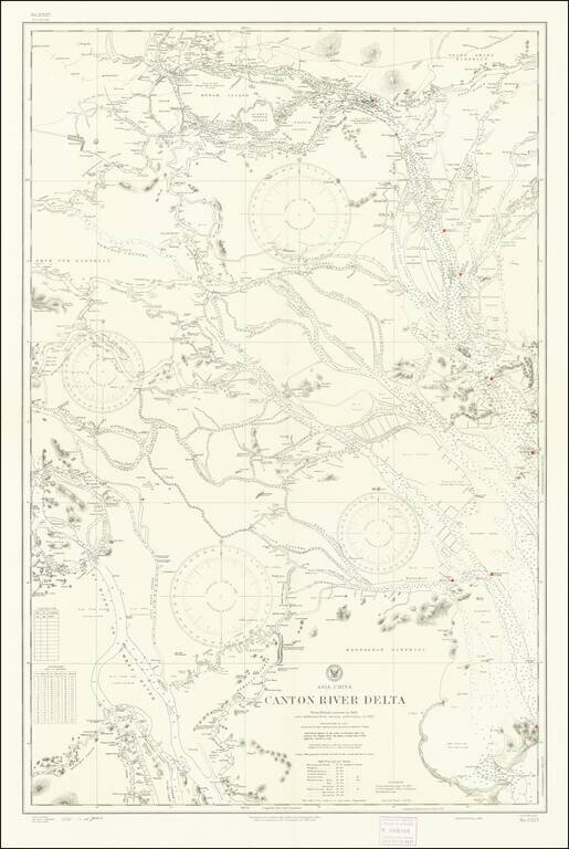
Detailed chart of the Pearl River (Zhujiang) Delta, published by the U.S. Navy Hydrographical Office based on a British Admiralty Chart published in 1909 and here updated to 1930s. The map provides significant detail of the area between Canton...
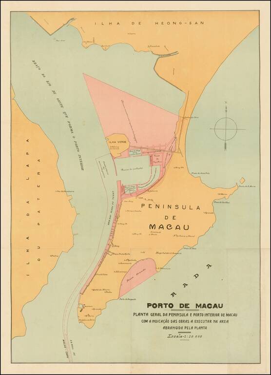
Rare and decorative large plan of the Peninsula of Macau, showing the beginnings of the significant man-made changes to the Portuguese colony. This artistically virtuous map employs attractive pastel colors and a transitional Art Nouveau-Art Deco font...
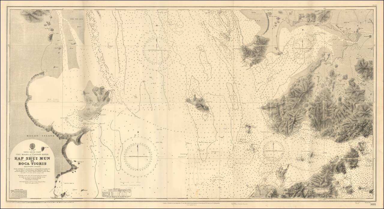
An Early Look At Shenzen Bay & Hong Kong Gold Coast Fine large format sea chart of the region between the western most part of Hong Kong, Shenzen, Macao and Lantao Island, published by the British Admiralty. The areas shown in Shenzen and Hong...
![[Hong Kong Published Fishing Map!] Bountiful fish harvest maritime map 漁獲豐收海圖](/map/small/55323.jpg)
Hong Kong Map Advertising New Skills to Fisherman Interesting fishing map extending from Hainan Islands in the southwest to Xiamen in the northeast, centered on the Hong Kong - Macau area. The map shows the fishing grounds in the area, highlighting...
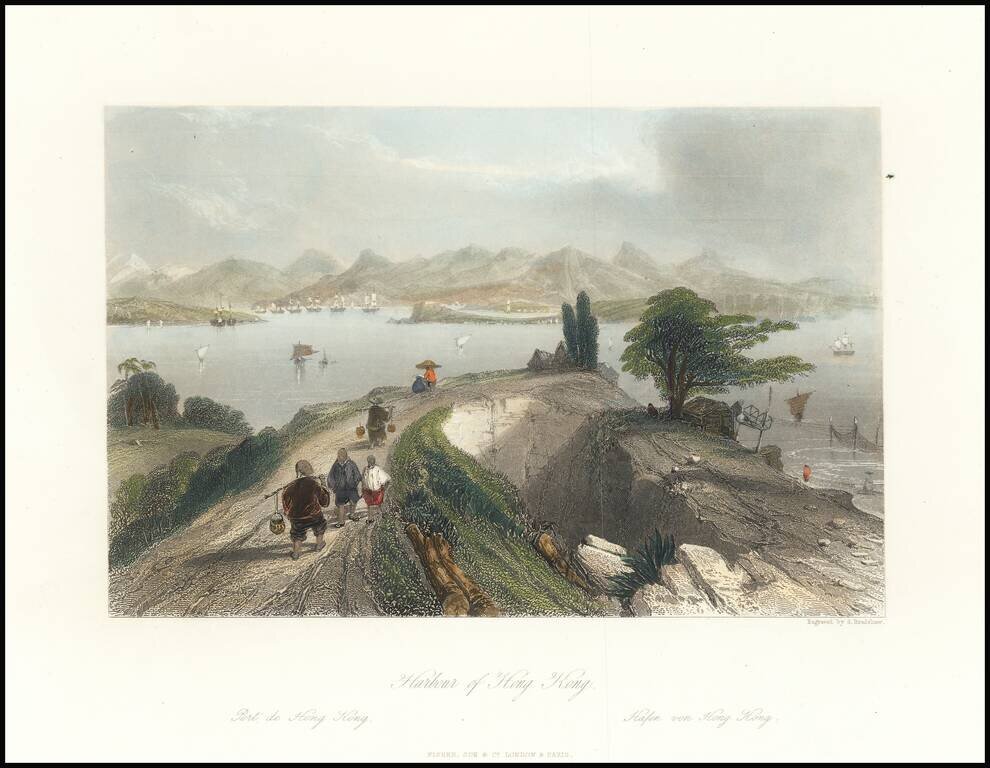
This is an attractive antique view of Hong Kong harbour, drawn by an Englishman in the first half of the 19th century. The view shows the harbour in the distance, framed by tall mountains. In the foreground, merchants and peasants dressed in...
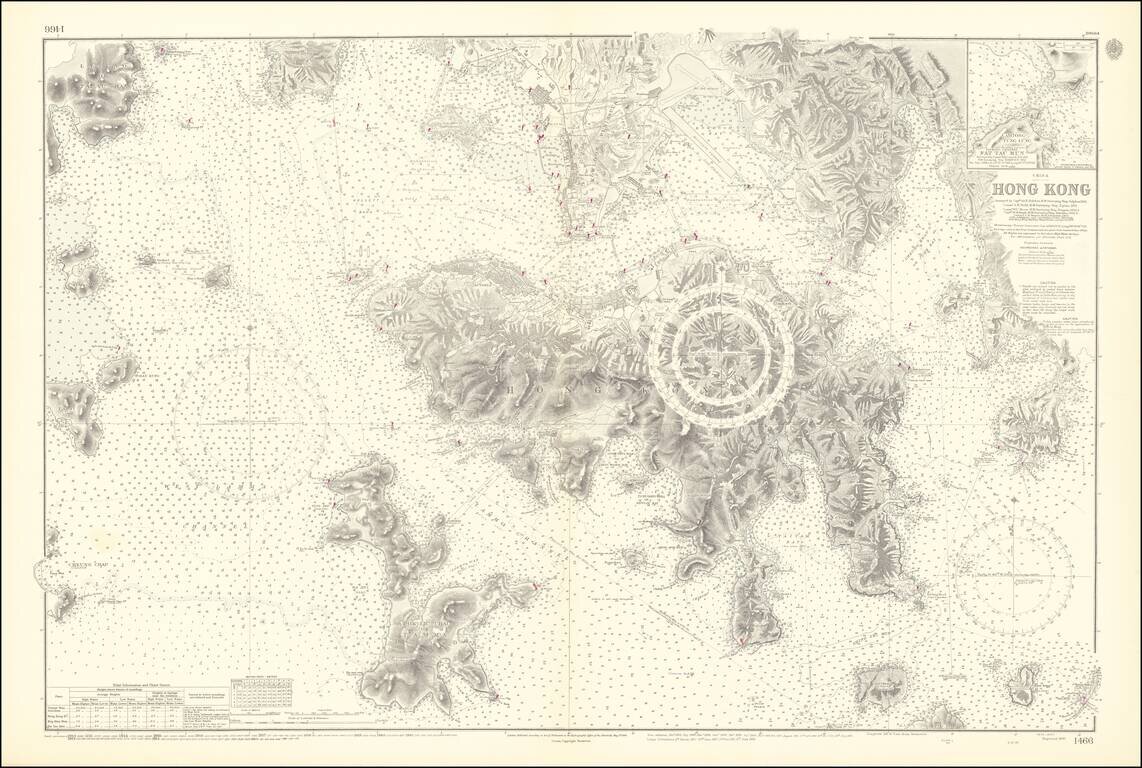
An Exceptional Post-World War II Chart of Hong Kong and Environs -- The First British survey of Hong Kong Harbor, updated to 1953 / 1964 Remarkably detailed British Admiralty Sea Chart of Hong Kong, first published in 1843, based upon the surveys of...
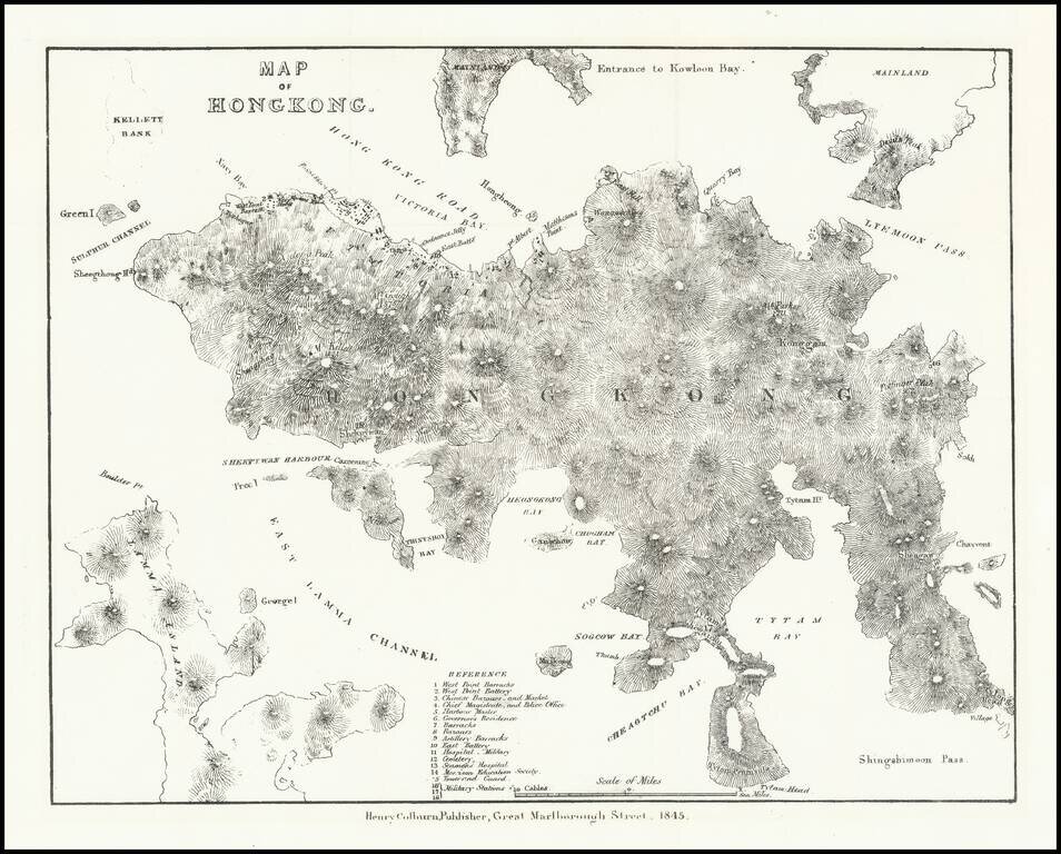
Very early lithographed map focusing specifically on Hong Kong, published in London in 1845. The map is one of the earliest obtainable mappings of Hong Kong after it was ceded to Great Britain in the Treaty of Nanking in 1842. The map derives in large...
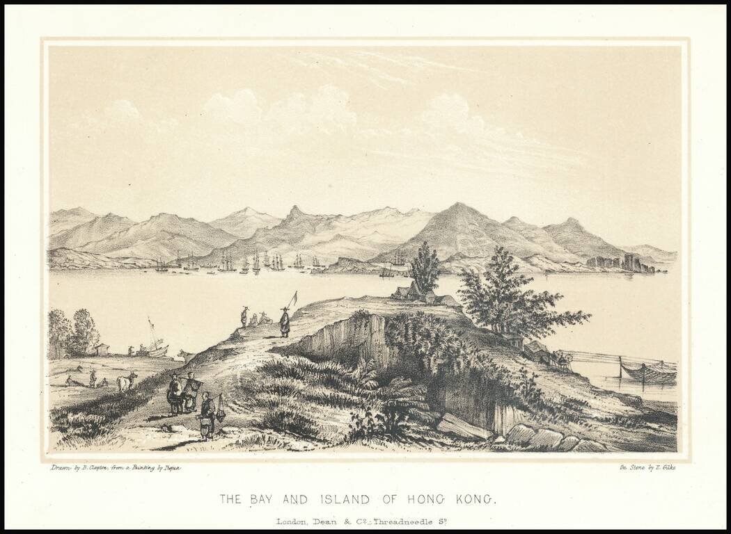
Fine early lithographic view of Hong Kong, "Drawn by B. Clayton from painting by Piqua."
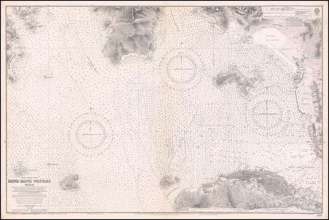
Western Approaches To Hong Kong Harbor A large-scale and detailed sea chart of the western approaches to Hong Kong Harbor, issued by the British Admiralty, including all of Victoria (Central), western Kowloon and extending westwards to Lantau...
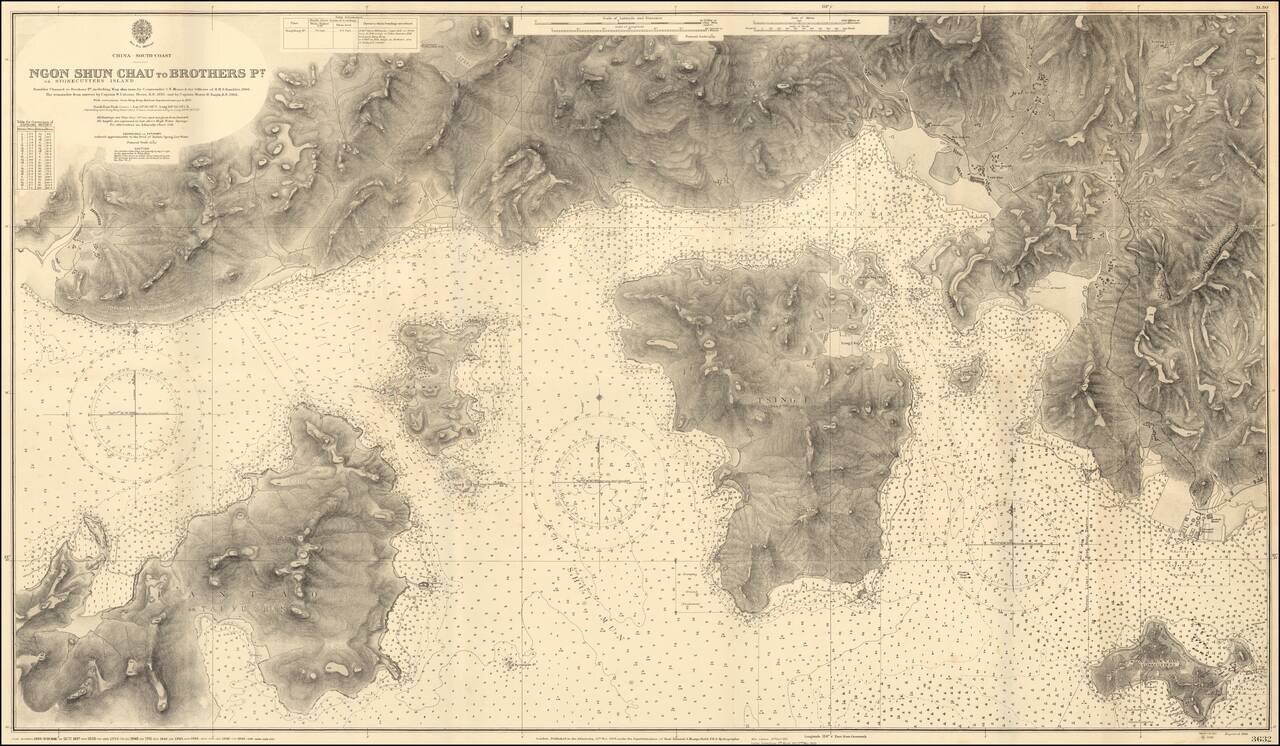
Impressive Chart of Park Island, Tsing Yi, and western Hong Kong Harbor. A very detailed chart of the section of water west of Hong Kong Harbor. The chart was first published in 1908, based on the surveys of Commander C.E. Monro of H.M.S. Rambler,...
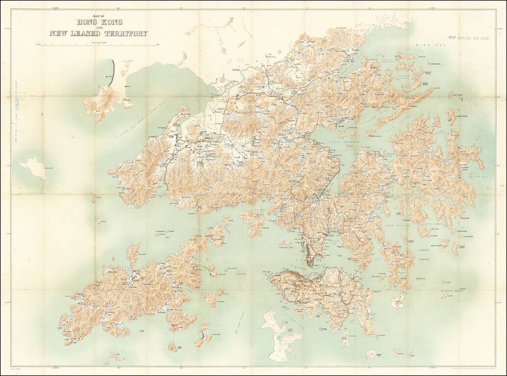
For Official Use Only. A Large Map of Hong Kong During the 1911 Revolution. Large antique map of Hong Kong Island and the region north to the Sham Chun River. The map was prepared by the Royal School of Military Engineering in concert with the...
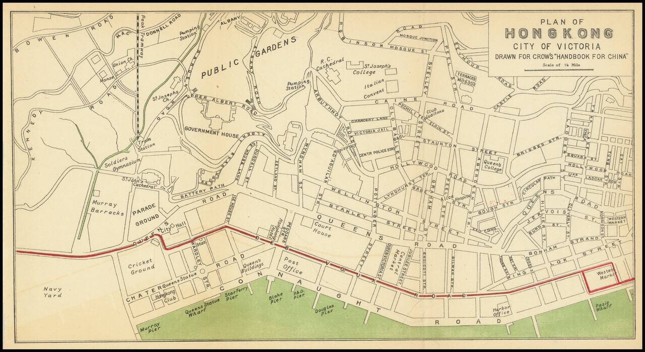
Nice antique map of Victoria, Hong Kong, published by Carl Crow in Shanghai, circa 1917. The map covers what is now central Hong Kong, from the harbor south to Government House and Robinson Road. All the major roads, and some of the major public...

Western Approaches To Hong Kong Harbor (Red Lined By An Early Harbor Planner) A large-scale and detailed sea chart of the western approaches to Hong Kong Harbor, issued by the British Admiralty, including all of Victoria (Central), western Kowloon...
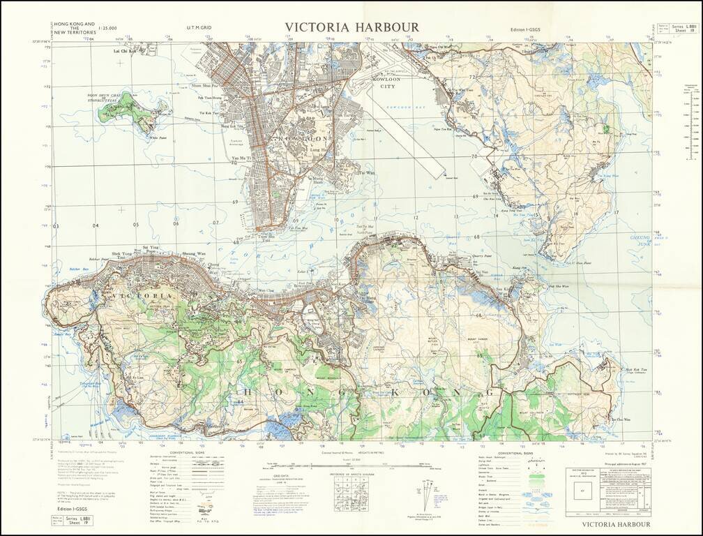
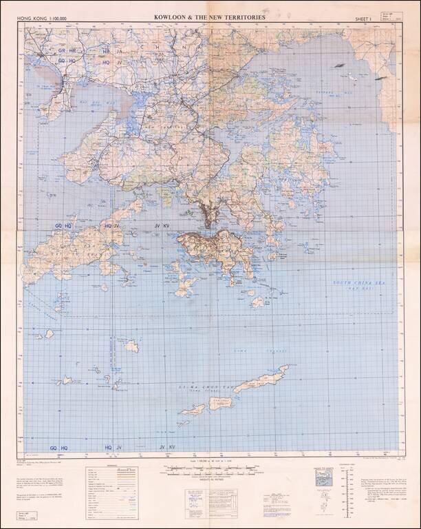
Detailed map of Victoria Harbour produced by D Survey, War Office and Air Ministry in 1957. There is a diversity of information communicated by the map including built-up areas, villages, "temporary native quarters", and isolated buildings in some...
Detailed War Office and Air Ministry Two-Sheet Chart of Hong Kong. Detailed British military mapping of Hong Kong, published in two sheets (here joined as one), in 1958. The sheets are labeled first editions and have as their sources RAF Air Survey...