

The First European Printed Map of Hong Kong Region -- Guangzhou, & Macao Fine example of Blaeu's map of the Canton or Guangdong Province, including Hong Kong, Guangzhou and Macao. Includes the Pearl River Delta and the Island of Hainan. The map...
![[ Hong Kong / Macao / Canton ] Iunnan, Queicheu, Quangsi et Quantun, Provinciae Regni Sinensi Praefecturae dictae](/map/small/55800.jpg)
Fine example of the Valk and Schenk edition of Jansson's regional map of China, including the Hong Kong - Macao Region . A beautifully engraved map of Southern China covering Hainan and the Pearl River Delta with Macao and the islands around...
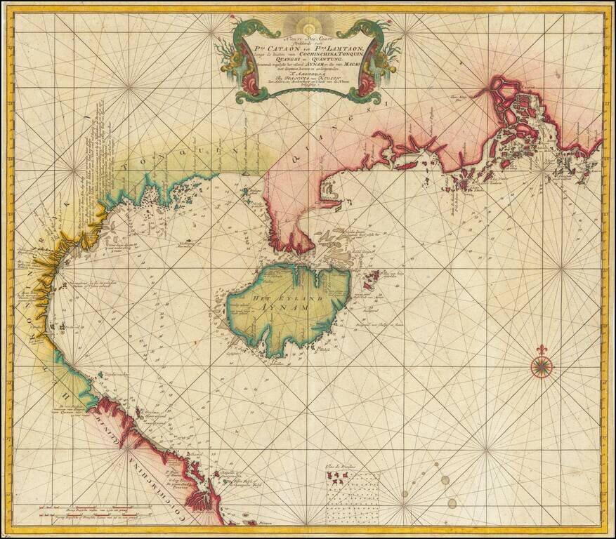
Canton, Macao & Hong Kong etc. -- The VOC Secret Atlas The chart was made for and used by the VOC (Dutch East India Company) for navigation and trading, with a compass rose with rhumb lines, depth indications and other relevant navigational...
![[Macao] Видъ Города Макао съ морской стороны | Ansicht Der Stadt Macao in China](/map/small/70739.jpg)
Magnificent View of Macao From the Original Russian Edition of Krusenstern's Important Atlas Fine example of this skillfully-engraved view of Macao, based upon drawings taken by Wilhelm Gottlieb Tilesius in 1805-6, which appeared in the atlas to...
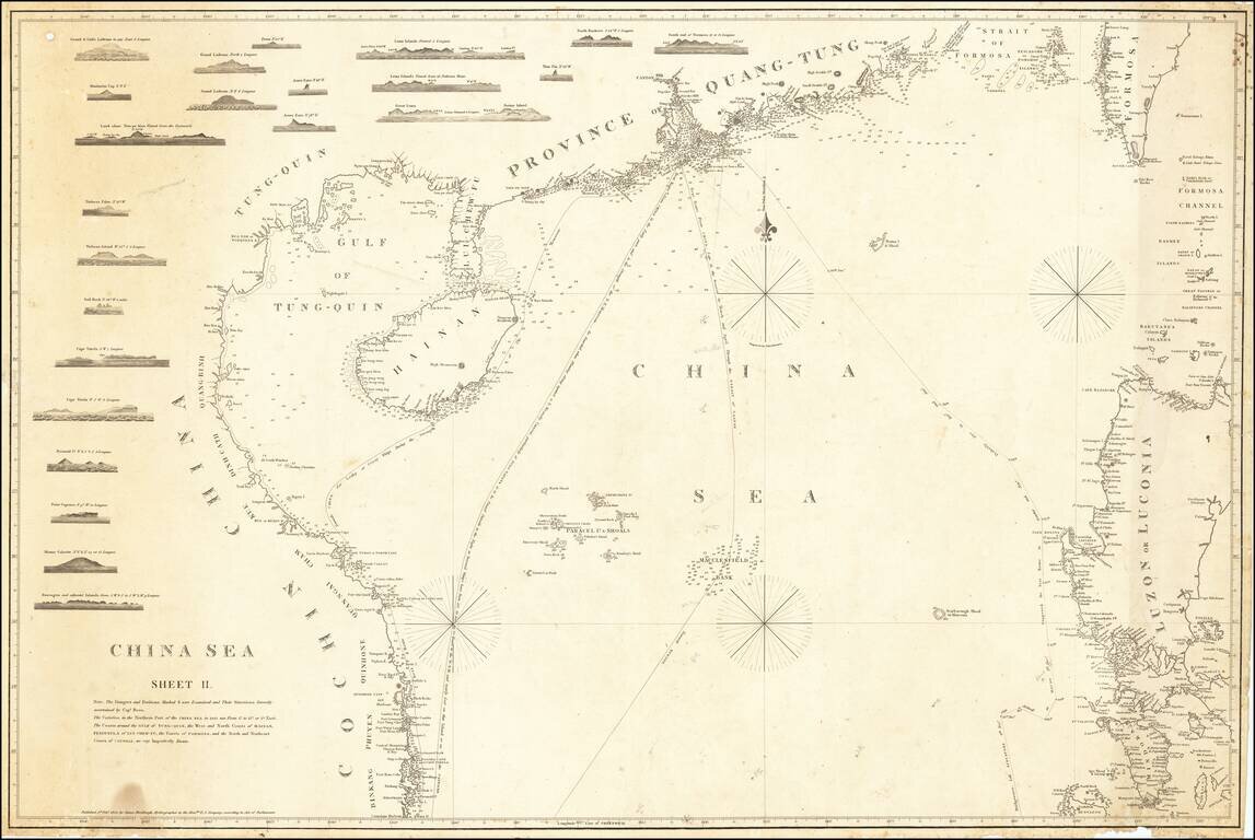
First State of Horsburgh's Second and Substantially Improved Chart of the Coast of China, Philippines and Cochinchina etc. Finely executed general chart of the South China Sea from Na Trang to Tonkin, Taiwan and Mindoro, with a number of approach...
![[Hong Kong / Macao / Canton] Asie No. 98. Partie de La Chine](/map/small/64115.jpg)
Detailed map of the Province of Canton and Hainan Island, published in Brussels. The map includes nice detail at the mouth of the Pearl River, with Lantao, Macao and Canton named.

An Important Early Sea Chart of the Area around Hong Kong and the Pearl River Delta Updated To Incorporate Placenames in Chinese Rare separately published chart of the areas between Canton (Guangzhou), Hong Kong to the islands around Hong Kong, with a...
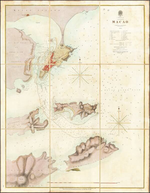
A Surreptitious Survey of Macau By A Famed British Officer Rare separately published sea chart of Macau, published by the British Admiralty, based upon the work of Peter Heywood, of Mutiny on the Bounty fame. The chart shows the town of Macau,...
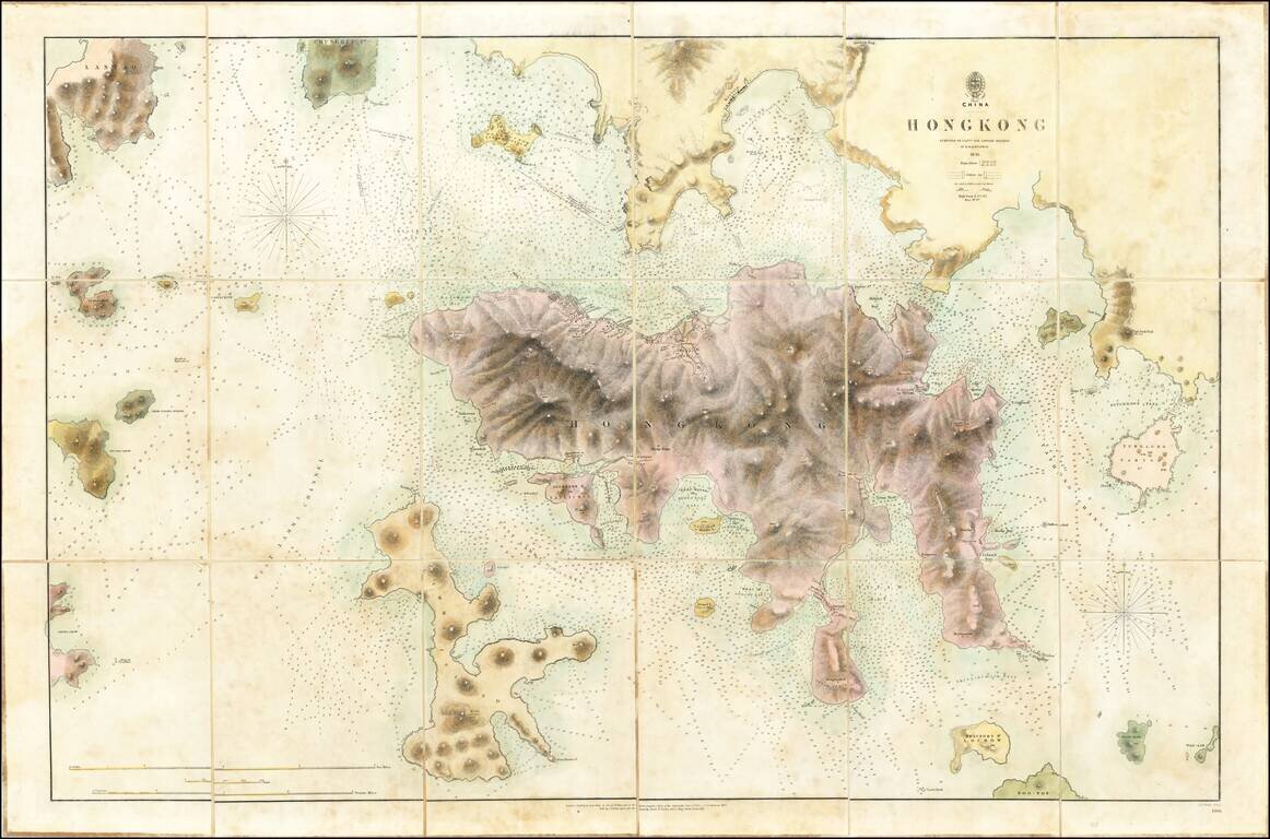
The First Printed Map of Hong Kong Early edition of the first printed map of Hong Kong, first published in 1843 by the British Admiralty Chart of Hong Kong, based upon the surveys of Sir Edward Belcher. Belcher's survey is the first large format map...
![South Eastern Asia Birmah - China - Japan [and Philippines]](/map/small/69678.jpg)
Interesting regional map of Southeast Asia and the Philippines. Hong Kong Island is noted, as is Singapore and a separate Malacca. Nice detail in the Philippines.
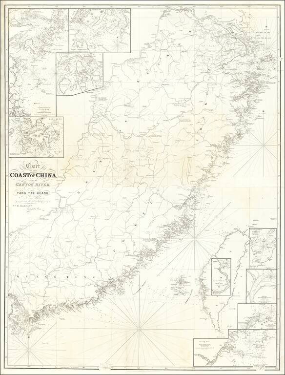
Rare 2 sheet map of Southwestern China, from Shanghai to Hong Kong, Macao and Canton, published in London by William Allen. The map includes a number of smaller insets, including: Hong Kong and its Anchorage River Woo-sung to Shang-Hae Mouth of...
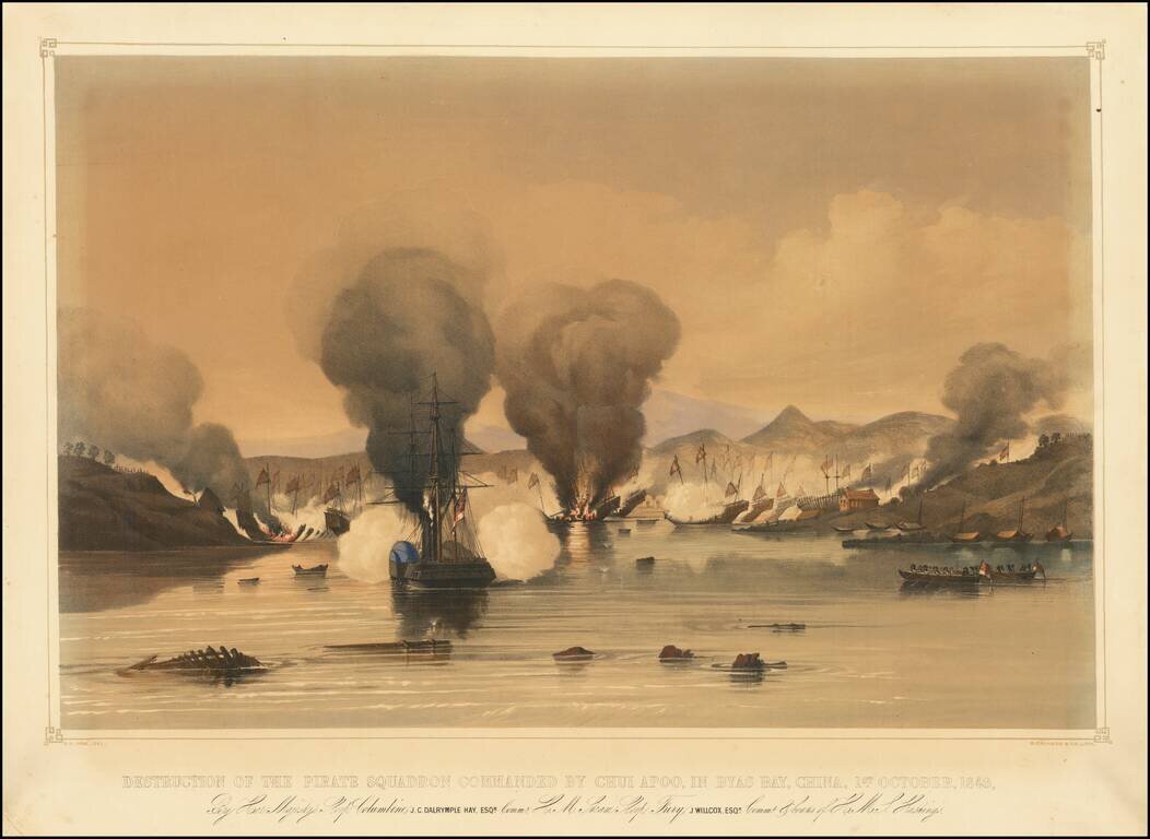
Finely-Executed Lithograph of a Battle Between the British Royal Navy and Chinese Pirates This lithographic view depicts the engagement between the British Royal Navy and Chinese pirates at Bias Bay, China, just northeast of Hong Kong. It shows a...
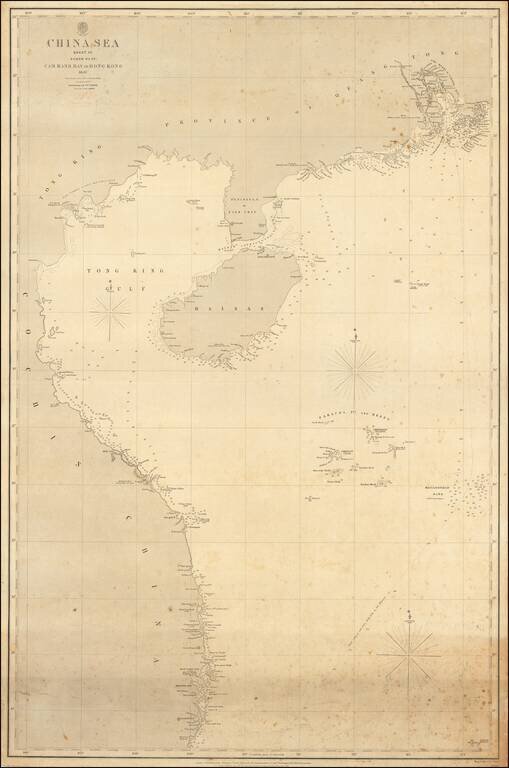
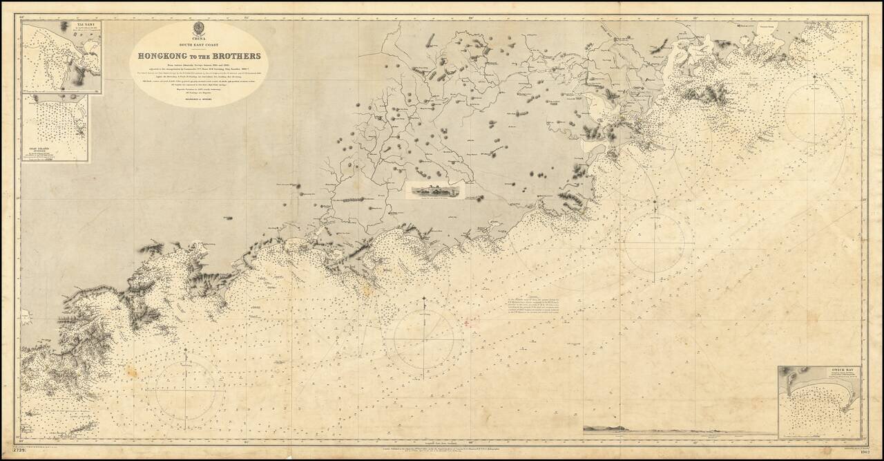
The authoritative sea chart of the southwestern coasts of China and northern Vietnam showing the main shipping route into Hong Kong during the era of the Second Opium War. This important work was part of a series of charts of the South China Sea first...
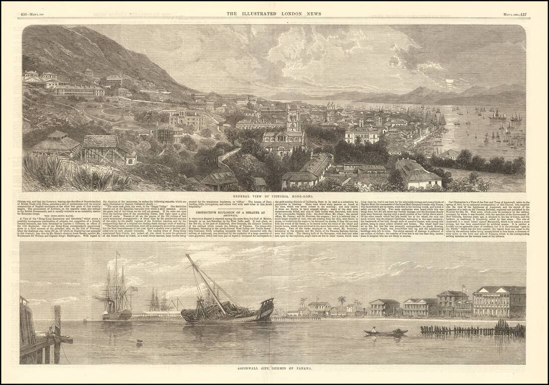
Fine early view of Victoria, Hong Kong, published by the Illustrated London News. The short article below notes that the view illustrates the Race Course and Cemetary, based upon an image furnished by Captain J. Colborne, an officer of the 11th...
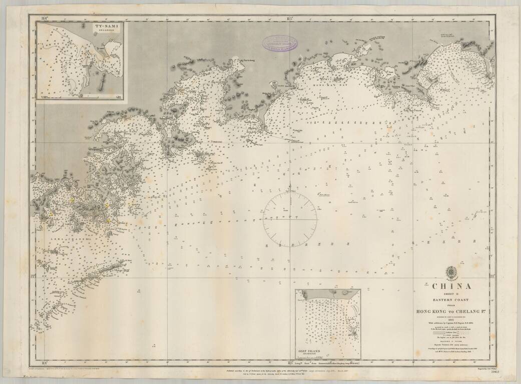
Detailed British Admiralty sea chart of China, extending from Hong Kong and the Lena Islands in the south to Hie Che Chin Bay in the north. Victoria is named on Hong Kong. The map includes extensive soundings and other sailing information. Includes...
19th Century British Navigational Chart Scarce early sea chart of the coast of China, from Hong Kong and Lantao to Nan'ao Island and Dongshan. Engraved chart, including tidal information, compass roses, soundings, seabed notations, currents,...