
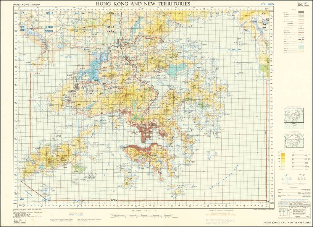
Scarce United Kingdom Ministry of Defence map of Hong Kong and New Territories. Published by the MOD in 1970 based on surveys from 1957 and 1968-69. Built-up areas, "squatter areas", areas under construction, topography, roads and tunnels, railroads,...
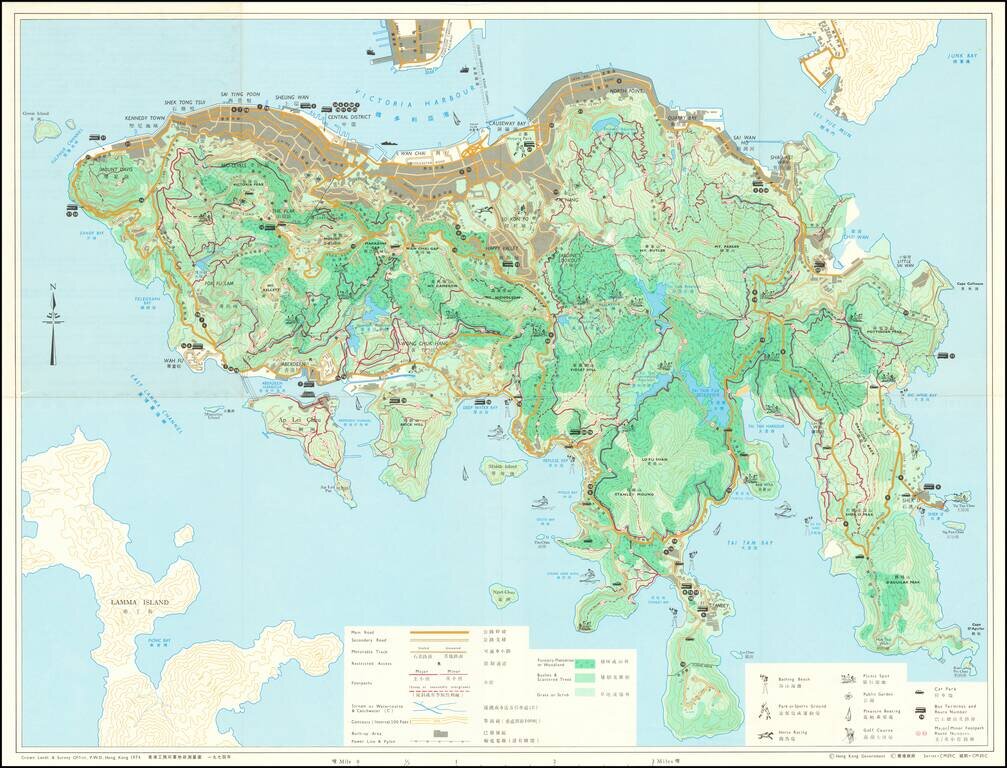
Detailed bi-lingual folding map of Hong Kong Island, with inset maps of The Peak Area, Aberdeen Reservoir Area, and Tai Tam Reservoir Area. The map uses small illustrations to show Bathing Beaches, Park or Sports Ground, Picnic Spots, Public Gardens,...
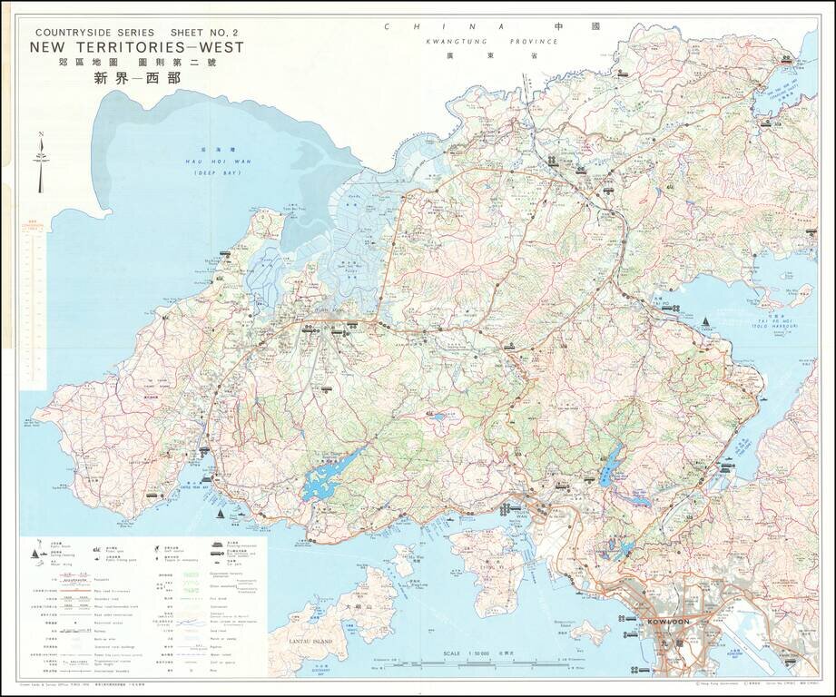
Detailed bi-lingual folding map of Hong Kong New Territories showing Kowloon, etc. The map uses small illustrations to show Bathing Beaches, Park or Sports Ground, Picnic Spots, Public Gardens, Horse Racing, Pleasure Boating, Golf Courses, etc.