Map size in jpg-format: 49.4421MiB
Click to open in high resolution (open in new tab).
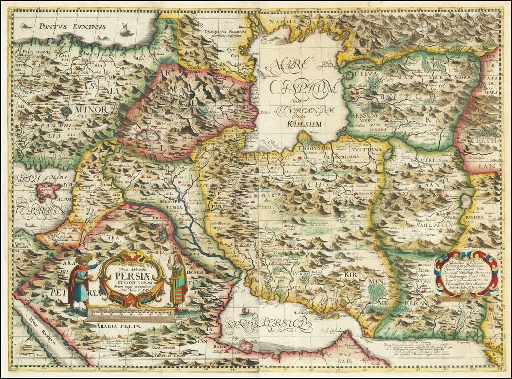
The First Realistic Map of Iran
Highly important regional map of the Persian Empire, published by Adam Olearius in 1656..
Olearus' map represents a milestone in the cartographic history of the mapping of Persia and most notably its treatment of the region around the Caspian Sea. Olearu's map is the first to begin to show the sea as elongated more dramatically north and south. The map is drawn from his travels in the region and from Islamic sources to which Olrearus had access during his travels.
Adam Olearus was the Secretary on an official expedition from Holstein to Persia and Russia from 1635 to 1639, aimed at negotiating a new direct trade route for Persian silk. He spent time in Persia during the reign of the Safavid Shah Ṣafi (r. 1629-1642). His report and map are considered significant to the cartographic depiction of Persia. He also provided the first unmediated translation of Saʿdi's Golestān into German.
After traveling to Russia and obtaining the initial consent of the Czar, the embassy set out for Persia in 1635. Taking the route through Moscow and following the Volga to Astrakhan, they entered Persia after crossing the Caspian Sea at Šamāḵ-i. There, the delegation had to wait for three months before they were allowed to proceed. Olearius used the time to acquire a basic knowledge of Persian and Arabic. Their route then took them from Ardabil, Qazvin, and Kāšān to Isfahan, the capital. After a stay of several months, the mission returned without concrete results by a similar route, this time passing through Rašt.
The first edition of Olearius' account of his travels was published in 1647 in Schleswig under the title Offt begehrte Beschreibung der newen orientalischen Rejse, so durch Gelegenheit einer Holsteinischen Legation an d. König in Persien geschehen. An extended and restructured edition appeared in 1656: Vermehrte Newe Beschreibung der Muscowitischen und Persischen Reyse, so durch gelegenheit einer Holsteinischern Gesandschafft an den russischen Zaar und König in Persien geschehen.
If you are a student, write to us in telegram: @antiquemaps and indicate what material you need and for what work you need a map in high detail. We are ready to provide material on special terms. For students only!

![[Europe, Mediterranean, Asia Minor and the Persian Empire]](/map/small/43558.jpg)
