
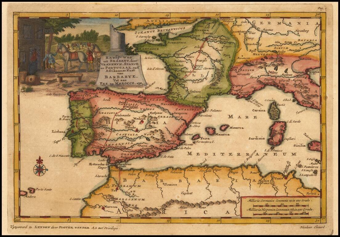
Detailed map of Spain, France and the Western Mediterranean. Francis Brooks was an Englishman who was enslaved by the Moors at the end of the 17th Century. After his escape, he wrote a narrative of his captivity, which detailed the practices of the...
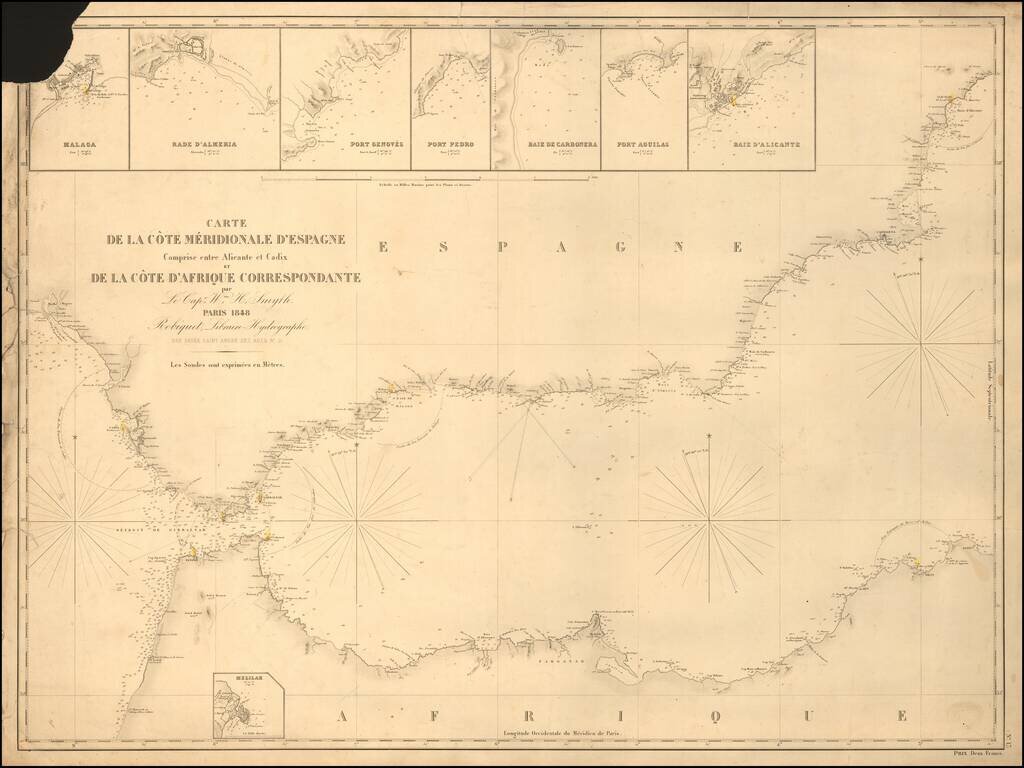
Rare separately published sea chart of the Strait of Gibraltar coast of Southern Spain and the corresponding coast of North Africa, published by Robique. Small inset maps of: Malaga Rade D'Almeria Port Genoves Port Pedro Baie de Carbonera Port...
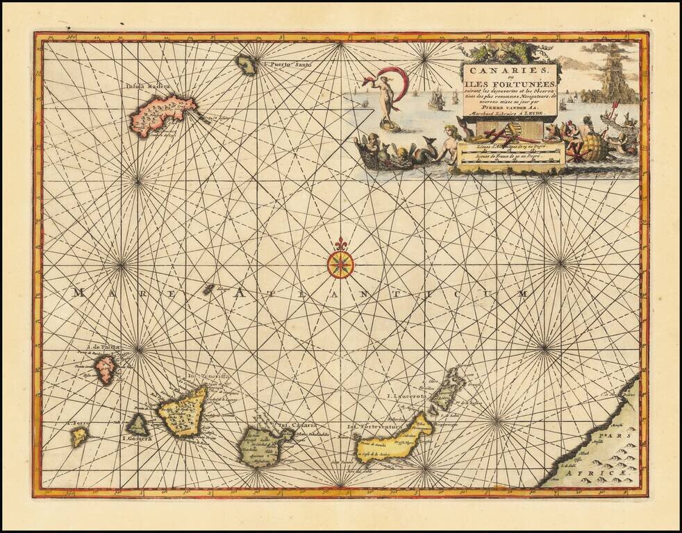
Decorative map of the Canary Islands, published in Leiden by Pierre Van der Aa. Includes an elaborate title cartouche and vignette.
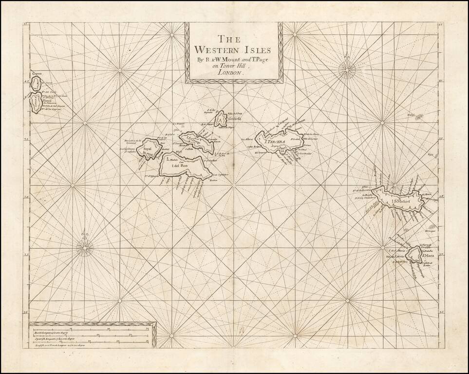
An Early Engish Sea Chart of the Azores Fine early chart of the Azores, which appeared in the English Pilot First Part, Southern Navigation.
![Les Isles Canaries . . . [With inset map of the Islands of Madeira and Porto-Santo]](/map/small/70853.jpg)
Detailed map of the Canary Islands, from De Vaugondy's Atlas Portatif, Universal et Militaire. Large inset of Madera and Porto Santo. Lots of place names shown.
![[Eastern Mediterranean]](/map/small/59510sb.jpg)
The Only Surviving Example Rare Lafreri school map of the Eastern Mediterranean and vicinity. The map is the Southeastern Sheet of an Unrecorded Map of Europe, published in Venice. The present example is the third state of three.
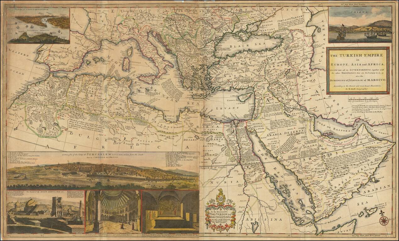
Dynamic Map of the Ottoman Empire with Rich Imagery of Jerusalem Striking large-format map of the Ottoman Empire by Herman Moll, one of England's leading map makers at the beginning of the eighteenth century. The map shows the sprawling Ottoman...
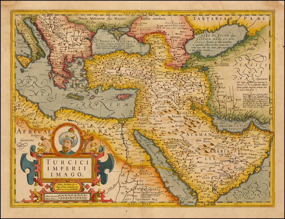
Fine Map of the Ottoman Empire from the Mercator-Hondius Atlas Striking example of this map of the Ottoman Empire, showing their territories in the Balkans, Anatolia, the Levant, the Arabian Peninsula, and North Africa. It was published by Henricus...
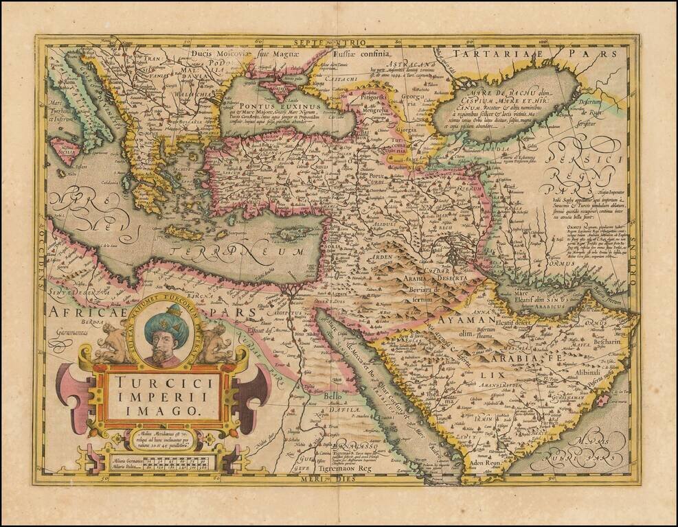
Fine Map of the Ottoman Empire from the Mercator-Hondius Atlas Striking example of this map of the Ottoman Empire, showing their territories in the Balkans, Anatolia, the Levant, the Arabian Peninsula, and North Africa. It was published by Henricus...
![Tabula Aphricae II [shows Sicily and Sardinia]](/map/small/47363.jpg)
16th Century Italian cartography of Sicily, Sardinia, and North Africa based on Ptolemy. Striking example of Magini's map of North Africa, based upon Ptolemy. Shows part of the Mediterranean, including Sicily and Sardinia. Three sea monsters and an...
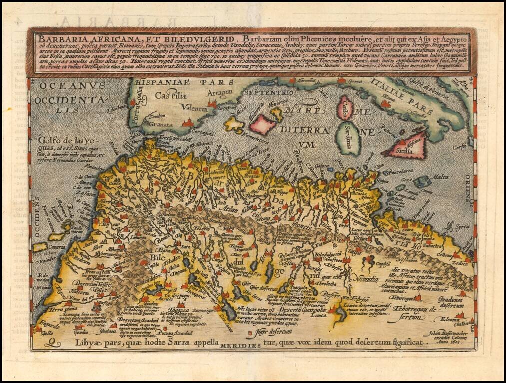
Scarce early map of North Africa and the Mediterranean, engraved by Johann Bussemacher and published by Quad in Cologne.
![A New & Accurate Map of the Western parts of Barbary Containing Fez, Morocco, Algiers . . . [and] A New & Accurate Map of the Eastern parts of Barbary . . .[Shows Cyprus]](/map/small/67838.jpg)
Two engraved maps on one sheet showing the Mediterranean, with a focus on North Africa. The upper map extends from the Atlantic to "Tripoly," while the lower map extends from Tunisia to the Holy Land. In addition to the many states of North Africa,...

Very attractive engraved double-page sea chart of the Mediterranean Sea, with publisher's hand color in outline. Jean Lattre was one of the premier French mapmakers of the last quarter of the 18th century. This map features his characteristic vignette...
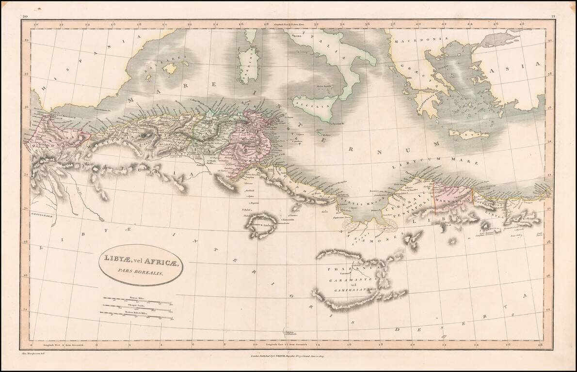
Detailed map of the north coast of Africa and the Mediterranean, published in London by Charles Smith.
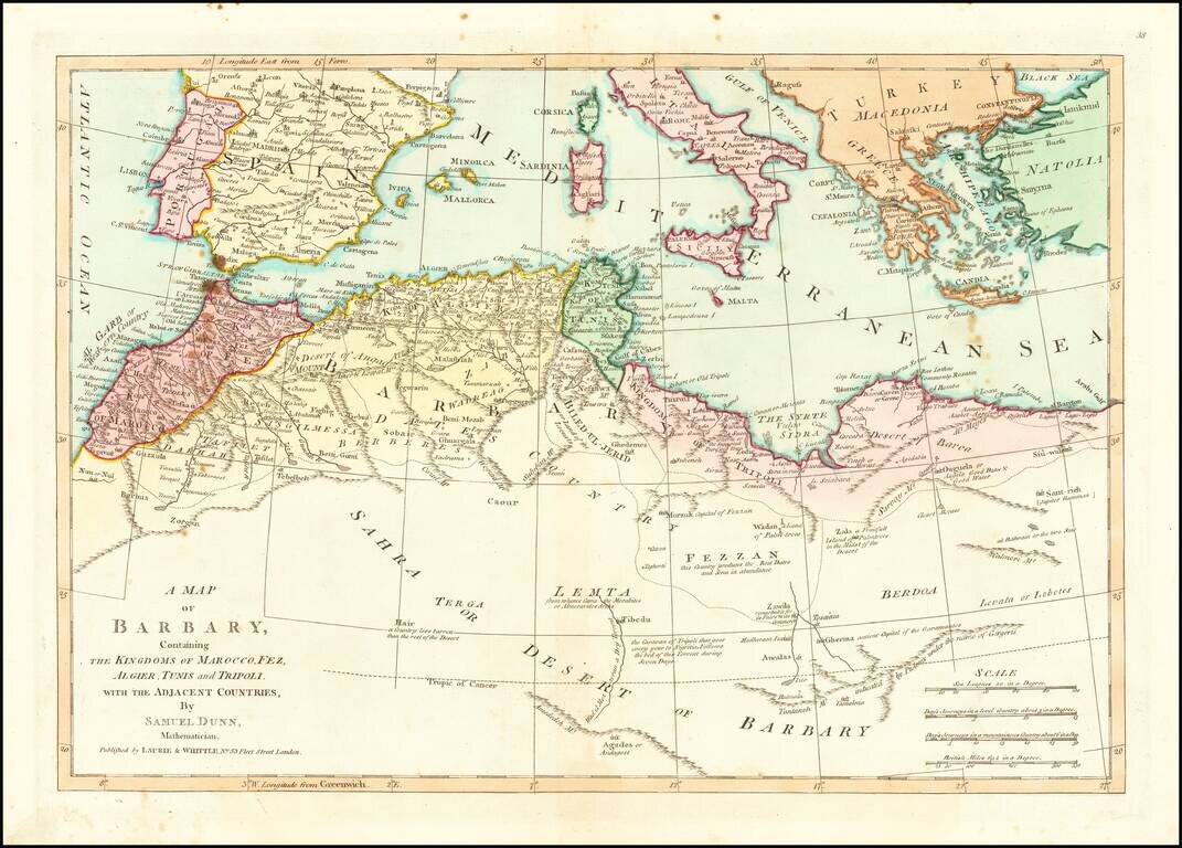
Detailed map of North Africa and the Mediterranean Sea. Nice detail and a number of annotations. The map was first printed for Robert Sayer at 53 Fleet Street, London.
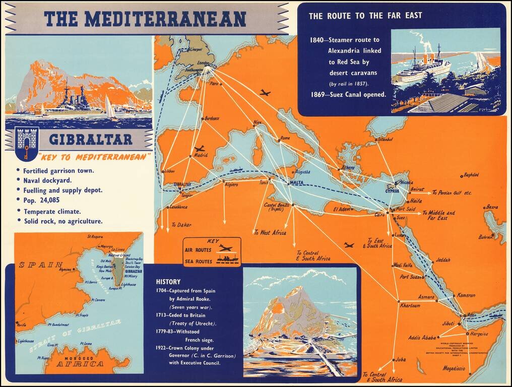
Rare separately published broadside illustrating the strategic importance of the Mediterranean in general and Gibraltar, published by Educational Products Limited with the British Society for International Understanding.