
![[Eastern Hemisphere Globe Gores] (Nova et integra universi Orbis descriptio)](/map/small/54480.jpg)
Extremely rare set of 6 globe gores, comprising the Eastern Hemisphere of Johann Oterschaden's rare work. The gores depict the world based upon the cartographic details prevailing in about 1540 to 1550. Among the more noteworthy features of the gores...
![[Wall Map] West-Indische Paskaert waer in de graden der breedde over weder zyden vande middelyn wassende so vergrooten dat die geproportioneert syn tegen hunne nevenstaende graden de lengde.](/map/small/60169.jpg)
A Remarkable Dutch Sea Chart Used For Navigation Between Africa and America Rare Johannes Van Keulen issue of Pieter Goos's sea chart of the Atlantic Ocean, America and Africa, first published circa 1680. This chart was created for use at sea by...
![[The First Maps in a la poupée Printed Color] Cartes en Couleur des Lieux Sujets aux tremblements de Terre Dans toutes les parties du Monde Selon le Sisteme de l’impulsion Solaire](/map/small/52293op.jpg)
The First a la poupée Color Printed Maps in A Rare Pamphlet On The Relationship Between The Sun and Earthquakes Extremely rare separately published pamphlet by Jean Fabien Gautier D'Agoty, containing a complete set of his maps from his Observations...

"A scientific and artistic document of the first order" -- One of the most important sea charts of the 17th century. Exceptionally rare Johannes Loots issue of Guillaume Blaeu's landmark sea chart of the Atlantic Ocean, America and Africa, printed on...
![[Untitled Map Africa, Red Sea and Saudi Peninsula]](/map/small/48522.jpg)
Upside Down Africa by Ramusio Nice example of Ramusio's (Mezzo Di) map of Africa (extending south to the Tropic of Capricorn and Madagascar). Giovanni Baptista Ramusio was Secretary to the Council of Ten in Venice for 43 years. His collection of...

The Earliest Obtainable Map To Show Houtman's Crossing of the Indian Ocean to the Java, Opening The Spice Trade to The Dutch in 1597. Finely engraved map, showing the route of first Dutch fleet from Zuider Zee to Java in 1596-97, under the command of...

Striking map of the Kingdom of Prester John, reduced from Blaeu's map. The map is embellished with elephants, monkeys, ostriches, etc., and includes a decorative title cartouche.

Rare map of the Kingdom of Prester John, which appeared in Picart's Tresor des carte Geographiques, published in Paris. Picart's map is based upon Jansson's map, published in his Atlas Minor in 1628. The first French version of the map was published...

Rare first state of this decorative map of Africa, published by Frederick De Wit in Amsterdam. The map includes decorative panels showing birdseye views of Alcair, Alexandria, Alger, Tunis, Tanger and Ceuta across the top and 8 costumed figures along...
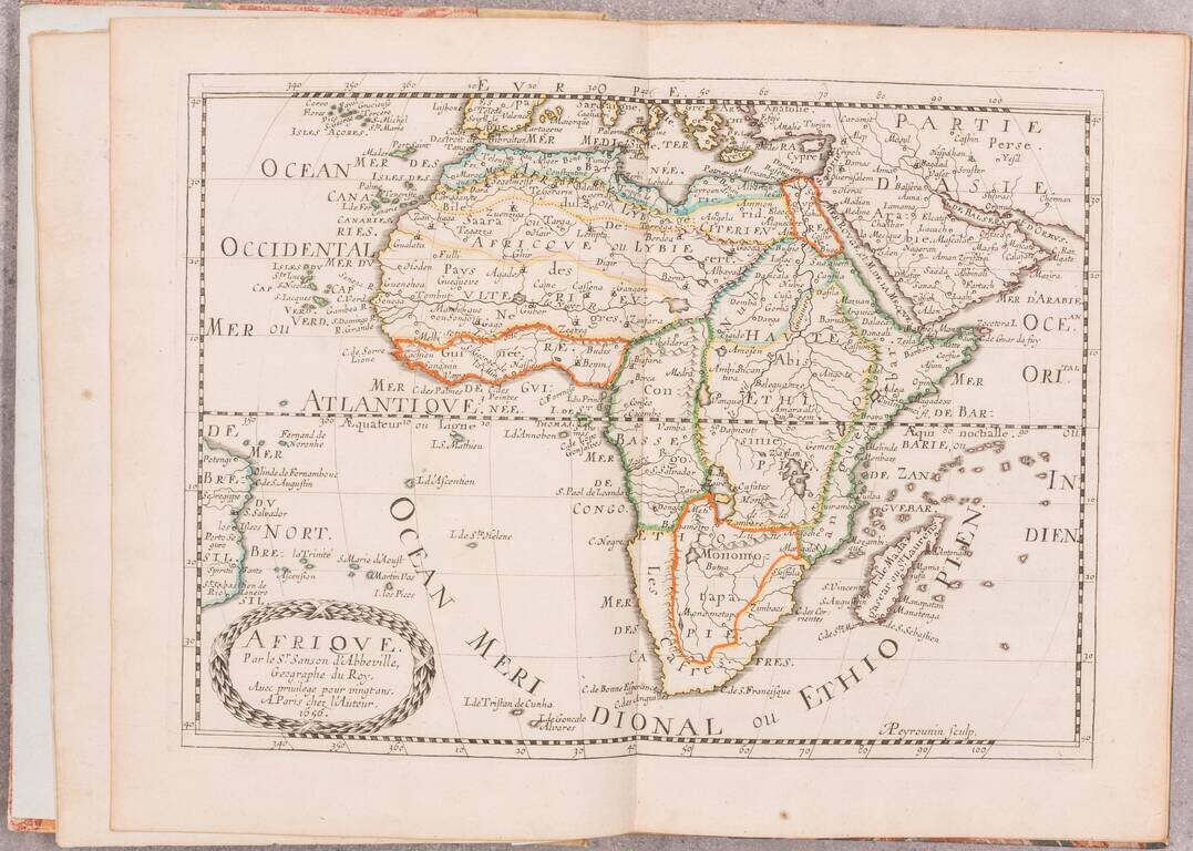
A beautiful example of the second edition of Sanson's atlas of Africa, one of the best atlases dedicated to the continent from the 17th century. The first edition of this atlas was published in 1656 as the third volume in Sanson's series of four...

Rare Luneberg edition of this 17th Century map of Africa, which appeared in a German edition of Cluverius' Introductionis in Universam Geographicam.
![The West Part of Barbary... [on sheet with:] The East Part of Barbary...](/map/small/52496.jpg)
A nice example of Herman Moll's 1729 miniature engraved map of North Africa in two images on the same sheet, from his Atlas minor. Hand-colored by kingdom. Includes an inset of the harbor of Oran.
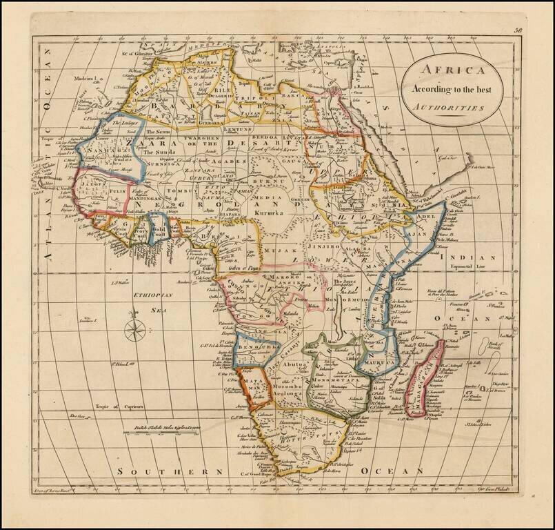
Detailed map of Africa, divided by kingdoms and colonies, many of which are fictional in nature.

Nice wash color example of Africa, colored by regions and kingdoms. The map still includes the fantastical Mountains of the Moon and Mountains of Kong.

The Greatest Early American Map of Africa. Rare American imprint copying Arrowsmith's important wall map, the latter of which was originally published in 1802. "One of the greatest maps ever published. Arrowsmith simply stripped away centuries of...
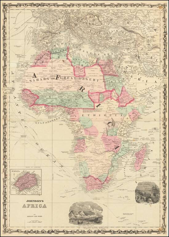
Attractive map of Africa with large vignettes of Cape Town and Port Natal and insets of St. Helena Island. Colored by countries and colonies and showing towns, mountains, ports, islands, explorers routes and similar details. Decorative border.