Vincenzo Maria Coronelli (1650-1718) is one of the most influential Italian mapmakers and is known especially for his globes and atlases. The son of a tailor, Vincenzo was apprenticed to a xylographer (a wood block engraver) at a young age. At fifteen he became a novice in a Franciscan monastery. At sixteen he published his first book, the first of 140 publications he would write in his lifetime. The order recognized his intellectual ability and saw him educated in Venice and Rome. He earned a doctorate in theology, but also studied astronomy. By the late 1670s, he was working on geography and was commissioned to create a set of globes for the Duke of Parma. These globes were five feet in diameter. The Parma globes led to Coronelli being named theologian to the Duke and receiving a bigger commission, this one from Louis XIV of France. Coronelli moved to Paris for two years to construct the King’s huge globes, which are 12.5 feet in diameter and weigh 2 tons.
The globes for the French King led to a craze for Coronelli’s work and he traveled Europe making globes for the ultra-elite. By 1705, he had returned to Venice. There, he founded the first geographical society, the Accademia Cosmografica degli Argonauti and was named Cosmographer of the Republic of Venice. He died in 1718.
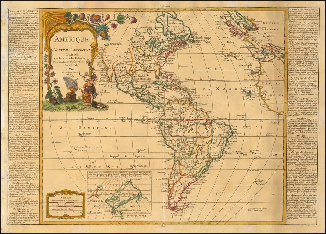
Decorative map of America, published in Paris by Daumont, based upon work of Johann Baptist Nolin. A fine early example of the map, which includes a large inset map showing the "New Discoveries" in the Northwest part of America, most notably the...
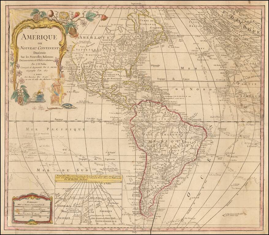
Rare late edition of Johanne Baptiste Nolin's map of America, first issued nearly 100 years earlier. The present example is noteworthy for its use of extremely old/dated cartographic detail. The map was updated in the latter part of the 18th Century...
A fascinating early 19th Century reissue by the French firm of Chez Jean of the 1787 Clouet, revised to include the first voyage of Captain Cook. Gone is the Bay of the West, although the Northwest Coast still hints at some sort of inland sea. The...
![[Arabian Peninsula, Red Sea, Nile River and Gulf of Aden] L'Afrique . . . 1740](/map/small/59382.jpg)
Title cartouche section of the Le Rouge wall map of Africa, published in Paris in 1740. The map includes a decorative cartouche showing Europeans trading gold and slaves with local African leaders.
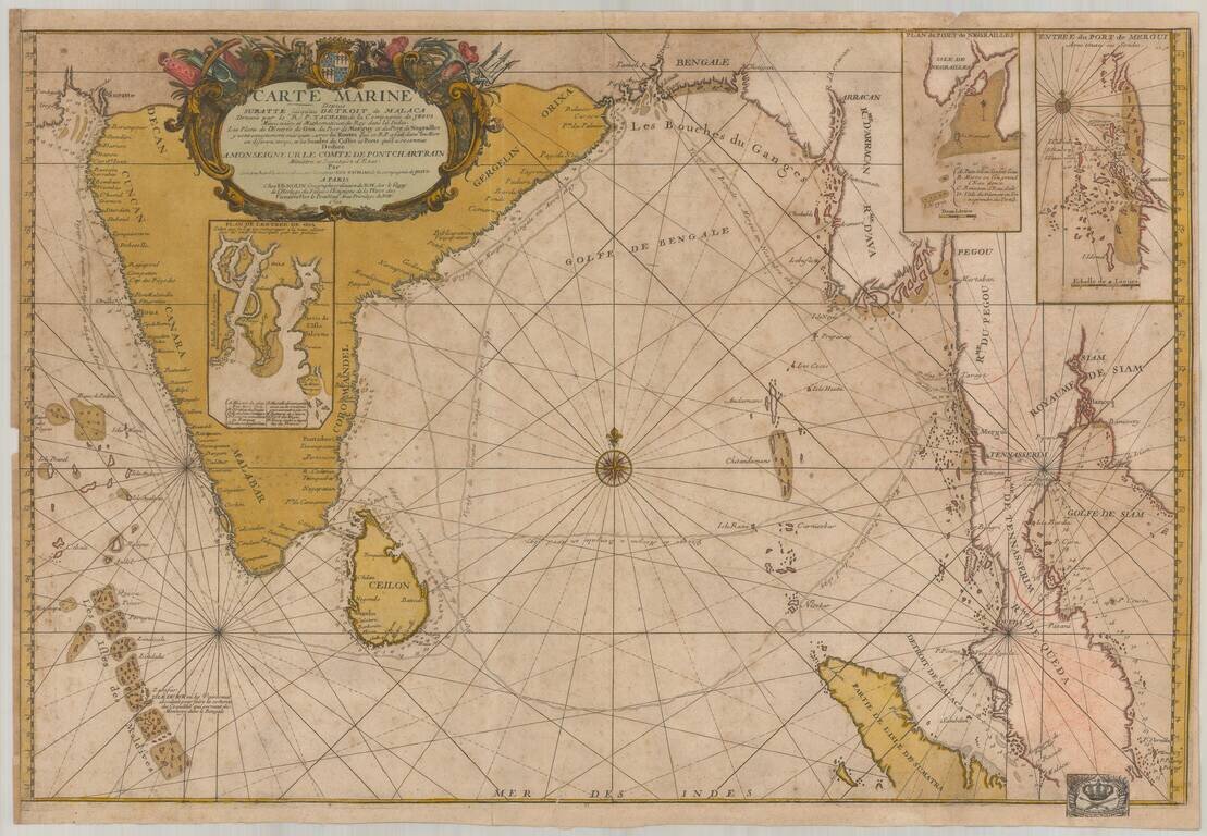
Old color example of this important chart of the Indian Ocean, illustrating the route of the Jesuit priest Guy Tachcard in 1697. The present example bears the bookplate (bottom right) of the Prussian Royal Academy of Sciences ( Königlich-Preußische...

The First Printed Map Devoted to The Great Lakes and Upper Mississippi Region Nice example of Jean-Baptiste Nolin's landmark map of the Midwest, presenting for the first time on a printed map the evidence of the robust and multi-faceted exploration of...
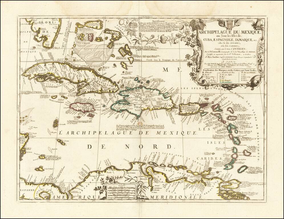
Nice example of the final edition of the Nolin-Coronelli map of the Caribbean. The map presents a marvelous large format look at the region, as it was known to Coronelli and Nolin at the end of the 17th century. Florida's southern coastline is...
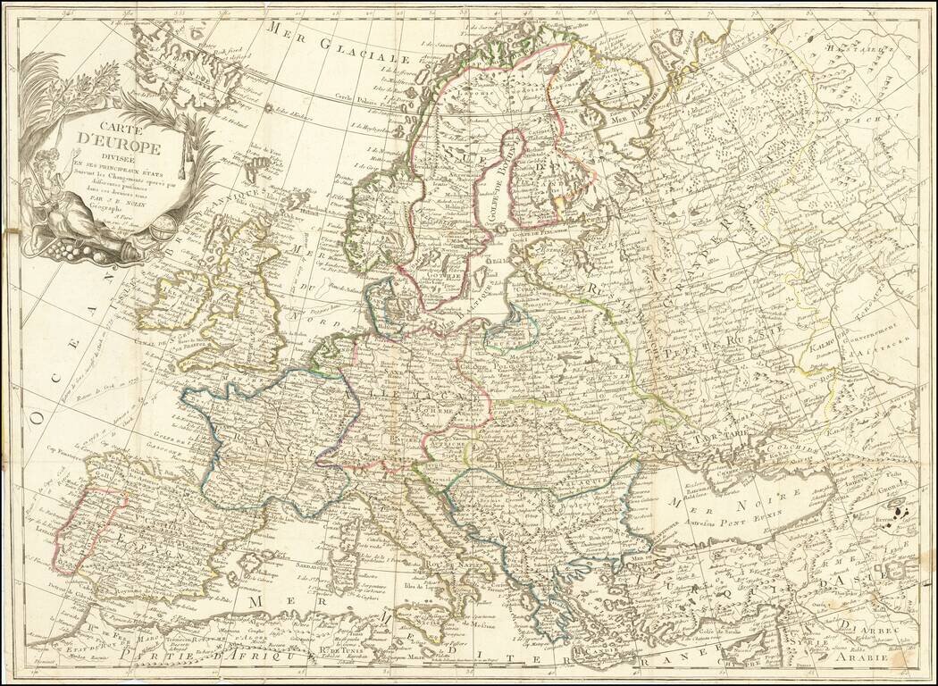
Scarce 19th Century JB Nolin map of Europe.
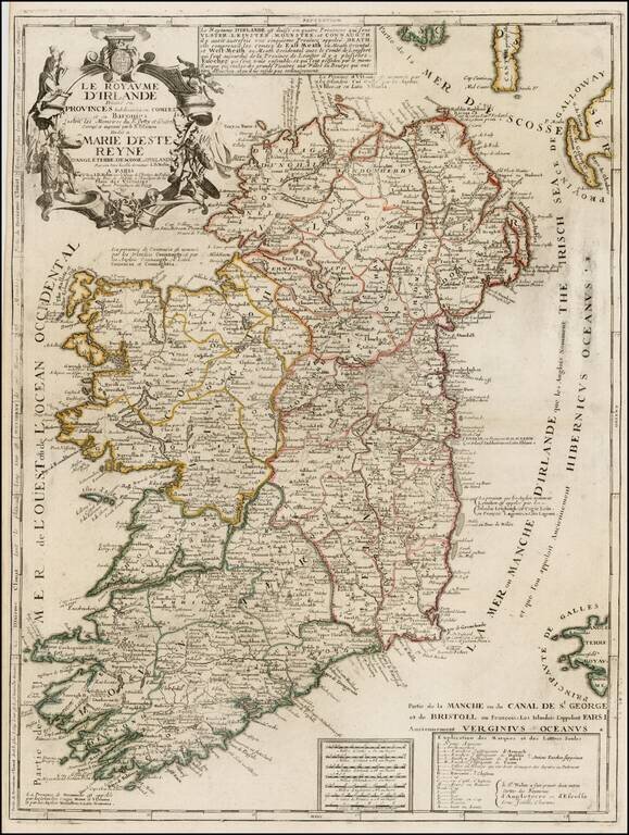
Scarce map of Ireland, published by Nolin. The map is colored by counties and includes an ornate cartouche, dedication to the Queen and a box of explanatory text not present in all editions. Nolin's maps are among the most accurate and well engraved...
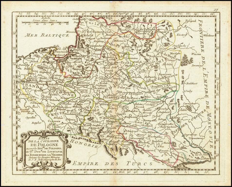
An attractive antique map of Poland showing the cities, rivers, lakes, and forests of the region during the commonwealth with the Grand Duchy of Lithuania. The various regions are demarcated and named, including Black Russia, Podolia, Volhynia, Greater...
![[Bohemia / Czechia] Le Royaume De Boheme Divise en 17 Cercles ou Prectures avec Partie Misnie de Silesie et de Moravie . . . 1742](/map/small/61339.jpg)
Detailed map of Bohemia, centered on Prague. Includes towns, roads, rivers, lakes and a number of other details. A rare late state of the map.
![Le Cours Du Po . . . [Eastern Sheet--Gulf of Venice, Padua, Vincenz, Feltre, Friouli, Carniola, Istria]](/map/small/58163.jpg)
Striking map of the Course of the Lower Po River, showing the Theater of War in Italy. Nolin's map was first issued in 1702 and corrected in 1703. The map was probably made to illustrate all the territories of the War of Spanish Succession in northern...
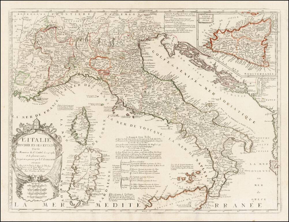
Rare variant edition of Nolin's map of Italy, with a large inset of Sicily. This edition has Nolin's address as "le Quay de l'Horloge du Palais vers le Pont Neuf ". An earlier edition of the map shows the address at "le Quay de l'Horloge du Palais...
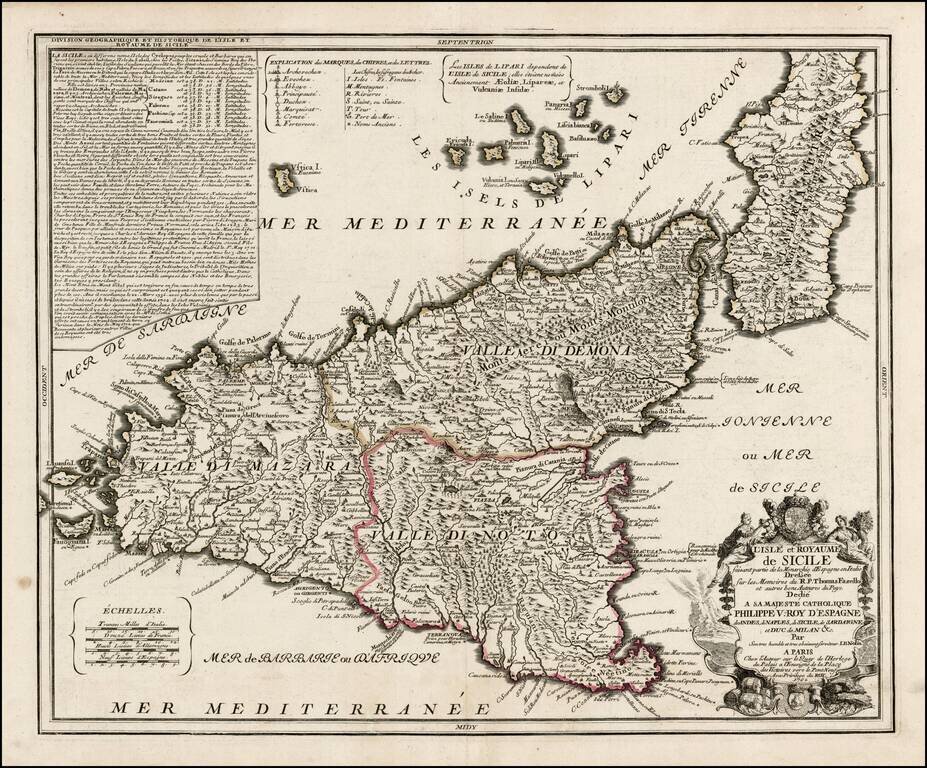
Early edition of Nolin's rare large format map of Sicily. Nolin's map is dedicated to Filipo V. The basic configuration and place names follow the map of Giacomo Cantelli. A later edition, with lengthy text annotation in the upper left corner,...
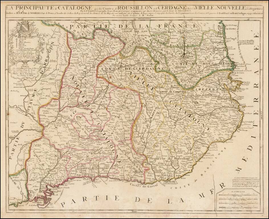
Detailed 17th Century map of Catalonia and Roussillon, by Jean-Baptiste Nolin, based upon an early map by Cantelli, which was thereafter revised by Tillemont. The map is finely detailed, showing towns, roads, rivers, mountains, lakes, cities, bays,...
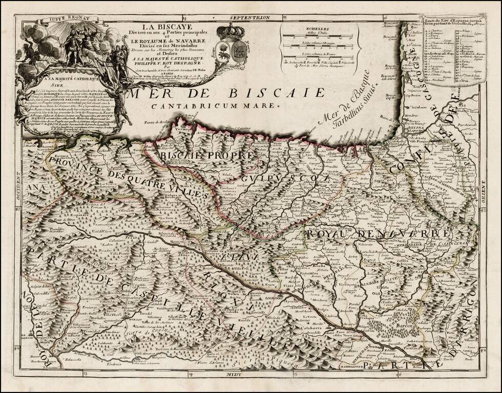
First state of this rare map of Biscaya and Navarra, likely offered originally as a separately issued map and primarily bound into composite atlases of the period. Includes a striking dedication cartouche to Philip V of Spain, with the young King shown...