logo

1811. Carte D'Europe Divisee en ses Principaux Etats Suivant les Changements operes par differentes puissances dans ces dernieres tems . . . 1811

  • Carte D'Europe Divisee en ses Principaux Etats Suivant les Changements operes par differentes puissances dans ces dernieres tems . . . 1811
  • Carte D'Europe Divisee en ses Principaux Etats Suivant les Changements operes par differentes puissances dans ces dernieres tems . . . 1811

Carte D'Europe Divisee en ses Principaux Etats Suivant les Changements operes par differentes puissances dans ces dernieres tems . . . 1811 information:

Year of creation: 
Resolution size (pixels): 
 17558x12843 px
Disk Size: 
 66.8401MiB
Number of pages: 
 2
Place: 
 Paris
Author: 

Print information. Print size (Width x height in inches):
Printing at 72 dpi 
  243.86 х 178.38
Printing at 150 dpi 
 117.05 х 85.62
Printing at 300 dpi 
 58.53 х 42.81

An example of detailing the file of this map of in a printable high-resolution:

Click to open in high resolution (open in new tab).
Attention! this is just the central piece (central area 960x960 px) of the map file!
This is an example, so that you can see and study the level of detail of a given map. The entire Map will be fully available after payment!

Carte D'Europe Divisee en ses Principaux Etats Suivant les Changements operes par differentes puissances dans ces dernieres tems . . . 1811

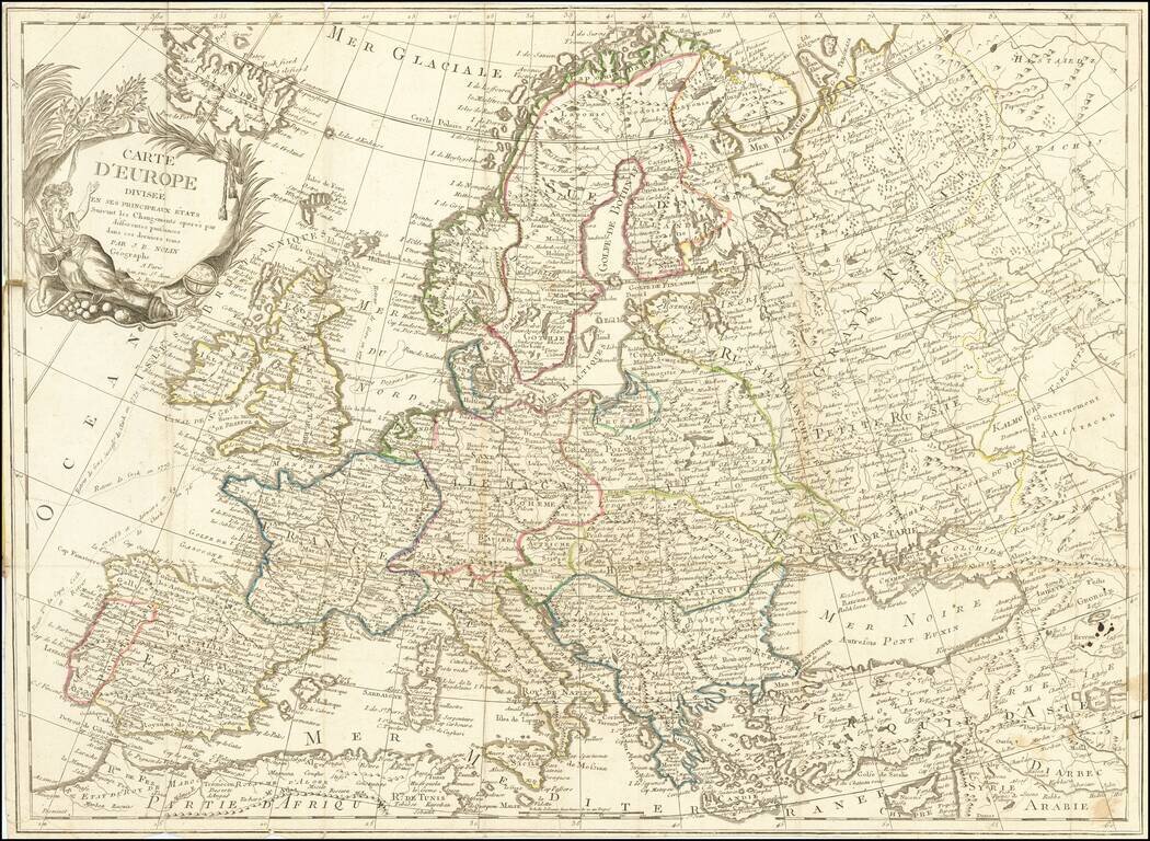
Scarce 19th Century JB Nolin map of Europe.


Special conditions for students!

If you are a student, write to us in telegram: @antiquemaps and indicate what material you need and for what work you need a map in high detail. We are ready to provide material on special terms. For students only!

Item information:

Year of creation:
Size:
17558x12843 px
Disk:
66.8401MiB
Number of pages:
2
Place:
Paris
Author:
Jean-Baptiste Nolin.
$14.99

Related item