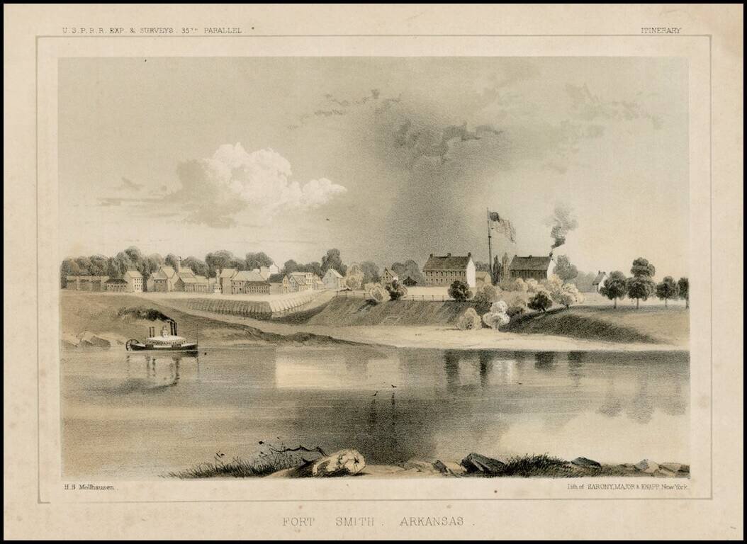
Fine early view of Fort Smith, Arkansas, prepared as part of the United States survey for the most practicable route for a railroad line to the West Coast of America, conducted just prior to the Civil War.
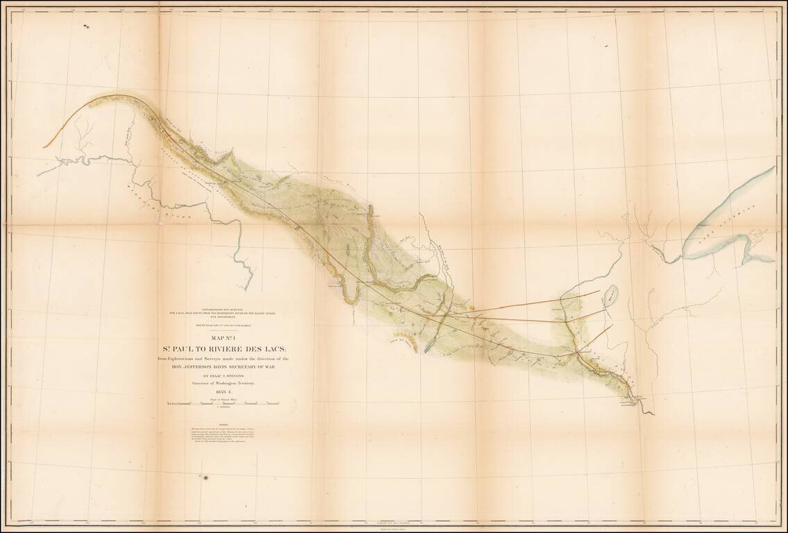
Detrailed map of the area from St. Paul and the Mississippi River to Fort Union and the confluence of the Yellowstone River and the Missouri River, published as part of the Pacific Railroad Surveys. The map shows one of the routes surveyed from St....
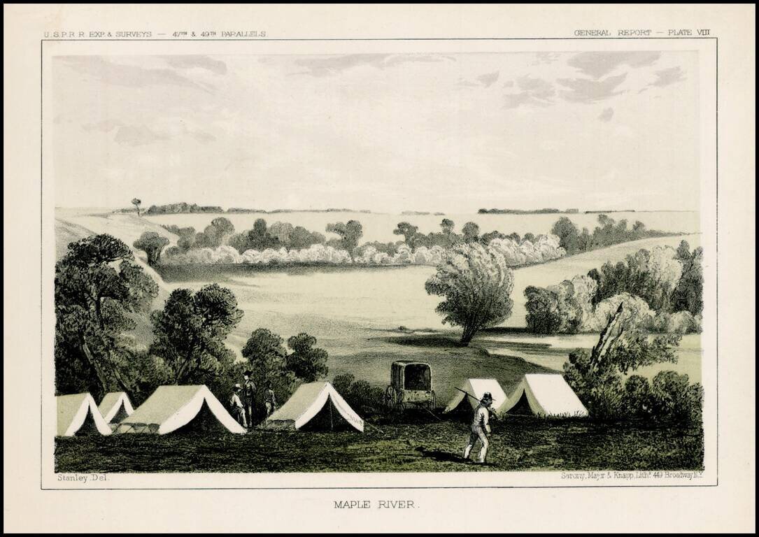
Fascinating view of an encampment on the Maple River in South Dakota, prepared as part of the United States survey for the most practicable route for a railroad line to the West Coast of America, conducted just prior to the Civil War. A scenic view as...
Detailed map showing parts of Wyoming, Colorado, New Mexico and South Dakota, extending west to Rocky Mountains, the Rio Grande River, San Luis Valley and Cheyenne area Shows the proposed raiload lin along the South Fork of the Platte River, extending...
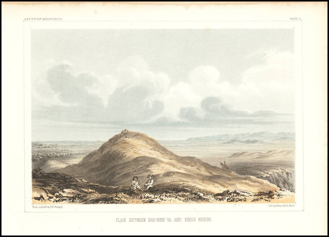
Detailed view of the Valley of the Kah Wee Yah River (Tulare River) and the Kings River. The expedition surveying the southern route along the 35th parallel, led by Lieutenant Amiel Weeks Whipple, explored from Little Rock, Arkansas, through Oklahoma,...
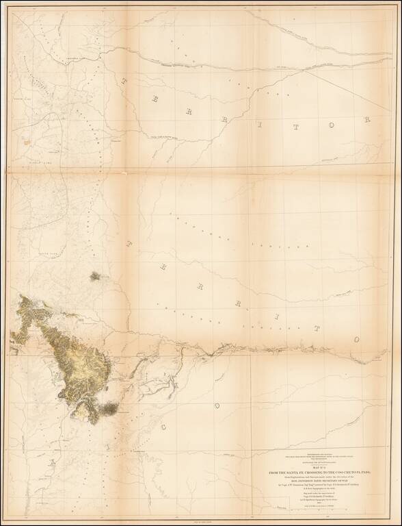
Detailed map extending from Bridger's Pass in the north to New Mexico, centered on the Sawatch and Wasatch Mountains. Shows proposed railroad line through Bridger Pass in Northeast Utah Territory, including parts of present day Colorado and Wyoming...
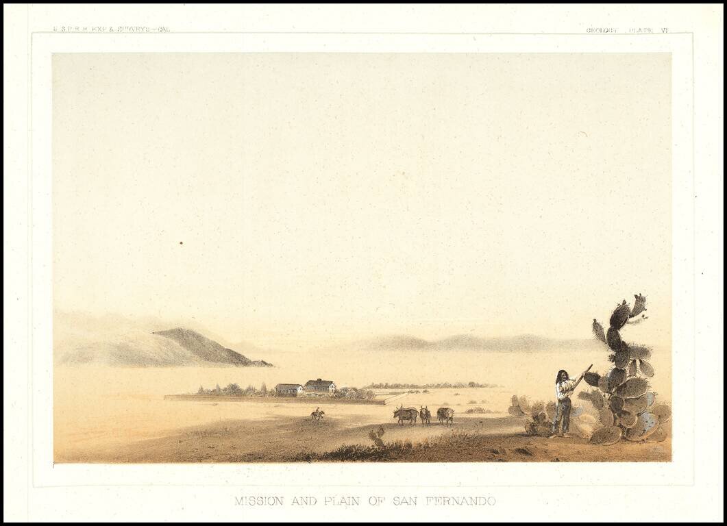
The earliest view of the Mission of San Fernando and the Valley, which accompanied Vol. V of the Reports of Explorations and Surveys to Ascertain The Most Practicable Route To the Pacific.
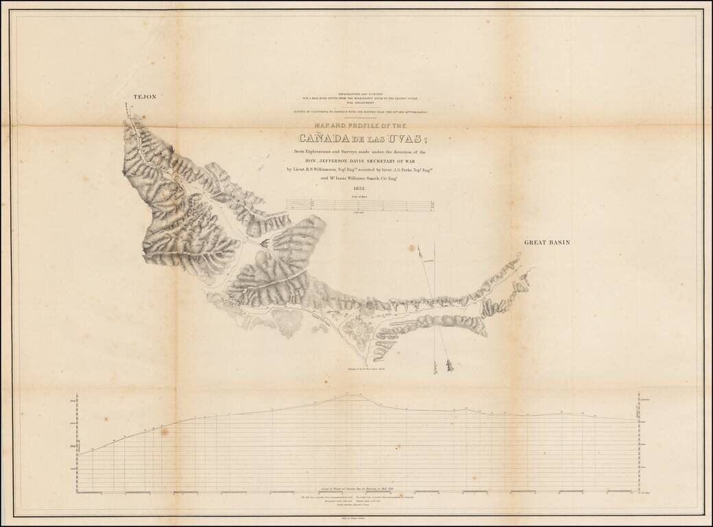
Detailed map of the region near Fort Tejon and the Tejon Pass, in Northern Los Angeles County.
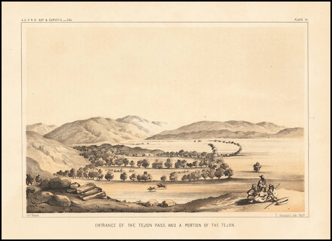
Interesting early view, looking into the Valley from the Tejon Pass.
![Valley of Kah Wee Ya River (Four Creeks) [San Joaquin Valley]](/map/small/61893.jpg)
Detailed view of the Valley of the Kah Wee Yah River, apparently the Tulare River.. From Reports of Explorations and Surveys, to ascertain the most practicable and economical route for a railroad from the Mississippi River to the Pacific Ocean, made...
Detailed view of the Valley of the Kah Wee Yah River (Tulare River) and the Kings River. From Reports of Explorations and Surveys, to ascertain the most practicable and economical route for a railroad from the Mississippi River to the Pacific Ocean,...
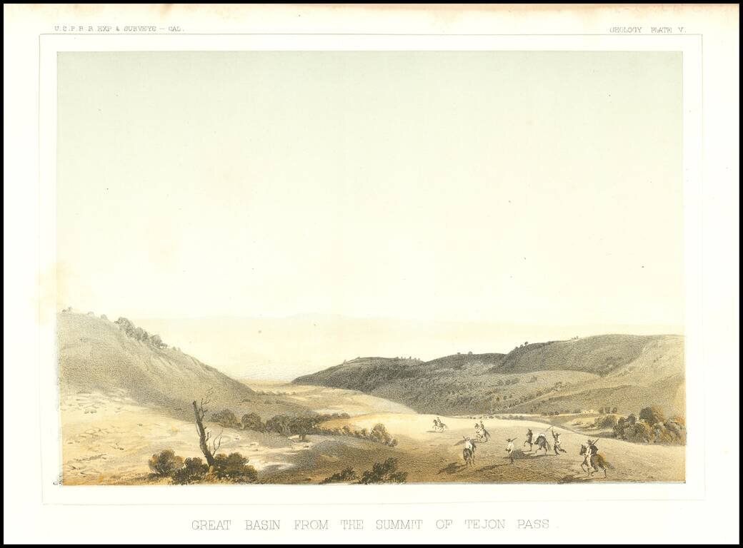
Early view of the Tejon Pass, looking to the northeast.
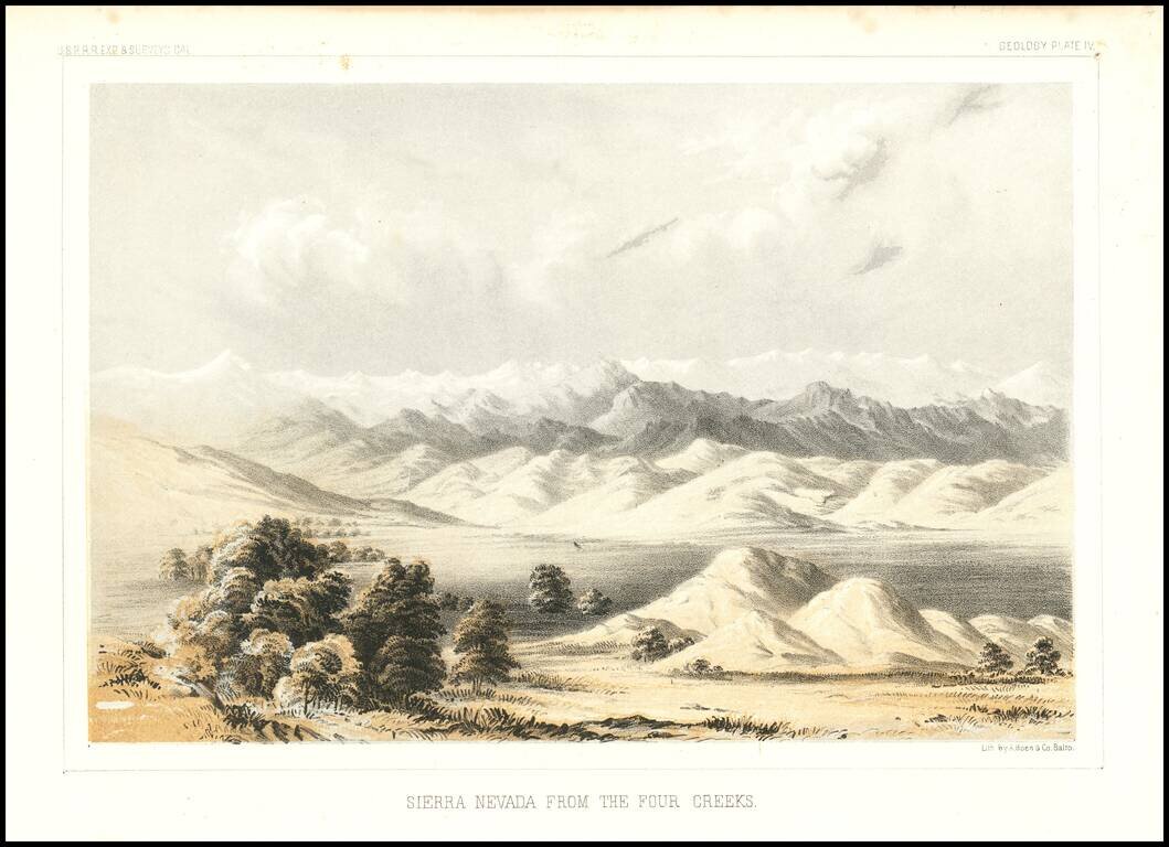
Detailed view of the Valley of the Kah Wee Yah River (Tulare River) and the Kings River. The expedition surveying the southern route along the 35th parallel, led by Lieutenant Amiel Weeks Whipple, explored from Little Rock, Arkansas, through Oklahoma,...
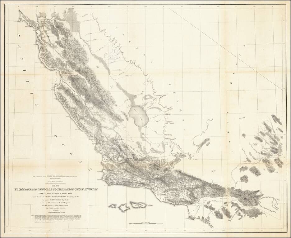
Fabulous regional map, extending from just north of San Francisco Bay to Orange County (not named) and the San Bernardino Valley. The map includes remarkable topographical detail throughout.
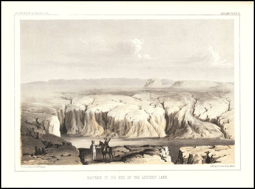
Interesting view showing a dry lake bed on the Arizona/California Border. The view was engraved by Charles Koppel for the Reports of Explorations and Surveys To Ascertain The Most Practicable and Economical Route For A Railroad From The Mississippi...