Pierre Duval (1618-1683) was a French geographer, cartographer, and publisher who worked in Abbeville and Paris during the seventeenth century. He was born in the former city, in northeast France, before moving to Paris. Duval was the nephew of the famous cartographer Nicolas Sanson, from whom he learned the mapmaker's art and skills. Both men worked at the royal court, having followed the royal request for artists to relocate to Paris. In addition to numerous maps and atlases, Du Val's opus also includes geography texts. He held the title of geographe ordinaire du roi from 1650 and died in 1683, when his wife and daughters took over his business.
![L'Amerique Autrement Le Nouveau Monde et Indes Occidentales . . . 1664 [1st complete state]](/map/small/68897.jpg)
Early state of Du Val's scarce map of America. Du Val's map of America was first issued in 1655, in the second edition of his Cartes Geographiques. Between 1655 and 1687, the map went through at least 12 recorded examples. Both the 1st and 2nd states...
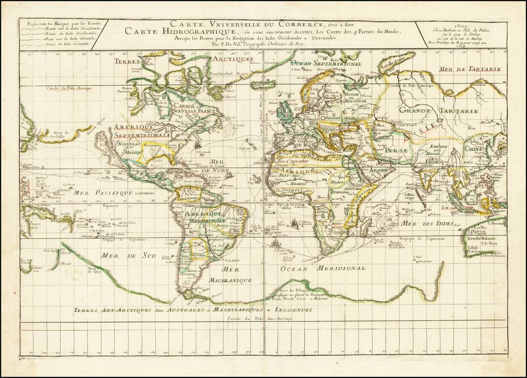
Illustrating the Major Commercial Sea Routes of the 17th Century First state of Pierre Du Val's scarce 17th Century map of the World, illustrating the most important world trade routes during the middle of the 17th Century. Du Val's map is...
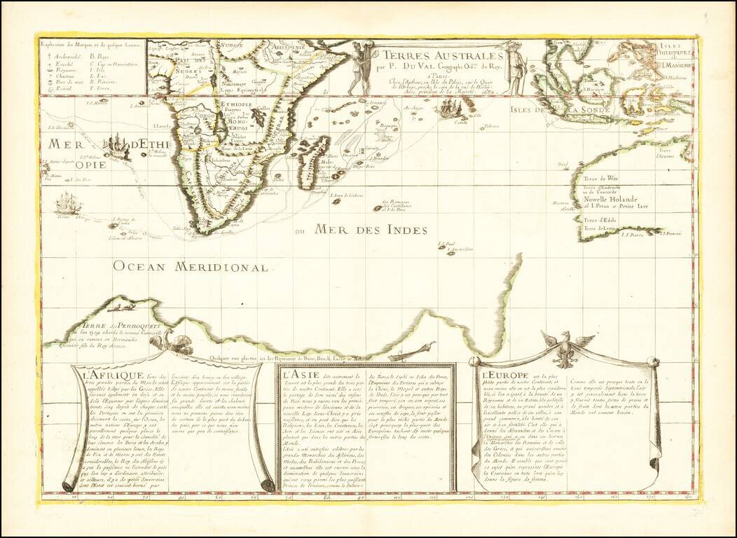
Antique Map of the Western Indian Ocean -- First State of the Second Printed Map to Show Gonneville's Land Fine early map of the Dutch Discoveries in the New Holland and the Indian Ocean, published in Paris by Pierre Du Val, the second printed map to...
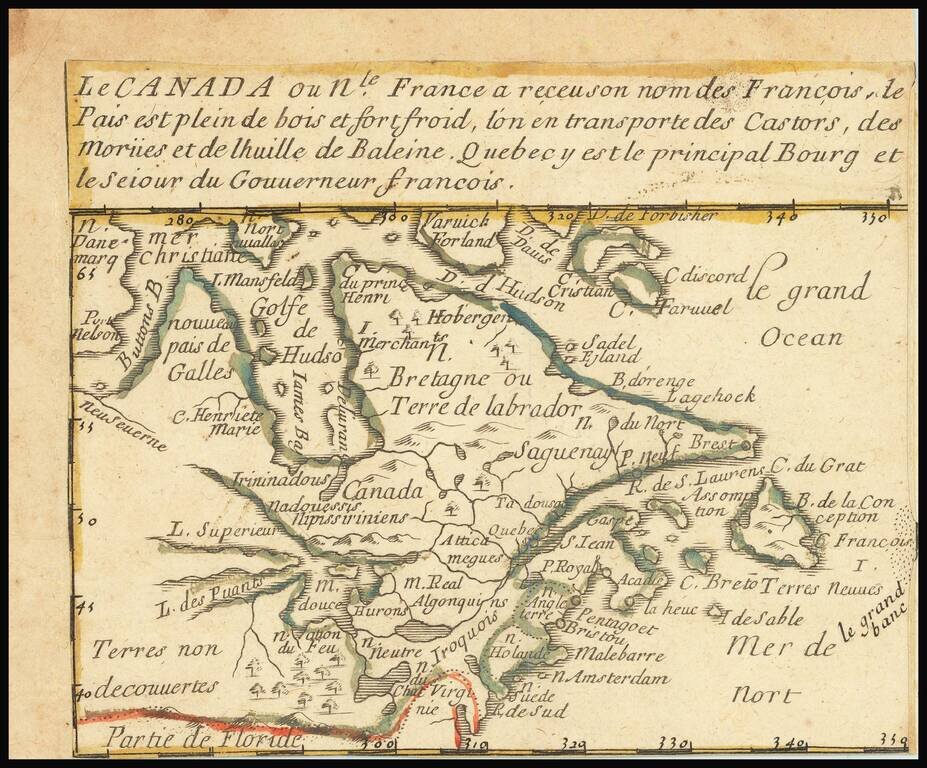
"[A] Rare Curiosity"-- Burden A little, very rare, gem of a map of eastern Canada and New England, stretching westwards past the Great Lakes. Many places throughout this region are named, and colonial claims are shown. The long title devotes itself to...
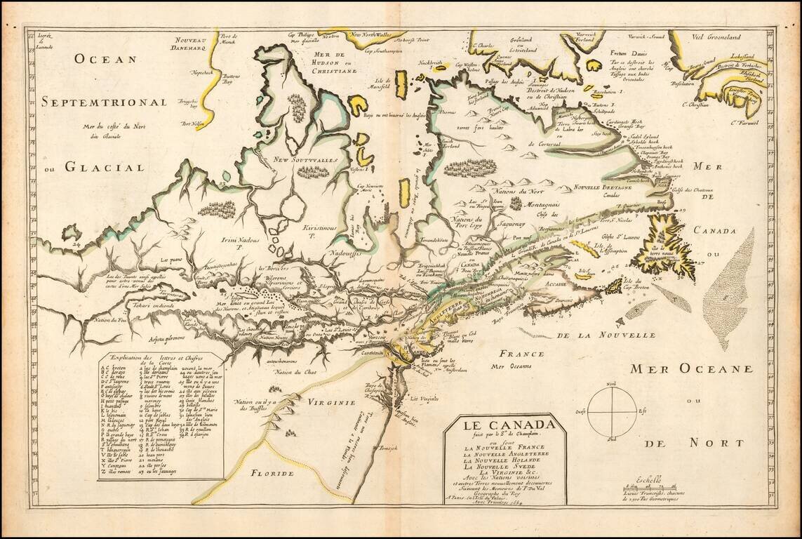
One of the Most Important Early Maps of Canada and the Great Lakes. Fine example of this highly important map of Canada, the Great Lakes and Northeastern United States, originally engraved for Samuel de Champlain's 1619 Les Voyages. Du Val's Le...
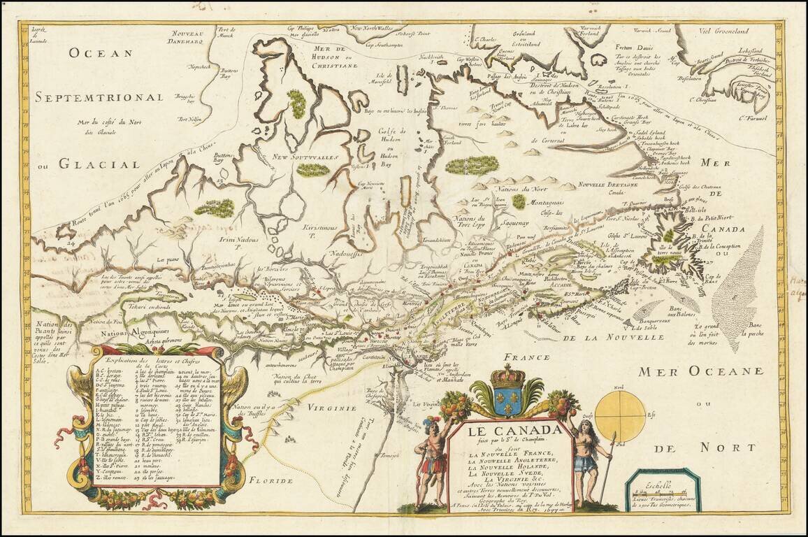
Fine example of this highly important map of Canada, the Great Lakes and Northeastern United States, originally engraved for Samuel de Champlain's 1619 Les Voyages. Du Val's Le Canada facit par le Sr. de Champlain . . . is unquestionably one of the...

Rare regional map of Florida, the Gulf Coast and Southeastern United States, from Du Val's Le Monde Terrestre. Du Val's map is based upon Sanson's 1657 map. The major difference is the prominence given the Rio del Spiritu Santu (Mississippi River),...
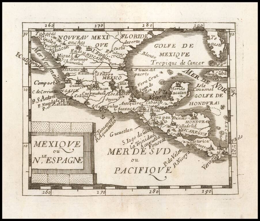
Nice example of Du Val's map of New Spain, extending from the American Southwest and Florida to Costa Rica and Panama.
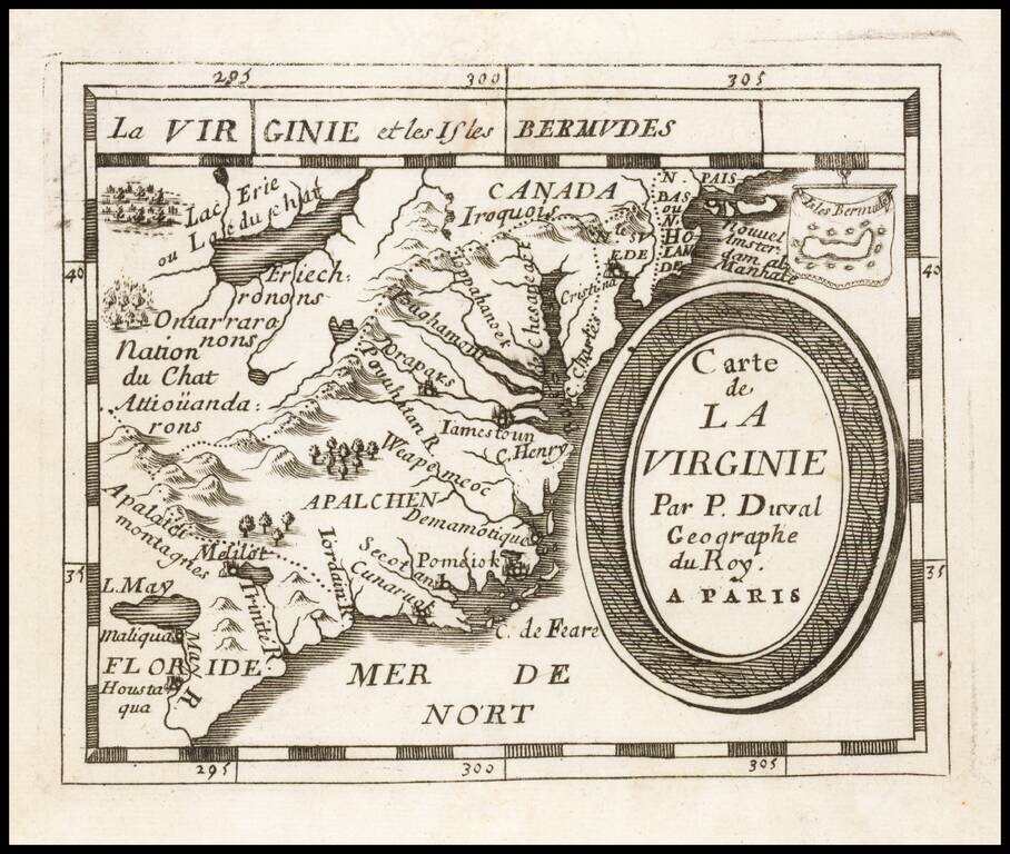
Early regional map from Duval's Le Monde Terrestre, first published in 1659, although no copy located pre-dates 1660. Includes an early depiction of the Chesapeake region, the mythical Lake May above Floride, Jamestown, Cape Henry, Secot, Pomeiok, an...
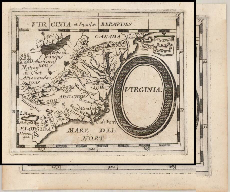
Early German Map of Virginia. Rare German edition of Pierre Duval's map of the region centered on Virginia, the Chesapeake and the Carolinas, published by Johann Hoffman in his Geographiae Universalis, first issued in 1678. The map is a close...
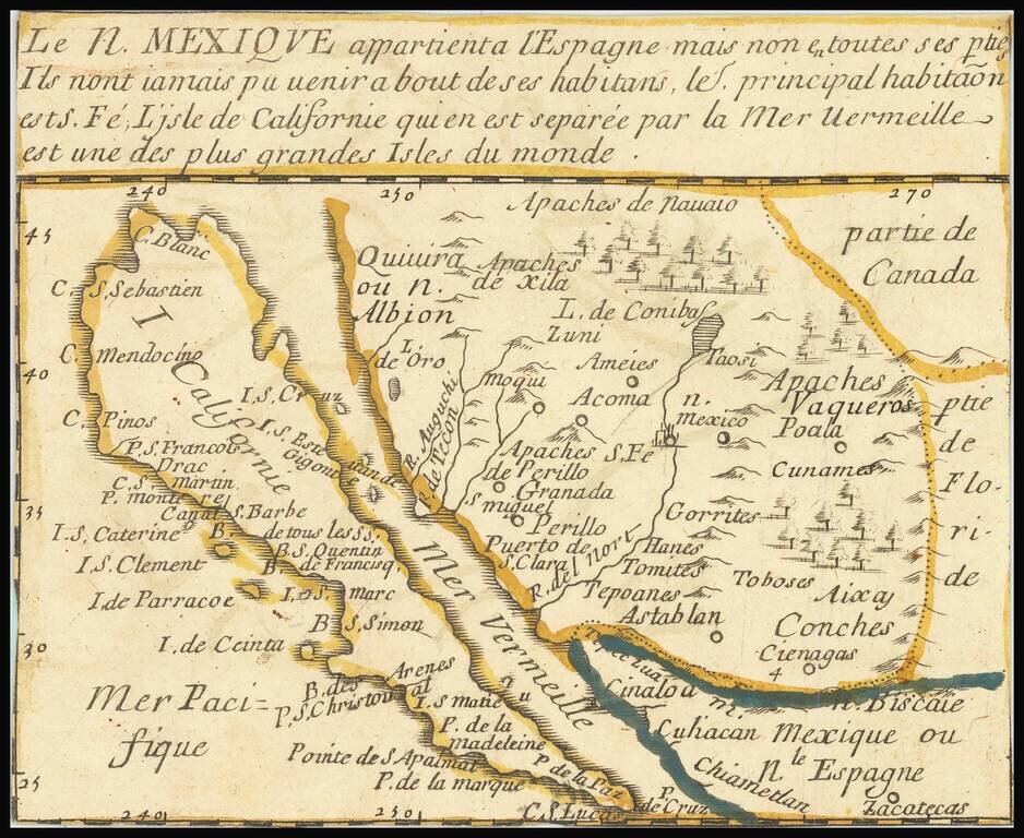
"The first map devoted so much to California"-- Burden A little, very rare, gem of a map of California as an Island, stretching eastwards into lands little known. Many places throughout this region are named, and colonial claims are shown. A long...
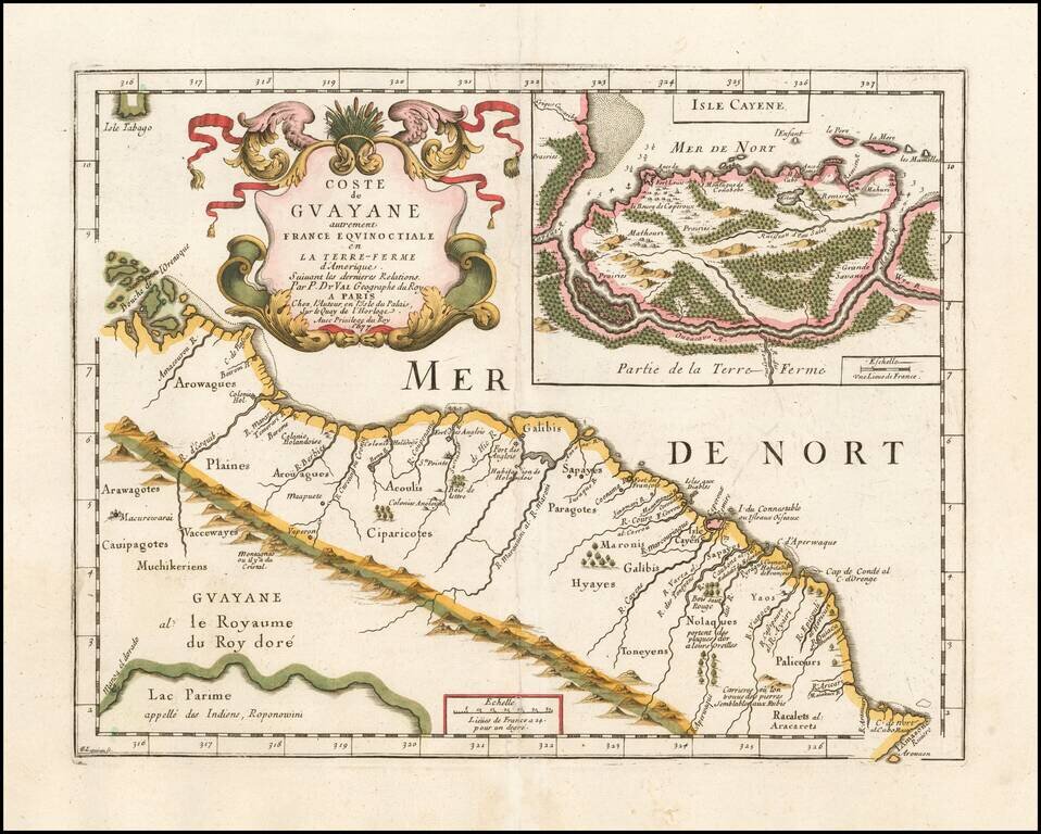
Very rare map of the Northeast coastline of South America, from the mouth of the Orinoco River to the mouth of the Amazon River, centered on Galibis, Sapayes and the Isle de Cayene. Shows a number of early place names, rivers, and a single cordillera...
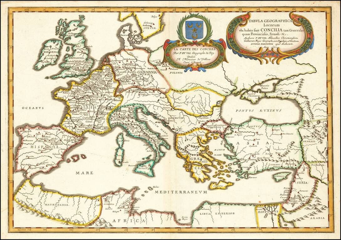
Finely colored example of Du Val's map of Europe, the Mediterranean and Asia Minor. Du Val's religious-historical map of Europe extends to include northern Africa and a portion of the Middle East. Locations of general and provincial councils and...
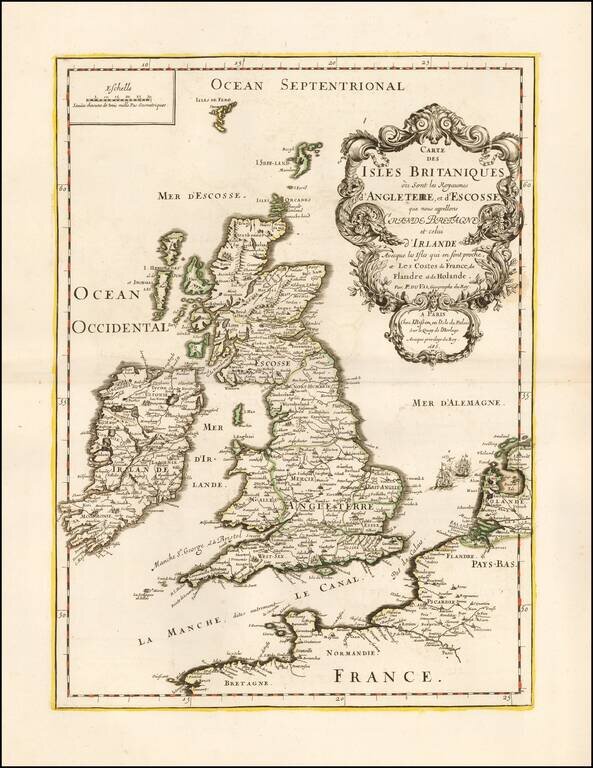
Fine example of Pierre Du Val's striking map of the British Isles. The present example bears the imprint of "Chez I. Besson en l'Isle du Palais sur le Quay de l'Horologue . . . 1685," making it a very early imprint following Du Val's death and before...
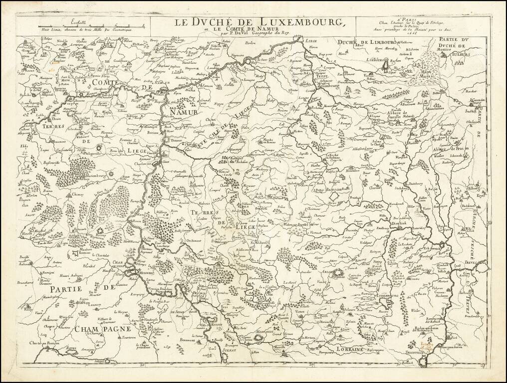
Scarce map of the Duchy Luxembourg and County of Namur, published in Paris by Pierre Du Val. Includes early manuscript annotation above Thionville, referencing Katenong (Cattenom) and Hunsingen?
![Itineraire de France, pour la Route de Paris a Lion [with] Route de Lion a Marseille et a Nice.](/map/small/47011.jpg)
Antique engraved map of the routes from Paris to Lyon and Lyon to Marseille and Nice in the middle of the 17th century. The map was published by Pierre Du Val probably around 1660.