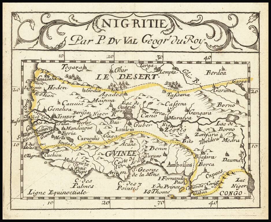
Pierre Duval (1618-1683) was a French geographer, cartographer, and publisher who worked in Abbeville and Paris during the seventeenth century. He was born in the former city, in northeast France, before moving to Paris. Duval was the nephew of the famous cartographer Nicolas Sanson, from whom he learned the mapmaker's art and skills. Both men worked at the royal court, having followed the royal request for artists to relocate to Paris. In addition to numerous maps and atlases, Du Val's opus also includes geography texts. He held the title of geographe ordinaire du roi from 1650 and died in 1683, when his wife and daughters took over his business.
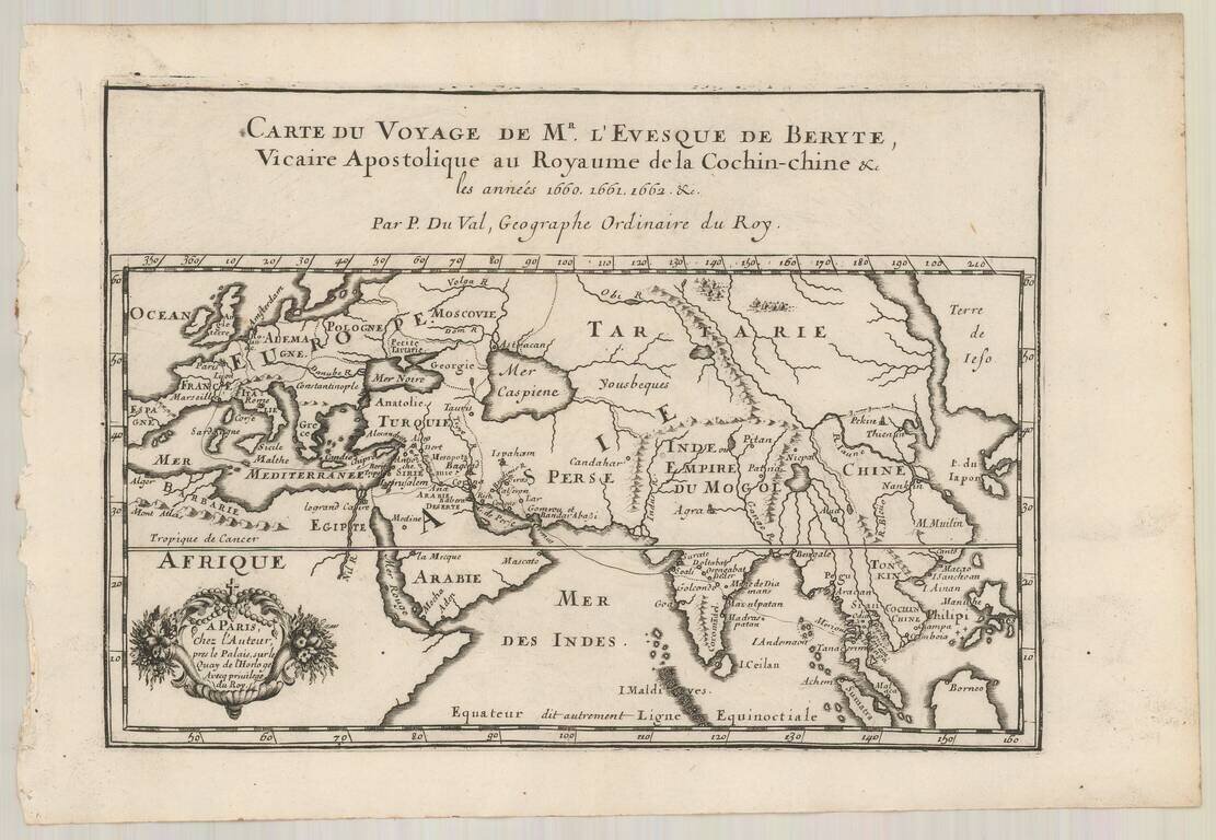
Antique engraved map showing the route of French missionaries to Siam. The map apparently appeared in Bourges's "Relation du voyage de Monseigneur l’évêque de Beryte Vicaire apostolique du royaume de la Cochinchine, Par la Turquie, la Perse, les...
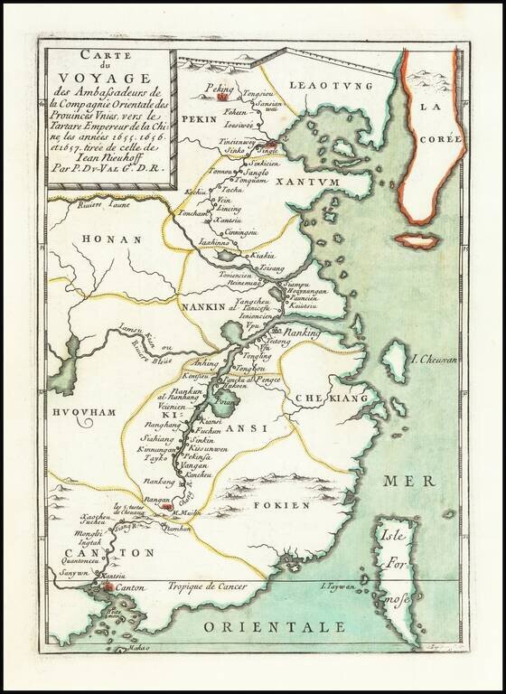
Scarce map of China, extending from Beijing, Korea and the Great Wall of China in the north to Canton, Macao and Formosa. The map illustrates the Dutch expedition to China led by Johan Nieuhof in 1655-57. In the first half of the 17th century, the...
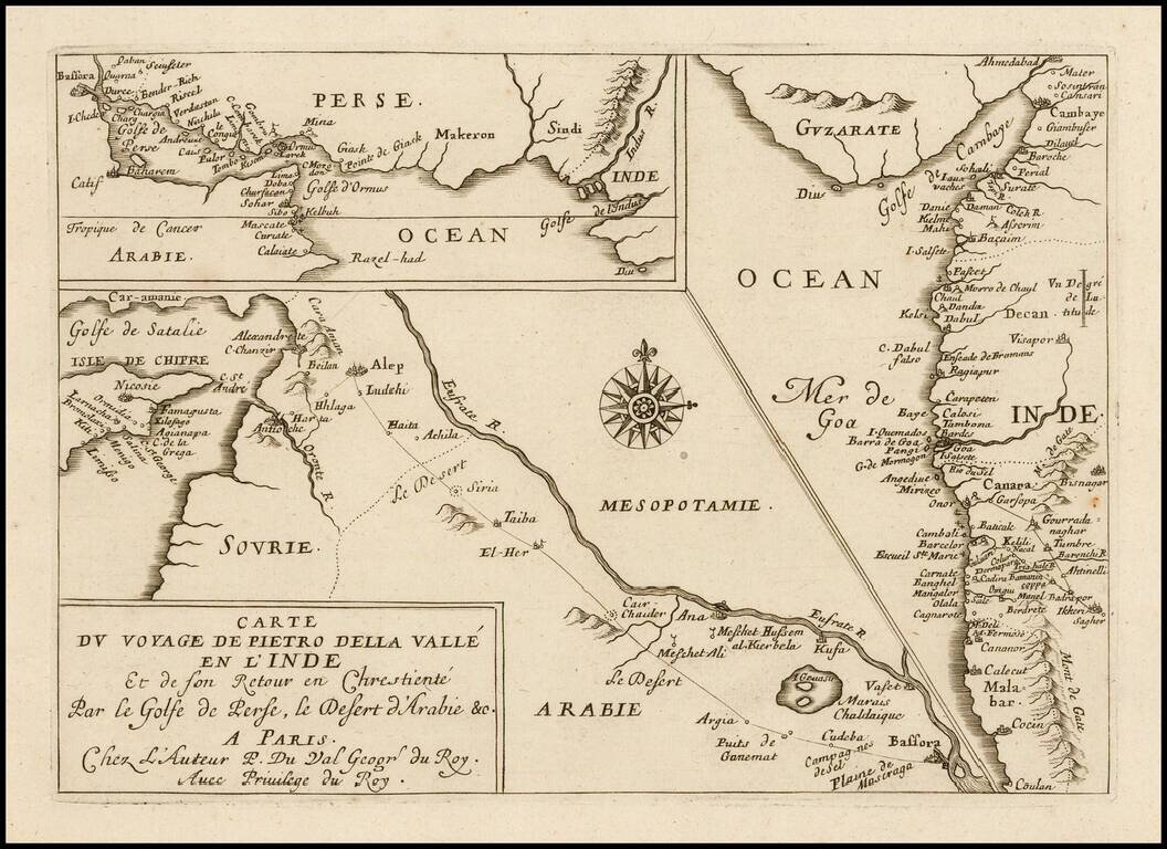
Rare Pierre Du Val antique engraved map featuring three small maps related to the travels of Italian writer Pietro della Valle's travel through the Middle East to the western coast of India in the early 17th century. Dell Valle's route is shown going...
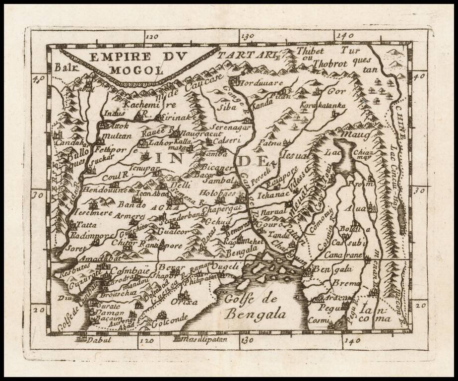
Detailed map of the Mogol Empire, centered on the Ganges River, published in Paris by Du Val. The map extends north to Tibet, west to the Indus River, south to the Bay of Bengal and east to the Mekong River.

Detailed map of the southern part of India and Sri Lanka, published in Paris by Du Val.
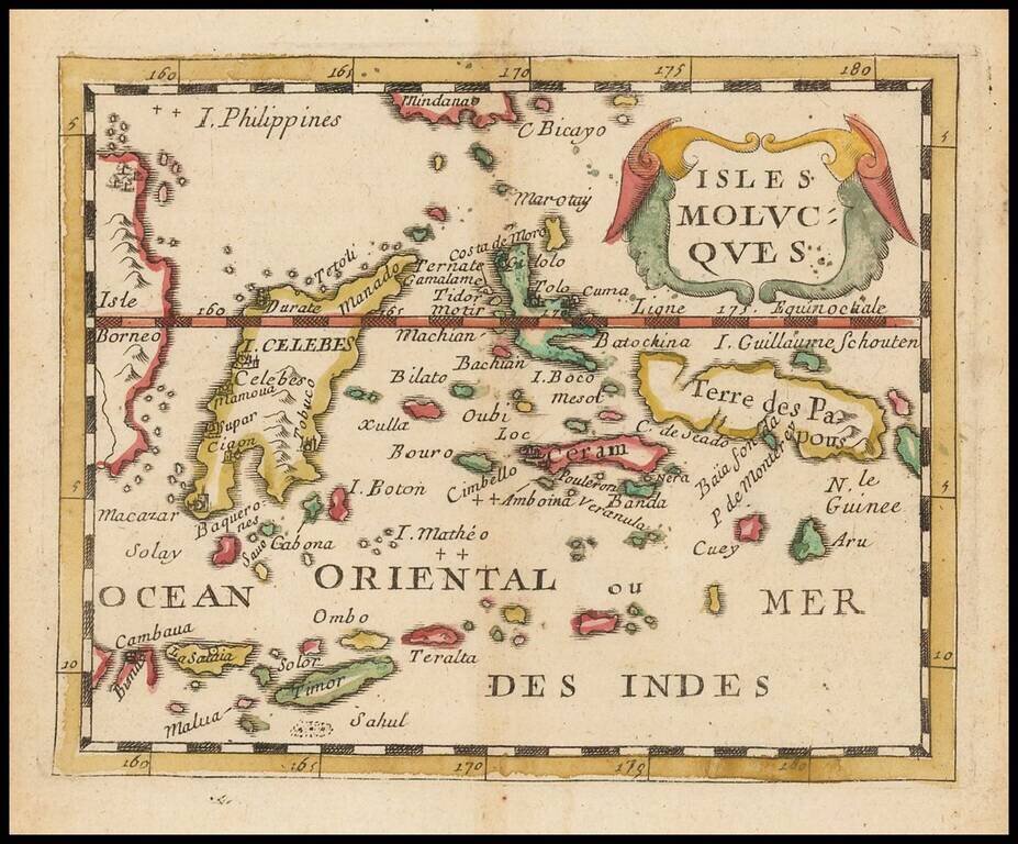
Scarce small format map of the Spice Islands, published by Pierre Du Val in Paris. One of the earliest obtainable maps to focus so closely on this region.
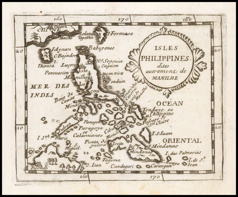
A Philippine Islands Rarity Detailed map of the Philippines, published in Paris by Du Val. An uncommon map of the Philippines, including parts of China and Borneo, depicting major towns and topographical features. The fictitious island of San Juan...
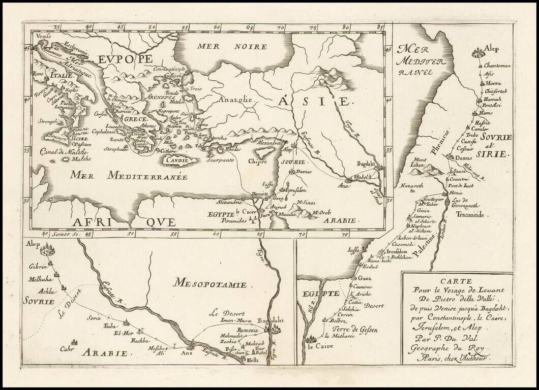
Interesting antique engraved three-part map of the Middle East following the travels of Renaissance writer Pietro Della Valle (1586-1652). The maps show voyages from Venice to Baghdad, from Cairo to Aleppo, and from Aleppo to Baghdad.
![Tabula Itineris Decies Mille Graecorum sub Cyro contra fratrem Artaxerxem Regem Persarum… [Shows Cyprus]](/map/small/46366.jpg)
This nicely engraved map features the expedition of Cyrus the Great (558-528 B.C.), the founder of the Persian Empire. Shows expedition route of conquest from the Eastern Mediterranean through Turkey to Armenia and Babylon. Centered on Cyprus. Three...
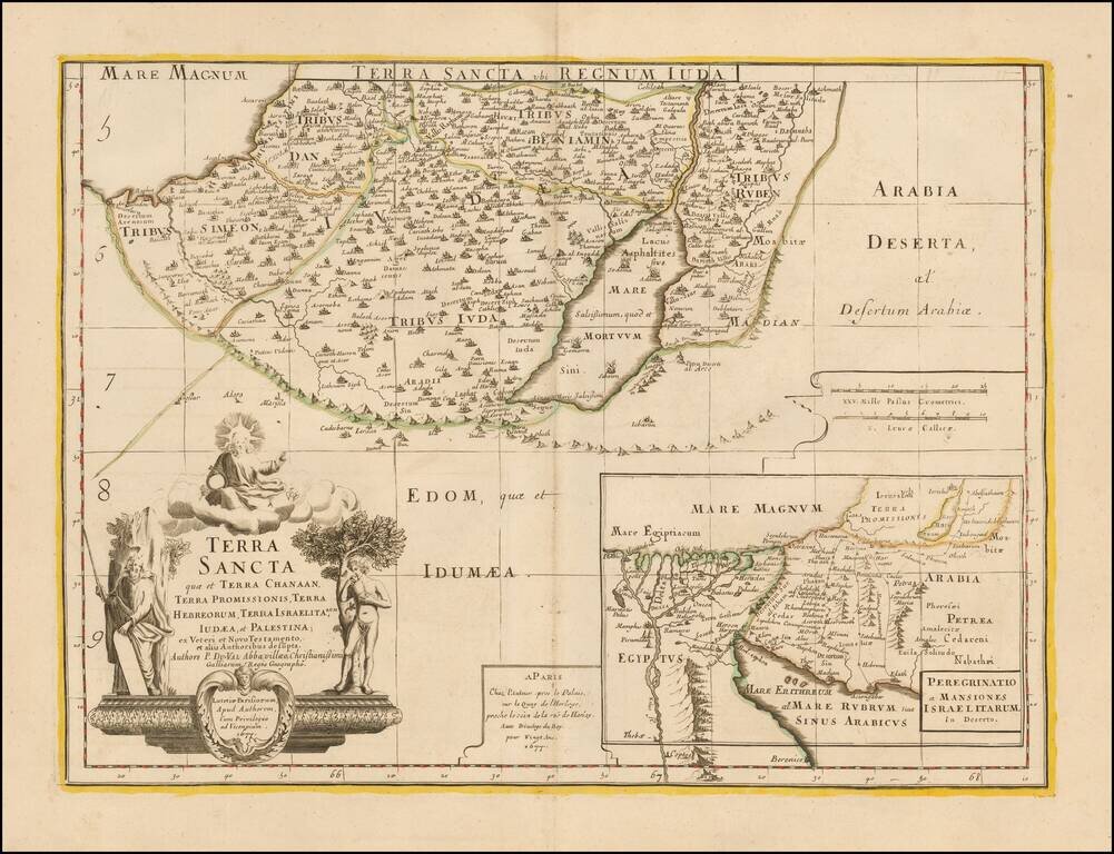
Southern half of Du Val's scarce 2 sheet map of the Holy Land. The map is centered on the Dead Sea and includes a large map showing the 40 years of wandering of the House of Israel through the desert after leaving Egypt.
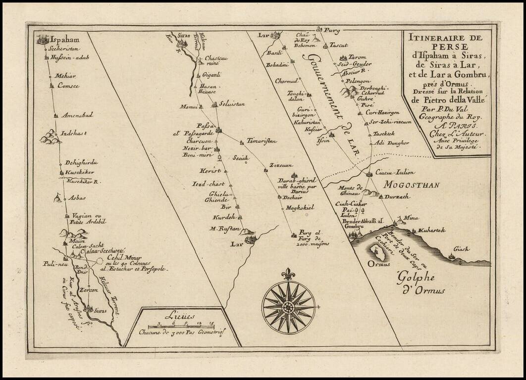
Interesting three-part map showing the journey of Renaissance writer Pietro Della Valle through Persia. The route extends from Isfahan to the Gulf of Hormuz.
![Africa ex Bello Africano [with] Egiptus ex Bello Alexandrino](/map/small/49002.jpg)
Small engraved map of two of the African theaters in Julius Ceasar's Civil War, produced by Pierre Du Val in Paris, circa 1660. The map shows the two African components of Ceasar's war of power consolidation, including Tunisia (showing the B.C. 49...
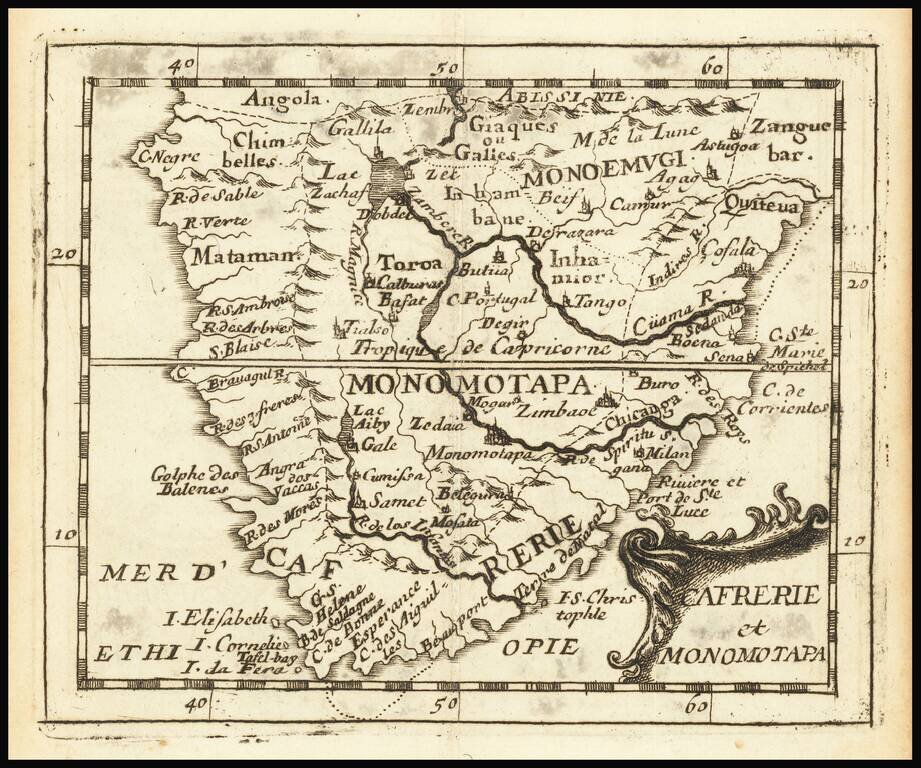
Rare engraved map of southern Africa, from Pierre Du Val's La Gegoraphie Universelle. This is a later state of a map that first appeared in 1663. In this state Table Bay and Aghulhas Bank are named. This map was published at the time that the first...
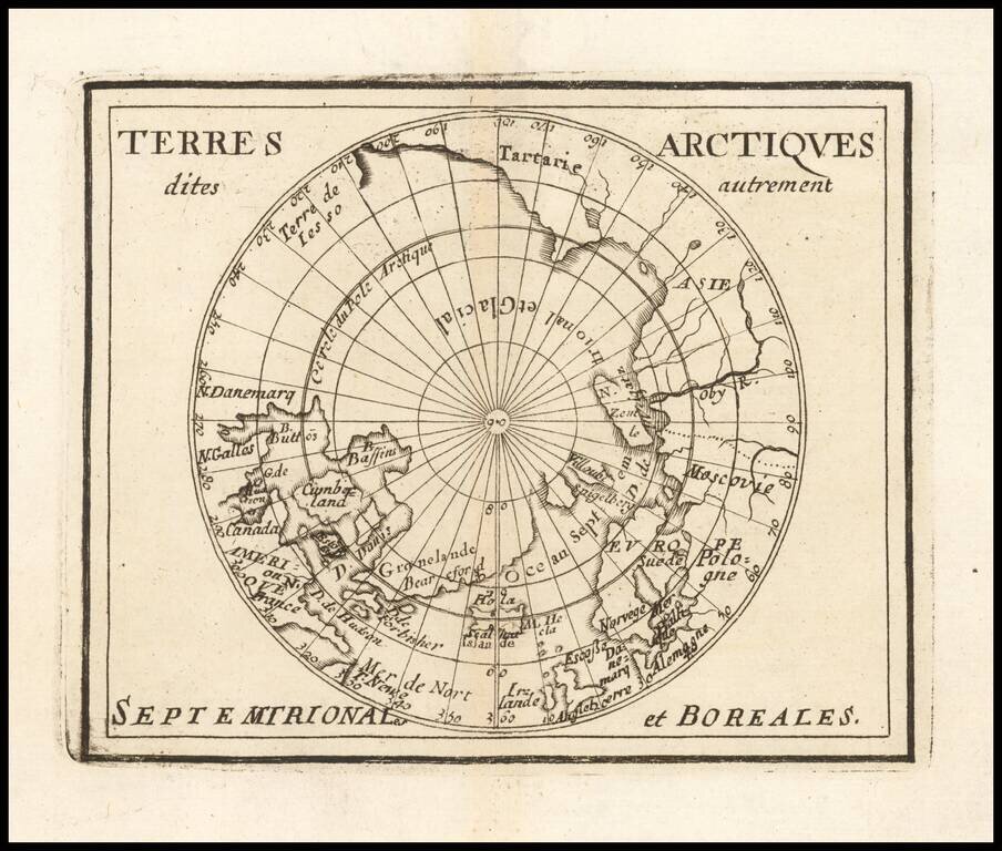
Rare map of the Northern Hemisphere, illustrating the known and imagined lands of the North Polar regions. The map provides a fine accounting of the lands of the North Polar regions, much of which were fictional.
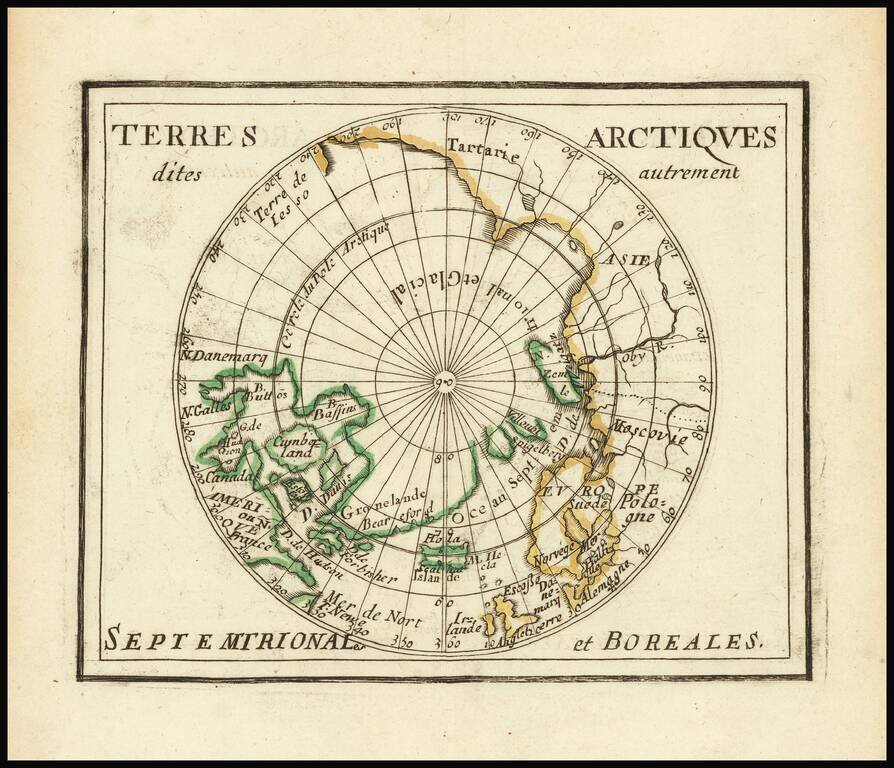
Du Val's Map of the Arctic Rare map of the north polar regions. The map provides a fine accounting of the lands of the Polar regions, which remained largely unexplored.