Pierre Duval (1618-1683) was a French geographer, cartographer, and publisher who worked in Abbeville and Paris during the seventeenth century. He was born in the former city, in northeast France, before moving to Paris. Duval was the nephew of the famous cartographer Nicolas Sanson, from whom he learned the mapmaker's art and skills. Both men worked at the royal court, having followed the royal request for artists to relocate to Paris. In addition to numerous maps and atlases, Du Val's opus also includes geography texts. He held the title of geographe ordinaire du roi from 1650 and died in 1683, when his wife and daughters took over his business.
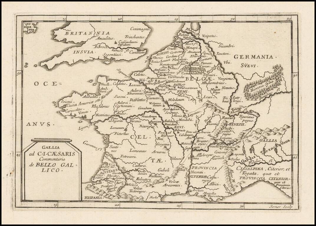
Antique engraved map of ancient France intended to illustrate Julius Caesar's commentary on the Gallic Wars. The map was issued by Pierre Du Val, probably in the 1660s. The map is scarce, this being the first time we have had it.
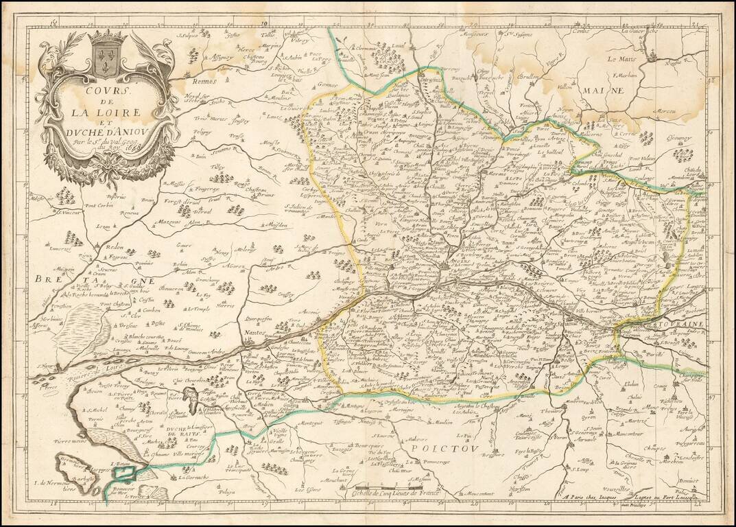
Rare double-page engraved map of the Loire River watershed, focusing on Anjou. Pierre Du Val (1619-83) was born in Abbeville, France. He was the nephew of the well-known geographer and cartographer Nicolas Sanson (1600-1667). After moving to Paris...
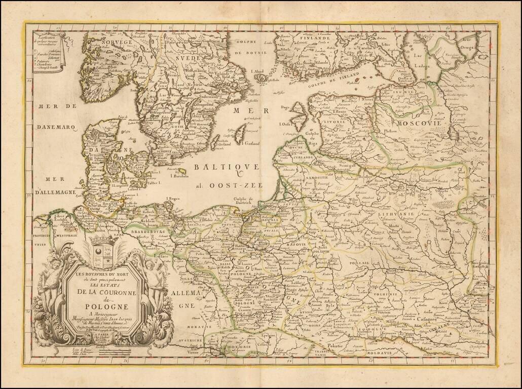
Rare map of Poland and the neighboring regions, published in Paris by Du Val. The map extends to include the Ukraine and western Russia. With decorative tittle cartouche lower left with a dedication to Jean-Jacques de Mesmes, comte d'Avaux (1640 - 9...

Antique engraved map of the parts of Bosnia, Herzegovina, and Serbia that fall along the route from Paris to Constantinople. The map explains the four ways to reach Constantinople from Paris. The roads from Ragusa (Dubrovnik) to Nisse and Belgrade to...

Map illustrating the route between Belgrade and Ragusa taken by Sieur Quiclet during his travels to and from Constantinople in 1657 and 1658. The map shows the itinerary described by Quiclet between Belgrade and Ragusa on the Adriatic, by way of Bsona...
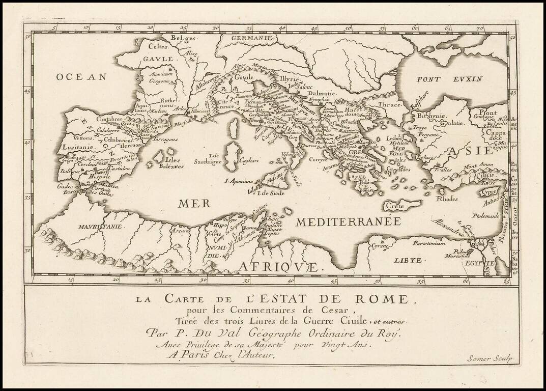
Antique engraved map of the Roman Empire, published by Pierre Duval in Paris in the 1660s. The map shows the important early Roman cities around the Mediterranean. According to the title, the map shows the State of Rome, from the Commentaries of...
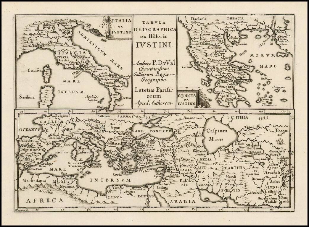
Antique engraved map of ancient Italy, Greece, Europe and the Middle East, after the writings of the Roman historian Justin.
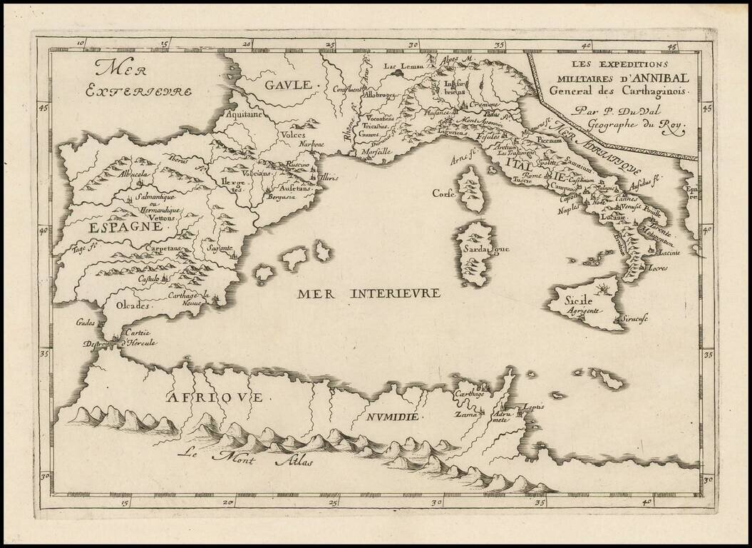
Antique engraved map of the military expedition of Hannibal, the Carthaginian general, published in Paris circa 1660 by Pierre Du Val. The map covers all of the western Mediterranean, with the most detail in Italy and Spain and a few locations in...
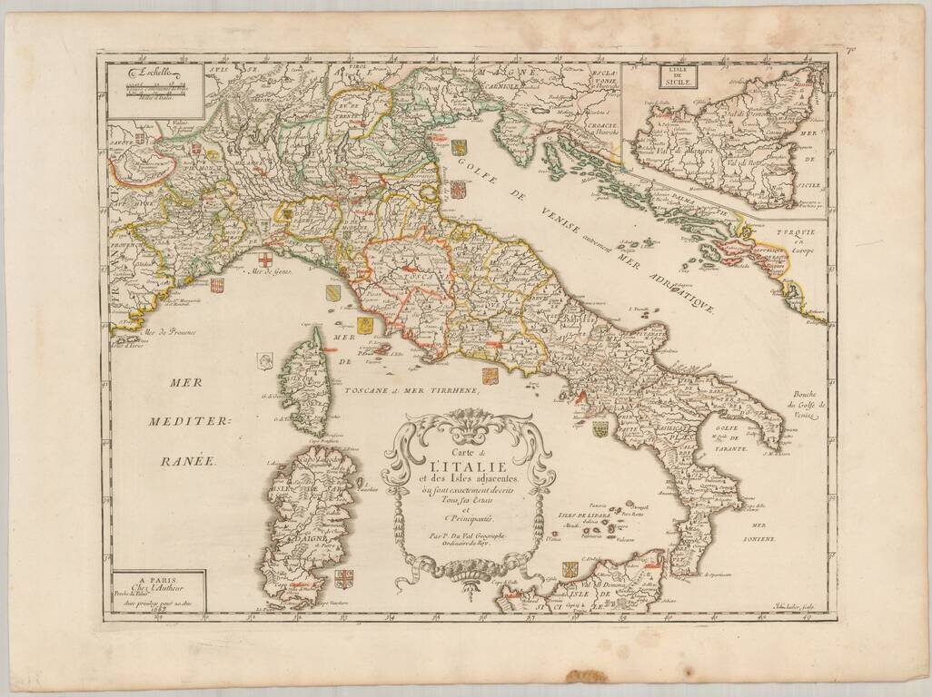
Scarce map of Italy, published in Paris by Pierre Du Val in 1663. The map is embellished by approximately 20 coats of arms of the various regions of Italy. Highly detailed, including towns, roads, rivers, castles, harbors, bays and a host of other...
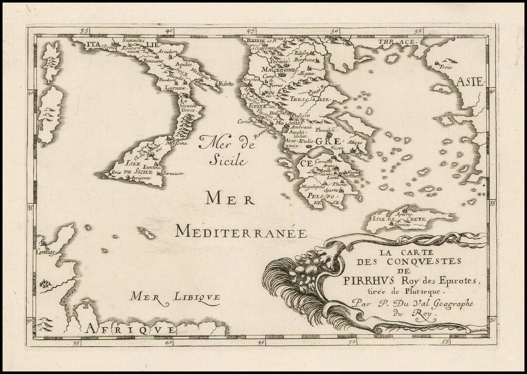
Antique engraved map of the conquests of Pyrrhus of Epirus, covering Greece, Southern Italy, and Sicily. The map was published in Paris in 1660 by Pierre Du Val.
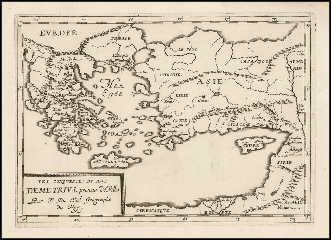
Antique map of the conquests of Demetrius I "Taker of Cities", published by Pierre Du Val in Paris, circa 1660.
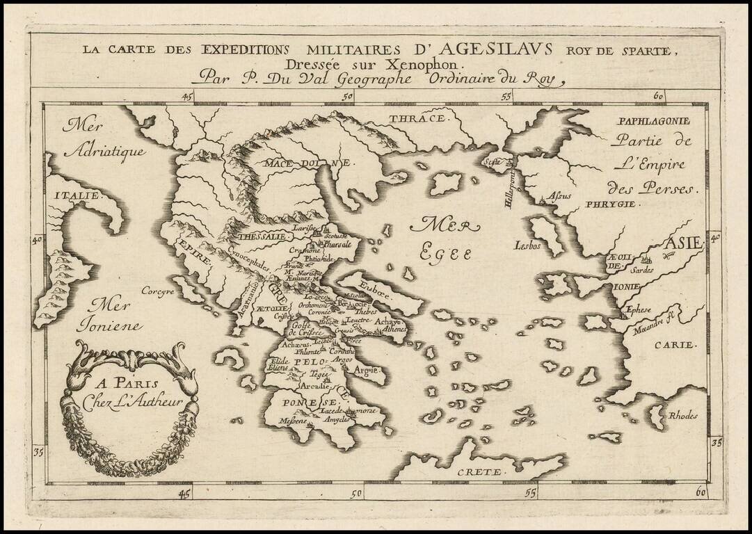
Antique engraved map of the military expeditions of Agesilaus II, as described by his friend the historian Xenophon. Agesilaus II was king of the Greek city-state of Sparta.
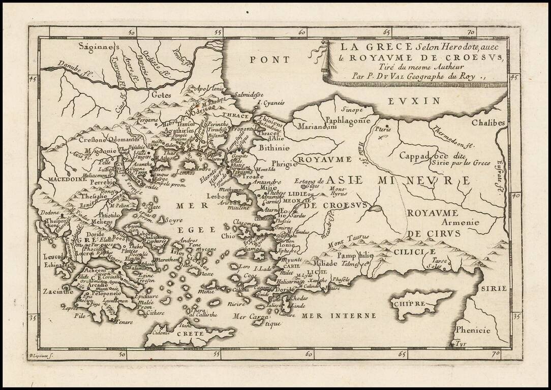
Antique engraved map of Greece and the Kingdom of Croesus (Lydia), after a description by Herodotus. The map was published in Paris by Pierre Du Val, probably around 1660.
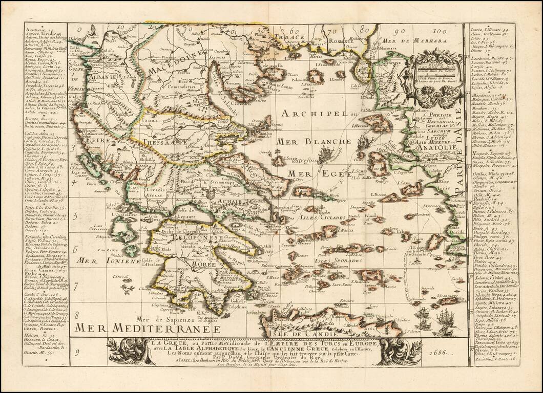
Rare map of the Greek Islands by Pierre Du Val, published in Paris. Du Val's map focuses on the Aegean and the various trade routes through the region and beyond, tracking the routes of ancient and modern Mariners from the Dardenelles, Gallipoli and...

Antique engraved map of the retreat of The Ten Thousand, published by Pierre Du Val in Paris around 1660. The Ten Thousand (Ancient Greek: οἱ Μύριοι, oi Myrioi) were a force of mercenary units, mainly Greeks, employed by Cyrus the Younger to...
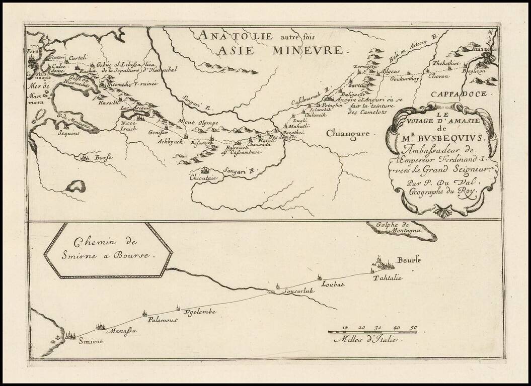
Antique engraved map of the route from Constantinople to Amasya in Turkey, and from Smyrna to Bourse. The route shown is that of Ogier Ghiselin de Busbecq, Ambassador for Ferdinand I of Austria.