Jacques-Nicolas Bellin (1703-1772) was among the most important mapmakers of the eighteenth century. In 1721, at age 18, he was appointed hydrographer (chief cartographer) to the French Navy. In August 1741, he became the first Ingénieur de la Marine of the Depot des cartes et plans de la Marine (the French Hydrographic Office) and was named Official Hydrographer of the French King.
During his term as Official Hydrographer, the Depot was the single most active center for the production of sea charts and maps, including a large folio format sea-chart of France, the Neptune Francois. He also produced a number of sea-atlases of the world, e.g., the Atlas Maritime and the Hydrographie Francaise. These gained fame, distinction, and respect all over Europe and were republished throughout the 18th and even in the succeeding century.
Bellin also came out with smaller format maps such as the 1764 Petit Atlas Maritime, containing 580 finely detailed charts. He also contributed many of the maps for Bellin and contributed a number of maps to the 15-volume Histoire Generale des Voyages of Antoine François Prévost or simply known l'Abbe Prevost.
Bellin set a very high standard of workmanship and accuracy, thus gaining for France a leading role in European cartography and geography. Many of his maps were copied by other mapmakers of Europe.
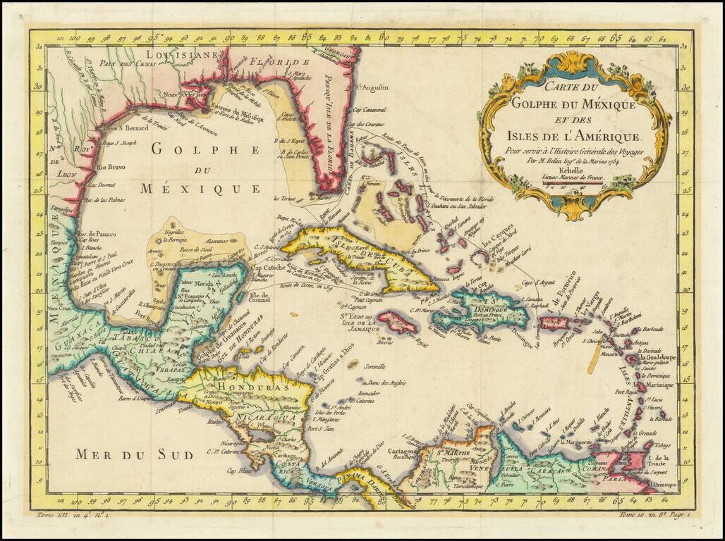
Interesting and detailed map of Florida, the Gulf Coast, Central America, and the Caribbean. The map shows the route of Ponce de Leon when he discovered Florida, Cortez's route in 1519, and that of De Cordova in 1517. The map features a decorative...
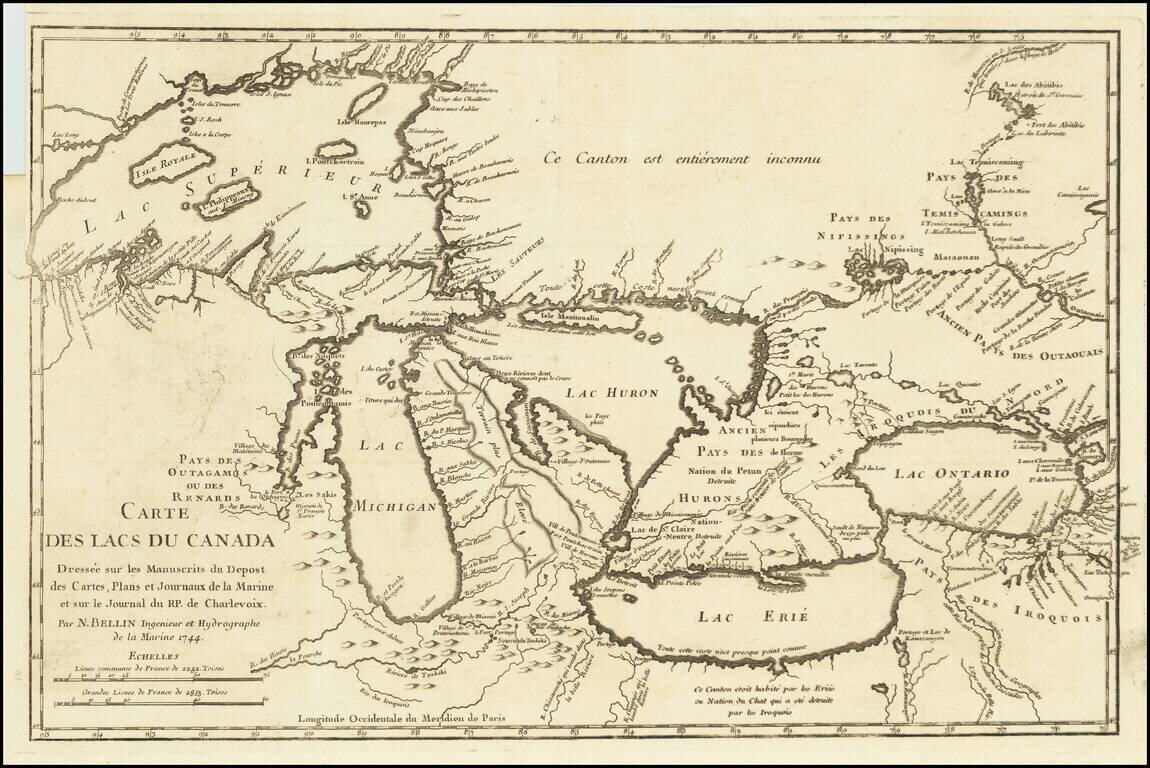
Fine example of Bellin's Landmark map of the Great Lakes region, published in 1744 Bellin's seminal early map of the Great Lakes represented a milestone in the progress of the mapping of the region. It is also one of the earliest appearances of...
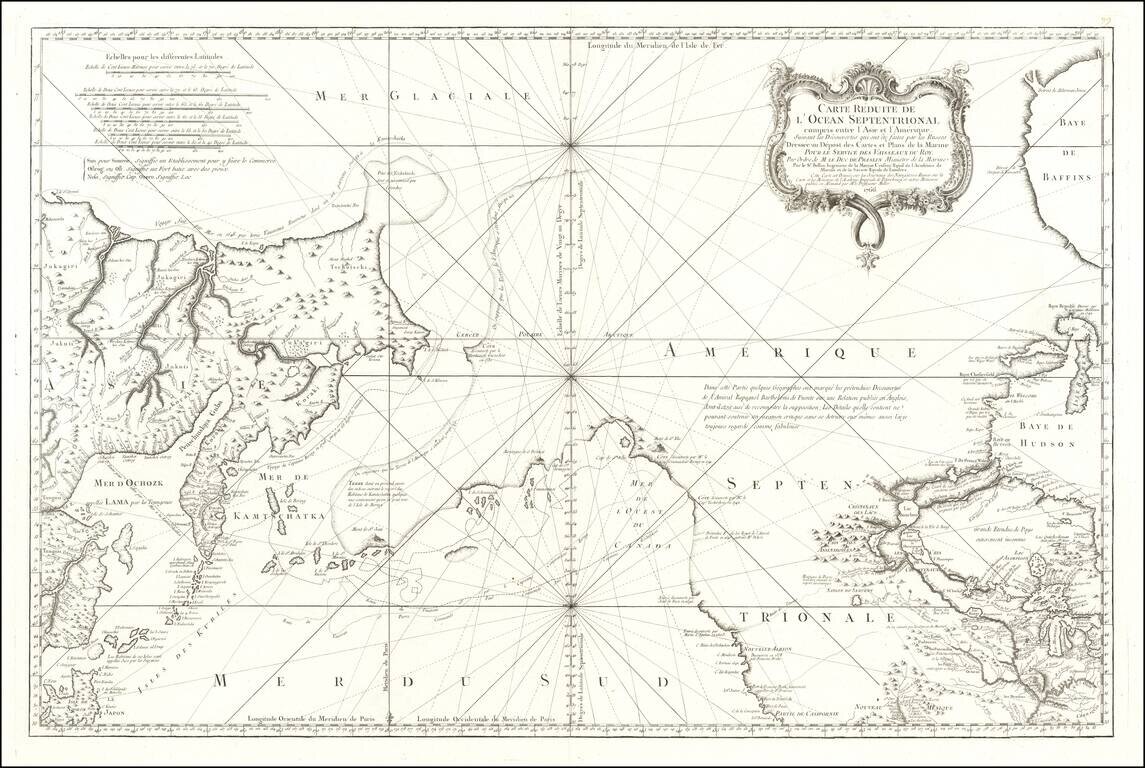
An Important Early Navigational Chart Which Shows Alaska This is a foundational chart of Alaska, the Pacific Northwest, and the northeastern coast of Asia, published in Paris. The Port of San Francisco is named, three years before the supposed...
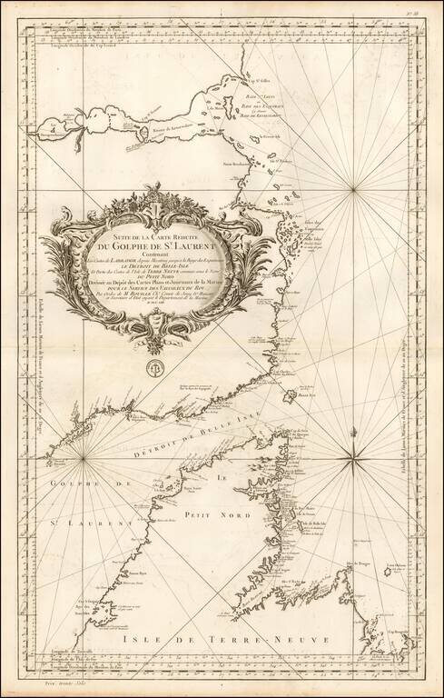
Important mid-18th Century chart of the Gulf of St. Laurence, Straits of Belle Isle and contiguous coastlines, published by Bellin, for the French Depot de la Marine. This interesting chart is one of the most significant maps of the region. The Strait...
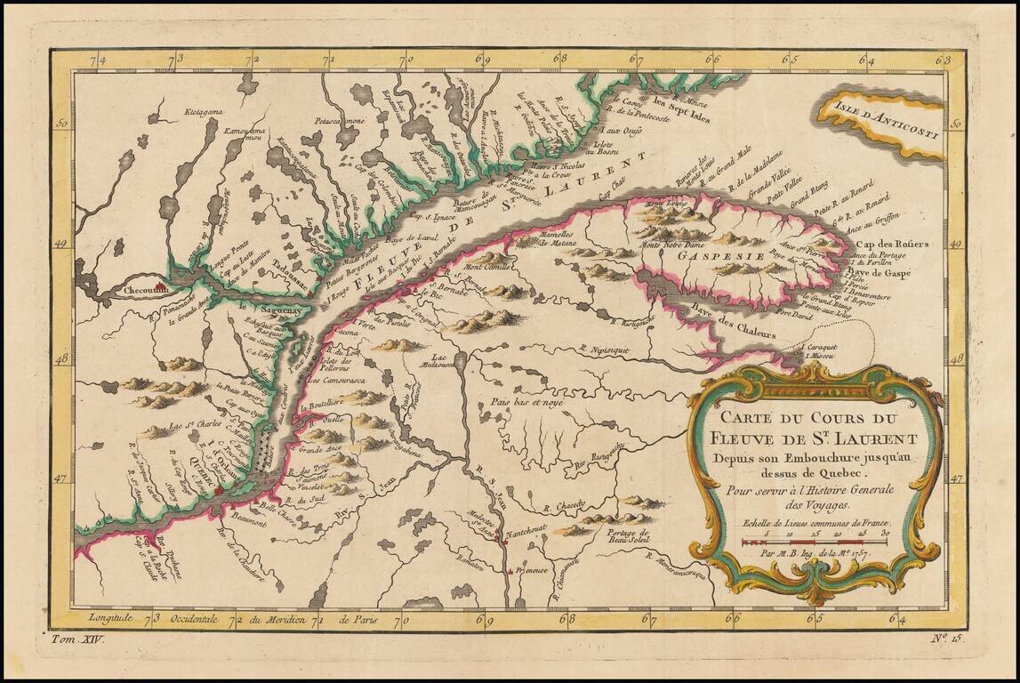
Detailed regional map of Canada, extending from Anticosti Island to just west of Quebec, centered on the St. Laurence River. Includes a decorative title cartouche.

Scarce Leipzig edition of Bellin's excellent map of Hudson's Bay, Labrador, Hudson's Straits and neighboring regions originally issued in Bellin's Histoire General des Voyages. Includes numerous bays, islands, rivers, mountains and notes regarding...
![Partie du Cours du Fleuve de Saint Laurent depuis Quebec jusqu'au Cap aux Oyes [on sheet with] Carte du Cours du Fleuve Saint Laurent depuis Quebec jusqu'a la Mer en Deux Feuilles ... 1761](/map/small/55185.jpg)
French Sea Chart of the Saint Lawrence, published during the French and Indian War. Jacques Nicolas Bellin's 1761 double-page engraved map of the Saint Lawrence east of Isle d'Orleans. The top map is a more focused version of the map on the bottom,...
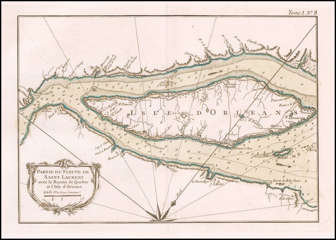
An excellent map of a portion of the St. Lawrence River centered on the Island of Orleans, from Bellin's Petit Atlas Maritime.
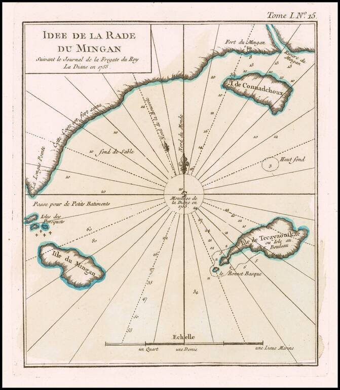
The French Fur Trading Fort at Mingan An excellent map of Harbor at Mingan and coastal islands, from Bellin's Petit Atlas Maritime. The map shows a section of the coast of Quebec, at the mouth of the Gulf of St. Lawrence, just north of the Island of...
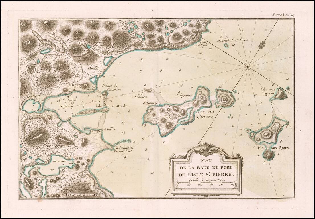
The Strategically Important Island of St. Pierre An excellent map of the western part of the island of St. Pierre, from Bellin's Petit Atlas Maritime. Following France's losses during the Seven Years War, France surrendered most of its Colonial...
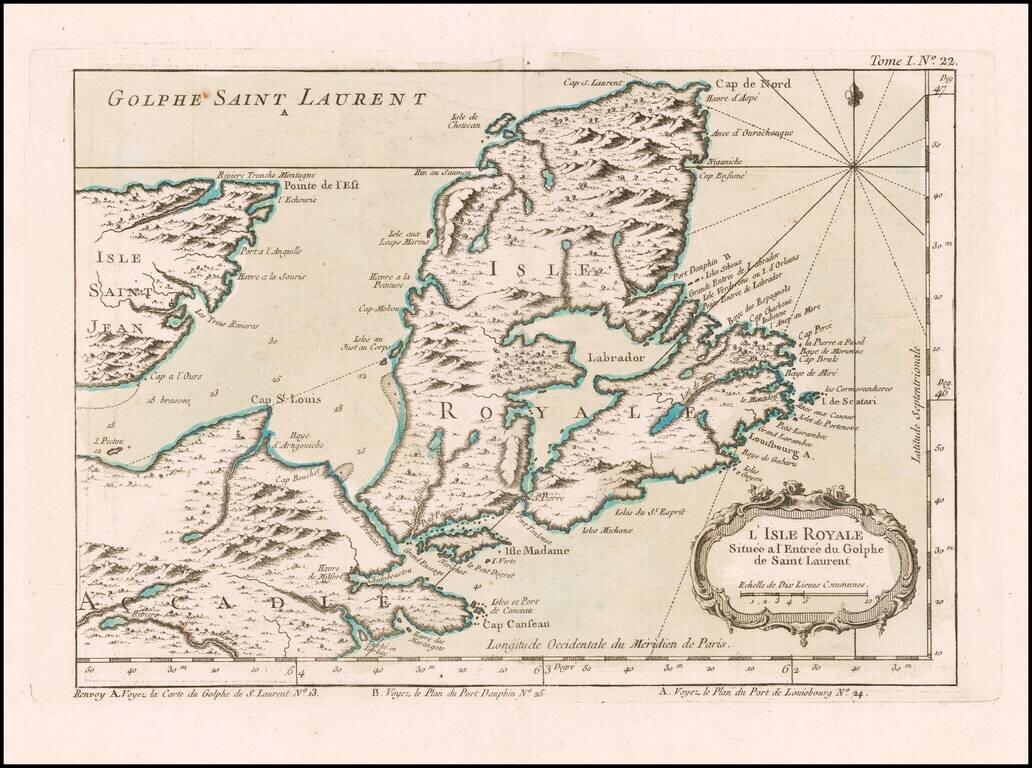
Attractive map of the area around Isle Royale at the entrance of the Gulf of St. Lawarence. The map appeared in Bellin's Petit Atlas Maritime.
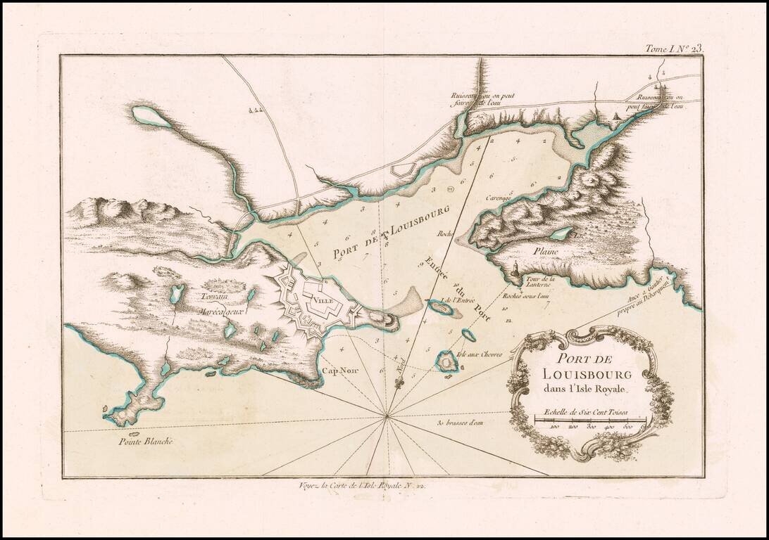
Attractive map of the harbor of Louisbourg, showing the fortified port and environs. The map appeared in Bellin's Petit Atlas Maritime. Louisbourg was originally settled in 1713, and initially called Havre à l'Anglois. Subsequently, the fishing...
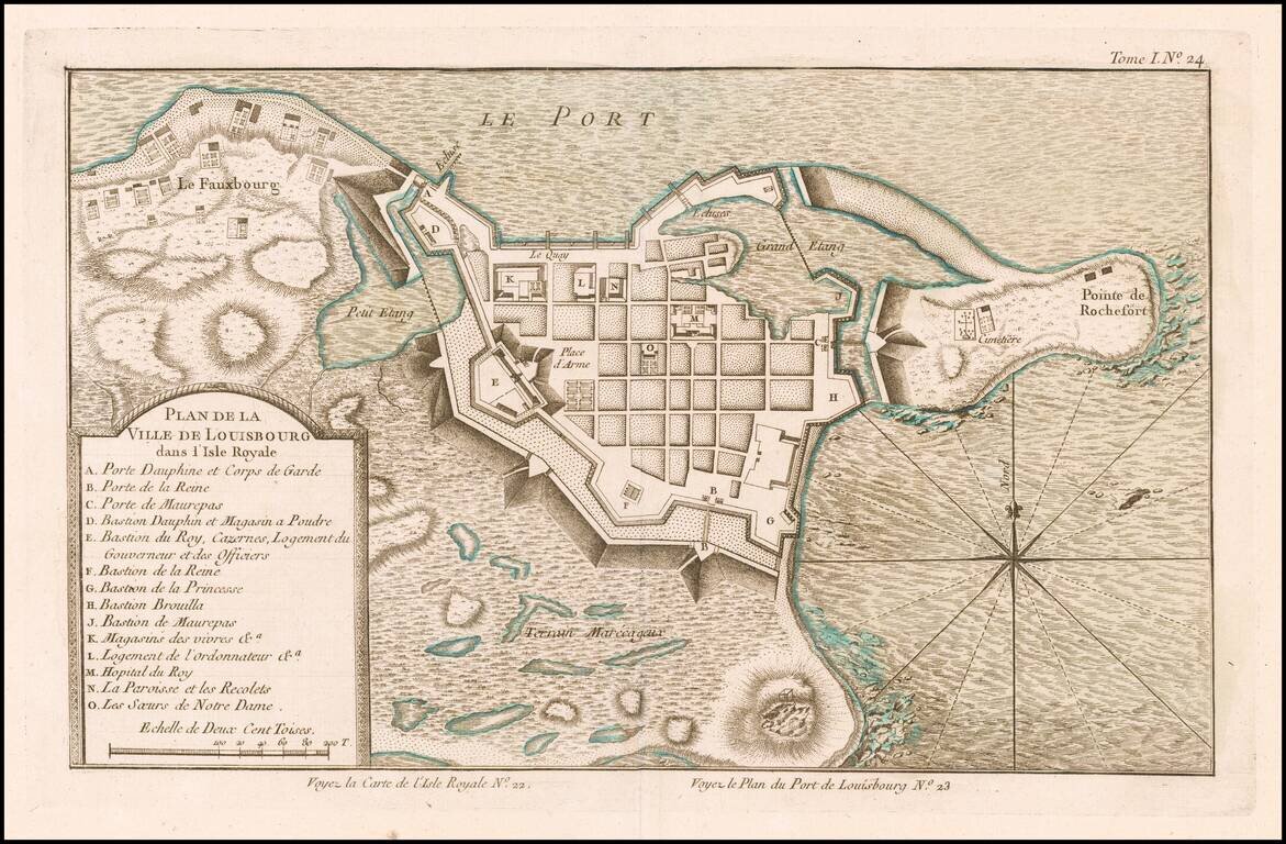
Scarce plan of Louisbourg, published at the conclusion of the French & Indian War, from Bellin's Petit Atlas Maritime. The map shows major fortifications and includes a key locating 14 important points of interest. Louisbourg was originally...
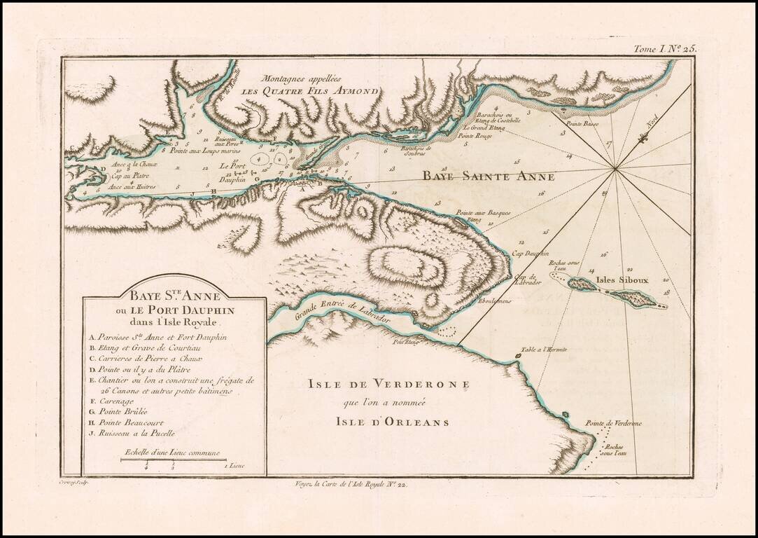
Detailed plan of the Bay of St. Anne and Port Dauphin on Isle Royale (Cape Breton Island). The map appeared in Bellin's Petit Atlas Maritime. The French established a fort and fishing base across St Anns Bay (Fort Sainte-Ann, now Englishtown) in...
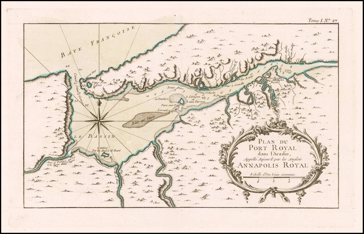
Interesting map of the harbor of Port Royal and the town of Annapolis Royal, pubished in Bellin's Petit Atlas Maritime.
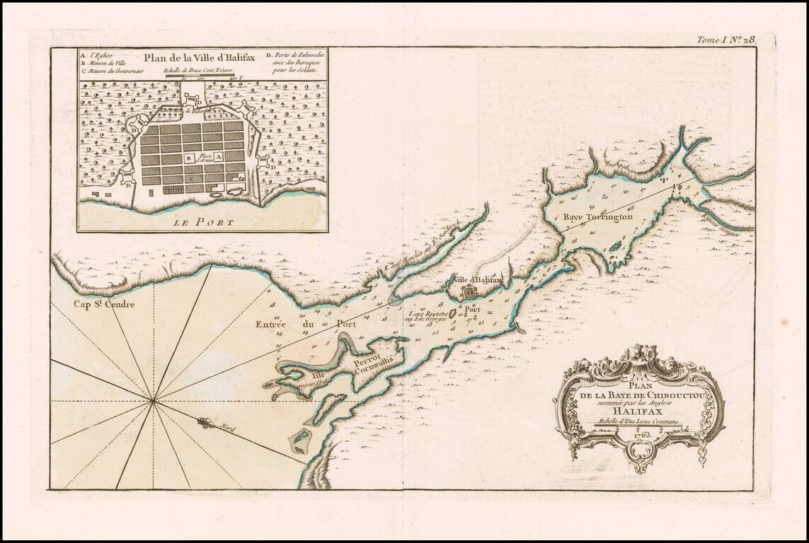
Halifax, Nova Scotia An excellent map of Chibouctou (Beford) Bay and environs, published by Nicolas Bellin in his Petit Atlas Maritime shortly after the conclusion of the Seven Years War. Includes a large plan of the town of Halifax.