Jacques-Nicolas Bellin (1703-1772) was among the most important mapmakers of the eighteenth century. In 1721, at age 18, he was appointed hydrographer (chief cartographer) to the French Navy. In August 1741, he became the first Ingénieur de la Marine of the Depot des cartes et plans de la Marine (the French Hydrographic Office) and was named Official Hydrographer of the French King.
During his term as Official Hydrographer, the Depot was the single most active center for the production of sea charts and maps, including a large folio format sea-chart of France, the Neptune Francois. He also produced a number of sea-atlases of the world, e.g., the Atlas Maritime and the Hydrographie Francaise. These gained fame, distinction, and respect all over Europe and were republished throughout the 18th and even in the succeeding century.
Bellin also came out with smaller format maps such as the 1764 Petit Atlas Maritime, containing 580 finely detailed charts. He also contributed many of the maps for Bellin and contributed a number of maps to the 15-volume Histoire Generale des Voyages of Antoine François Prévost or simply known l'Abbe Prevost.
Bellin set a very high standard of workmanship and accuracy, thus gaining for France a leading role in European cartography and geography. Many of his maps were copied by other mapmakers of Europe.
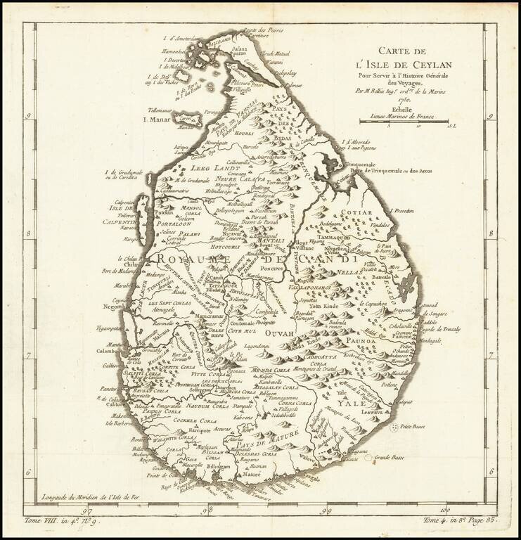
Finely engraved map of Sri Lanka, from Jacques Nicolas Bellin's Le Petit Atlas Maritime Recueti de Cartes et Plans des Quatre Parlies du Monde en Cinq Volumes, first published in Paris in 1764. Jacques Nicolas Bellin Jacques Nicolas Bellin...
![[Sidon, Lebanon] Plan de Seide en Syrie](/map/small/61410.jpg)
Finely engraved map of of Sidon in Lebanon, from Jacques Nicolas Bellin's Le Petit Atlas Maritime Recueti de Cartes et Plans des Quatre Parlies du Monde en Cinq Volumes, first published in Paris in 1764.
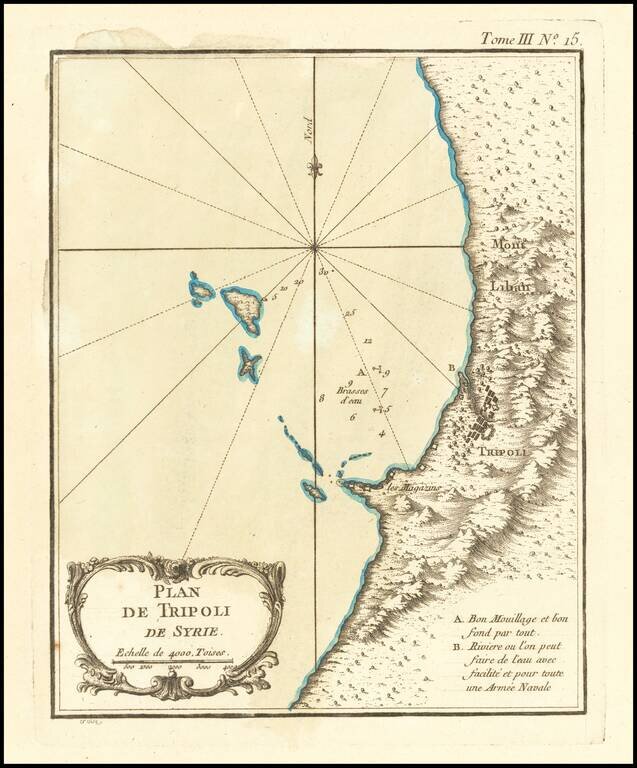
Finely engraved map of the area around Tripoli, on the northern coast of Lebanaon, from Jacques Nicolas Bellin's Le Petit Atlas Maritime Recueti de Cartes et Plans des Quatre Parlies du Monde en Cinq Volumes, first published in Paris in 1764. The map...
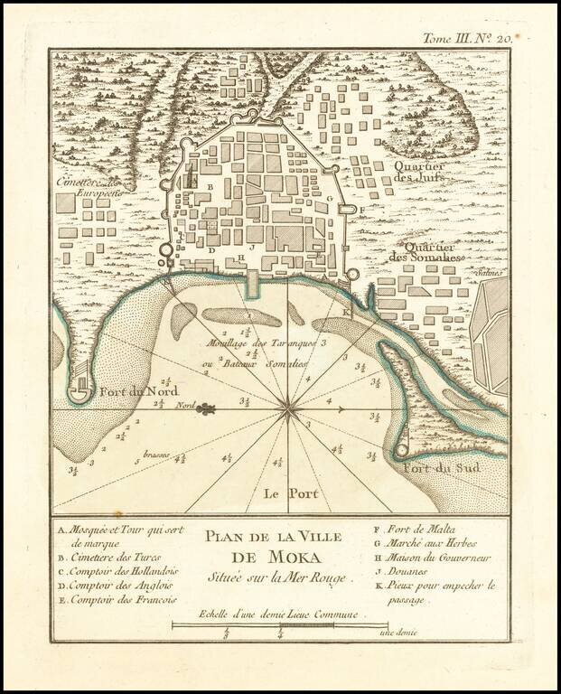
Finely engraved map of Mocha, Yemen, from Jacques Nicolas Bellin's Le Petit Atlas Maritime Recueti de Cartes et Plans des Quatre Parlies du Monde en Cinq Volumes, first published in Paris in 1764.
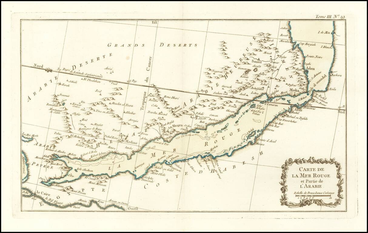
Finely engraved map of the Red Sea and Southern part of the Arabian Peninsula, from Jacques Nicolas Bellin's Le Petit Atlas Maritime Recueti de Cartes et Plans des Quatre Parlies du Monde en Cinq Volumes, first published in Paris in 1764.
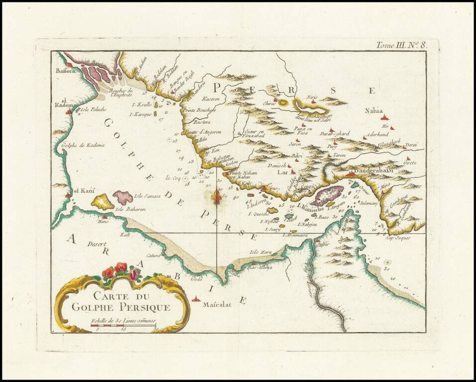
Names "Catura" (Qatar). Finely engraved map of the Persian Gulf, from Jacques Nicolas Bellin's Le Petit Atlas Maritime Recueti de Cartes et Plans des Quatre Parlies du Monde en Cinq Volumes, first published in Paris in 1764. Names the following...
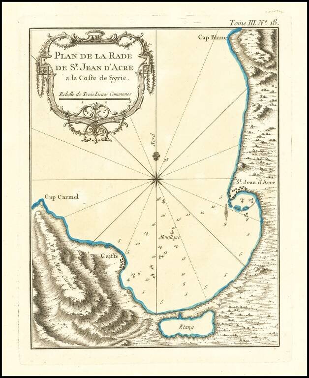
Finely engraved map of the area around the city of Acre in Israel, from Jacques Nicolas Bellin's Le Petit Atlas Maritime Recueti de Cartes et Plans des Quatre Parlies du Monde en Cinq Volumes, first published in Paris in 1764. Acre was the scene of...
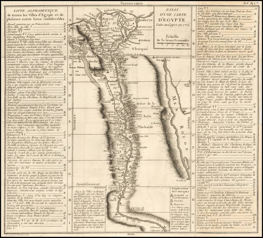
Scarce map of a portion of Egypt, focused on the course of the Nile River. The title suggests that the map is based upon a map made in Cairo in 1715. The map extends from the Cataracts of the Nile and Aswan to the Nile River Delta, meticulously...
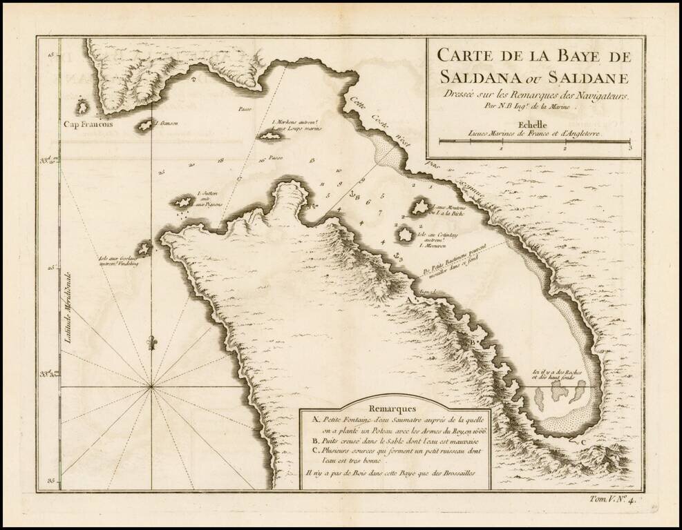
Detailed plan of Saldanha Bay, northwest of Cape Town In South Africa, published by Bellin, the Royal Hydrographer to the King of France.
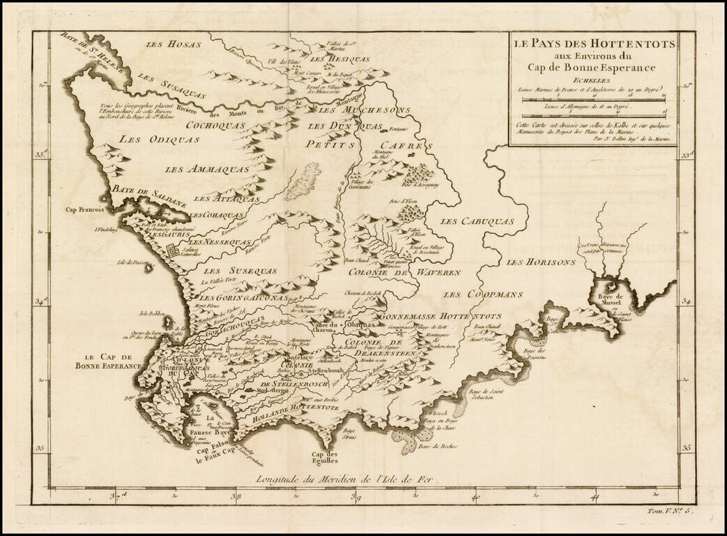
Detailed map of a portion of South Africa, from Baye de St. Helen and Baye Saldane in the West, to Baye de Musssel in the East, centered on the Dutch Hottentot regions and Petit Cafres. Shows tribes, rivers, towns, mountains, lakes, bays, capes, and a...
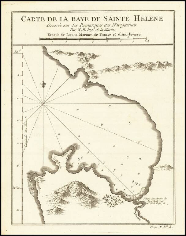
Detailed plan of St. Helena Bay, northwest of Capetown, South Africa.
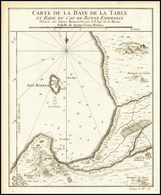
Detailed map of the Table Bay and Robben Island, extending north to Montagne Bleue. Includes nice topographical detail. Shows towns, fortifications, cultivated farming areas, etc.
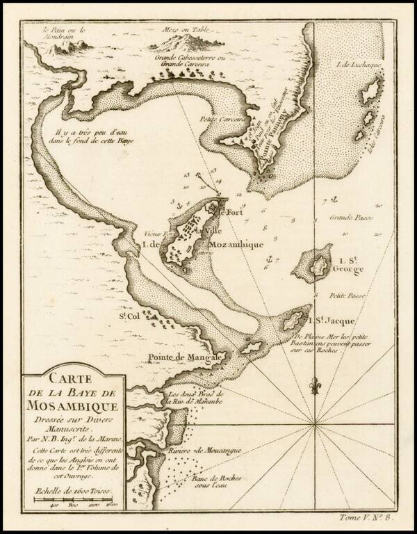
Fine example of this highly detailed map of the Bay of Mosambique, published by French Royal Geographer J.N. Bellin in Paris.
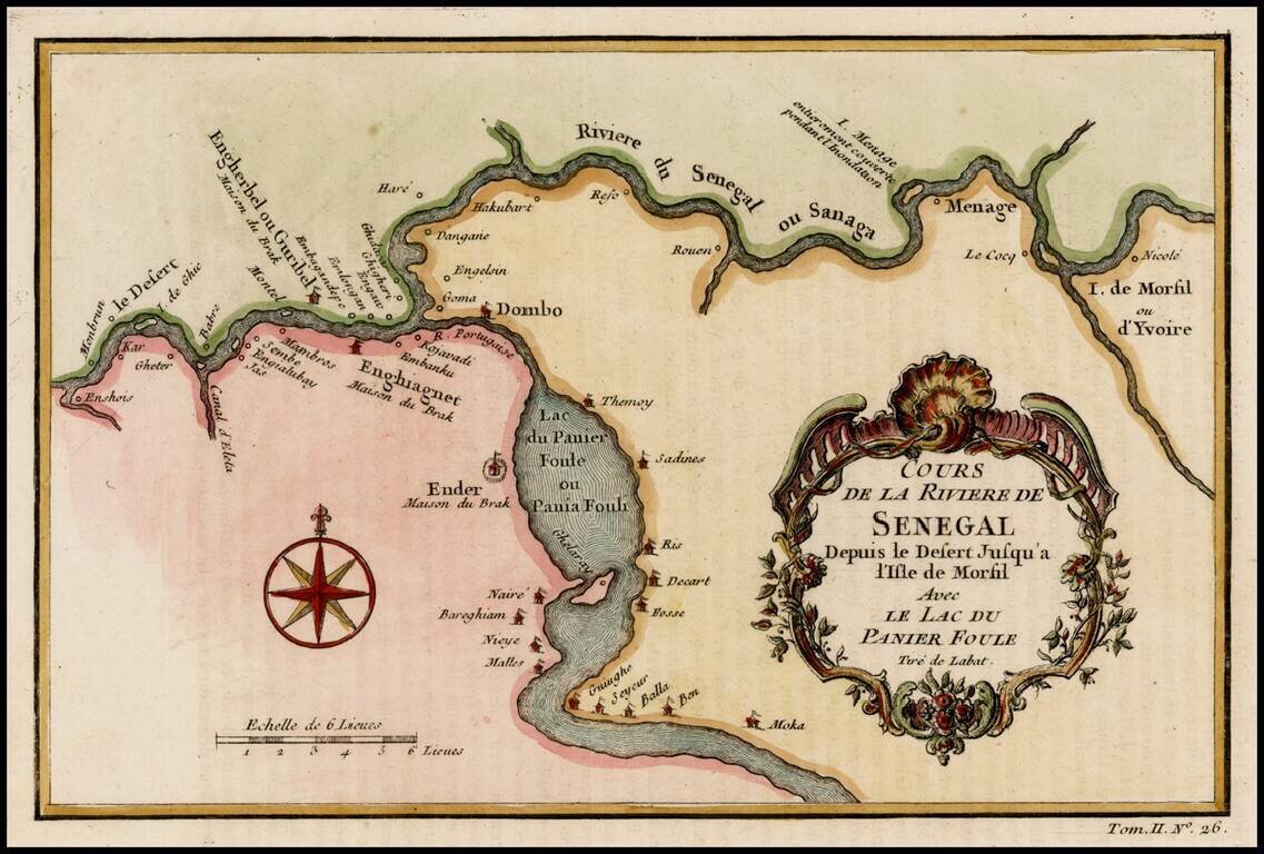
Detailed map of a part of the Senegal River, published by Bellin in Paris.
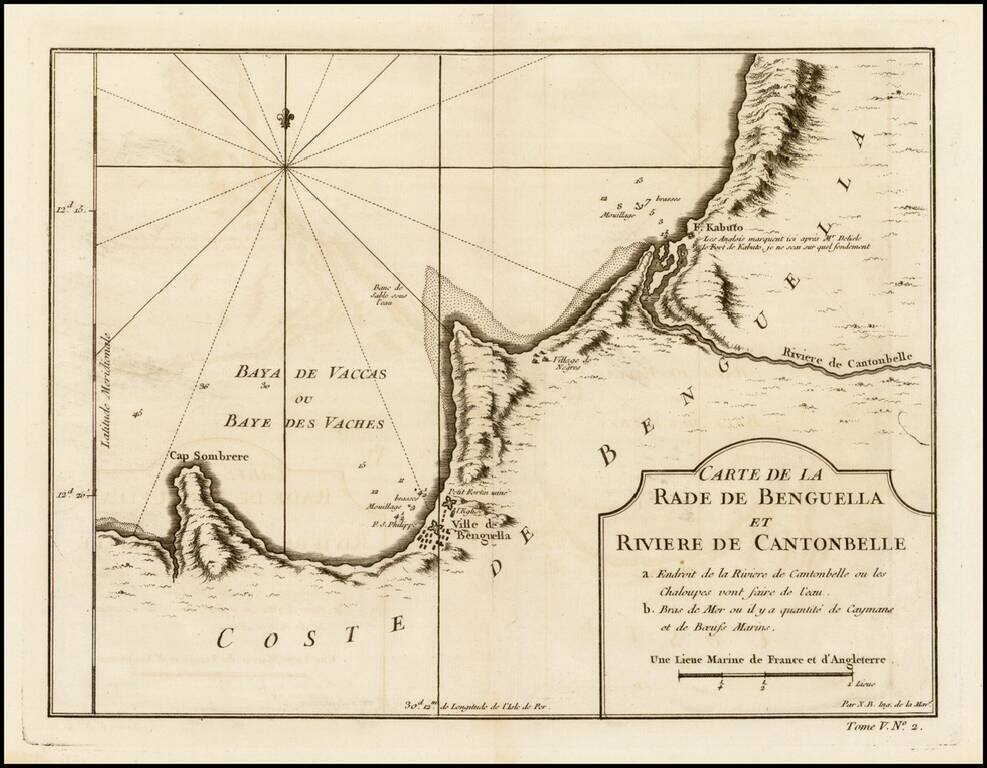
Detailed regional map of the region between Benguela, Angola and the Cantonbelle (Catumbela) River, from J.N. Bellin, the map maker to the King of France. The map includes Fort. Kabuto, which Bellin notes as having been identifed by the English and De...
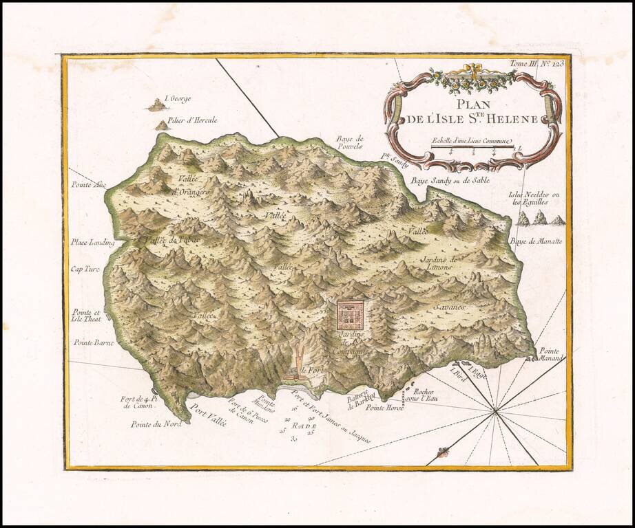
Fine early map of the St. Helene. Bellin's map Plan de l'Isle Ste Helene is largely is derived from the maps of Seller and Moll. The outline of the island essentially is that portrayed by Seller, with, for example, the very pronounced 'finger' of...