Jacques-Nicolas Bellin (1703-1772) was among the most important mapmakers of the eighteenth century. In 1721, at age 18, he was appointed hydrographer (chief cartographer) to the French Navy. In August 1741, he became the first Ingénieur de la Marine of the Depot des cartes et plans de la Marine (the French Hydrographic Office) and was named Official Hydrographer of the French King.
During his term as Official Hydrographer, the Depot was the single most active center for the production of sea charts and maps, including a large folio format sea-chart of France, the Neptune Francois. He also produced a number of sea-atlases of the world, e.g., the Atlas Maritime and the Hydrographie Francaise. These gained fame, distinction, and respect all over Europe and were republished throughout the 18th and even in the succeeding century.
Bellin also came out with smaller format maps such as the 1764 Petit Atlas Maritime, containing 580 finely detailed charts. He also contributed many of the maps for Bellin and contributed a number of maps to the 15-volume Histoire Generale des Voyages of Antoine François Prévost or simply known l'Abbe Prevost.
Bellin set a very high standard of workmanship and accuracy, thus gaining for France a leading role in European cartography and geography. Many of his maps were copied by other mapmakers of Europe.
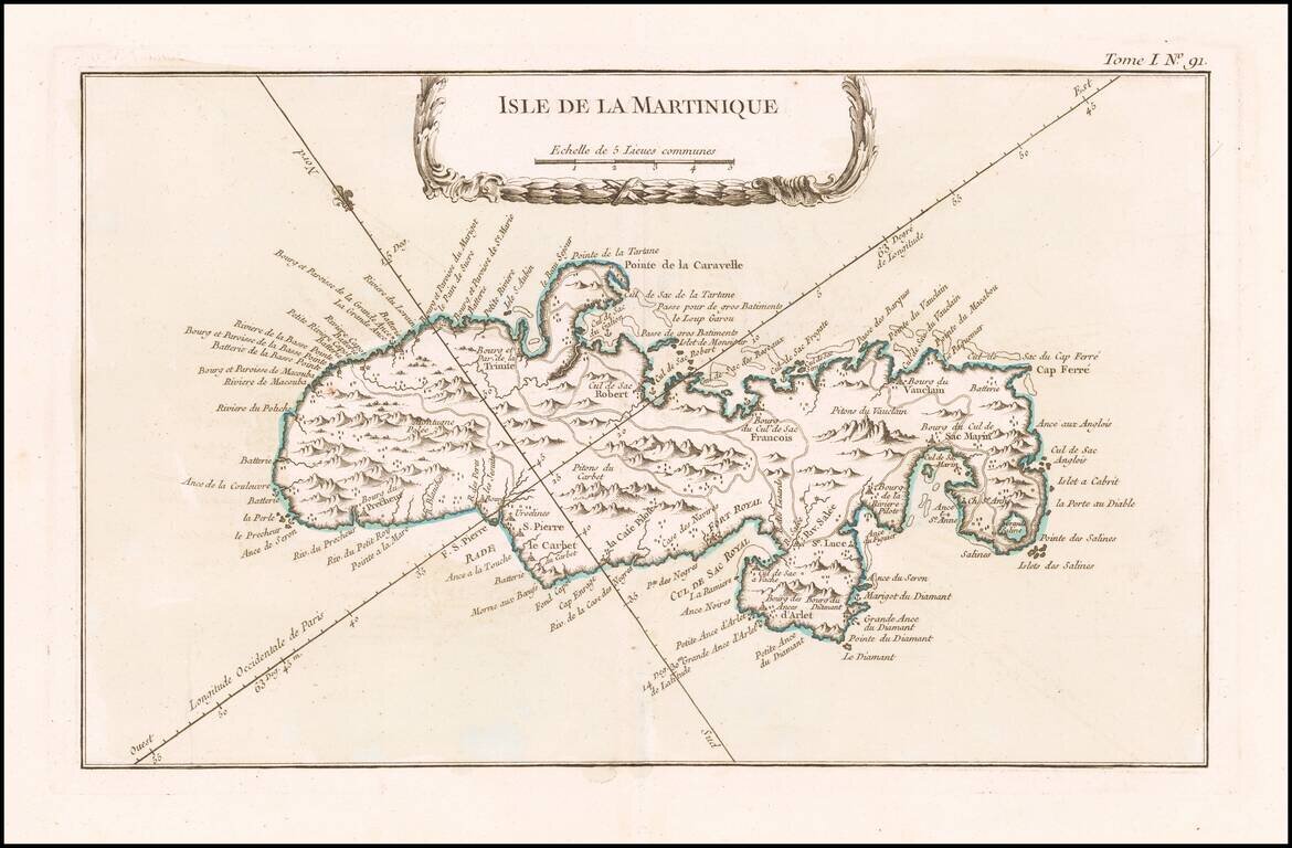
Detailed map of Martinique. Includes a decorative title cartouche. Highly detailed. One of the maps produced by Nichlas Bellin for his Petit Atlas Maritime.
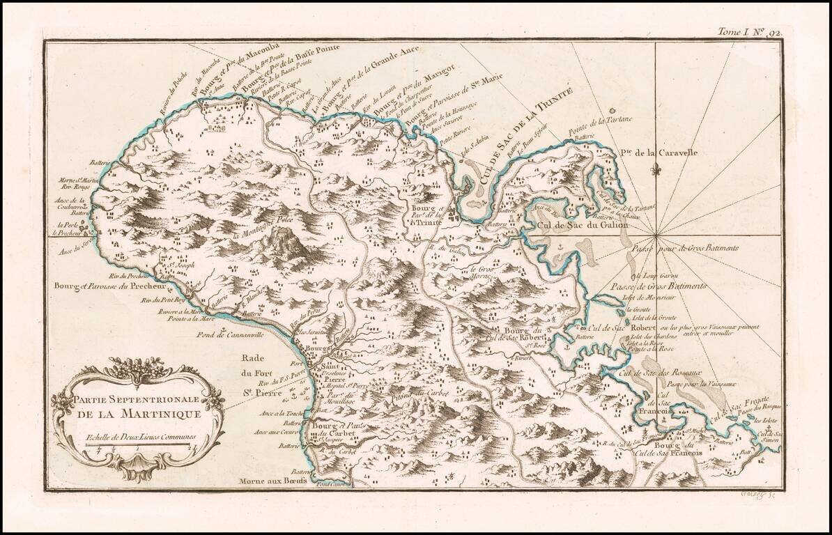
Detailed map of the northern part of the Island of Martinique. Includes a decorative title cartouche. One of the maps produced by Nichlas Bellin for his Petit Atlas Maritime.
Detailed map of the northern part of the Island of Martinique. Includes a decorative title cartouche. One of the maps produced by Nichlas Bellin for his Petit Atlas Maritime.
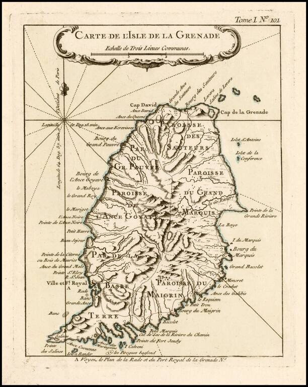
Antique Map of Grenada Detailed map of the Island of Grenada, showing remarkable detail for the period. Includes a large decorative title cartouche. From Bellin's Petit Atlas Maritime.
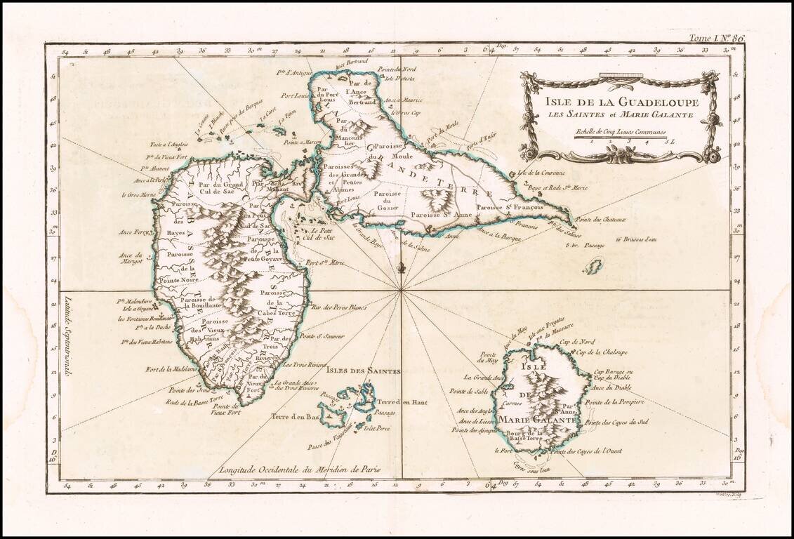
Detailed map of Guadalupe, Mari-Galante and the Isles de Saintes. Includes a decorative title cartouche, smaller cartouche and Rhumb lines. One of the maps produced by Nichlas Bellin for the Petit Atlas Maritime.
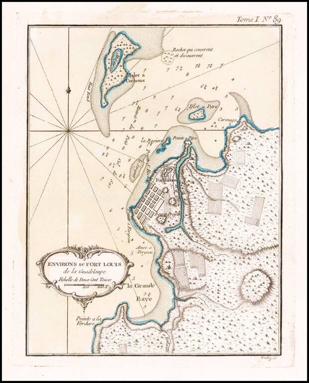
Detailed map of the environs of Fort Louis on the island of Guadalupe. Includes a decorative title cartouche and Rhumb lines. One of the maps produced by Nichlas Bellin for the Petit Atlas Maritime.
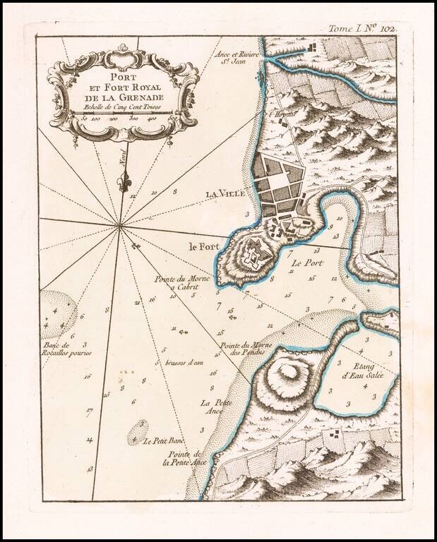
Antique Map of St. George's / Port Royal, Grenada Excellent map of the area around Port Royal, in Grenada. Includes marvelous geographical and topographical detail, the fortifications of the Fort, a town plan, etc. Includes a large decorative title...
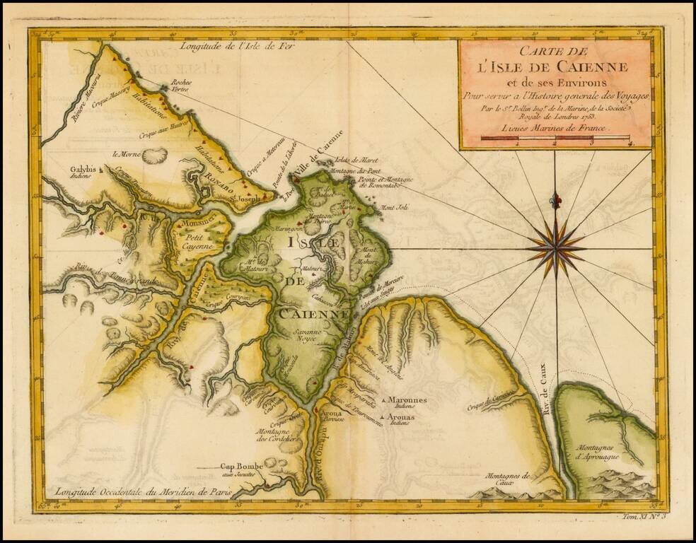
Detailed and well engraved sea chart of French Guiana and the island of Cayenne. The map was pubilshed in 1763 by Bellin (1703-72), a prolific cartographer assigned the Ministry of the French Navy. The chart shows soundings, anchorage's, channels,...
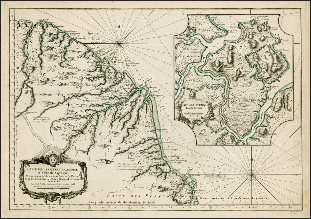
Detailed and well engraved sea chart of French Guiana and the island of Cayenne. The map was pubilshed in 1763 by Bellin (1703-72), a prolific cartographer assigned the Ministry of the French Navy. The chart shows soundings, anchorage's, channels,...
Detailed and well engraved sea chart of French Guiana and the island of Cayenne. The map was pubilshed in 1753 by Bellin (1703-72), a prolific cartographer assigned the Ministry of the French Navy. The chart shows soundings, anchorages, channels,...
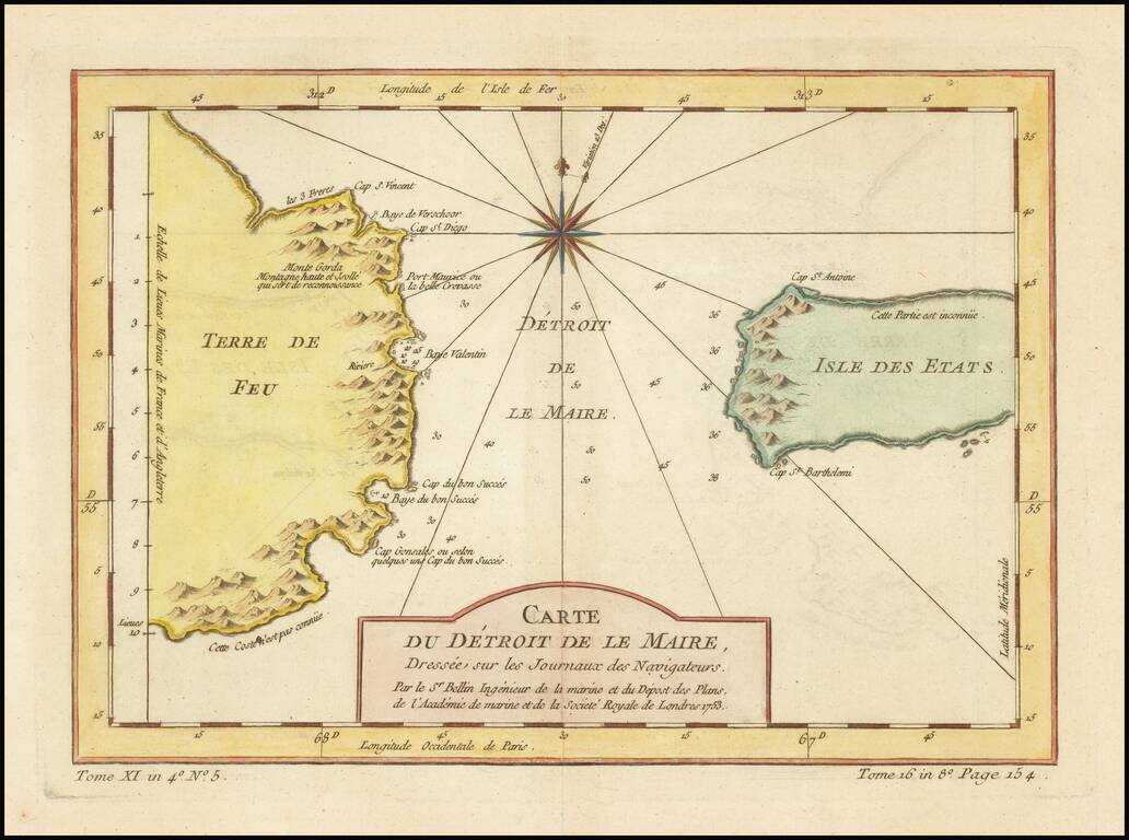
Detailed map of the Straits of Le Maire and Tierra Del Fuego, with a large compass rose. One of the maps produced by Nichlas Bellin for Prevost d'Exiles' influential travel book, L'Histoire Generale des Voyages.
![[Straits of Magellan] Carte Reduite Du Detroit De Magellan Dressee sur les Journaux des Navigateurs; Par le Sr. Bellin . . . 1753](/map/small/68956.jpg)
Highly detailed map of the Straits of Magellan, based upon important recent surveys. Many islands, bays and other details in the Straits.
![[Straits of Magellan] Carte Reduite Du Detroit De Magellan Dressee sur les Journaux des Navigateurs; Par le Sr. Bellin . . . 1753](/map/small/66318.jpg)
Highly detailed map of the Straits of Magellan, based upon important recent surveys. Many islands, bays and other details in the Straits.
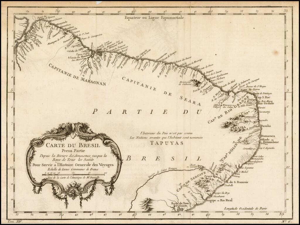
Detailed regional map of the coast of Brazil, from Maracana to Baye de Tous les Saints. Covers Capitanie De Maragnan, Seara, Rio Grande, Paraiba, D'Olinde and Sergipe. Includes a decorative title cartouche. One of the maps produced by Nichlas Bellin...
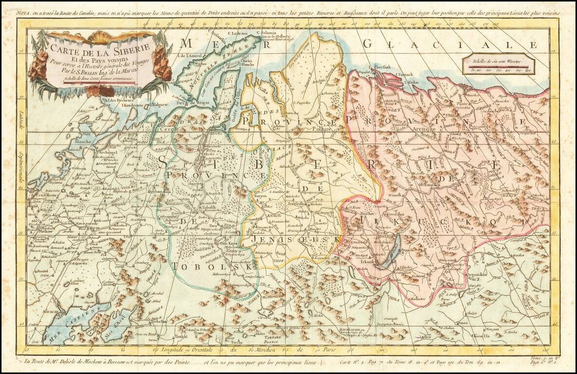
Detailed map of Siberia, extending from the White Sea and the Caspian Sea in the west to Irkuckoi Province, Jakutky on the Lena River and regions just to the east. Centered on the Jenisi River. Nicolas Bellin was the official map maker to the King of...

Detailed map of Nova Zembla and part of the Northeast passage. Includes a decorative title cartouche. One of the maps produced by Nicholas Bellin for L'Histoire Generale des Voyages.