Jacques-Nicolas Bellin (1703-1772) was among the most important mapmakers of the eighteenth century. In 1721, at age 18, he was appointed hydrographer (chief cartographer) to the French Navy. In August 1741, he became the first Ingénieur de la Marine of the Depot des cartes et plans de la Marine (the French Hydrographic Office) and was named Official Hydrographer of the French King.
During his term as Official Hydrographer, the Depot was the single most active center for the production of sea charts and maps, including a large folio format sea-chart of France, the Neptune Francois. He also produced a number of sea-atlases of the world, e.g., the Atlas Maritime and the Hydrographie Francaise. These gained fame, distinction, and respect all over Europe and were republished throughout the 18th and even in the succeeding century.
Bellin also came out with smaller format maps such as the 1764 Petit Atlas Maritime, containing 580 finely detailed charts. He also contributed many of the maps for Bellin and contributed a number of maps to the 15-volume Histoire Generale des Voyages of Antoine François Prévost or simply known l'Abbe Prevost.
Bellin set a very high standard of workmanship and accuracy, thus gaining for France a leading role in European cartography and geography. Many of his maps were copied by other mapmakers of Europe.
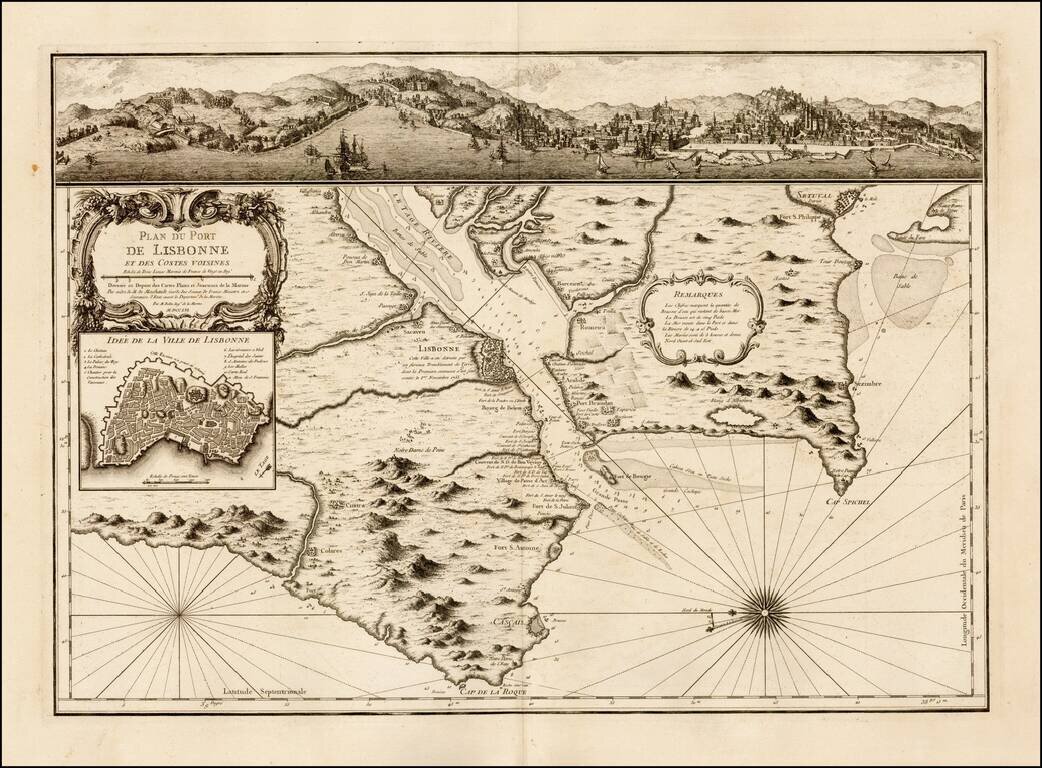
Scarce map and plan of Lisbon, published by Jacques Nicolas Bellin in Paris. The map was published shortly after a major earthquake destroyed much of Lisbon on November 1, 1755. Includes a fine view of Belem and Lisbon at the top and and inset plan...
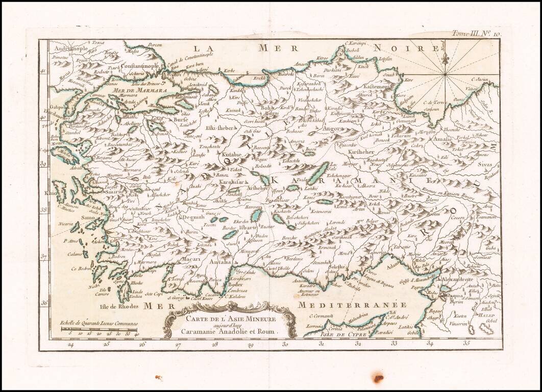
Finely engraved map of Asia Minor and the north part of Cyprus, from Jacques Nicolas Bellin's Le Petit Atlas Maritime Recueti de Cartes et Plans des Quatre Parlies du Monde en Cinq Volumes, first published in Paris in 1764.
![Carte De La Syrie [Shows Cyprus and the Holy Land!]](/map/small/47512.jpg)
Finely engraved map of the eastern Mediterranean, from Jacques Nicolas Bellin's Le Petit Atlas Maritime Recueti de Cartes et Plans des Quatre Parlies du Monde en Cinq Volumes, first published in Paris in 1764. The map covers the seaboard north from...
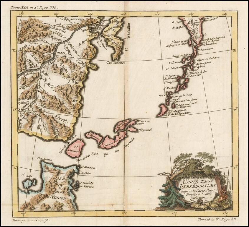
A striking map of Northern Japan and the contiguous islands and coastline. Very detailed and interesting.
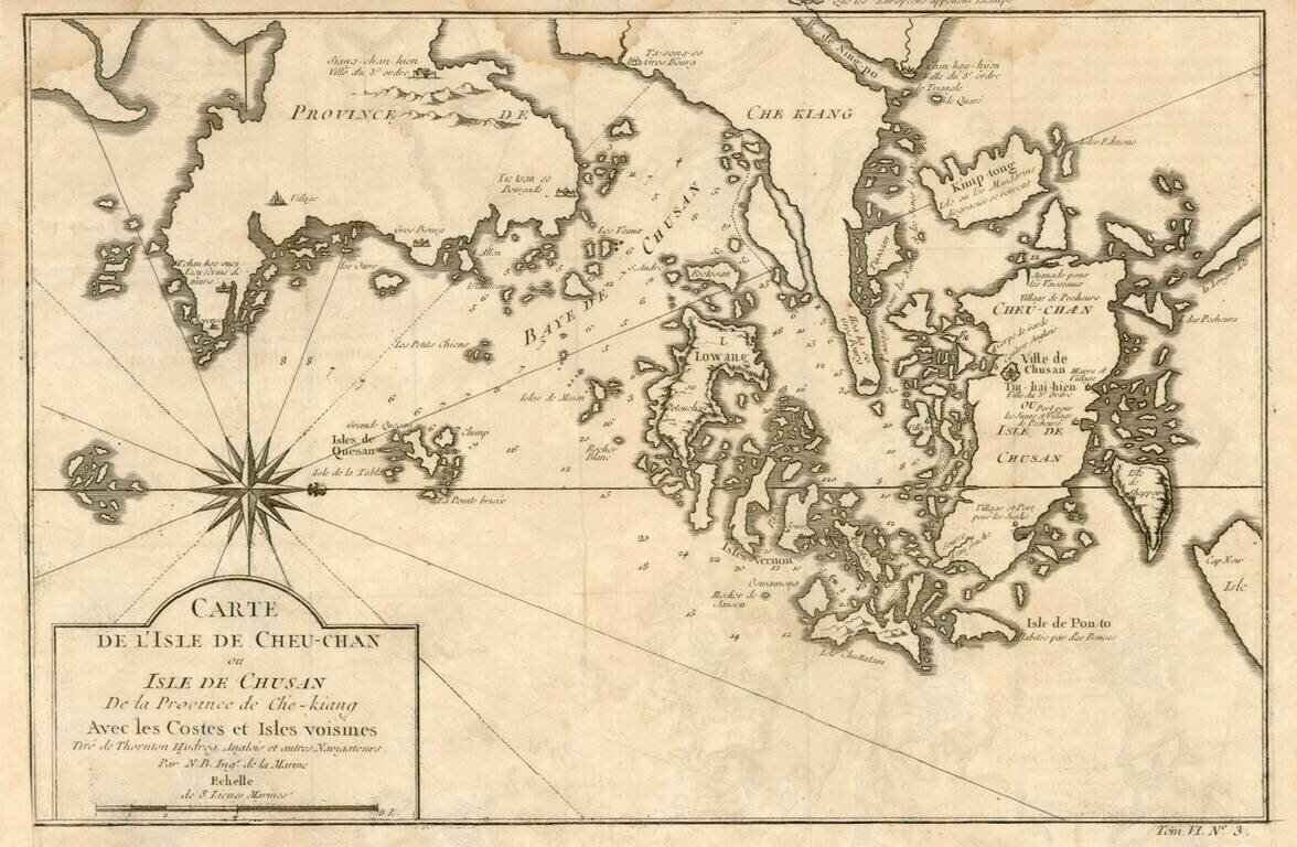
Detailed map of the area east of Ningbo in the Chinese province of Chekiang, located across the bay from Shanghai. The compass rose orients the chart with north to the right.
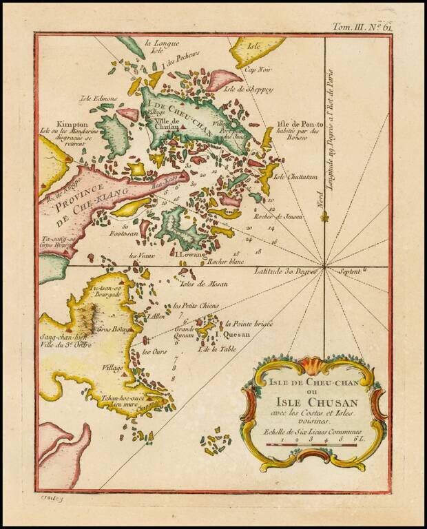
Detailed map of the area east of Ningbo in the Chinese province of Chekiang, located across the bay from Shanghai.
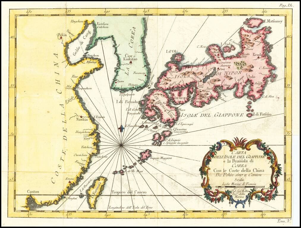
Italian edition of Bellin's regional map, showing Japan, the Korean Peninsula and China, including Canton and the Island of Formosa. Decorative cartouche and Rhumb lines.
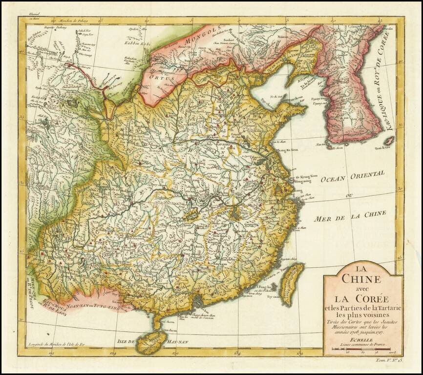
Detailed map of China and Korea, based upon the reports of Jesuit Missionaries between 1708 and 1717.
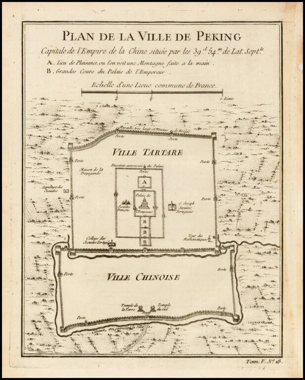
Finely engraved plan showing the walls, gates and inner details of the city of Peking (Beijing). The city is divided into the Ville Tartare and Ville Chinoise, with Emperor's Place and French Jesuit and Portuguese Jesuit missions shown in the Ville...
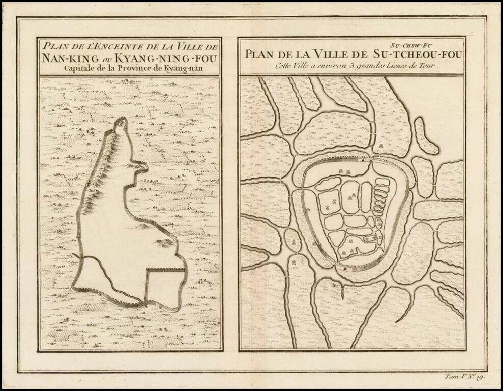
Two maps on a single sheet, depicting major Chinese cities. The plan on the left shows Nanking and its fortifications. The plan on the right shows Su-Tcheou-Fou or Su-Chew-Fu.
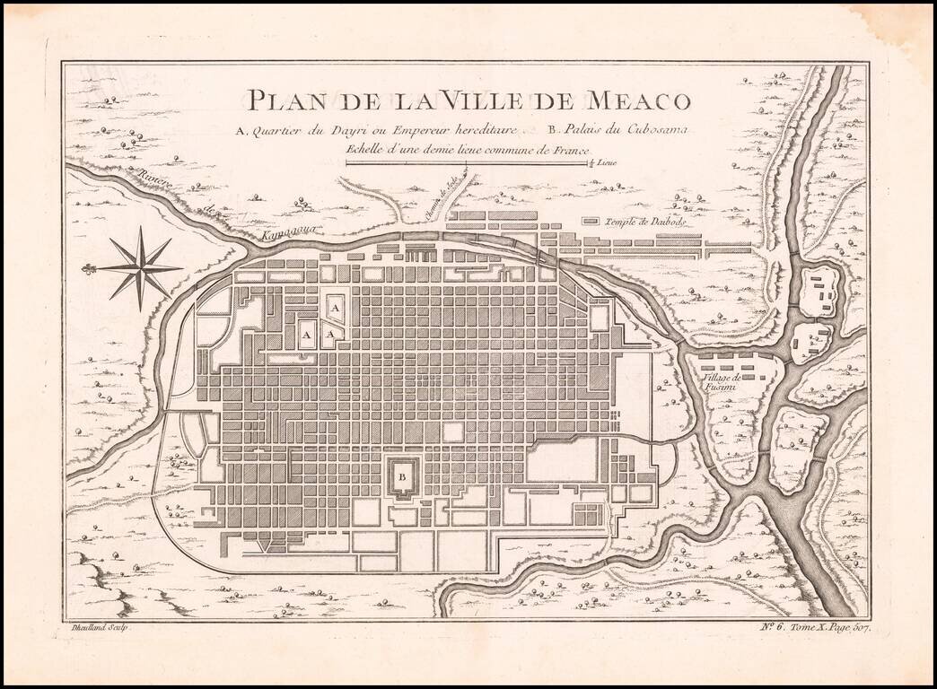
Detailed plan of Kyoto, from Bellin's Petit Atlas Maritime. The five volume work covered all the known areas of the world and is considered to be one of the finest and well produced marine atlases during the period. This map show the city of Kyoto...
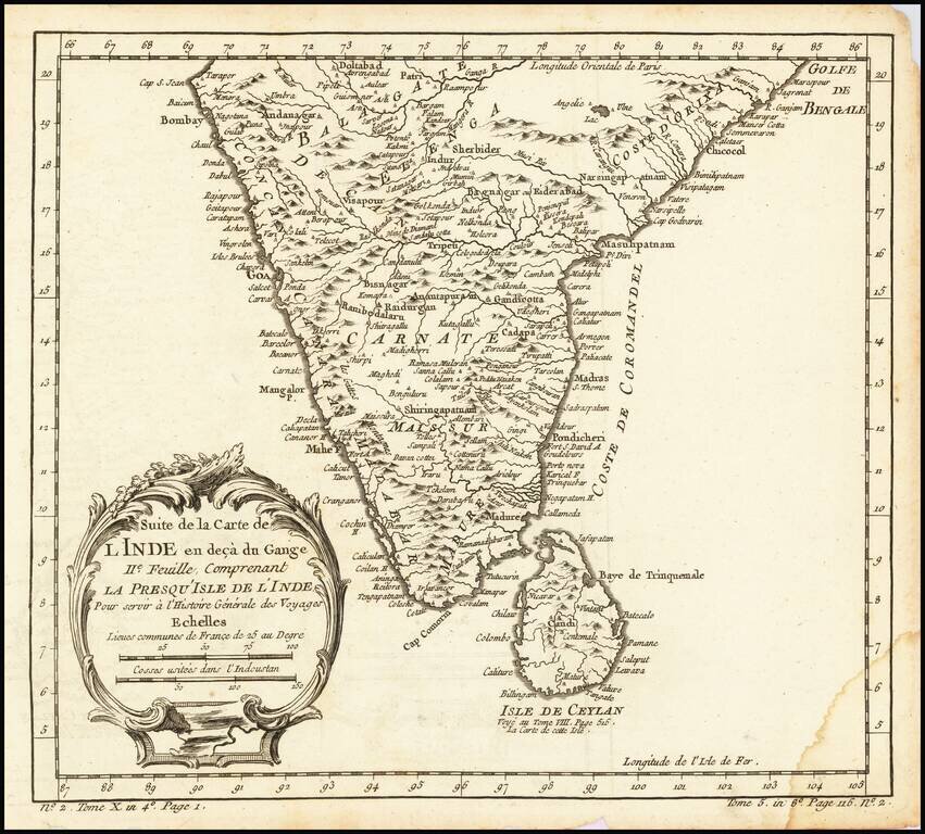
Interesting regional map of Southern India and Ceylon (Sri Lanka). A wonderfully detailed map. Includes a large decorative title cartouche. One of the maps produced by Nichlas Bellin for Prevost d'Exiles influential travel book, L'Histoire Generale...
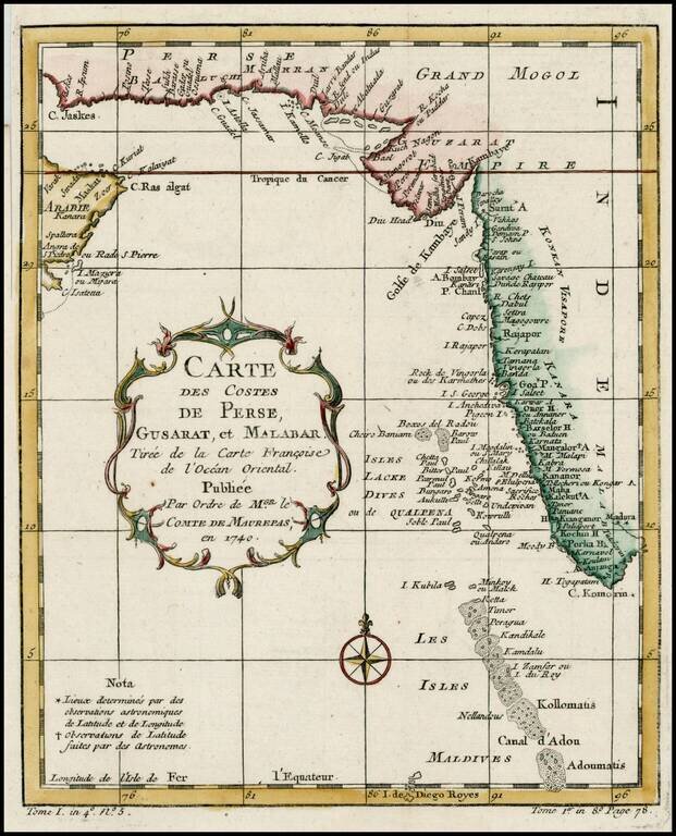
Detailed map of the region from the mouth of the Persian Gulf to the Maldives. Includes large decorative cartouche and compass rose.
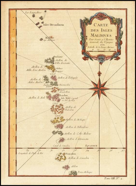
Detailed map of the Maldives, with rhumblines and a large compass rose. Includes a decorative title cartouche. One of the maps produced by Nichlas Bellin for Prevost d'Exiles influential travel book, L'Histoire Generale des Voyages.
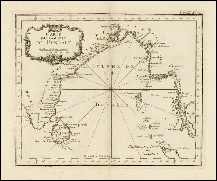
Scarce larger format edition of Bellin's detailed regional map of the Gulf of Bengal and the lower Ganges River. This larger format edition has a different cartouche and lacks the compass rose in the center.
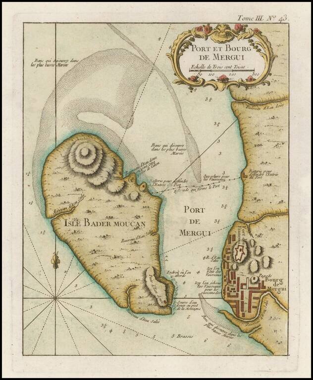
Finely engraved map of Pahtaw Pahtet - Myeik - Tanintharyi Region - Myanmar (Burma), from Jacques Nicolas Bellin's Le Petit Atlas Maritime Recueti de Cartes et Plans des Quatre Parlies du Monde en Cinq Volumes, first published in Paris in 1764....