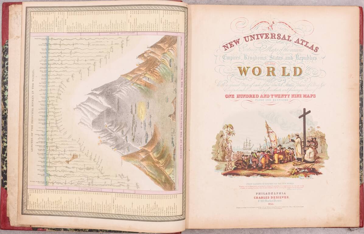
A handsome example of the 1855 Samuel August Mitchell New Universal Atlas, an important edition from one of the quintessential American atlas series of the 19th century. Despite being an atlas of the world, most of the atlas is concerned with the...
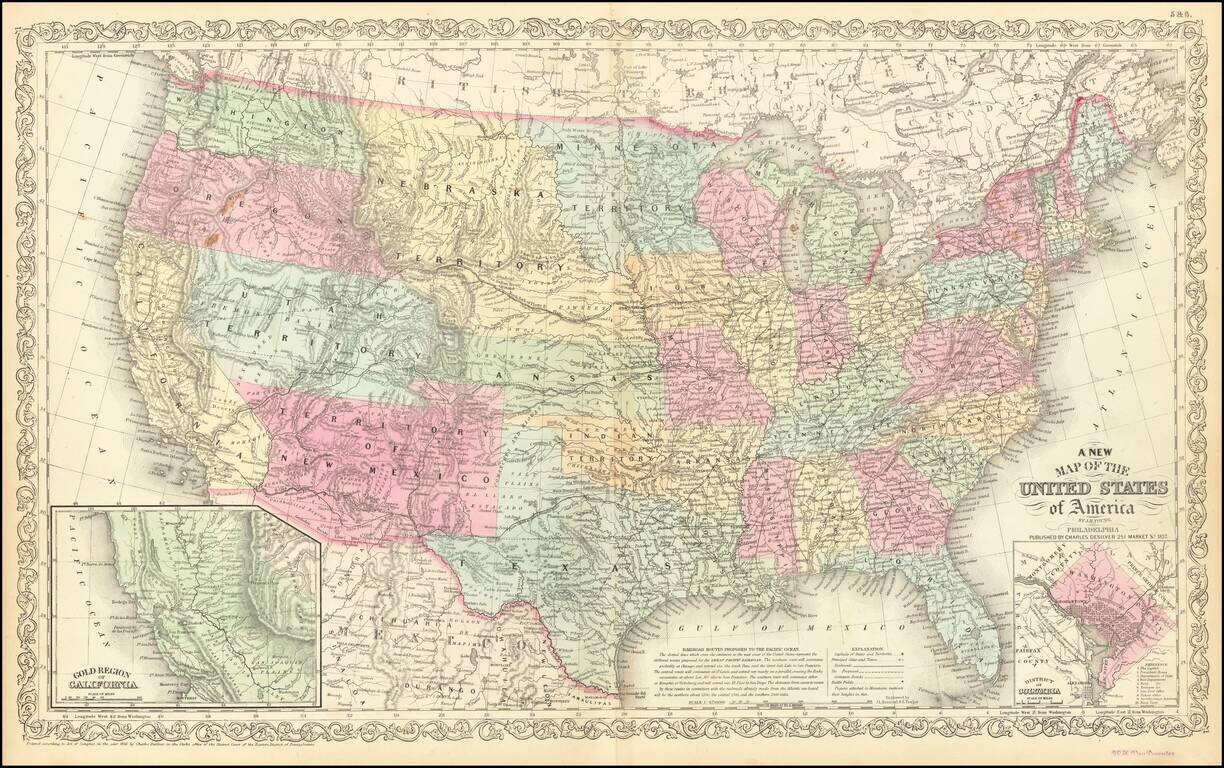
Antique Map of United States with early Western Territorial Borders Nice example of Charles Desilver's map of the United States, illustrating the evolving American West. Oregon and Washington extend to the Rocky Mountains. Massive Nebraska Territory...
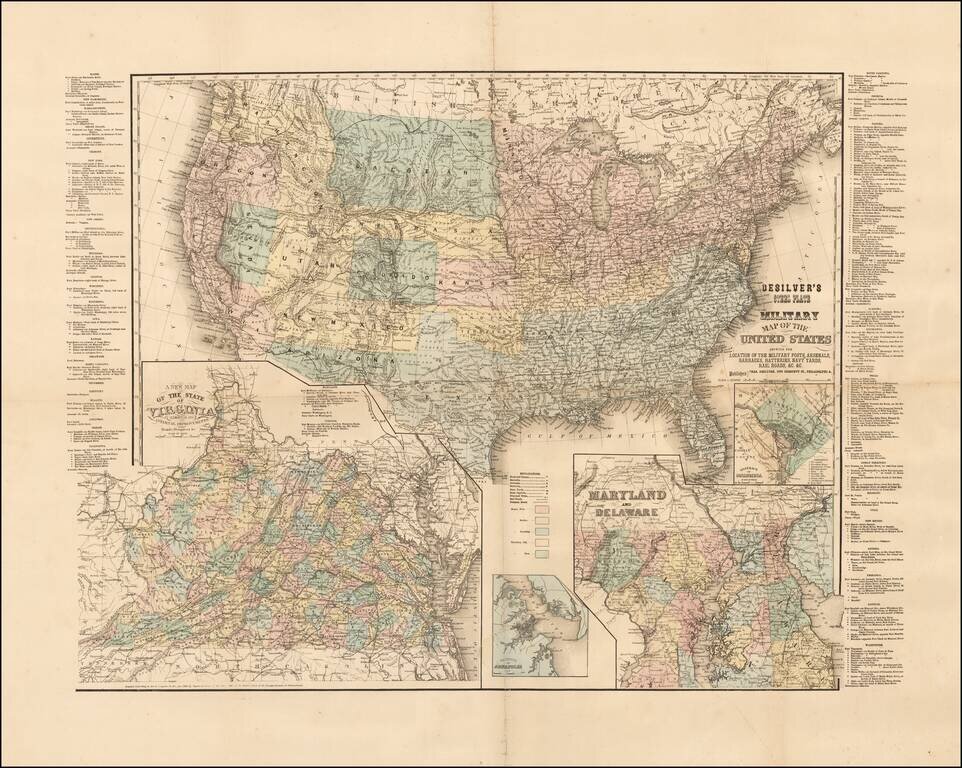
Rare Civil War era map of the United States, published in Philadelphia by Charles Desilver. The map includes inset maps of Washington D.C., Virginia, Maryland and Delaware, and the Vicinity of Annapolis. Includes a list of all the Military Forts and...
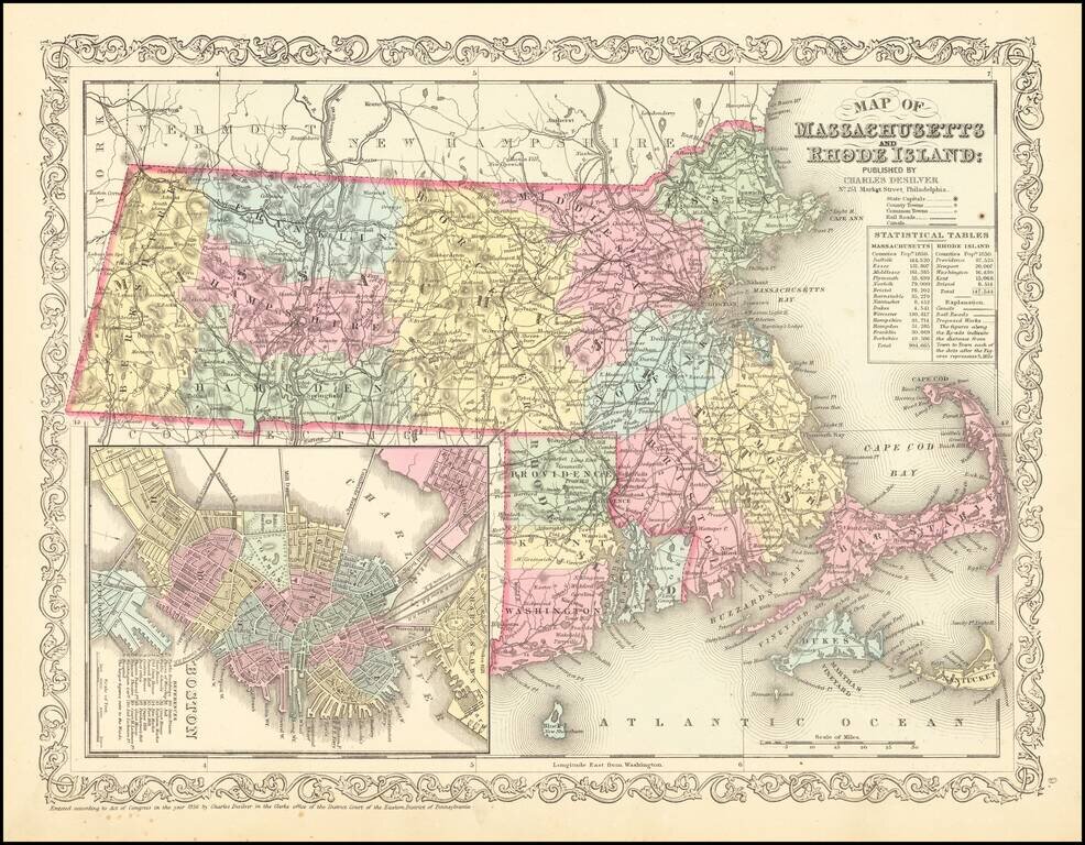
Striking map of Massachusetts and Rhode Island, hand colored by counties, from Charles Desilver's New Universal Atlas. The map names towns, rivers, lakes, islands, etc. and shows roads with distances, railroads and other details. Large inset of Boston.
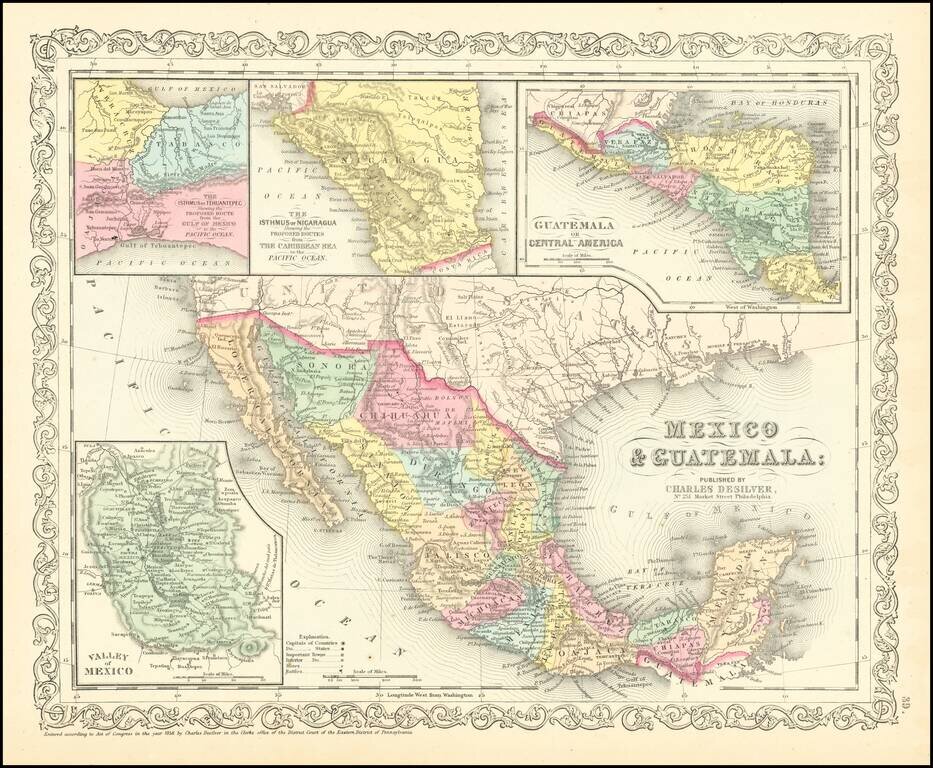
Scarce Charles Desilver map of Mexico and the Southwest. Many of the early place names in Texas still appear. Pre-Gadsden Purchase border with Mexico. Large insets of the Valley of Mexcio, Ithmus of Tehuantepeci, Isthmus of Nicaragua and Guatemala.
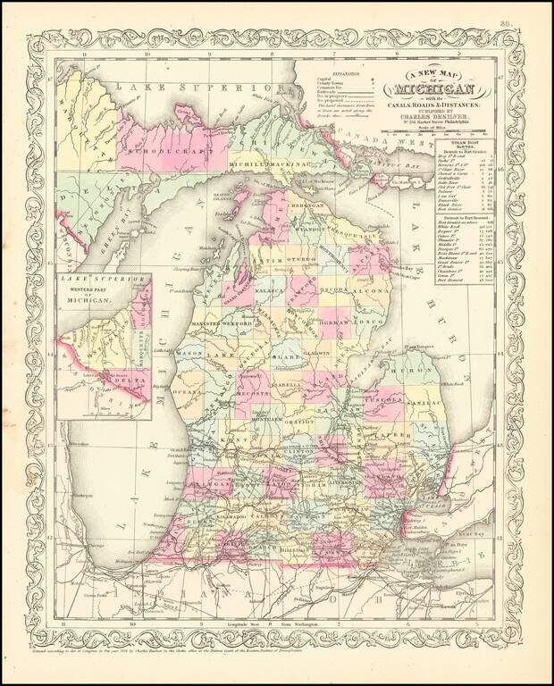
Scarce Charles Desliver map of Michigan, hand colored by county and showing towns, rivers, bays, lakes, railroads, roads, distances, etc. Tables of Steam Boat routes and distances. A number of Michigan Counties still not yet formed. Railroads are...
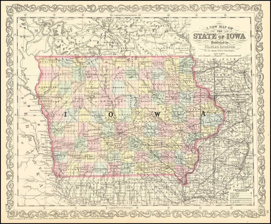
Scarce 1857 edition of this detailed map of Iowa. The map is hand colored by counties, showing railroads, stage lines, canals, roads, rivers, lakes, forts and other details.
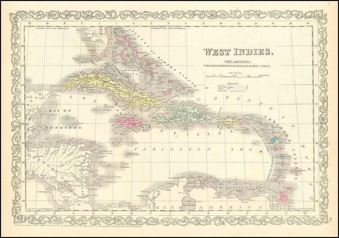
Detailed and attractive map of the southern portion of Florida and the Caribbean, in Charles Desilver's Universal Atlas. The map shows the various European Powers possessions, including Spanish, British, French, Dutch, Danish and Swedish, along with...
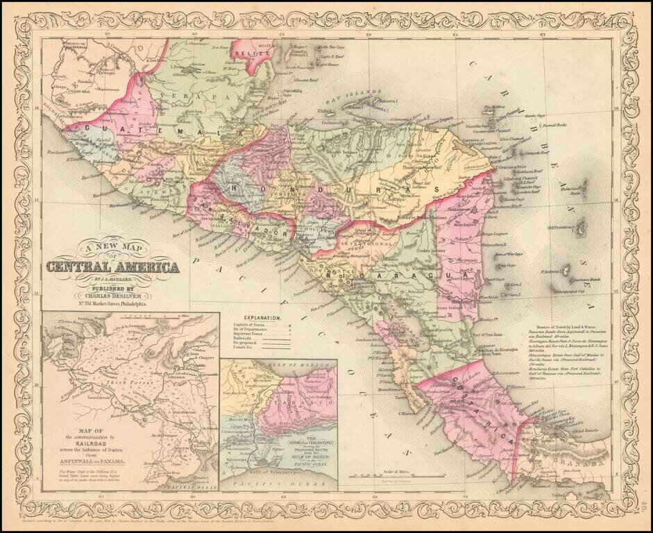
Detailed map of Central America, colored by country and states, with insets of the Railroad across the Isthmus of Darien and The Isthmus of Tehuantepec. Text annotations and other interesting details are noted.
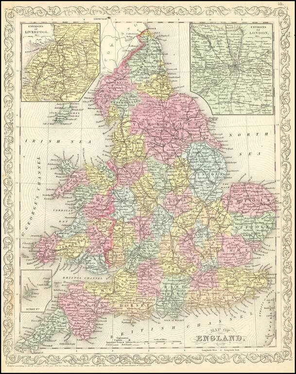
Scarce Charles Desilver map of England, published in 1857. The map is hand colored by county and shows towns, rivers, bays, lakes, railroads, roads, etc.