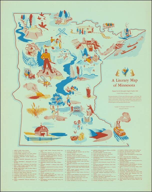
Scarce vintage pictorial of Minnesota, focusing on the state's literary heritage. The map was published by the Minneapolis English Teachers Club in 1954. "Drawings descriptive of books about Minnesota appear on this map. The numbers under the drawings...
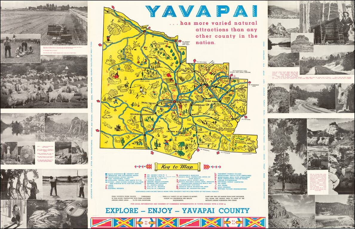
Lively promotional map of Yavapai County, Arizona, produced by the Yavapai Board of Supervisors. Centered on Prescott, Arizona, the map illustrates landmarks, tourist attractions, roads nd railroads, and is surrounded by photographs promoting the...
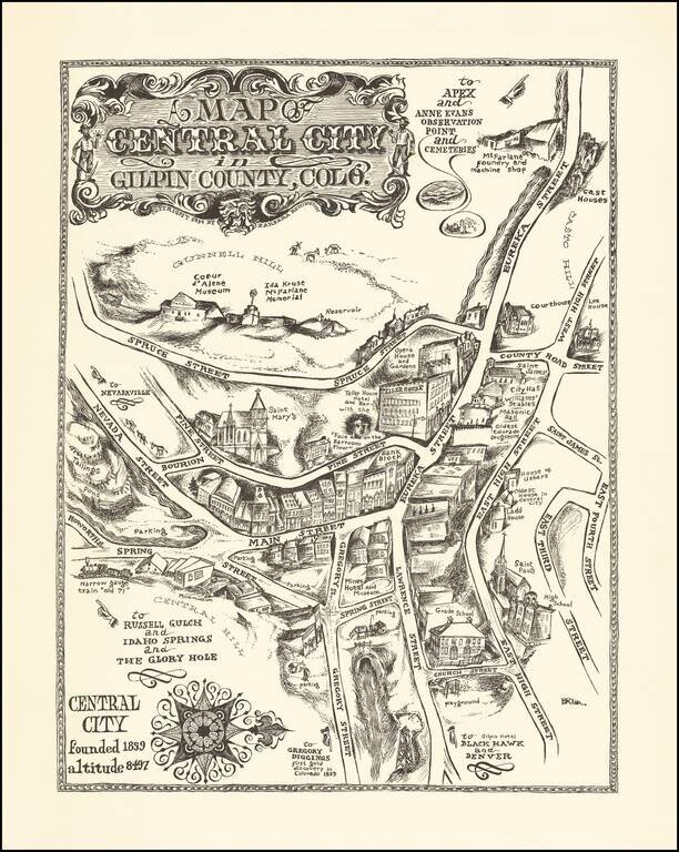
An Early Barbara Remington Illustration Attractive pictorial map of Central City, Colorado, drawn by Barbara Remington. The map is oriented with west at the top, showing the town spreading out along Eureka and Main Streets. Includes a decorative...
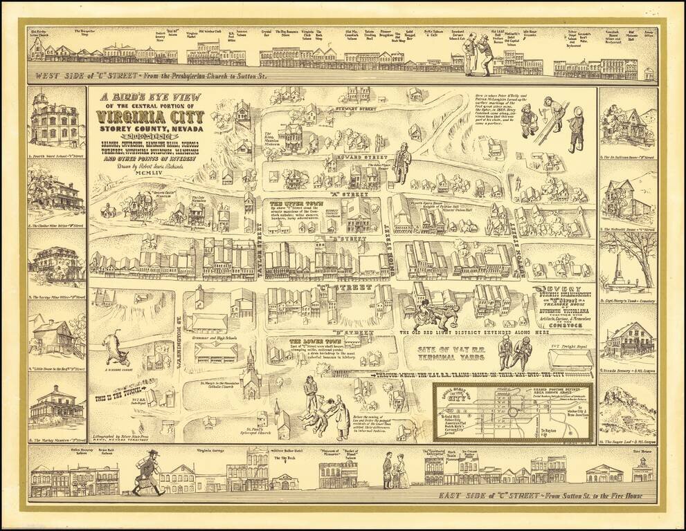
Finely executed pictorial map / birds eye view of Virginia City, drawn by Robert Lewis Richards and lithographed by the Silver State Press in Reno. The map is a fine combination of historical vignettes and meticulous recreation of Virginia City during...
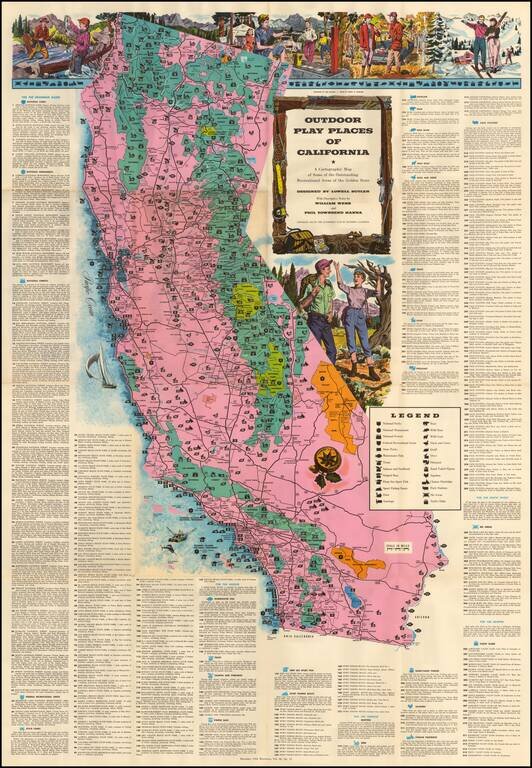
Large decorative map of California, identifying and location over 300 recreational areas around the state and including a series of decorative recreationally themed vignettes of fishing, camping, skiing, hunting and hiking, with additional vignettes...
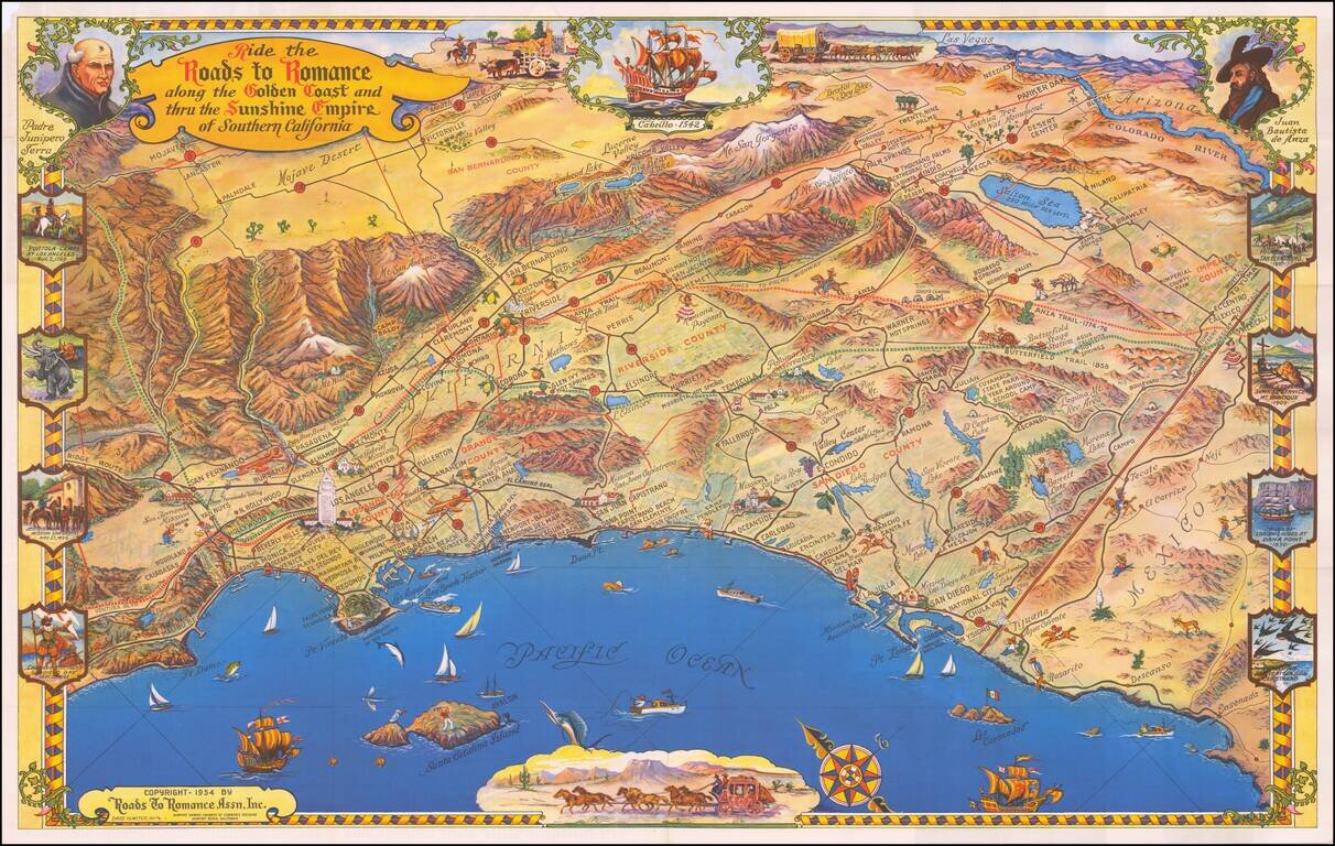
One of the great decorative maps of Southern California, published in the 1950s. Extends from Malibu Beach, Topanga Canyon and Mission San Fernando to Ensenada, centered on San Juan Capistrano in the west. Death Valley, Las Vegas, Needles, Parker Dam...
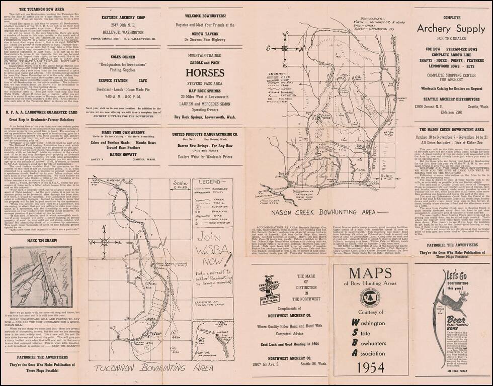
Washington State Bow Hunters Map Interesting guide and advertising map for Washington Bow Hunters, published in 1954. Includes maps of the following bow hunting areas: Tucannon Nason Creek Sherwood Forest Capitol Forest' Rarity We were...
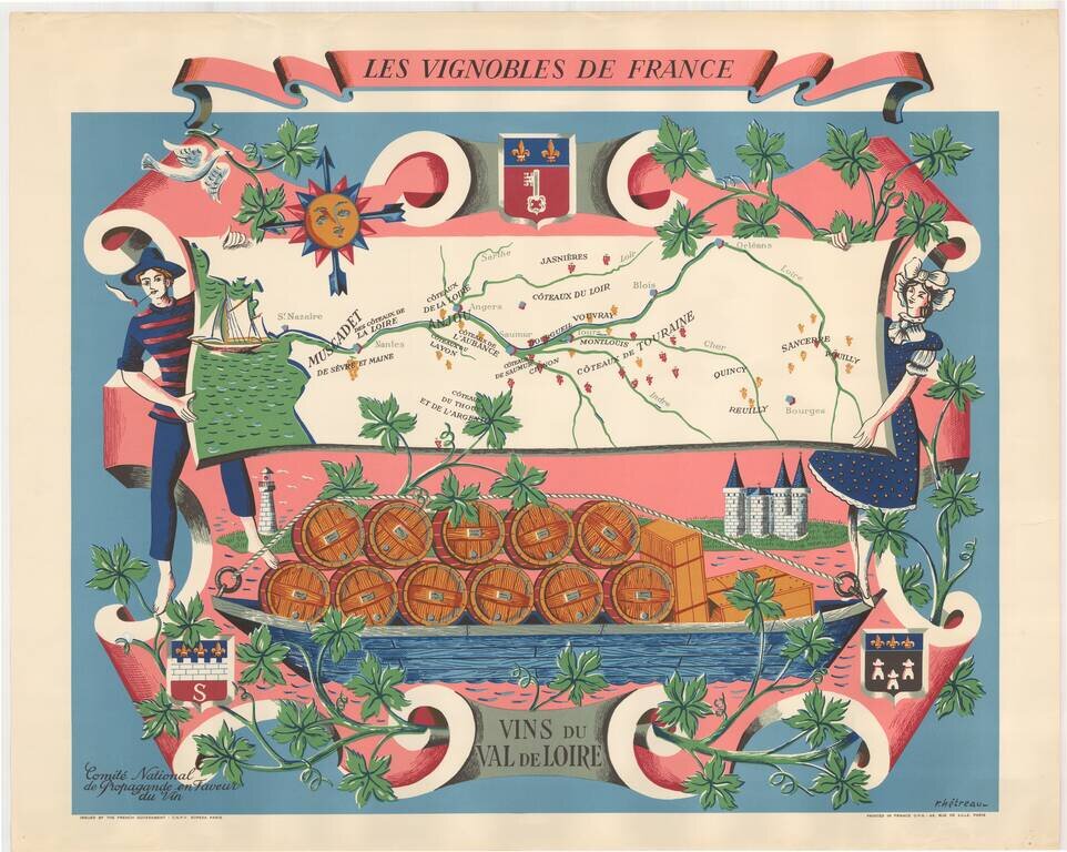
Fine promotional map of the wine regions of the Loire Valley, drawn by Remy Heteau in 1954. The map shows the major wine producing regions with cluster of grapes, using red for red wines, and yellow for white wines. The map is surrounded by a compass...
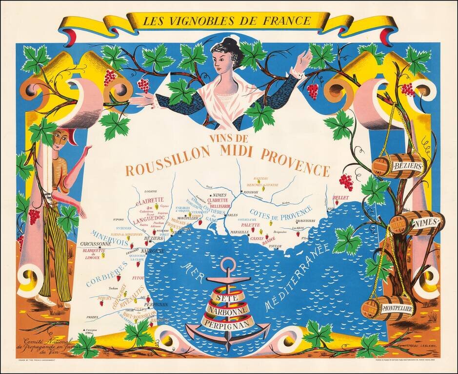
Fine promotional map of the wine regions of Roussillon and Provence, drawn by Remy Heteau in 1954. The map shows the major wine producing regions with cluster of grapes, using red for red wines, and yellow for white wines. The map is surrounded by a...
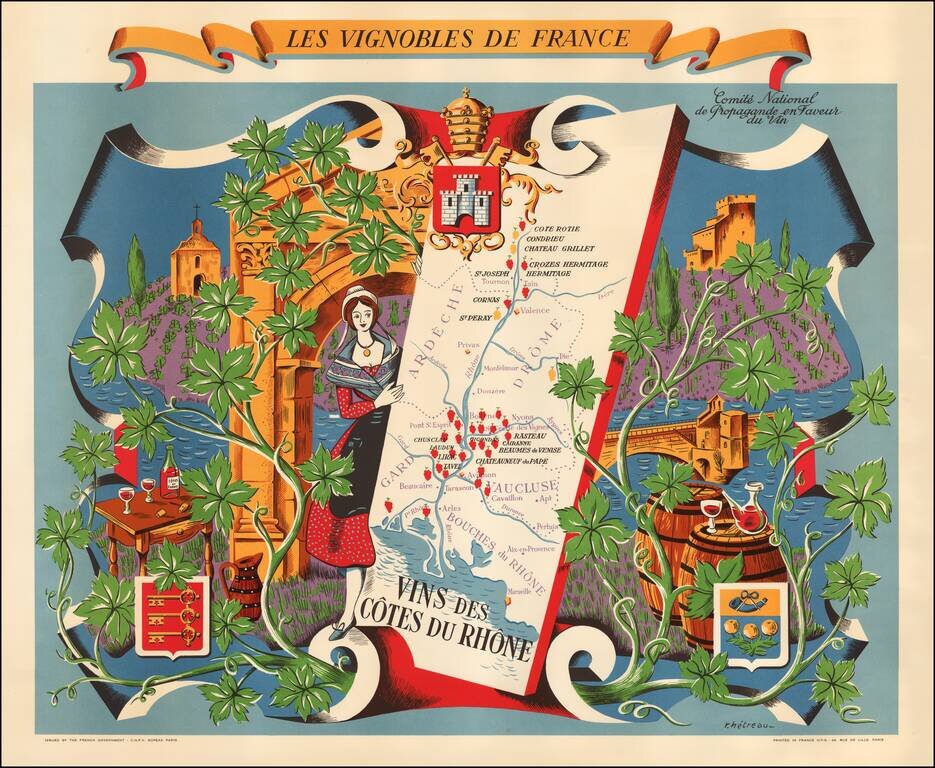
Fine promotional map of the wine regions of the Cote du Rhone, drawn by Remy Heteau in 1954. The map shows the major wine producing regions with cluster of grapes, using red for red wines, and yellow for white wines. The map is surrounded by a compass...
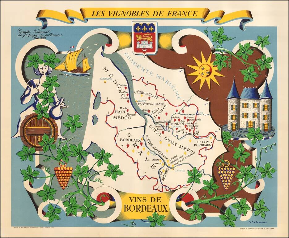
Fine promotional map of the wine regions of Bordeaux, drawn by Remy Heteau in 1954. The map shows the major wine producing regions with cluster of grapes, using red for red wines, and yellow for white wines. The map is surrounded by a compass rose,...
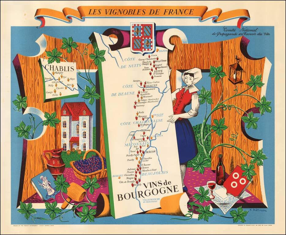
Fine promotional map of the Burgundy wine region, drawn by Remy Heteau in 1954. The map is one of a series of 11 maps titled Les Vignobles de France; the others in the series are of Région Est, Région Normandie, Champagne, Roussillon, Val de Loire,...
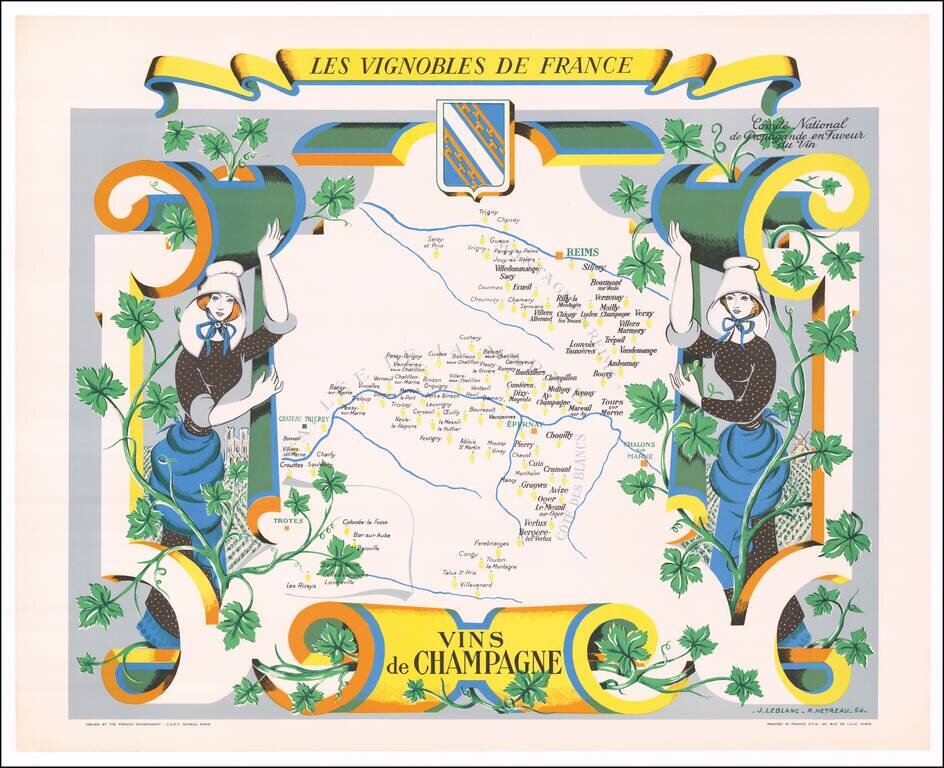
Fine promotional map of the Champagne Region, drawn by Remy Heteau in 1954. The map shows the major wine producing regions with cluster of grapes, using red for red wines, and yellow for white wines. The map is surrounded by a compass rose, grapes on...
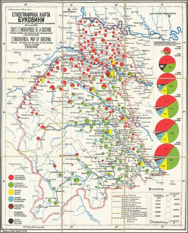
This fascinating map is a rare look into the distributions of various ethnicities through the historical region of Bukovina, prior to the world wars, with insights regarding Jewish history in the region. The map was based on work by the famed Ukrainian...