Map size in jpg-format: 106.144MiB
Click to open in high resolution (open in new tab).

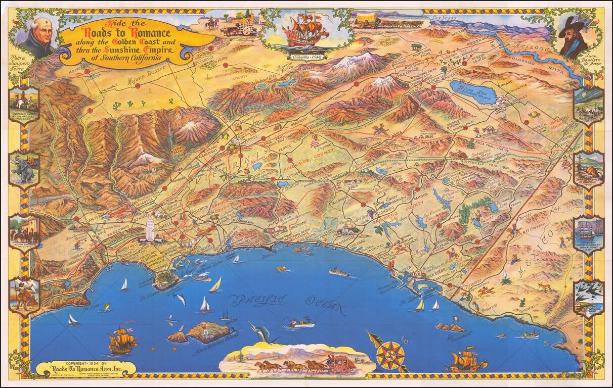
One of the great decorative maps of Southern California, published in the 1950s.
Extends from Malibu Beach, Topanga Canyon and Mission San Fernando to Ensenada, centered on San Juan Capistrano in the west. Death Valley, Las Vegas, Needles, Parker Dam and the Salton Sea appear on the horizon. A remarkable tourist/caricature map, showing the points of interest in Southern California and illustrated with decorative scenes of California's history and pre-history (the La Brea Tar Pits!). A lively and highly artistic view of Southern California!
If you are a student, write to us in telegram: @antiquemaps and indicate what material you need and for what work you need a map in high detail. We are ready to provide material on special terms. For students only!


