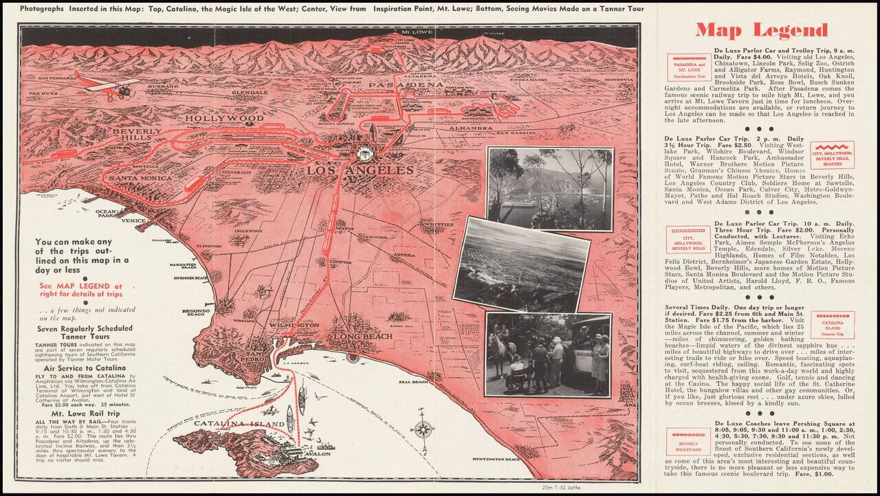
A pictorial map of Los Angeles from circa 1930 with photographs of Avalon, Mt. Lowe, and more. The map itself shows the area from Long Beach to the San Fernando Valley, and eastwards as far as Mt. Lowe and Monrovia. The image is drawn from a birdseye...
![Map of Yosemite National Park Showing Routes of Yosemite Transportation System, High Sierra Camps and Pack Trip Country. [on sheet with:] Map of the Floor of Yosemite Valley Yosemite National Park, California](/map/small/66362.jpg)
Illustrated Stage and Railroad Routes To Yosemite Detailed topographical / pictorial map of Yosemite and Vicinity, published as a vistor's guide promotional map. The primary map illustrates the Y.T.S. Stage Service and Railroads servicing the valley...
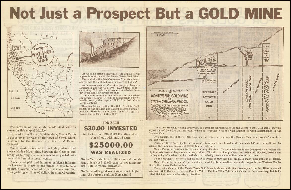
Interesting and very rare promotional map for what was in all likelihood a gold mine scam perpetrated in the early 1930s. In breathless language, the sheet solicits investment in the "Monteverde Gold Mine", supposedly located in southwest Chihuahua,...
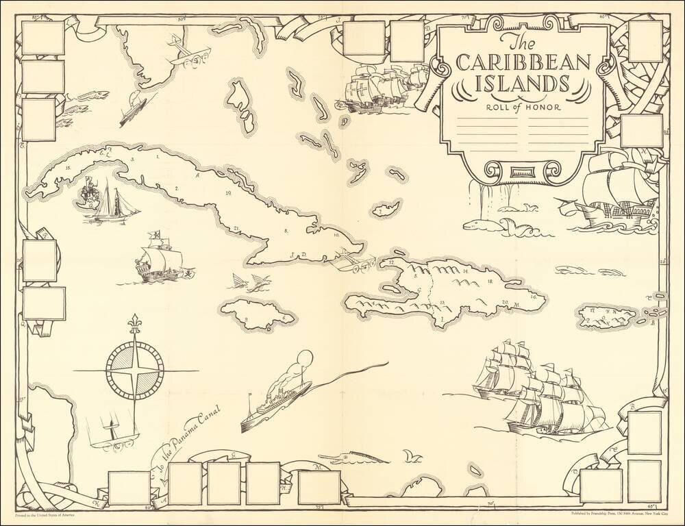
A Missionary Educational Map of the Caribbean for Children Fine large format map of the Caribbean, intended as an educational tool for church school children, published by the Friendship Press of New York City. The artist, Dr. Gilbert Q. LeSourd,...
![A Chart of the Aintree Race Course [Liverpool, England]](/map/small/70234.jpg)
Rare pictorial map of the famed Aintree Race Course, home to the Grand National, drawn by pictorial artist George Annand, The two mile course boasts 30 fences, individually numbered, the race consists of two laps. Ditches and water features provide...
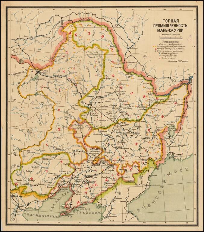
Interesting Soviet-era map of Manchuria, with particular focusing on the natural mineralogical resources of the region and the efforts to exploit them. The key in the upper right has symbols for iron ore, gold ore, salt, etc. Rail lines are depicted...
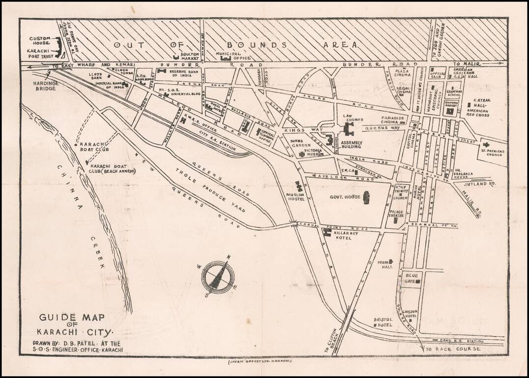
Rare Karachi Imprint Early guide map of Karachi, drawn by D.B. Patel. Points of interest shown on the map include: Customs House Karachi Port Trust Imperial Bank of India Boulton Market Reserve Bank of India Hq. S.O.S. Oriental Building...
![[Persia and the Middle East]](/map/small/63394kb.jpg)
Interesting circa 1930 map of Turkey, Iran, and the Middle East, in Ottoman Turkish. The map has insets of the Middle East and Iran, northern Greece, and elsewhere.
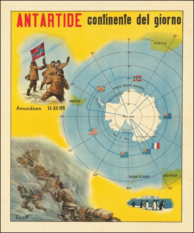
The Race for The South Pole Fine large, early twentieth-century Italian image illustrating the race for the South Pole and a map of Antarctica. The map depicts the race for the South Pole, where explorers from various nations sought to be the first...

Intereting publication and maps focused on the special methods of air navigation in the Polar regions. The maps cover the north and south Polar regions.