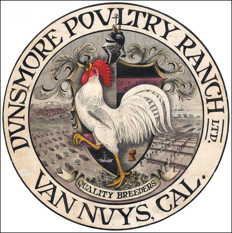
Breeding Chickens in the San Fernando Valley Finely executed advertising artwork for the Dunsmore Poultry Ranch of Van Nuys, California, likely drawn in the 1920s. On the left side of the coat of arms is a bird's-eye view looking westward from Van...
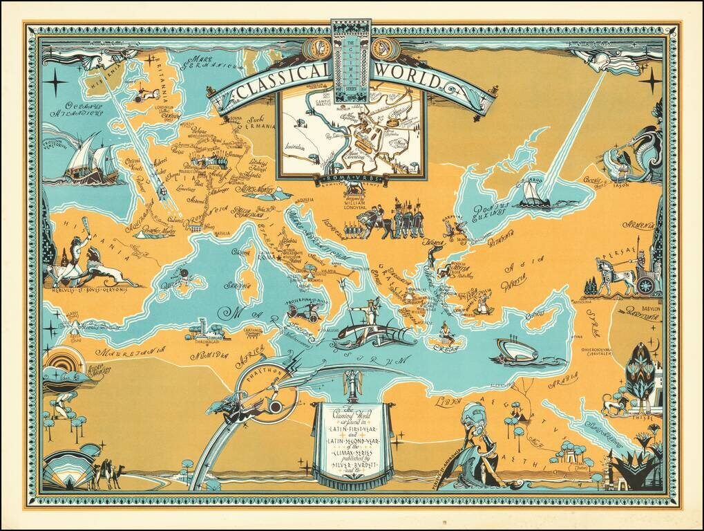
Rare pictorial map centered on the Mediterranean Sea, showing the world at the time of the Roman Empire, with place names in Latin. The map was produced for educational purposes to accompany a series of Latin textbooks published by Silver Burdett...
![[Polish Towns in the United States] Ks. Fr. Bolek Osiedla Zalozone Przez Polakow W. Stanach Zjednoczonych / The Towns and Villages Settled By Poles in the United States](/map/small/63071.jpg)
Interesting map of the United States, drawn by Polish historian Franciszek Bolek and published by the Polski Prezglad Kartograficzny (Polish Cartographic Review) in 1930. Franciszek Bolek (also known as Francis Bolek ) was a Polish historian,...
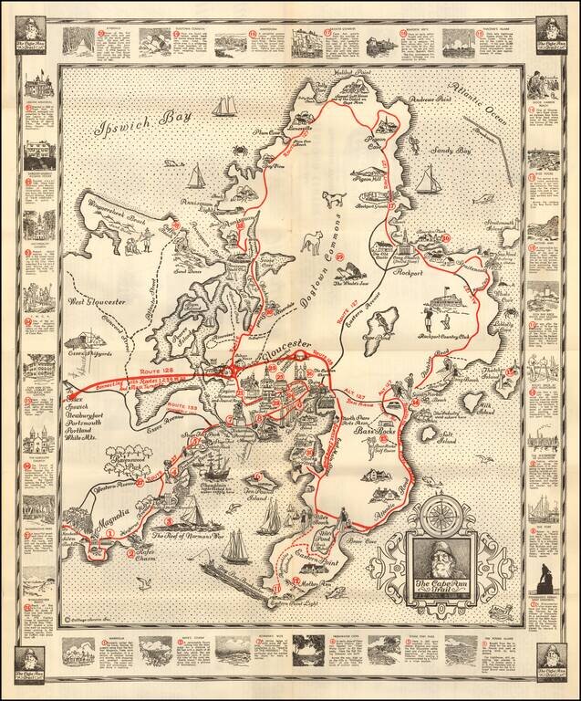
Pictorial map of the Cape Ann Trail, published by the Glocester Chamber of Commerce. The map is centered on Gloucester and extends north to Ipwsich Bay, Halibut Point and Andrews Point and south to Eastern Point Light The primary Roads (Routes) are...
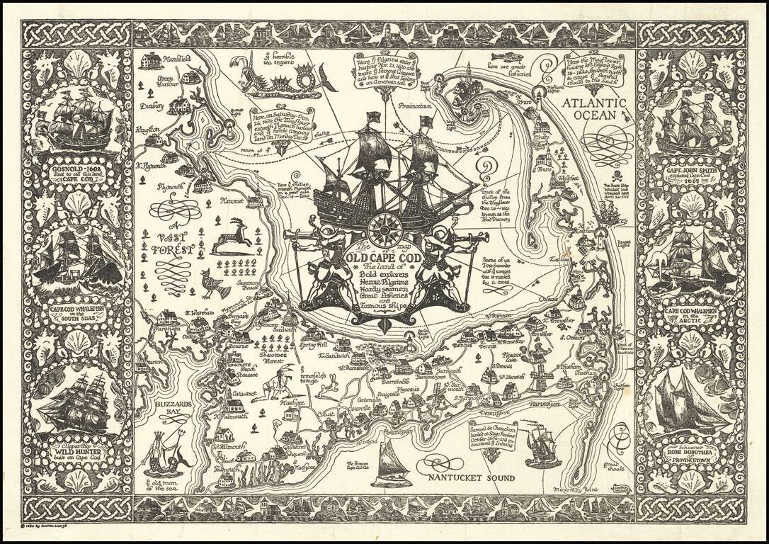
Fine example of Waugh's 1930 pictorial map of Cape Cod and part of the South Shore of Massachusetts including Plymouth, Buzzard Bay, and Duxbury. Waugh elegantly illustrate important towns and roads, while integrating a host of historical vignettes,...
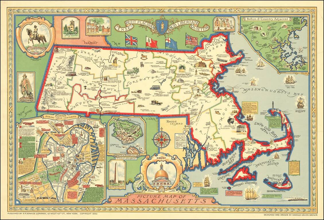
Decorative pictorial map of Massachusetts designed and drawn by Harold Haven Brown. Inset maps include: Boston During Three Centuries (a map of the centre of Boston, with detailed commentary) Battle of Bunker Hill ("After and Old Map Published in...
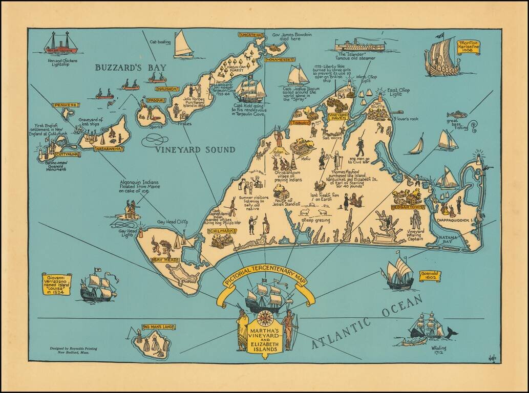
Decorative map of Martha's Vineyard and the Elizabeth Islands, celebrating is 300 year anniversary in 1630. Includes a number of lively historical vignettes and drawings and explanatory text. The maker is listed as Noble. We note several...
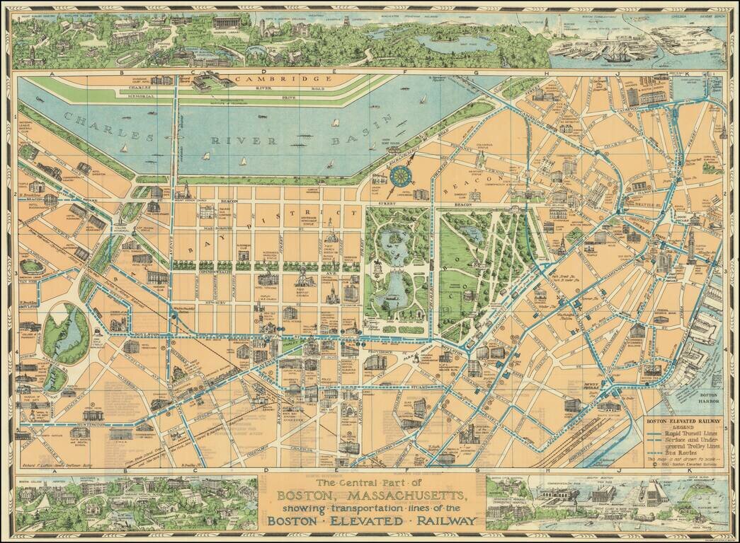
Decorative pictorial map of Boston, with 3 large inset views of various parts of the City. The map shows streets, parks, city blocks, Rapid Transit Lines, surface and underground trolley lines and bus routes, city landmarks, including hotels, Fenway...
![[Colorado -- Pike's Peak Region] Detailed Perspective Map of Corley Mountain Highway -- Through the Heart of the Rockies to the Land of Gold . . . .](/map/small/65682.jpg)
Interesting map illustrating the scenic automobile routes in the Pike's Peak region, including the recently constructed Corley Mountain Highway. The map illustrates Colorado Springs the foreground and is centered on Cameron's Cone and Pike Peak,...
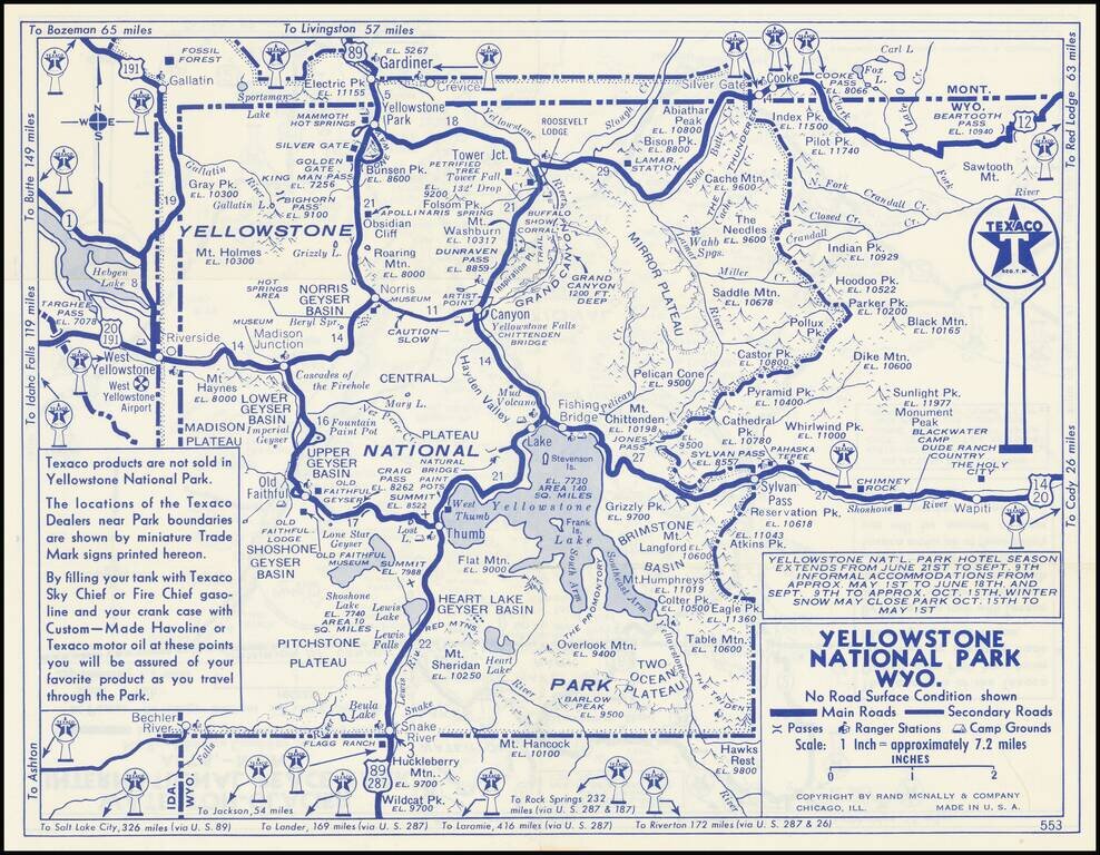
Detailed Texaco Road map covering Yellowstone National Park and Glacier National Park. This an early example of the major oil companies using auto touring in the National Parks as a medium for product promotin.
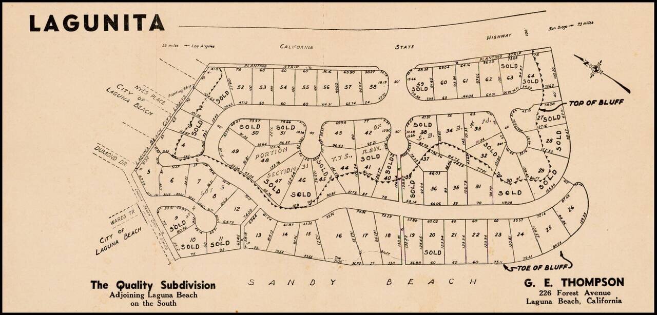
Fine example of this early subdivision map of Lagunita, in Orange County.
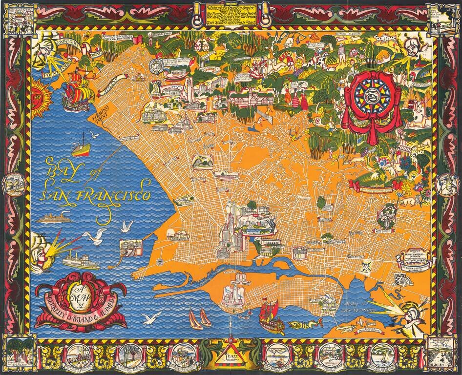
A Monumental Pictorial Map of Berkeley & The East Bay, With Original Decorative Folder Fabulous Art Deco style map by Michael Baltekal Goodman, notable for its brilliant color and striking design. The minimalist design of the street layout at...
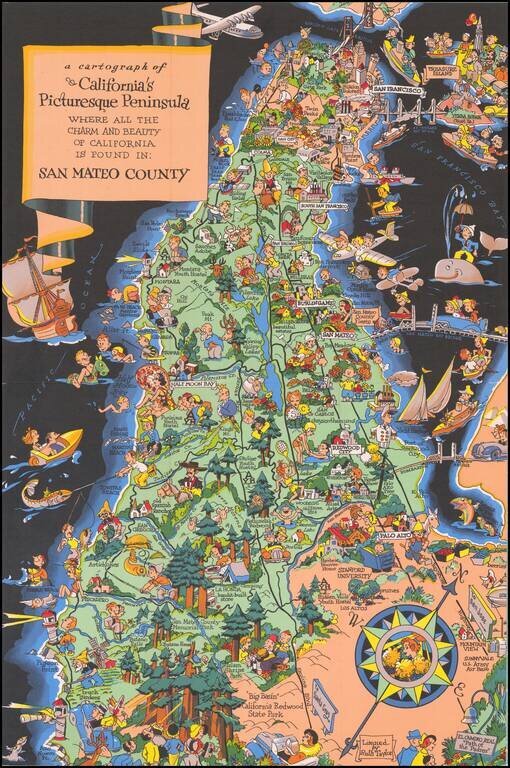
Marvelous whimsical map of San Mateo County by Ruth Taylor White one of the most famous pictograph artists of the period. Ruth Taylor White was among the most prolific makers of pictographic maps. Her whimsical style combines her artistic skills with...
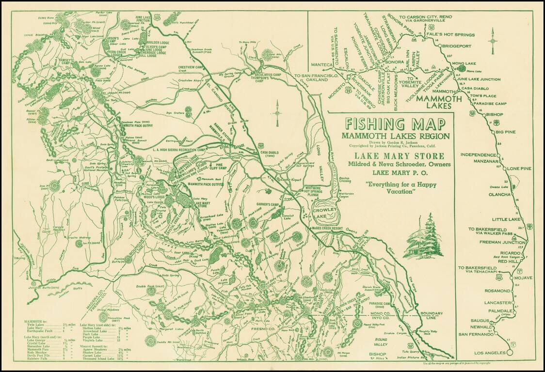
Everything For A Happy Vacation Interesting map of the area centered on Mammoth Lakes and Crowley Lake, published for the Lake Mary Store. The map covers parts of Mono, Inyo, Fresno and Madera Counties, focusing on the locations of the lakes and...
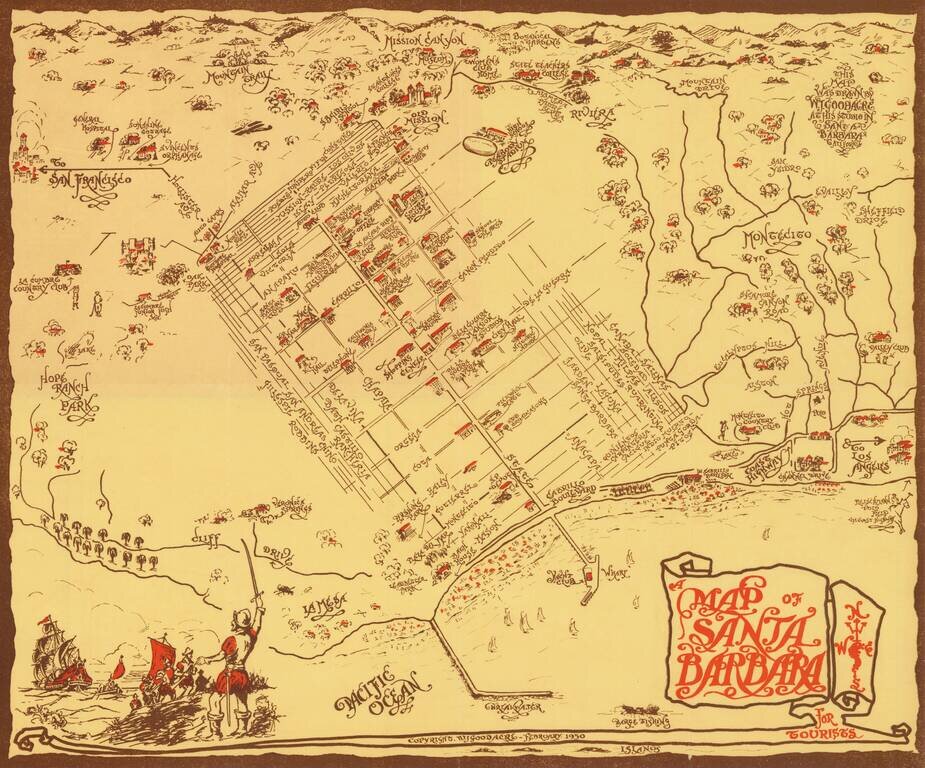
Rare pictorial map of Sant Barbara, drawn by William Johnson Goodacre. The map offers other interesting historical facts about the state of California. William Johnson Goodacre was a commercial artist who came to Santa Barbara from England in 1924....
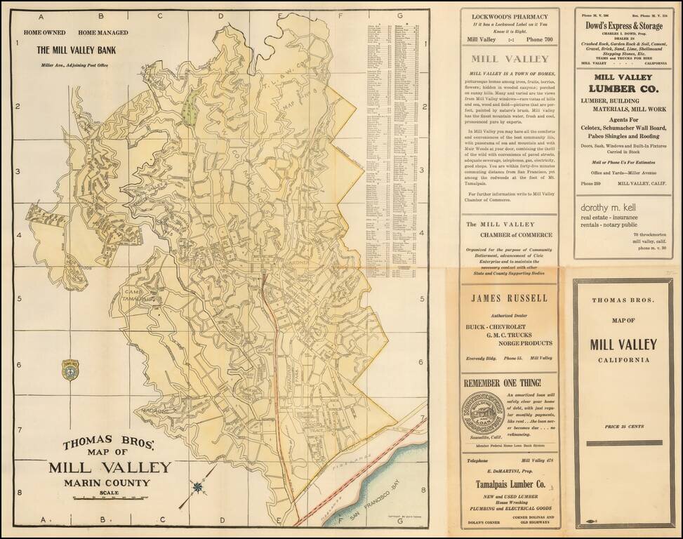
Scarce map of the Mill Valley, published by George C. Thomas. The map includes a detailed city plan, along with advertising.