Map size in jpg-format: 882899B
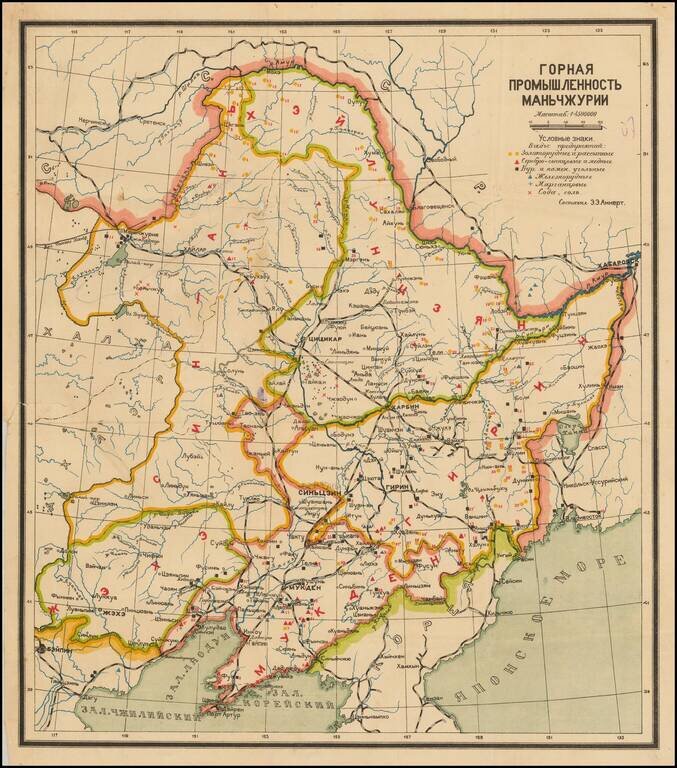
Interesting Soviet-era map of Manchuria, with particular focusing on the natural mineralogical resources of the region and the efforts to exploit them.
The key in the upper right has symbols for iron ore, gold ore, salt, etc. Rail lines are depicted as well.
The map probably predates the Soviet occupation of Manchuria immediately following the Second World War, however, it does not appear to depict the Japanese occupation.
If you are a student, write to us in telegram: @antiquemaps and indicate what material you need and for what work you need a map in high detail. We are ready to provide material on special terms. For students only!
![[Martin Behaim Globe / Book] Pars Globi terrestris Ao. 1492 a Martino Behaim Equite Lusitano Norimbergae confecti Delineavit Christoph. Theoph de Murr 1778 (bound with:) Diplomatische Geschichte des Portugesischen berühmten Ritters Martin Behaims](/map/small/68828.jpg)
![Il Disegno Della Terza Parte Dell' Asia [Gastaldi's Wall Map of SE Asia with extra panels!]](/map/small/30554hbp.jpg)
![Chinae, olim Sinarum regionis nova descriptio. auctore Ludouico Georgio. [English Edition!]](/map/small/71123.jpg)