![[San Francisco View] Schmidt Lithograph Co. Second and Bryant Sts. San Francisco, California](/map/small/64719.jpg)
Birdseye View Calendar Showing the Schmidt Printing Works Against the San Francisco Sky Line Rare Calendar for 1908, published by the Schmidt Label & Litho. Co, and bearing the name of its sales agent in Portland, E. Shelley Morgan. In the late...

Separately Published Map of the Largest Suffragette March in the United Kingdom up to That Point. Rare separately-issued map of the Women's Sunday March of June 21, 1908, in Hyde Park, featuring the portraits of the 20 platform chairs. The map...
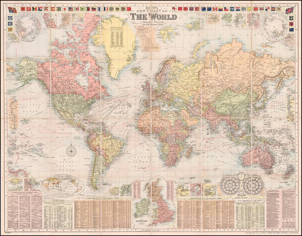
A Grand Map of the World At The Height of the British Empire Decorative large format map of the world, showing the British Empire, at its height. Around the map are inset details: with plans of towns including Hong Kong, Singapore, Sydney and New...
![[Long Island City - Blackwell's Island Bridge]](/map/small/59904.jpg)
Auction broadside of central Long Island City, printed in black and red. This attractive auction broadside shows Long Island City during its first boom, at the beginning of the 20th century. Long Island City is currently the fastest growing...
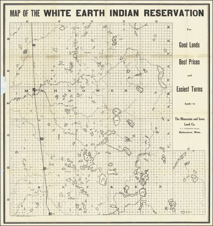
The Continued Dispossession of Native Americans in 20th-Century Minnesota. Interesting map of the White Earth Indian Reservation in northwestern Minnesota, printed for the Minnesota and Iowa Land Co. to promote the sale of "surplus" reservation land...
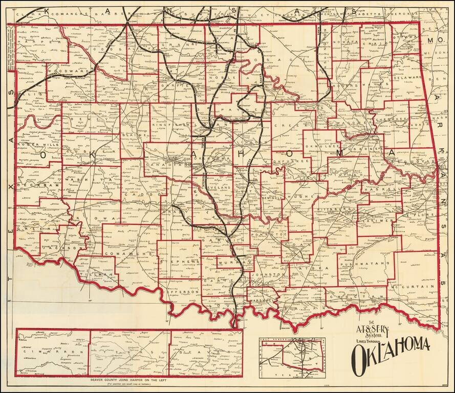
Fine map of Oklahoma, shortly after it obtained statehood on September 17, 1907, and published by the Atchison Topeka & Santa Fe Railroad. Fine map of the state, with the lines of the Santa Fe Railroad running up the center and a number of other...
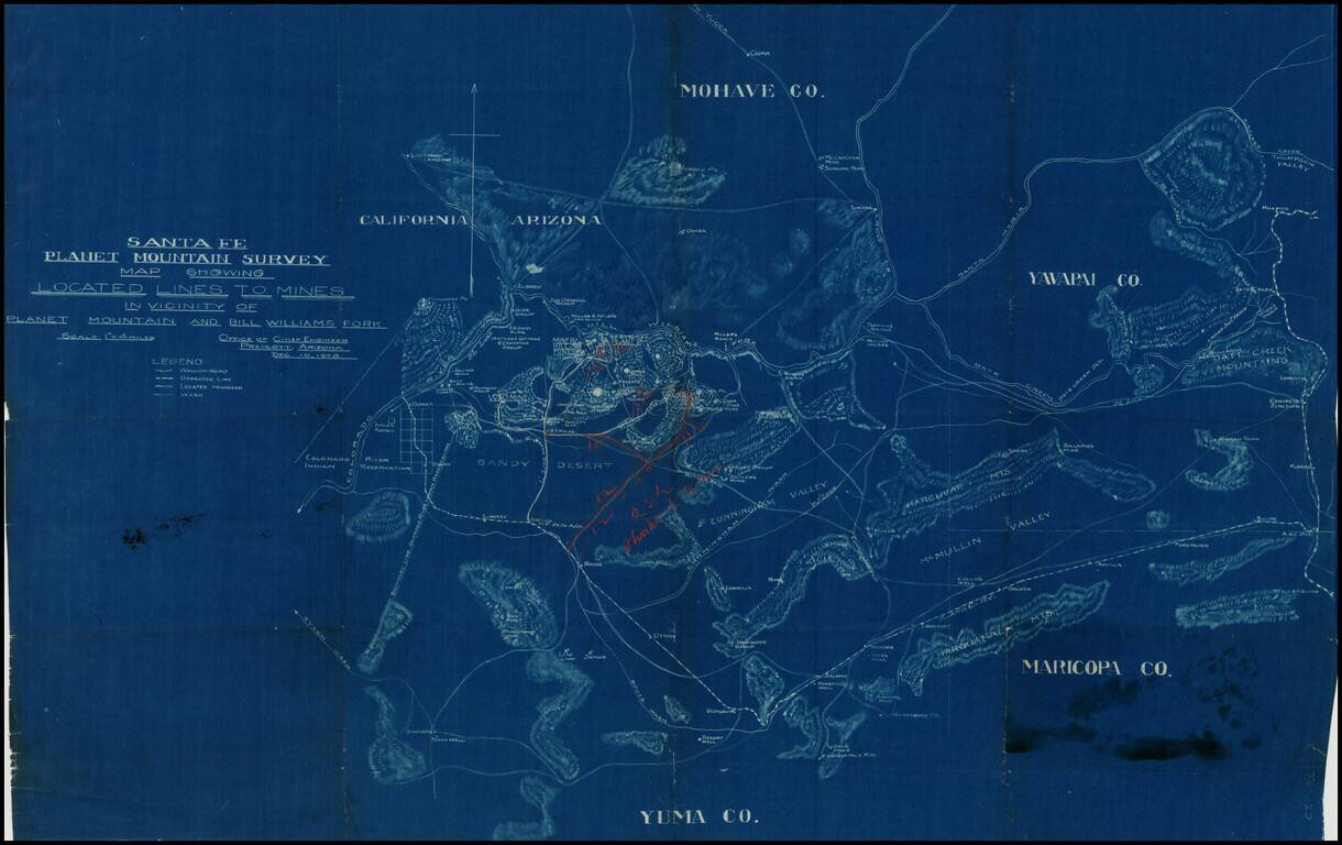
Detailed blue print map of southwestern Arizona, focusing in on the lines of transportation to the mining regions around Planet Mountain and Bill Williams Fork, prepared by the Atchison Topeka & Santa Fe Railroad in 1908. The map includes parts of...
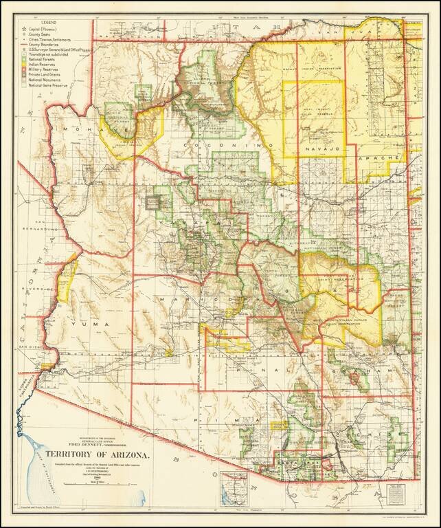
Fine Arizona Territorial Map One of the best and most highly detailed map of Arizona Territory of the period. The map was produced by the Dept. of the Interior, under the Supervision of Harry King. This edition is revised and reconstructed by R.H....
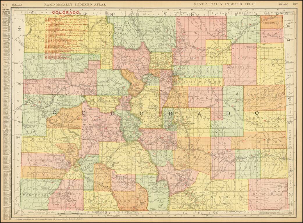
Highly detailed separately issued pocket map of Colorado, showing counties, townships, towns, railroads (numbered), railway stations, rivers, lakes, etc. Includes a list of approximately 30 railroads operating in Colorado at the time.
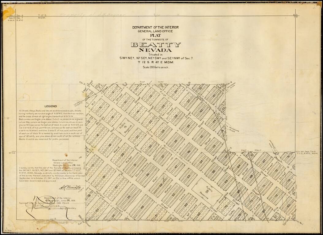
Detailed plan of Beatty, Nevada, one of the primary Nevada mining boom towns in the first part of the 20th Century, published by General Land Office. The present map is one of the earliest obtainable maps of the City, which had been laid out only a...
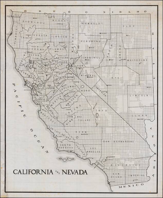
Early manuscript draft of a large format map of California and Nevada. The county configurations would appear to be circa 1908-1909, based upon shape of Glenn County. The guidelines in the title and other places are visible.
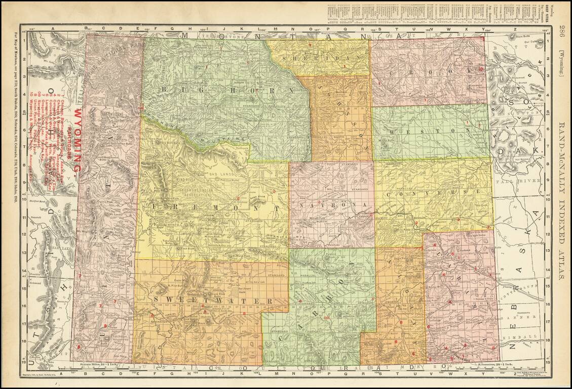
Highly detailed map of Wyoming Territory showing towns, rivers, railroads, mountains, lakes, etc. Includes a list of 9 Railroads at the top left.
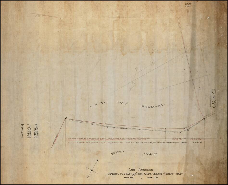
Southern Pacific Railroad Survey showing the boundary between the Stern Tract and the Southern Pacific Shop Ground, in Downtown Los Angeles. Includes the lines surveyed in August 1881, July 1899 and March 1891, the apparent basis for the dispute.
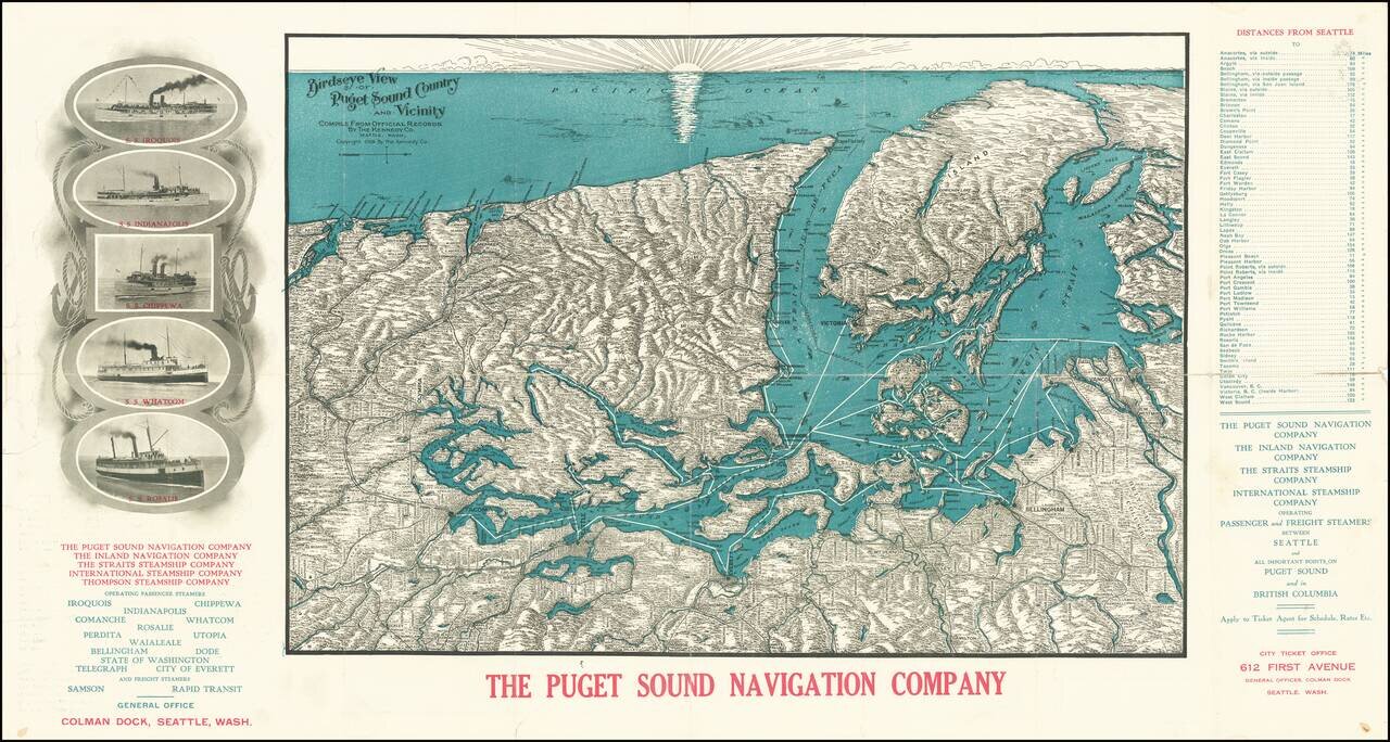
A Puget Sound Navigation Company Promotional View Detailed antique bird's eye view of Puget Sound, the Olympic Peninsula, the San Juan Islands, Vancouver Island, including the major cities of the region, such as Seattle, Tacoma, Vancouver, Olympia,...
![[Para] Estados Unidos do Brasil -- Mappa do Estado Do Para Mandado organisar pelo Exmo. Snr. Dor. Augusto Montenegro Governador do Estado 1908](/map/small/62471.jpg)
Rare Map of the Brazilian State of Pará, Including the Mouth of the Amazon River Rare, separately-published map of what are today the Brazilian states of Pará and Amapá in northern Brazil. The map, which is the only example we could locate, offers...
![[Gansu & Ningxia] Kansu](/map/small/61498.jpg)
Fine regional map of Gansu & Ningxia, from the Atlas of the Chinese Empire; Prepared by Mr. Edward Stanford for the China Inland Mission. The work was published by Morgan & Scott, Ltd., London. Lanchowfu (Lanzhou), the Great Wall of China,...