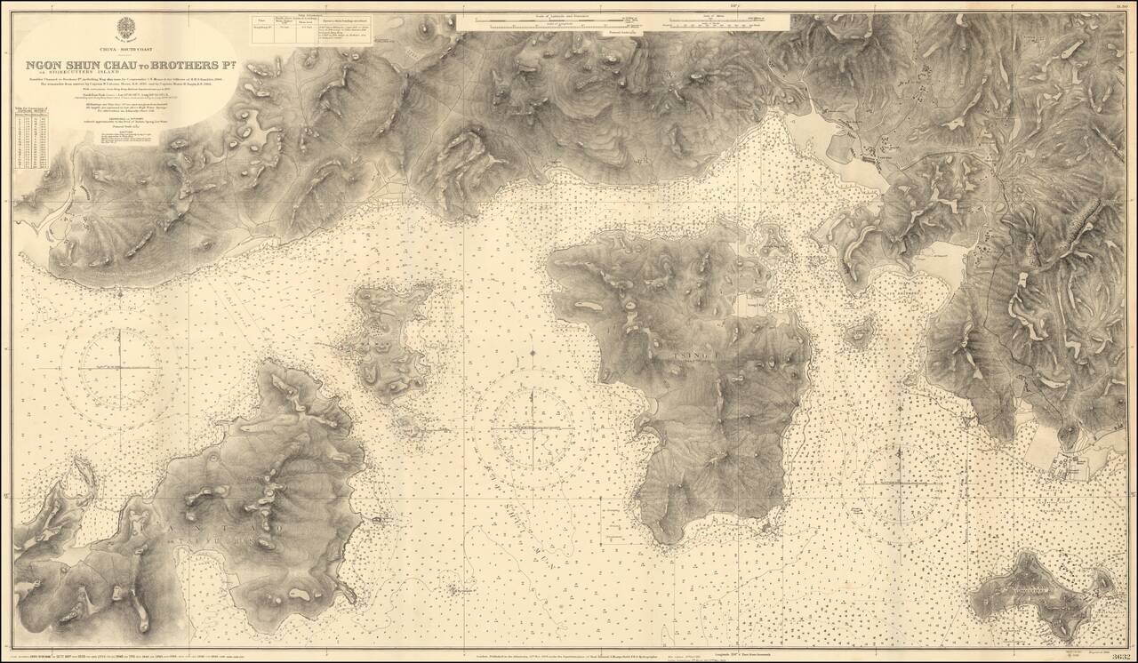
Impressive Chart of Park Island, Tsing Yi, and western Hong Kong Harbor. A very detailed chart of the section of water west of Hong Kong Harbor. The chart was first published in 1908, based on the surveys of Commander C.E. Monro of H.M.S. Rambler,...
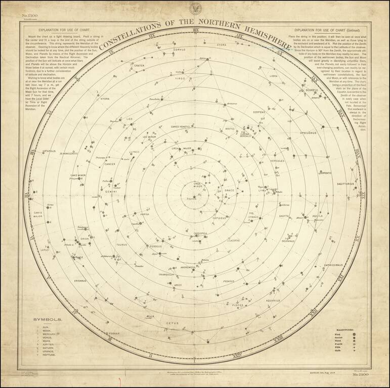
Rare Working Celestial Navigation Chart! Rare working navigational celestial chart of the northern skies, published by the United States Hydrographic Office. Updated to August 5, 1916, the chart was actually utilized by mariner's at sea to take...