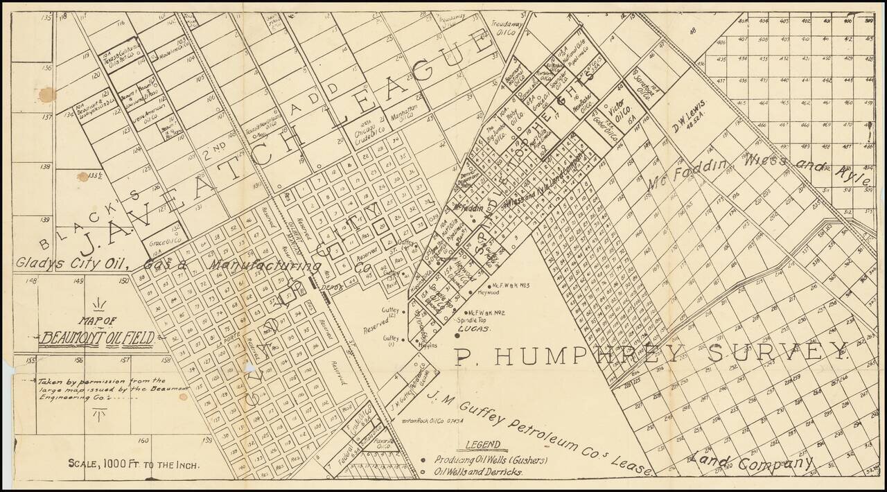
One of the first printed maps of the first major Texas oilfield centered on the Spindletop "Lucas" Gusher. The map is reflective of the frenzy of commercial and oil-drilling activity that took place around the Lucas Gusher in 1901, especially in the...
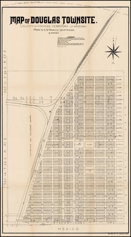
Detailed plan of the town of Douglas, Arizona, on the border with Mexico. In 1878, the place where the town of Douglas now exists was known as Black Water, so called because of a dirty water hole. Water was so scarce that Black Water was much used....
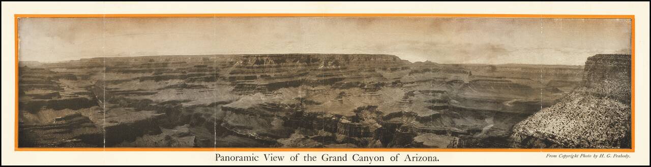
The Grand Canyon of Arizona -- Most Sublime Scenic Panorama in the World Fine photographic view of the Grand Canyon, published in conjunction with the Pan American Exposition. Includes a promotional tract on the verso. Title on verso: The Grand...
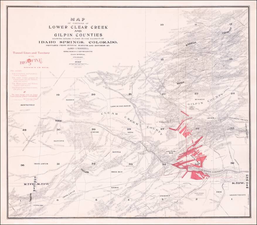
Rare separately published map of the area around Idaho Springs, Colorado, as surveyed by James Underhill. The map extends from Idaho Springs to Lamartine and Downieville and north to Central City, identifying the locations of hundreds of mining...
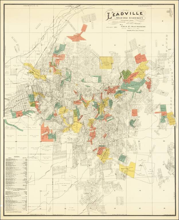
Scarce locally published map of the Leadville Mining District, compiled by Charles F. Saunders and printed by the Denver Litho Co. The map is filled with a vast dense array of mineral claims, perhaps more than one thousand in all, each named and...
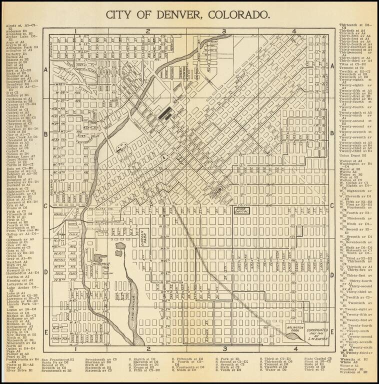
Antique map of Denver, first published in 1901 by S.W. Baxter, and then republished by C.N. Hoover, again in Denver, in 1905. The map extends to Arlington Park in the southeast and the present-day Potter Highlands Historic District in the northwest....
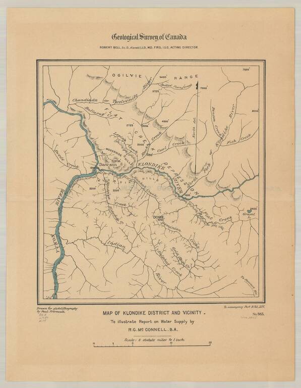
Detailed map of the Klondike Gold Region, centered on Dawson's and the Klondike River.
![[Pearl Harbor] Pearl River and Lochs From The United States Government Plan of 1899 . . .](/map/small/67434.jpg)
Finely detailed chart of the Pearl River and "Lochs", illustrating the environs of Pearl Harbor, published by the British Admiralty. First issued in 1901, this chart includes major revisions to 1920 and smaller revisions to 1931. The use of the term...
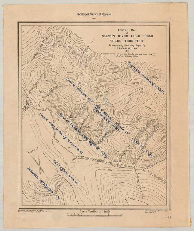
Detailed map of the Salmon River Gold Field, as surveyed by the Geological Survey of Canada. The map provides a highly detailed description, overlaid on a topographical map of the South Fork of Big Salmon River. The 1881 on strike on the Big Salmon...
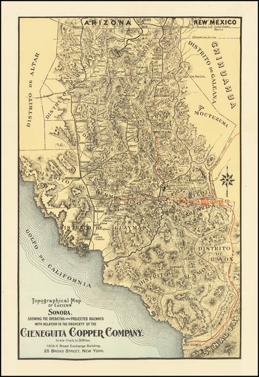
Promoting Copper Mine Investments in Sonora During the Copper Boom in the Early 20th Century Finely executed map showing the transit routes to the Copper Mines of Eastern Sonora in Mexico. While the map is unrecorded, it was likely published in order...
![[Map of Western Shangdong Province]](/map/small/60891.jpg)
Boxer Rebellion-Era Map of Shangdong Province. Highly detailed map of part of Shandong Province by the Kartographische Abtheilung der Konigl. Preuss. Landes-Aufnahme. The map was prepared in Germany to highlight German interests in China, as the Boxer...
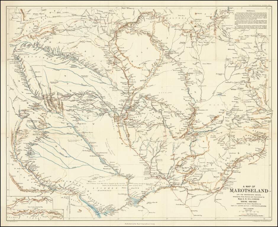
A Scarce Map Following Expeditions Exploring The Zambezi Basin An antique map showing western half of Zambia, collating the results from several expeditions to the region which occurred at the end of the 19th century. The area shown extends into parts...