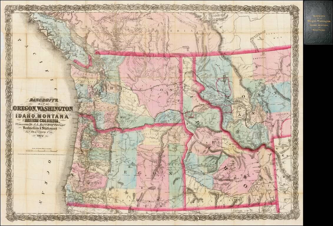
Rare separately issued map of the northwestern United States and British Columbia, issued in 1872 by A.L. Bancroft & Co. in San Francisco. Bancroft's map was first issued by HH Bancroft in 1868. The map was drawn from a section of Bancroft's...
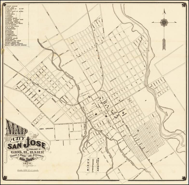
One of the Earliest Printed Maps (and Guides) for San Jose Fine early map of San Jose, lithographed in San Francisco by Britton & Rey in 1872. The map provides a fine early look at San Jose, including street names, early buildings, railroad...
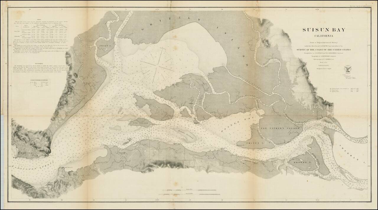
Detailed view of Suisun Bay, from Benicia to Sherman's Island and Brown's Island. Includes soundings, tides and other details. One of the earliest detailed surveys of the region.
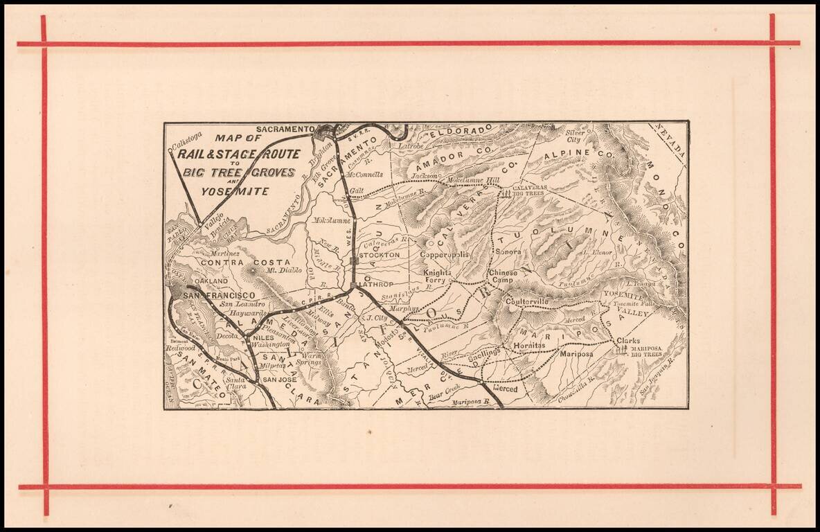
Rare early map of the routes to Yosemite and the Redwood Groves to the south, which would become Sequoia National Park. Versions of this map are known to have been published as early as 1872, in The Wonders of the Yosemite Valley, and of California...
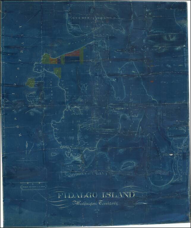
One of the Earliest Surviving Maps of Fidalgo Island Rare map of Fidalgo Island, named after the Spanish explorer and cartographer Salvador Fidalgo who explored the area in 1790. The map is color coded to show the lands owned by several different...
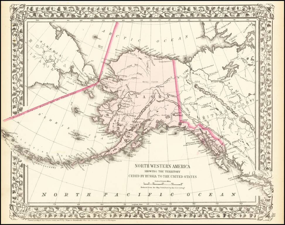
A detailed map of Alaska, showing the territory shortly after it was sold by Russia to America for $7.2 Million in 1867. The map locates towns, mountains (with elevations), rivers, bays, and other details. Cities named include Sitka and Sheshalik. The...
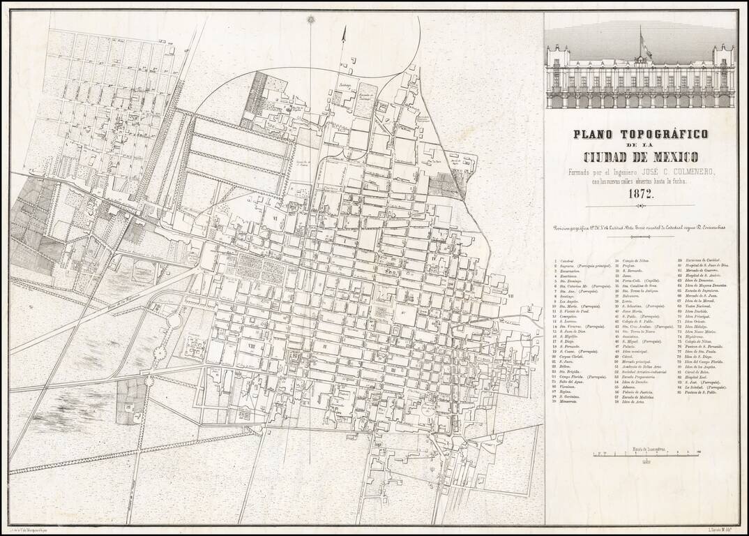
Rare separately issued map of Mexico City, lithographed by V. de Murguia e hijos in Mexico City. The map provides a fine overview of the city, including identifying newly opened streets, as noted in the title of the map. The map includes an inset...
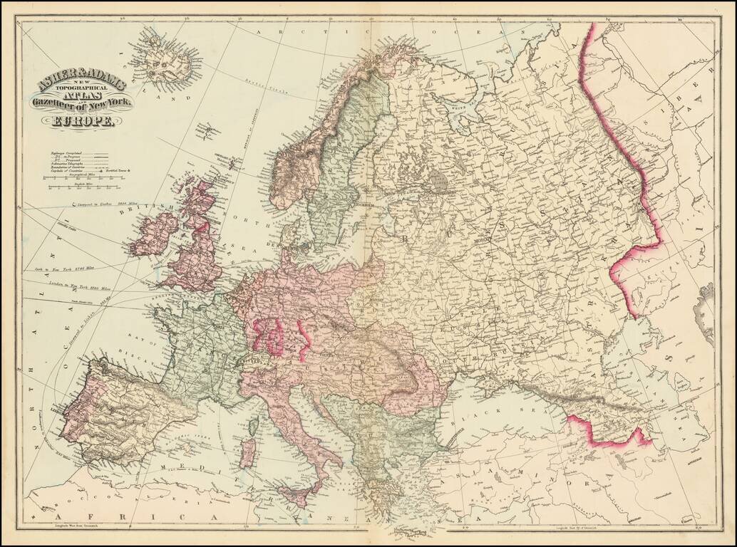
Fine large map of Europe, published by Asher & Adams. The map includes railroads and shipping routes, with distances to ports in North America and Europe.

Detailed map of the Nova Zemla region, focusing on the polar voyages in the region in the 1870s. The following explorer routes are noted: Johannsen 1869 Johannsen 1870 F.C. Mack 1871 Johannsen 1871 Tobiesen 1871 Isacksen 1871 Dorma 1871 Rosenthal...
![[Chandannagar] French Settlement of Chandernagore Surveyed Season 1870-71 with a portion of the River Hoogly, and of the Country on its Left Bank](/map/small/63527.jpg)
A Rare French Colonial India City Map Rare map of the city of Chandannagar in West Bengal, published by the Surveyor General of India in 1872. The map provides an exceptionally detailed look at the city, which at the time was one of three remaining...
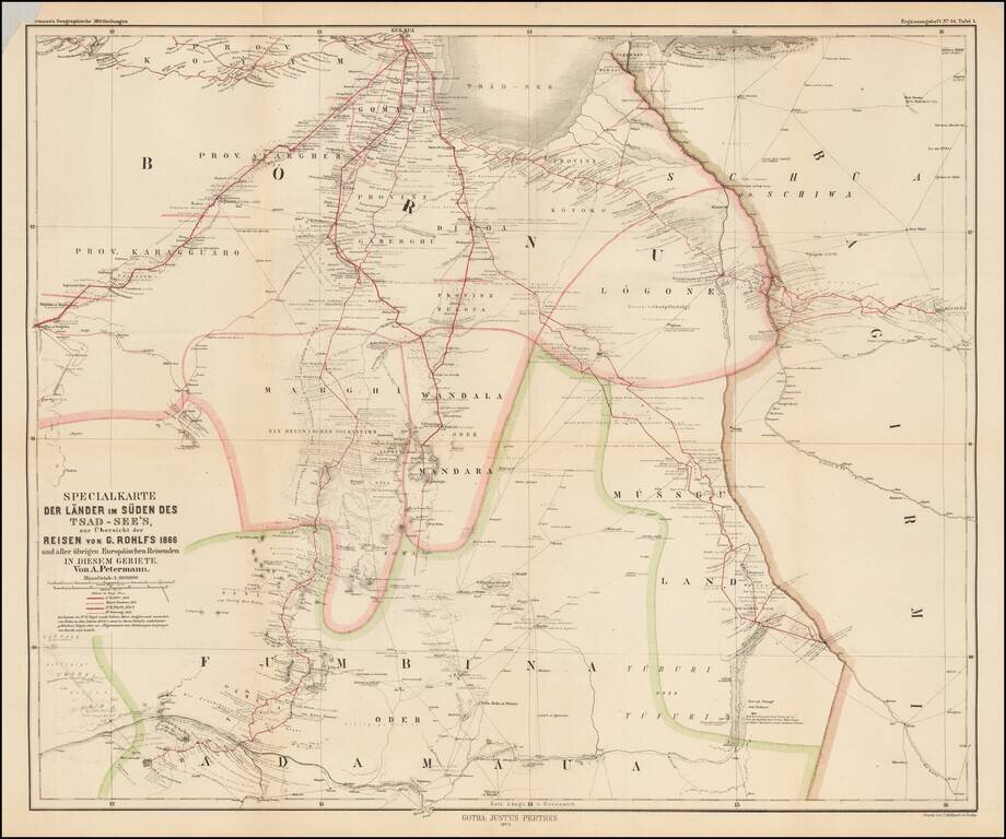
Scarce map of central Africa, illustrating the region to the south of Lake Chad, focusing on the explorations of Gerhard Rohlfs. The map identifies the routes of a number of explorers, including: Gerhard Rohlfs -- 1866 Major Denham -- 1824 Dr. M....
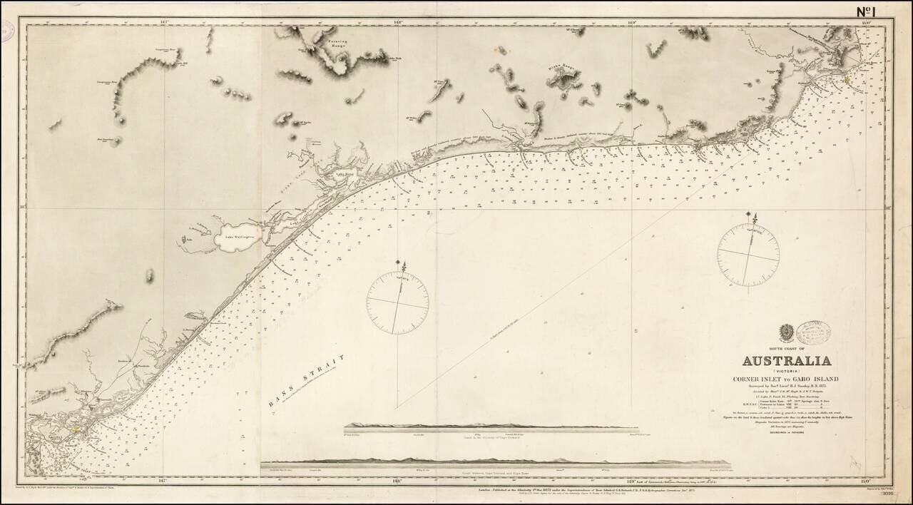
First State of this scarce working sea chart of the Victoria Coastline, to the northeast of Melbourne, published by the British Admiralty. The chart starts at the border between New South Wales and Victoria, near Cape Howe and Gabo Island, and extends...
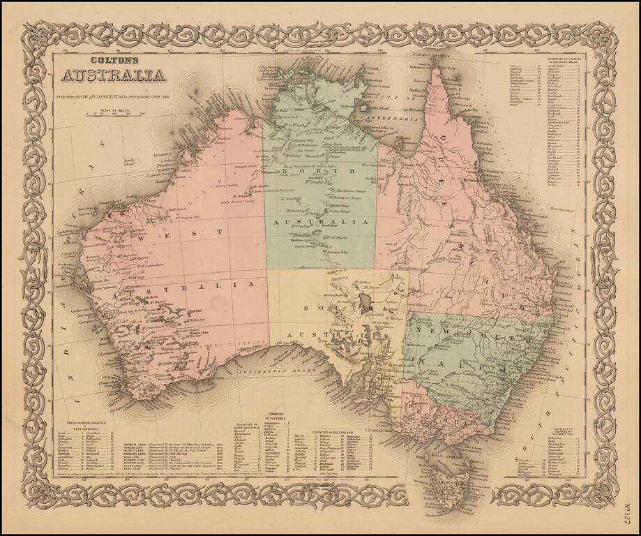
Highly detailed map of Australia, colored by provinces. Includes a key showing the various counties in each of the provinces. Shows towns, rivers, lakes, mountains, islands, etc. The interior is still highly primitive and unknown. Decorative border....
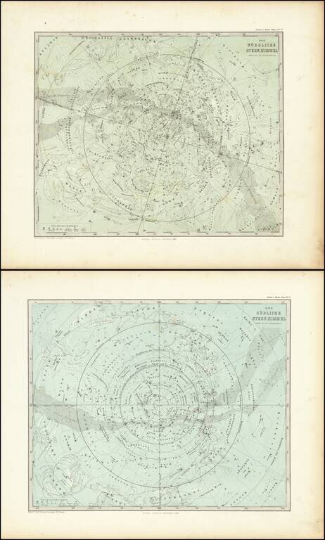
Nice pair of star charts of the Northern and Sourthern Hemisphere, showing various constellations with accompanying subtle illustrations.