
The First Edition of the First Great Scientific Atlas of All of Mexico. Antonio Garcia Cubas is regarded as "el fundador de nuestra geografia como ciencia" (Diec. Porrua). Glass, page 680 (citing the plates and commentary for Mapa Siguenza and Codice...
![Die Vereinigten Staaten von Nord Amerika (Ostlicher Theil) [New York City Inset]](/map/small/62143.jpg)
Highly detailed map of the eastern part of the United States, with a large inset map of New York City.
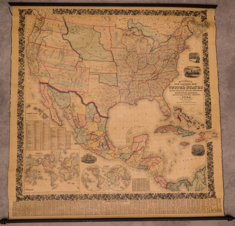
Fine Example of Mitchell's National Map of the United States Fine wall map of the United States, illustrating the transitional western Territorial and State borders, published by S A Mitchell in 1858. First published in 1856, Mitchell's remarkable...
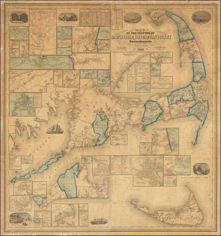
An Iconic Cape Cod -- Nantucket - Martha's Vineyard Wall Map Nice example of this remarkable wall map of the area around Cape Cod, Nantucket and Martha's Vineyard, one of the largest ever produced for the region. The views on the map include...
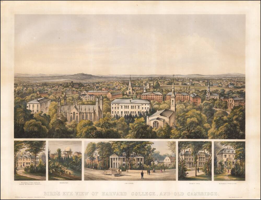
Finely colored early view of Harvard College, published in Boston in 1858. Includes a fine overview of Harvard, with 5 smaller views showing: Residence of Prof. Longfellow, formally Genl. Washington's Headquarters Observatory Law School Divinity...
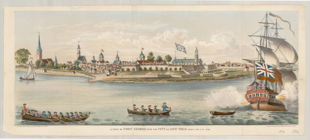
Fine mid-19th Century edition of this rare early view of Fort George, originally engraved by George Carwitham, circa 1736. In 1624 the Dutch West India Company established the colony of New Netherland. It grew to encompass all of present-day New York...
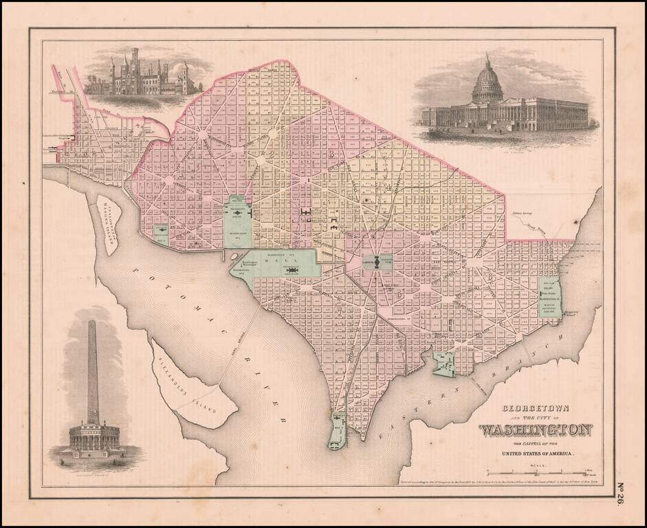
Interesting map of the Capitol, colored by wards, from one of the most prolific 19th Century American publishers. JH Colton was one of the pre-eminent American map publishing firms in the mid-19th Century.
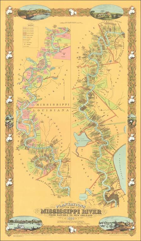
Fine limited edition copy of Norman's Chart of the Mississippi River from Natchez to New Orleans, also known as the Persac map. The map shows the divisions of land with owners’ names, vignettes of New Orleans, Baton Rouge and plantations, the...
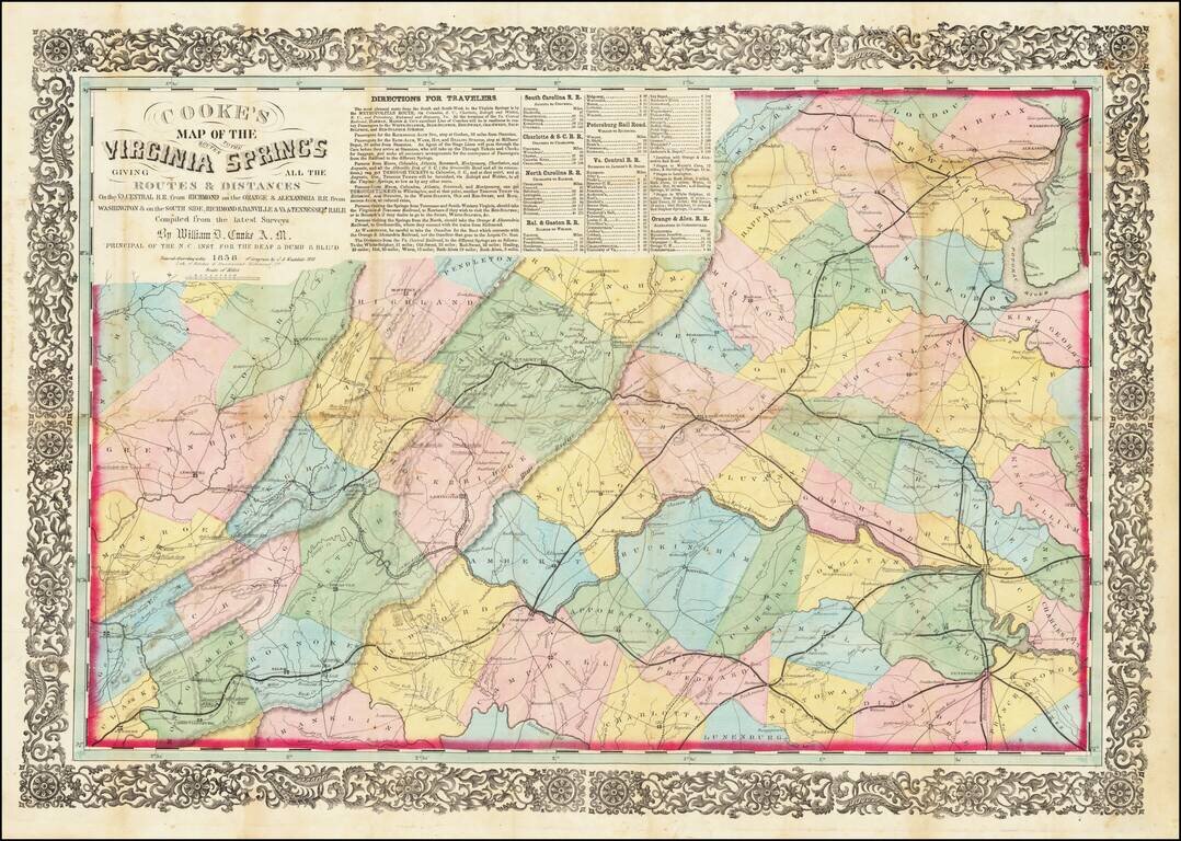
Rare Richmond Imprint Centered on Charlottesville Nice example of this rare regional map of Virginia, centered on Charlottesville and emphasizing the early railroads within the state. The map was intended to illustrate the available railroad routes...
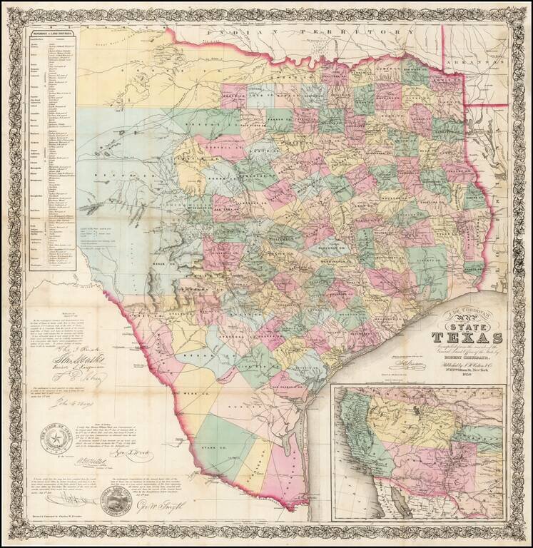
One of the rarest and most important of maps of Texas, and a foundation map for all future Texas cartography. Jacob de Cordova was a land developer in Texas following its annexation by the United States in 1845. De Cordova and Robert Creuzbaur,...
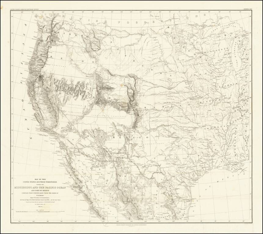
Emory's Map of the Transmississippi West. Marvelously detailed map of the Western Territorial US, published by W.H. Emory in his Report of the United States and Mexican Boundary Survey. The map is one of the fundamental post-Gadsden Purchase maps of...
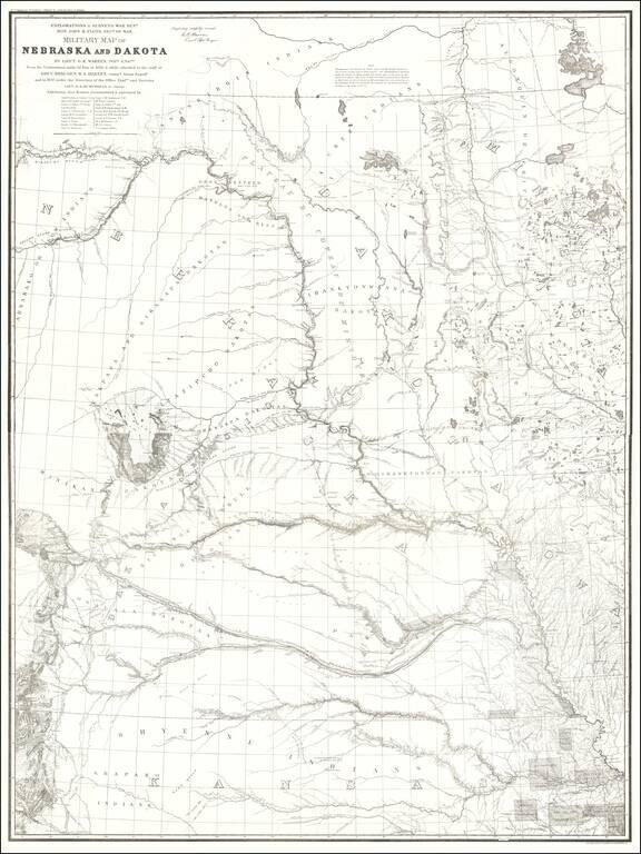
1875 Edition of Warren's Pivotal Map of the American Plains -- Early Reference To the Colorado / Kansas Gold Regions 1875 edition of Gouverneur Kemble Warren's large format map of Kansas, Nebraska, Dakota and part Colorado and Wyoming, based upon...
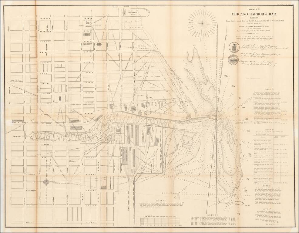
Detailed plan of Chicago, based upon the surveys conducted by the US Topographical Engineers, under the direction of Lieutenant Colonel J.D. Graham in 1857 and 1858. Centered on Downtown Chicago and the Loop, this large format map of Chicago Harbor...
![Milwaukee City and Environs Engraved expressly to accompany the City Directory for 1858 & 9. [with:] Milwaukee City Directory. 1858-9.](/map/small/57977.jpg)
Detailed, early lithographed map of Milwaukee, published in Milwaukee by Lipman and Riddle. The map features rail lines and the street grid in downtown, with almost all of the streets named. It also details subdivisions that are beginning to extend...
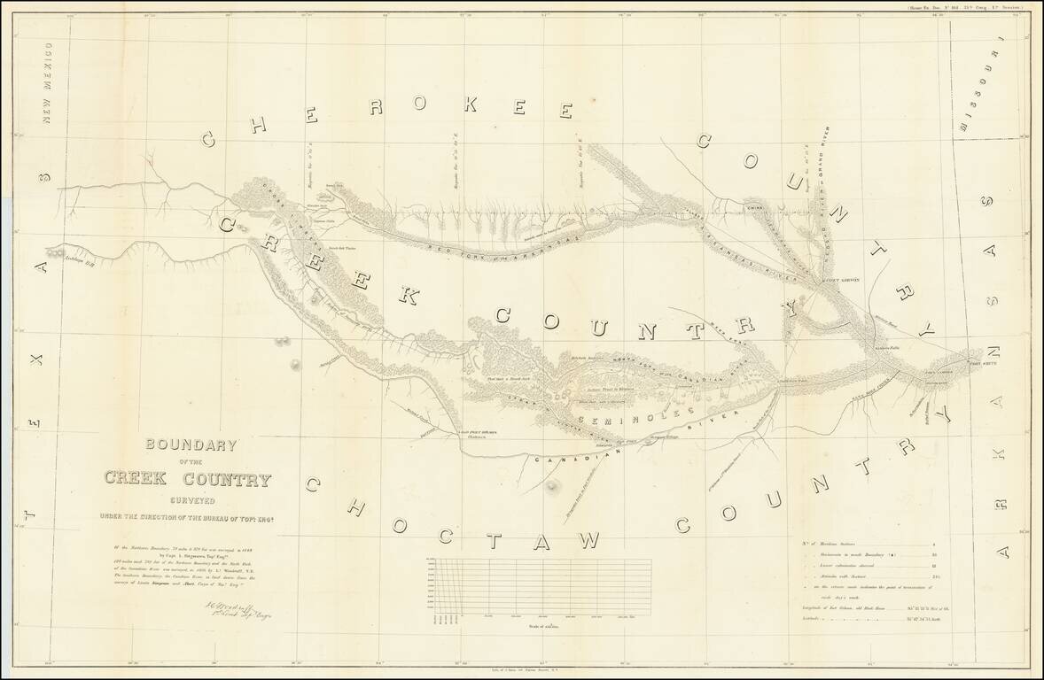
Detailed survey of the lands in Indian Territory occupied by the Creek Indians by agreement with the United States Government. The map shows the results of the earliest surveys of the watershed of the Canadian River and Red Fork of the Arkansas River...
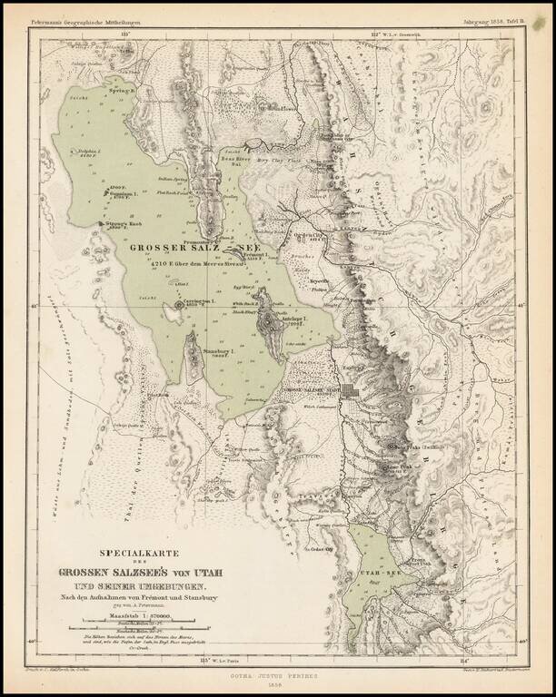
Scarce and highly detailed map of part of Utah in the Salt Lake and Wasatch region, published by Augustus Petermann. The map names numerous early Utah towns, including: Provo Salt Lake City (with a town grid) Springville Brigham City Palmyra Payson...