Map size in jpg-format: 69.2789MiB
Click to open in high resolution (open in new tab).
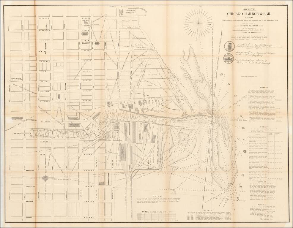
Detailed plan of Chicago, based upon the surveys conducted by the US Topographical Engineers, under the direction of Lieutenant Colonel J.D. Graham in 1857 and 1858.
Centered on Downtown Chicago and the Loop, this large format map of Chicago Harbor illustrates the waterfront, piers and early streets during the earliest period of Chicago's modern history, prior to the Chicago Fire.
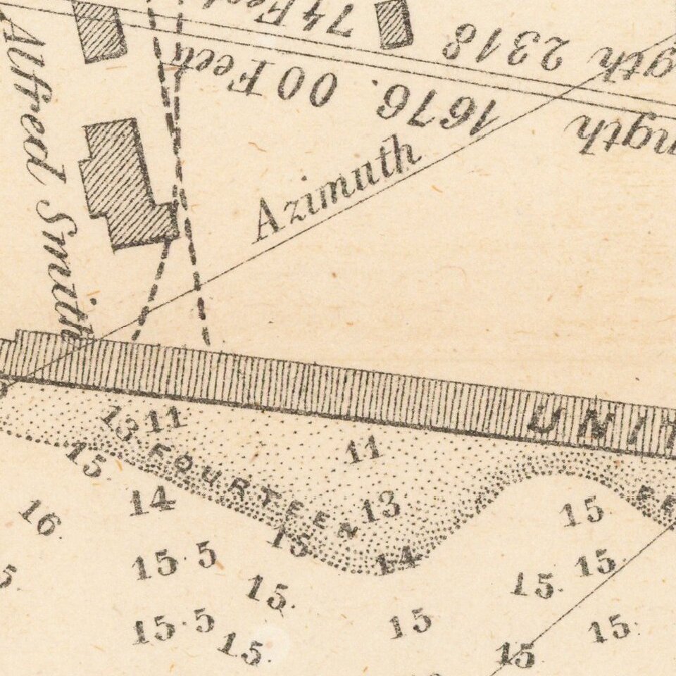
Both the harbor and the Chicago River are filled with information including soundings, buoys, navigational hazards and notations. Along the lake shore, the numerous buildings and rail lines of the Illinois Central Railroad are depicted. In the city, streets are named, but there is little additional information beyond a few buildings including City Hall, the Marine Hospital, and several churches.
As noted in the online description of the map by the Newberry Library:
In the 1850s, Chicago's harbor emerged as a critical link between the waterways of the Great Lakes, including the Erie Canal, and the new railroads leading from riverside docks and piers (as shown on this map) to the interior of the country. Repeated attempts to keep the river and harbor clear of sediment had had only temporary effect. In April 1854, the government brought Lieutenant Colonel James Duncan Graham (1799-1865), a member of the Army Corps of Engineers, to Chicago in April 1854 to direct more comprehensive improvements. The improvements cost $200,000, four times the amount spent on previous improvements. Graham's 1858 map of the Chicago Harbor and Bar records the data from soundings taken by his engineers in order to determine the water depth and hence the silt accumulation on the harbor's floor. Detailed notes on the map describe the process he used to calculate the precise latitude and longitude of the site. This enabled him to pinpoint the underwater locations needing to be dredged. The detailed three-dimensional visualization of the river mouth and adjacent lakeshore offers a clear picture of how the prevailing southward flow of the lakeshore current and consequent drift of lake sand constantly pushed the natural flow of the river towards the south. . .One of the earliest obtainable large format maps of Chicago.
If you are a student, write to us in telegram: @antiquemaps and indicate what material you need and for what work you need a map in high detail. We are ready to provide material on special terms. For students only!