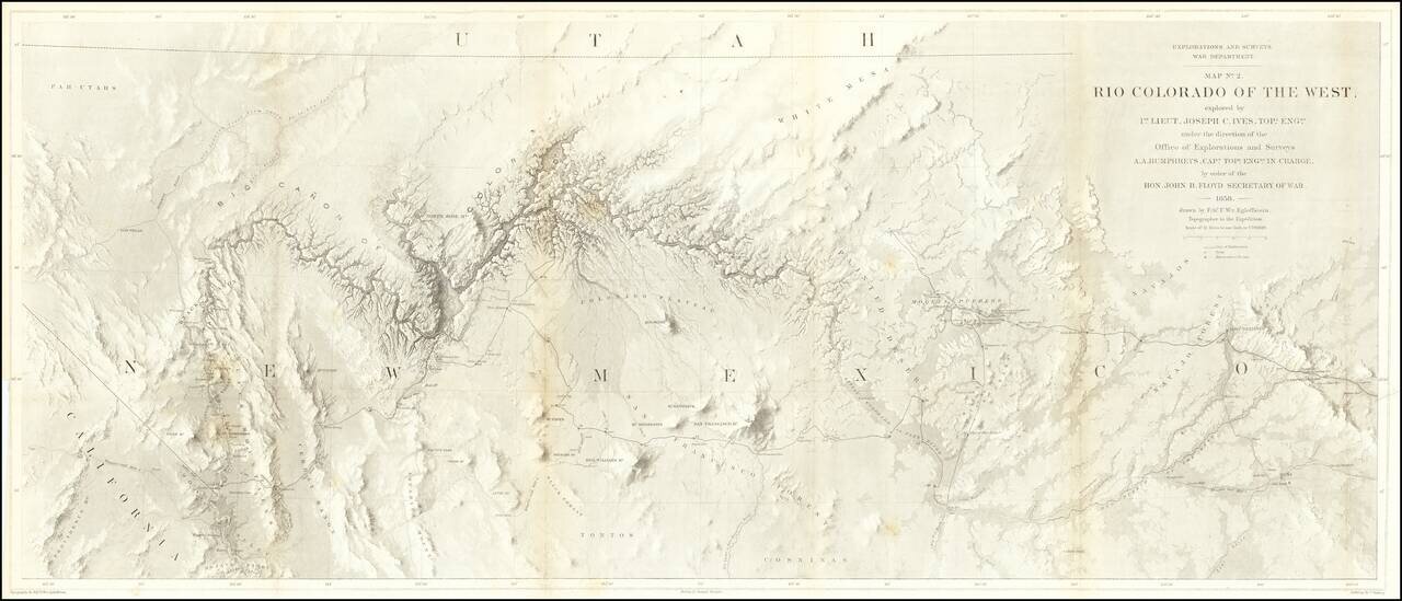
The Earliest Scientific Mapping of the Grand Canyon and Environs. This map is the centerpiece of one of the most important exploring efforts of the American Southwest. The map is one of three maps which accompanied the Report upon the Colorado River,...
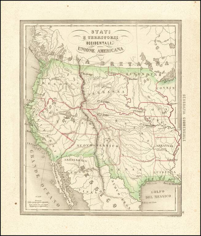
Rare and fascinating map of the Transmississippi West, from Marmocchi's Il Globo--Atlante di carte geografiche . . . , published in Genoa. The map is engraved by Bonatti in Turin. Despite the dating, the map show a pre-Gadsden Purchase border with...
![Map of the Great Salt Lake and Adjacent Country in the Territory of Utah [with] The Great Salt Lake (Mormon) City And Surrounding Country](/map/small/67084.jpg)
The Earliest Atlas Map To Focus on The Salt Lake City Region and Mormon Settlements Two excellent early regional maps of the Salt Lake area. The upper map extends a bit west of the Lake to the Uintas and South to Lake Utah, as well as considerably...
Fine large British sea chart of the Coast of California, improved to 1897, with small corrections to 1925. The chart tracks the coast of California, showing over over 30 light houses and lights, meticulous soundings and sailing directions. Early rail...
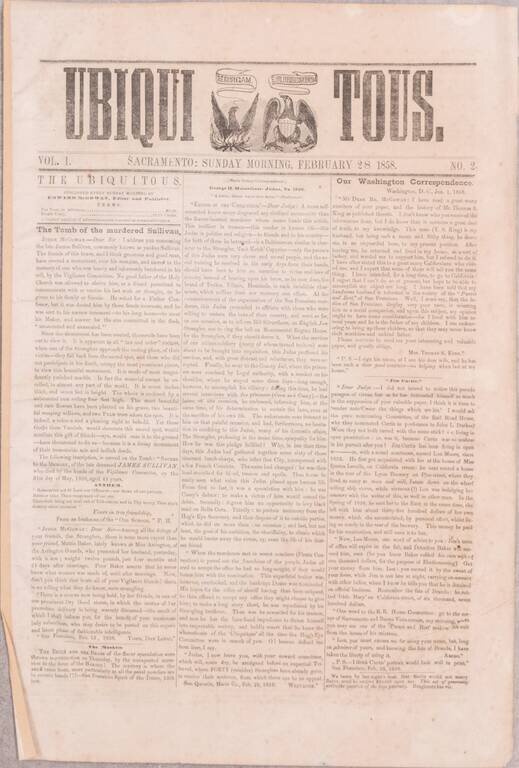
A Nearly-Complete Run of One of the Great Rarities of California Newspaper Collecting. Ned McGowan's Continued Response to the San Francisco Vigilance Committee. A substantially complete run of sixteen issues (numbers 2-11 and 13-18, of 18 total) of...

Rare map of the Northwest Passage, Northern Canada, part of Alaska (America Russa) and Greenland. The map is quite unusual, being one of the few maps to focus on the known islands of the Northwest Passage, including several partially known...
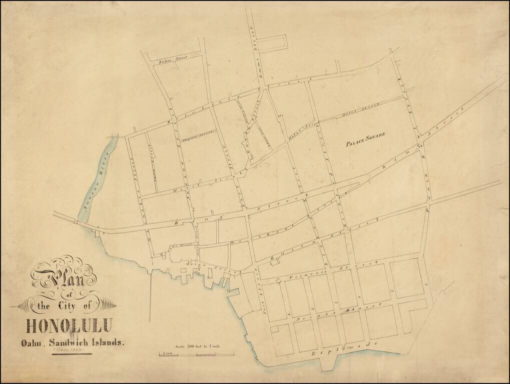
A Remarkable and Previously Unknown Early Manuscript Survey of Honolulu Highly important early manuscript map of Honolulu, Hawaii, likely dating from the late 1850s, and most likely the work of Hawaii's most important early surveyor William C....
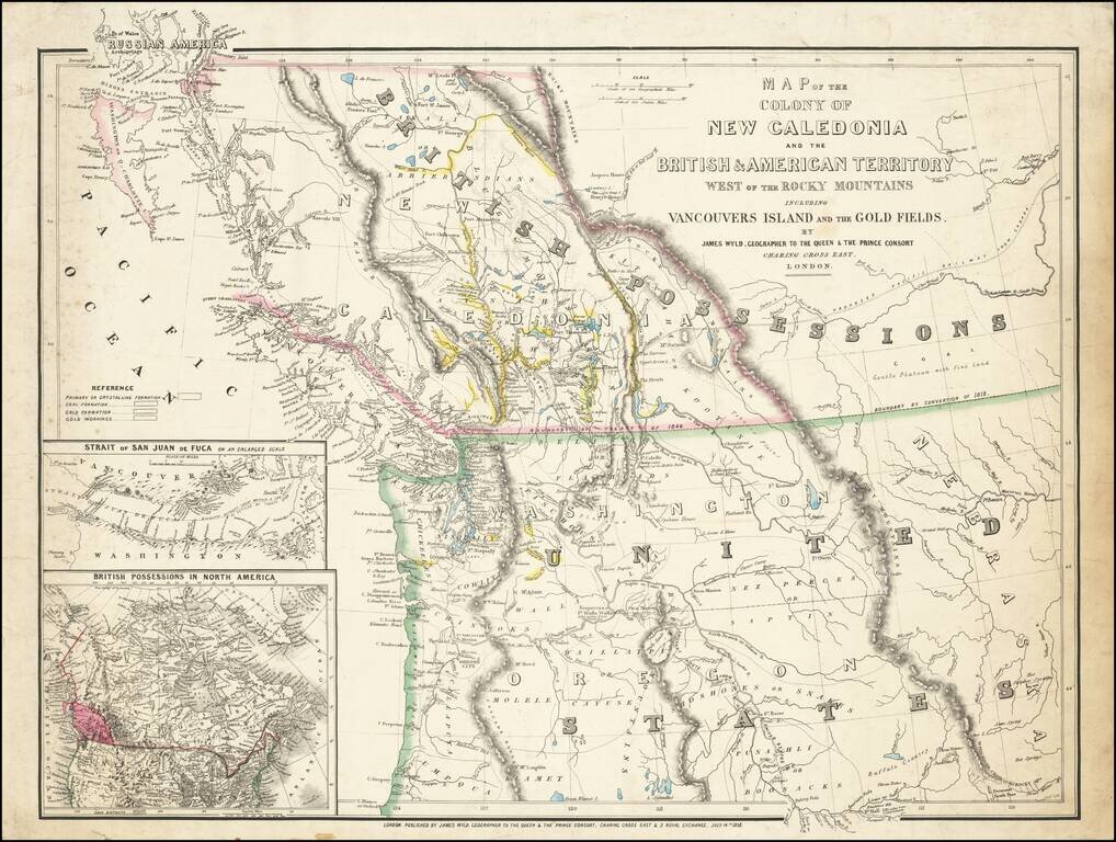
First State of this Exceptional Fraser Canyon Gold Rush Rarity One of the great early mappings of the Pacific Northwest, covering Oregon Territory, Washington Territory, and British Columbia (which was then still "New Caledonia") with information...
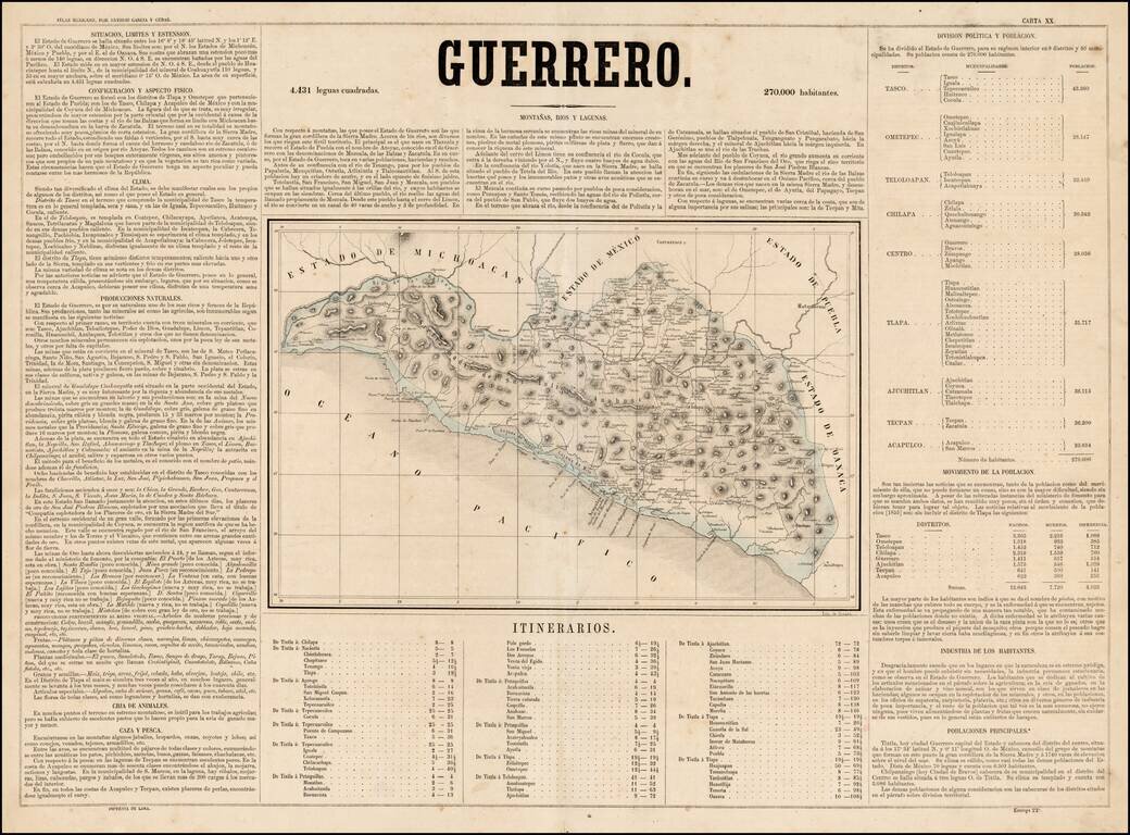
Scarce map of the State of Guerrero in Mexico, from Antonio Garcia y Cubas' monumental Atlas Geographico, Estadistico e Historico de la Republica Mexicana, the first atlas of the Mexican Republic. Garcia Cubas' map of Guerrero is one of the earliest...
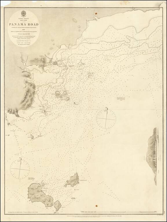
Detailed sea chart of the approaches to Panama City, published by the British Admiralty in 1858. The chart extends to Taboga Island and the smaller neighboring islands. Includes sailing directions, soundings, and some topographical features.
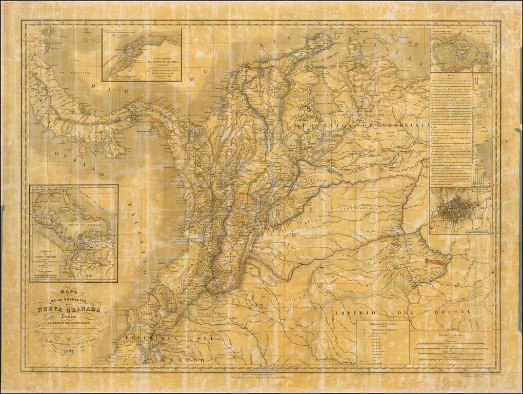
Quite Possibly The Only Official Map of the Confederation Granadine -- Originally Created By One Colombia's Most Important Historians and Scholars Second state of this rare wall map of the Republic of New Granada dedicated to the Baron de Humboldt,...
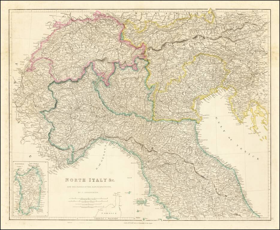
Detailed map of Northern Italy (including Switzerland and Austria, etc.), published in London by John Arrowsmith. The map appeared in Arrowsmith's London Atlas.
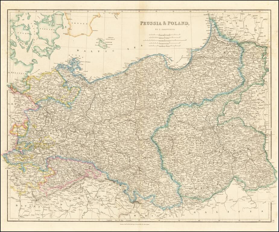
Striking map of the Kingdom of Poland, Prussia and the Baltic Region, published by John Arrowsmith. Highly detailed, showing towns, roads, rivers and other details, by John Arrowsmith, London's leading mapmaker of the period.
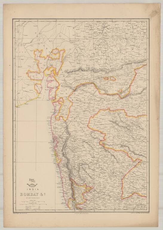
Highly detailed map of Bombay, from the Weekly Dispatch Atlas. 'The Weekly Dispatch' newspaper between the years 1856 and 1862, included in each edition, a map of a part of the world. During this period a total of 118 maps were issued. The maps bear...
![Asiatic Archipelago [Early Singapore Inset]](/map/small/64854.jpg)
Nice example of John Arrowsmith's map of the Asiatic Archipelago, including a large inset map of Singapore. Centered on the Philippines and Borneo, the map shows a number of different seasonal passages through the region to Hong Kong and Macao. The...
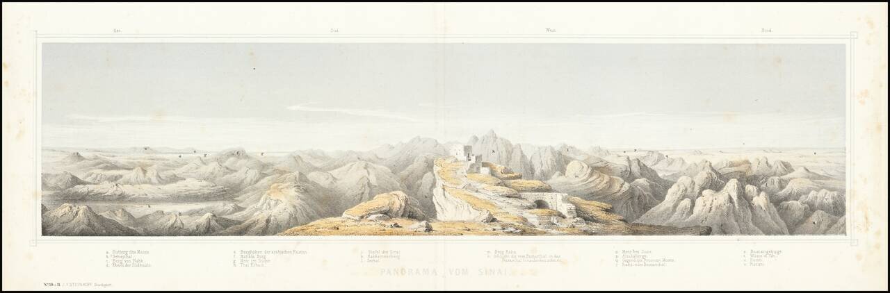
This is a nice panorama of Mt. Sinai, created by the German publisher J. F. Steinkopf. The view shows Mt. Sinai, one of the highest points in Egypt and an important religious site. Located in the southern Sinai peninsula, the mountain range is a...