Map size in jpg-format: 1.65566MiB
Click to open in high resolution (open in new tab).

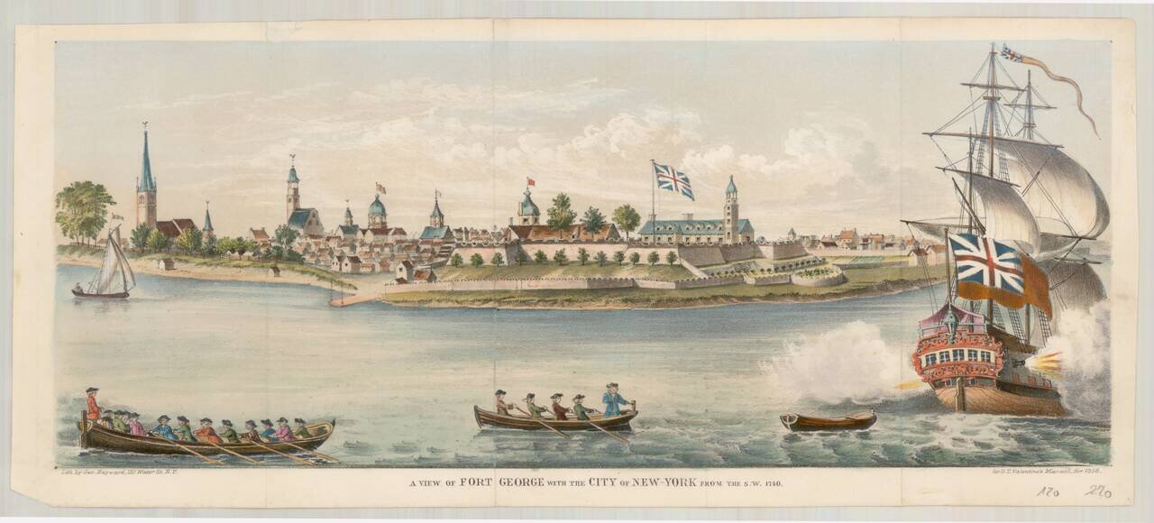
Fine mid-19th Century edition of this rare early view of Fort George, originally engraved by George Carwitham, circa 1736.
In 1624 the Dutch West India Company established the colony of New Netherland. It grew to encompass all of present-day New York City and parts of Long Island, Connecticut, and New Jersey.
The first Fort George was built on the strategic, fortifiable southern tip of the island of Manhattan by the Dutch in 1626, who named it Fort Amsterdam. It was charged to defend New Netherland by defending river access to the company's fur trade operations in the Hudson River. It remained a Dutch possession until September 1664, when it fell to the British Army, who occupied it as Fort James from 1664 to 1687. It was briefly re-occupied by the Dutch from 1673-1674, as Fort Willem Hendrick. It was later re-named Fort George. This view is of the configuration in 1740. The fort was destroyed in 1776 by the Americans and finally demolished in 1790. The site is now a museum and courthouse in Lower Manhattan.
The view was lithographed by George Hayward (fl. 1834-1872), who later moved to 171 Pearl Street.
Edited by David Thomas Valentine (1801-1869) in New York, 1858. The books were produced annually (28 Vols.) from 1841 to 1870, and are commonly referred to as Valentine's Manuals. They are officially titled Manual of the Corporation of the City of New York. Another title seen is Manual of the Common Council of the City of New York. They contain hundreds of maps, lithographs and woodcuts of New York City, often of sites demolished earlier such as this view of Fort George. They are illustrated histories of New York City. They are more than picture books; they also organize and present a governmental record of the Corporation of New York City, including lists of offices and office holders, election results, and financial summaries. In addition, they contain statistics such as those for social and religious institutions, banks, hospitals, and schools.
If you are a student, write to us in telegram: @antiquemaps and indicate what material you need and for what work you need a map in high detail. We are ready to provide material on special terms. For students only!

![[Charles Lindbergh] Spirit of St. Louis](/map/small/69234.jpg)
![[Charles Lindbergh / New York to Paris View] Spirit of St. Louis](/map/small/69235.jpg)