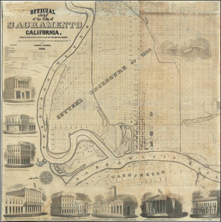
A Remarkable Survival Very rare wall map of Sacramento, oriented with east at the top of the map, showing the city at the height of the Gold Rush boom, drawn b y J.H. Peirce and lithographed by B.F. Butler. Originally printed on 8 sheets, the map...
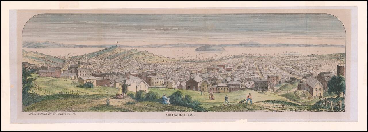
Rare Early Lettersheet View of San Francisco Panoramic view from Pacific Heights of densely populated city and harbor; Telegraph Hill and Russian Hill at left; Yerba Buena Island and bay in distance; artist sketching, onlookers and workers in...
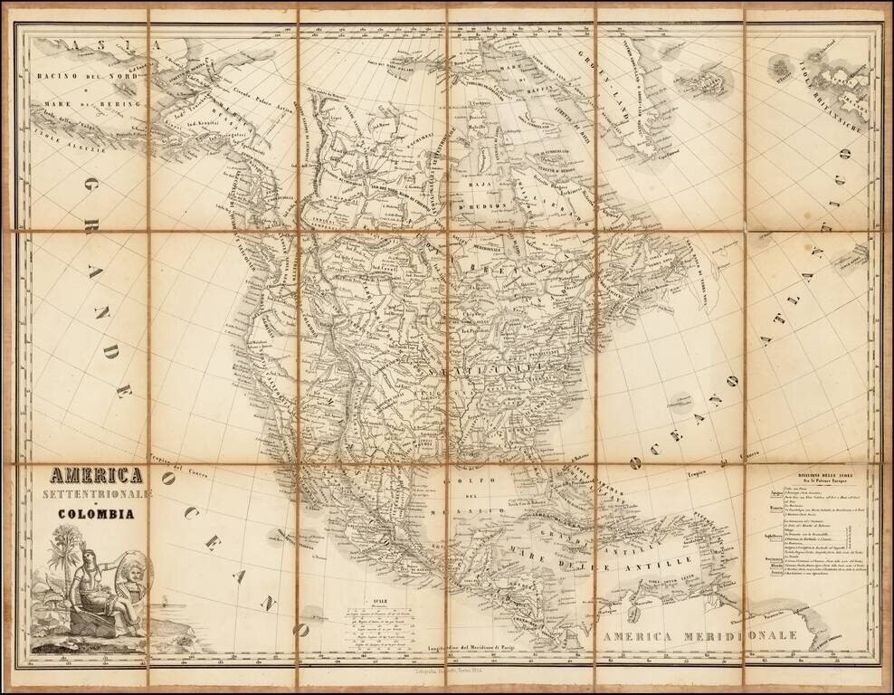
Rare lithographic edition of this fine decorative map of North America, originally published jointly by Maggi in Torino and Stucchi in Milan. The present edition was re-issued as a lithograph in Torino by Fedratti in 1854, without any obvious changes...
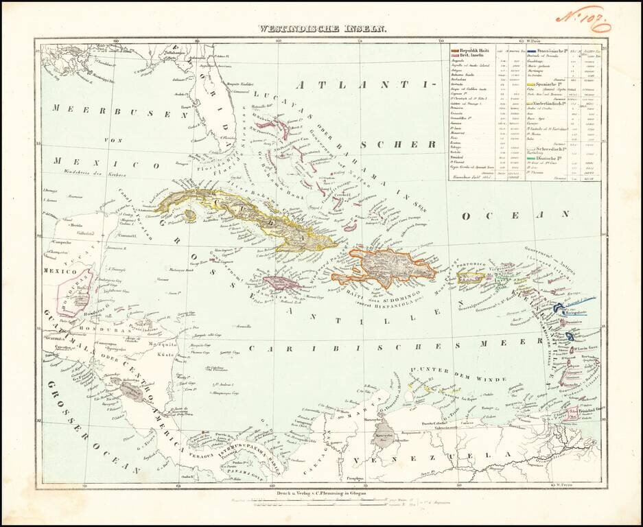
Detailed map of the Caribbean, from Florida to the cCoast of Venezuela and the Yucatan. Includes a key identifying populations, sizes and colonial possessions.
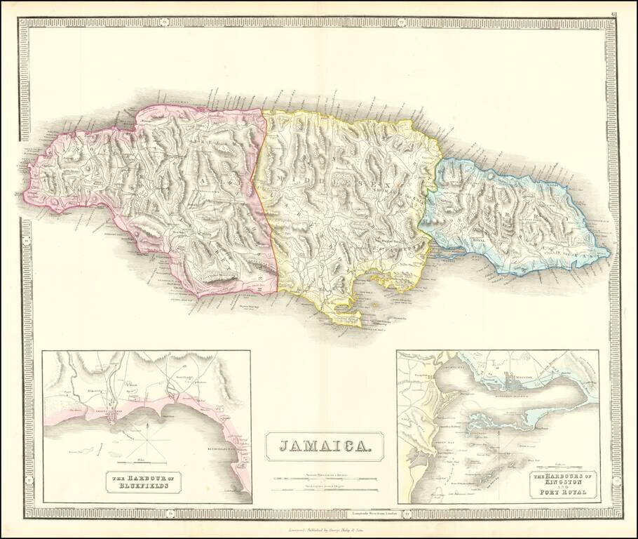
Detailed map of Jamaica, based upon Thomson's map of 1815. Includes large insets of the Harbors of Kingston and Port Royal and of Bluefields. Gorgeous topographical details. One of the best large format English maps of the period.
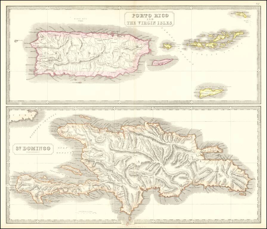
Scarce pair of maps of the Virgin Islands, Puerto Rico and Hispaniola. The top map extends to St. Croix, Anegada and Virgin Gorda.
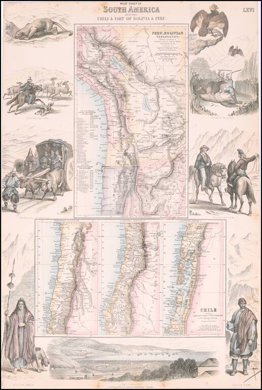
Decorative regional map of South America, which consists of 4 maps (the upper map showing Peru and the Bolivian Table Lands and the lower 3 maps showing Chile, each in excellent detail). Includes a birdseye view of Valparaiso at the bottom and...
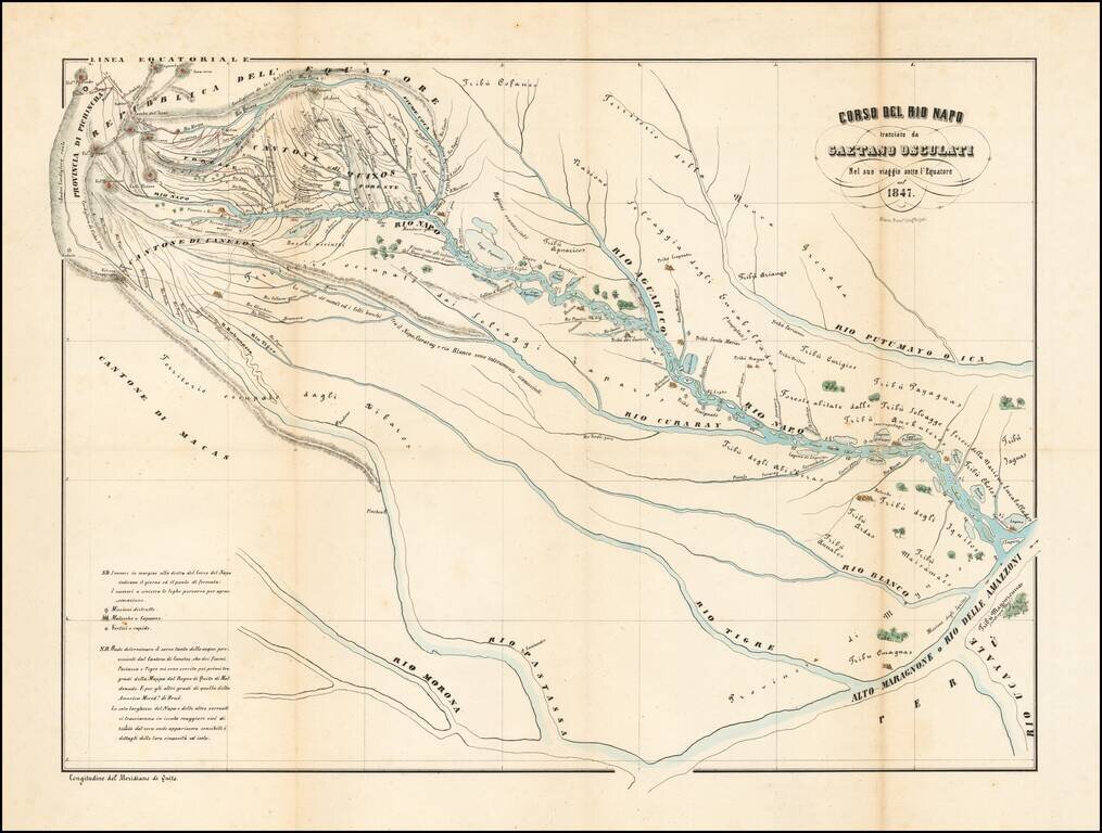
The Rio Napo and Tributaries Detailed map centered on the Rio Napo and its Tributaries, illustrating the travel of the Italian Naturalist Gaetano Osculati. The map extends from Quito in the northwest to the Upper Marangnoni and the confluence of the...
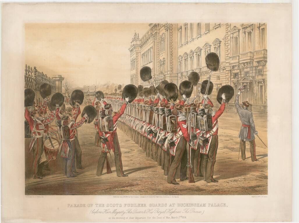
Decorative view of the parade of the Scots Fusileer Guards, prior to their departure for the Crimean War. First established in 1805, the Scots Fusileer Guards were deployed in the Napoleonic Wars and later in the Crimean War. In 1854, the Crimean War...
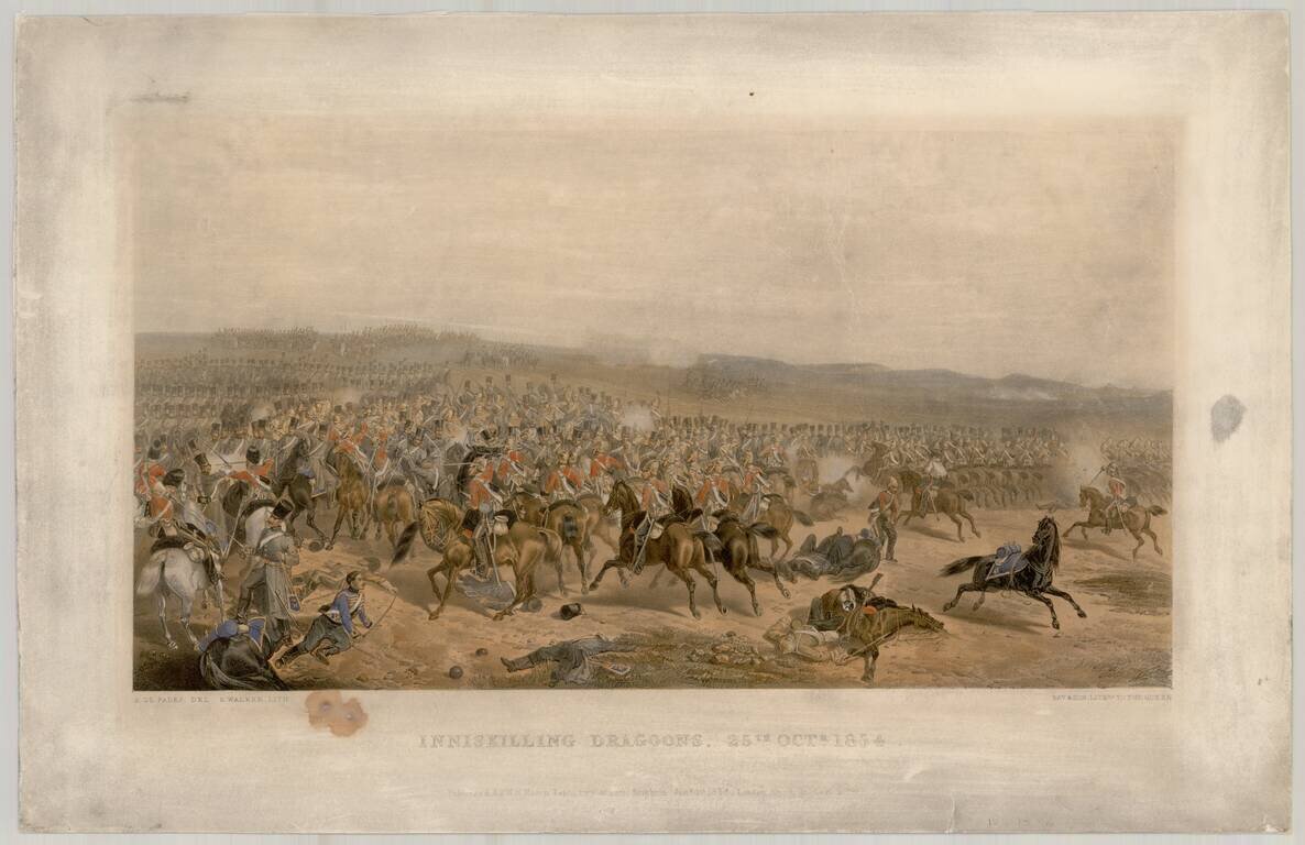
View showing the Inniskilling Dragoons during the Battle of Balaclava. The 6th (Inniskilling) Dragoons was a cavalry regiment in the British Army, first raised in 1689. It saw service for three centuries, before being amalgamated into the 5th/6th...
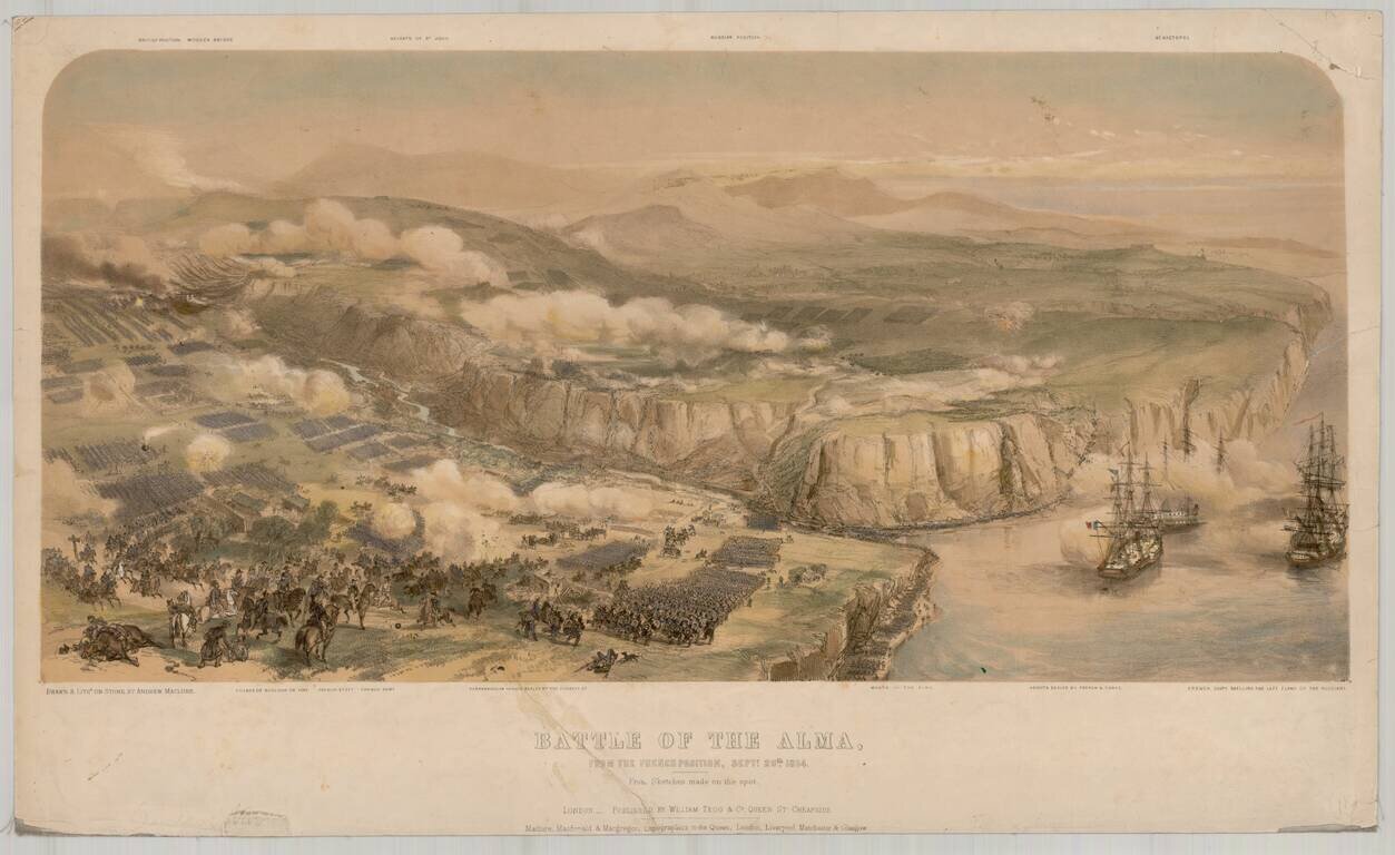
Fine view of the battle of Alma, lithographed by Andrew Maclure from contemporary drawings. The Battle of Alma (September 20, 1854) is generally considered the first battle of the Crimean War. An Anglo-French force under Jacques Leroy de Saint Arnaud...
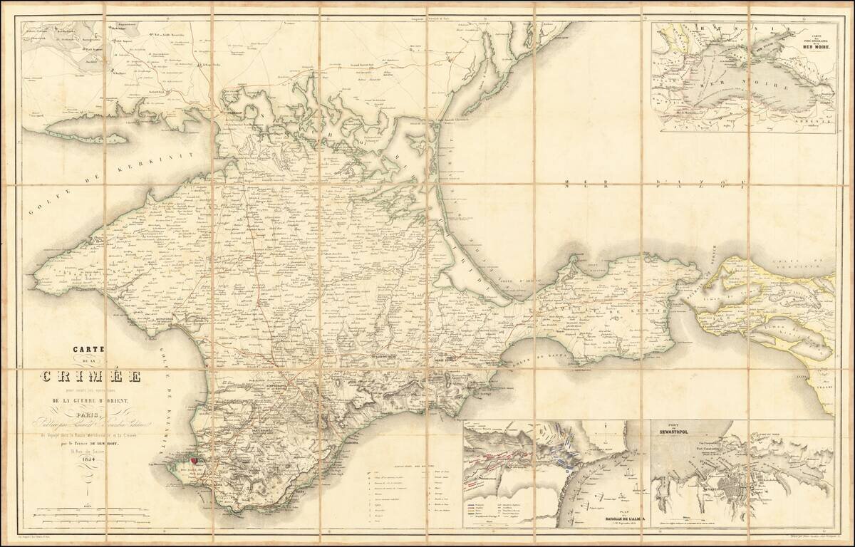
Large map showing the Crimea region, published to follow the Crimean war, published by Ernest Bourdin in Voyagé dans la Russie Méridionale et la Crimée, par le Prince de Deminoff. The map includes Post Roads, Great Roads, Railroads, etc. Includes...
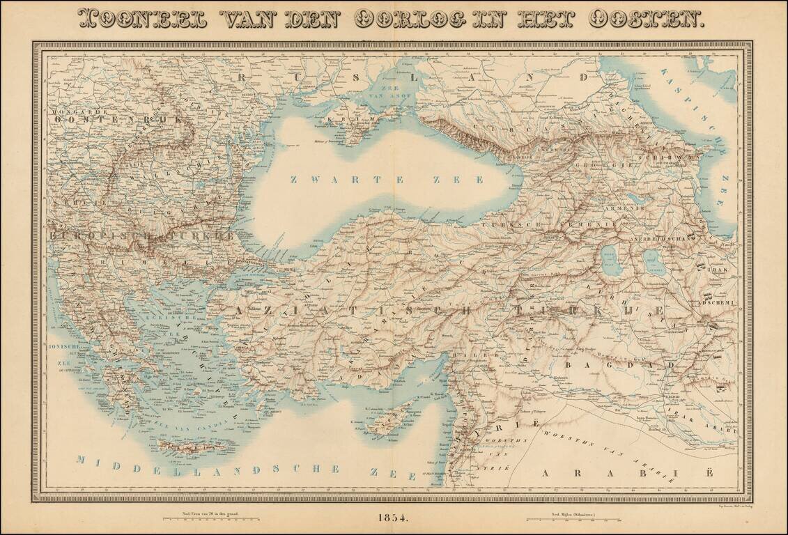
Rare large format map of the region between Greece and Hungary in the west and Iraq and the Caspian Sea in the east, centered on Turkey. The map shows rivers, roads, topographical and other features. This is the first time we have seen the map.
![[Illustration of the Dutch Ship] [Ransen no zo]](/map/small/55547.jpg)
Popular Japanese Conception of Foreign Naval Power During the Post-Commodore Perry Era. Woodcut kawaraban featuring a handsome illustration of an elaborate Dutch paddle steamer. The text on the upper right indicates distances from Nagasaki to such...
![[On North America. On Europe: Russian Empire, England, and France] [Kita-Amerika no bu. Yoroppa no bu: Teikoku Roshia, lgirisu, Furansu].](/map/small/55549.jpg)
The People in the United States are Brave and Have a Fondness for Learning. Kawraban woodblock sheet of text divided into four bands, each band containing a short description of the United States, the Russian Empire, England, and France respectively....
![[Officials Assigned to Defence Duty along the Shore in Nagasaki] [Nagasaki kaigan okatame oyakunin]](/map/small/55552.jpg)
Woodblock kawaraban plan of Nagasaki Bay. The fan-shaped area in the middle of the image is Dejima where the Dutch were allowed to live and trade with the Japanese authorities. The square land on the left of Dejima is the Chinese quarter with the...