![[Lower California]](/map/small/25667.jpg)
Early map of Baja California, printed in connection with an early Government exploration of the region.
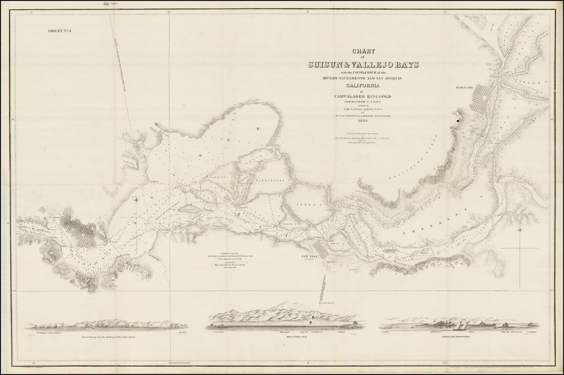
The Earliest Map of the Lower Sacramento River and San Joaquin River (Sacramento Delta) One of the earliest obtainable privately issued California charts, tracking the lower Sacramento and San Joaquin Rivers as they leave the Gold Regions of...
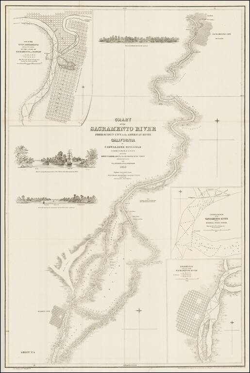
Fine example of Ringgold's map of the Sacramento River, from Suisun City and Brannan Island in the South, to Sacramento City, Boston and the American River. The map includes 3 profile views from the Sacramento River, each showing large sailing vessels...
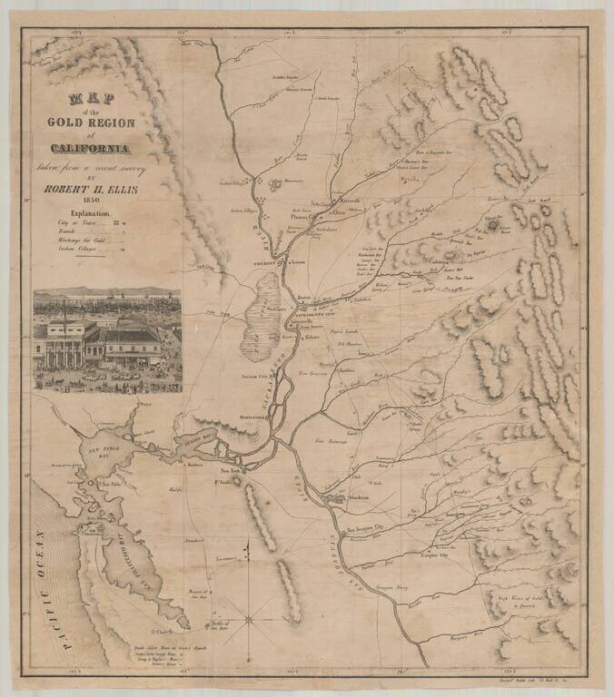
Rare Annotated California Gold Regions Map, with a Vignette of Portsmouth Square in San Francisco, Annotated to Show The Earliest Gold Discoveries in Plumas County. Fine early map of the gold regions of California, lithographed by George F. Nesbitt,...
![Map of the Mining District of California by Wm. A. Jackson. [Proof State]](/map/small/44905.jpg)
Proof State of the First Edition of William Jackson's Map of the Gold Regions of California. The second recorded surviving example of William A. Jackson's seminal 1850 map of the California Gold Region, noted by Gary Kurutz as "as one of the best to...
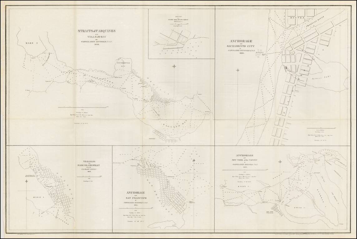
Nice example of Ringgold's chart of harbors and anchorages from San Francisco to Sacramento. The chart shows the primary anchorages in San Francisco Bay and environs at the outset of the 1849 California Gold Rush. Cadwalader Ringgold was a US Navy...
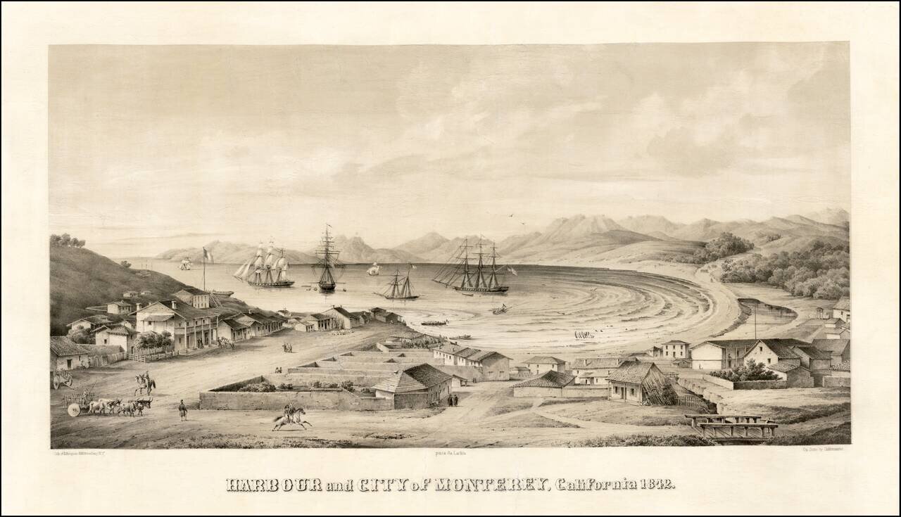
Monterey -- Mexican Capital of Alta California Nice example of one of the earliest bird's-eye views of California, published by Charles Gildemeister, and printed by D'Avignon in New York, for Thomas O. Larkin. The view depicts Monterey at the height...

Rare map showing the Northwest Passage, via the Bering Straits, with a fantastic early depiction of Alaska (then Russian America) and contiguous parts of Canada. Philip's map highlights the discoveries of Franklin and Richardson in the Arctic Sea...
![[Hand Drawn Map of the Hawaiian Islands]](/map/small/62429.jpg)
Early Manuscript Chart of Hawai’i/Sandwich Islands with Ships’ Track Finely executed chart of the Hawai’ian Islands, drawn from contemporary sources, including the first Admiralty chart of the archipelago. Although intended as a nautical...
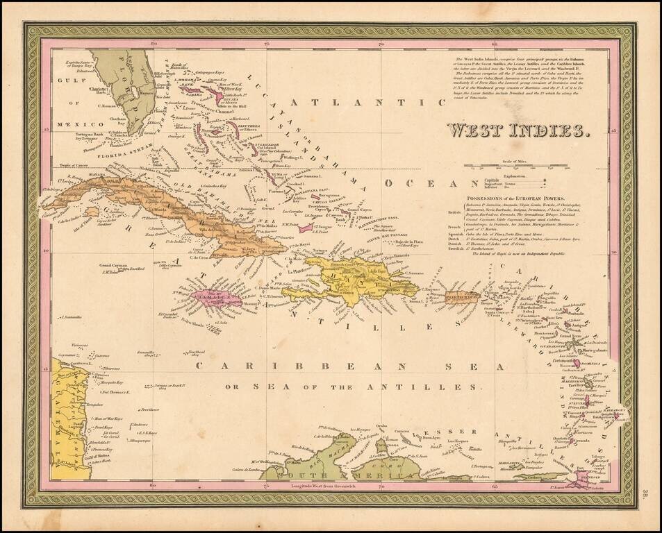
Detailed and attactive map of the southern portion of Florida and the Caribbean, from the Universal Atlas. The map shows the various European Powers possessions, including Spanish, British, French, Dutch, Danish and Swedish, along with substantial...
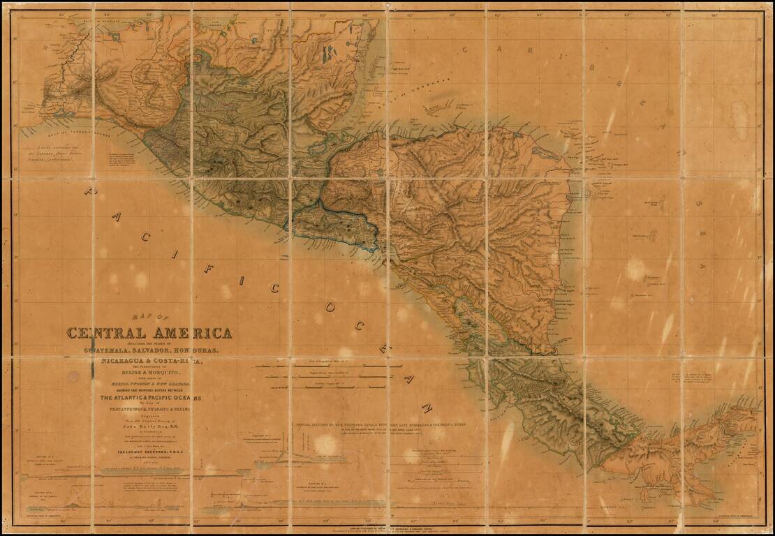
Unique annotated example of this finely detailed map of Central America, prepared by John Baily, who served as a surveyor of Nicaragua and was an early proponent of a canal across Central America, published in London by Trelawney Saunders. The present...
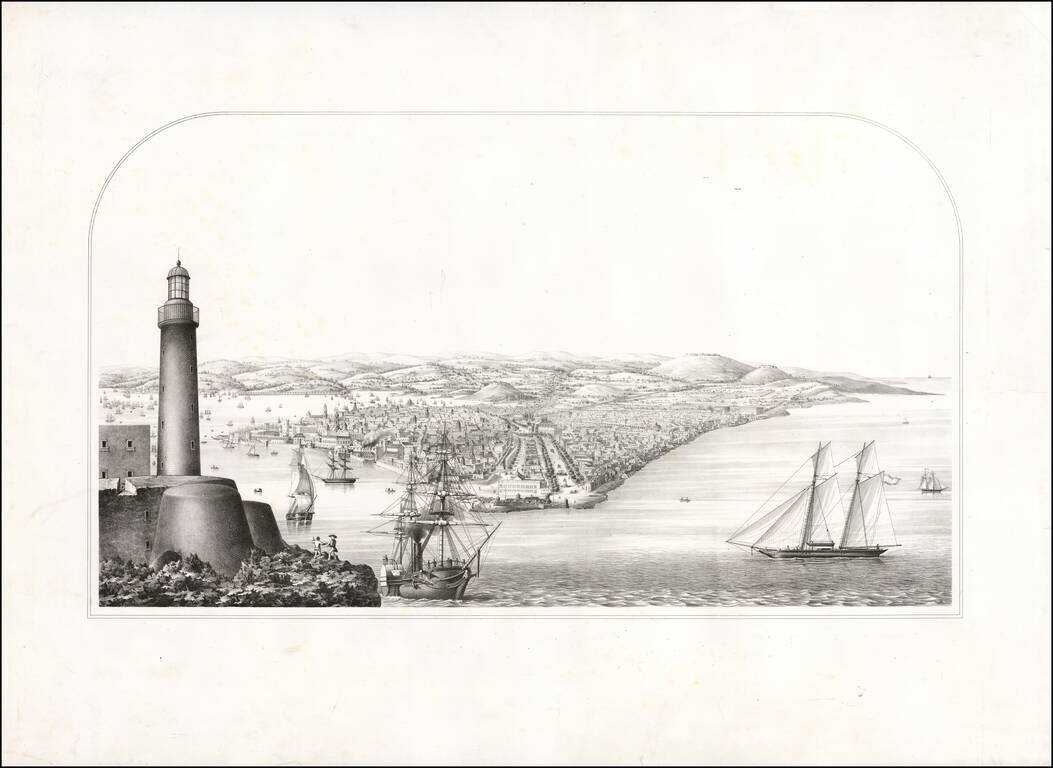
Proof state of a rare view of Havana. The view was acquired in group of other items, most of which related to Rafael Rodriguez, whose most famous work is a Cuban Atlas described by Emilio Cueto as follows: 528. Rodriguez Rodriguez, Rafael Ρίο...
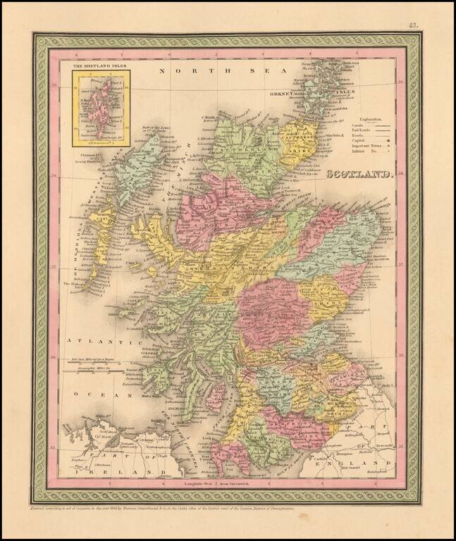
Detailed and interesting map of Scotland, hand colored by county and showing towns, rivers, lakes, railroads, roads, etc. Inset of the Shetland Islands. A decorative interesting map.
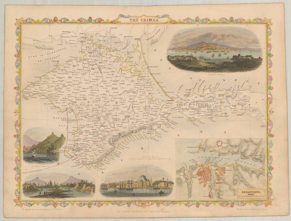
Nice full color example of Rapkin' map of The Crimea, in the style of the maps of John Tallis Vignettes includes Sebastopol (2), Balaklava Harbor, Bank of the Alma River and Eupatoria.
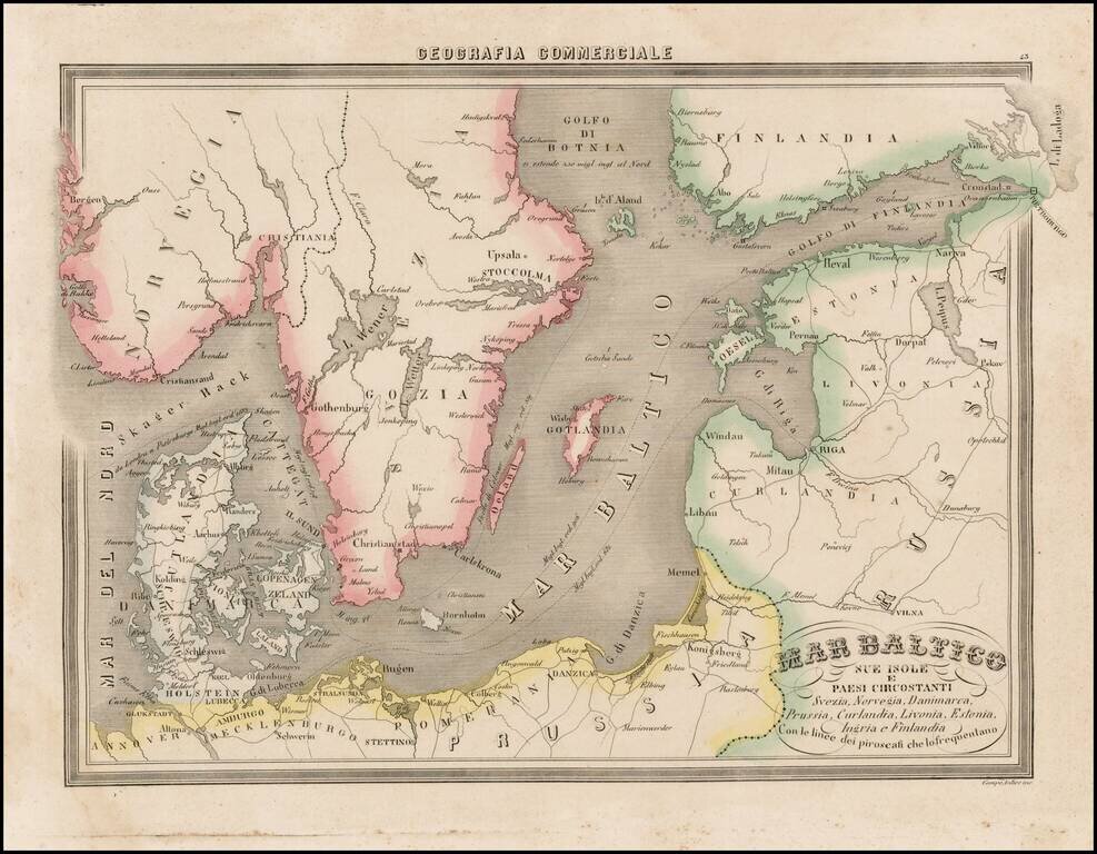
Fascinating map of the Baltic region and Scandinavia, focusing on the topographcal features, from Marmocchi's scarce Geografia Commerciale. A very unique map. The second time we have seen this map on the market.