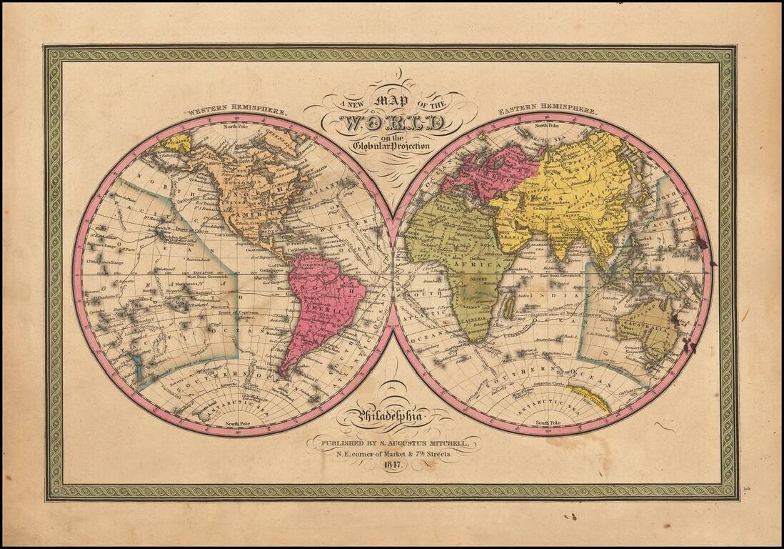
Attractive double hemisphere map of the world with decorative borders. Attractive example with wide margins. The Antarctic regions are just now being discovered. Includes the routes of Captain Cook, Captain Gore and the United States Exploring Expedition.
![Map of the World on Mercator's Projection Published By T & E. H. Ensign. . . . 1846 [Flag of Republic of Texas]](/map/small/68426.jpg)
Flag of the Republic of Texas! Striking map of the World on Mercator's Projection, published by Ensign in New York. The map is ringed with flags of the World, including the flag of the Republic of Texas, American Jack and American Commodore. The...
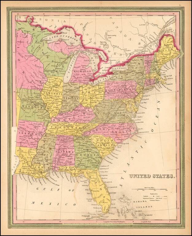
Fine example of Mitchell's scarce 1846 map of the US, including massive and curiously colored Wisconsin and oddly shaped Michigan. Shows towns, roads, rivers, lakes, forts, etc. Nice ephemeral treatment of the Northwest, immediately before the...
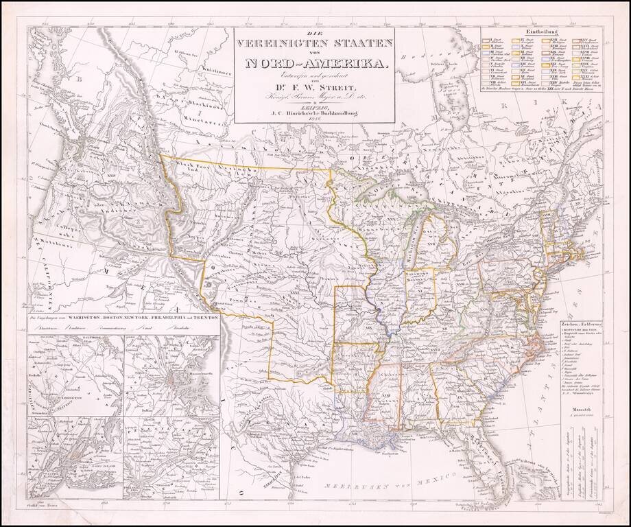
Rare late edition of Streit's fascinating map of the United States with inset maps of the region around Washington DC, Boston, Philadelphia and New York. Very nice detail along the Upper Missouri River and in Oregon Territory. The west is configured...
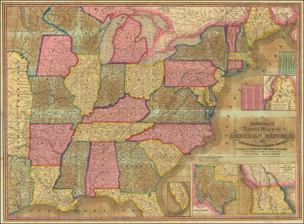
Including Unusual Territorial Representations of Iowa and Wisconsin / New State of Texas / Upper California Good example of Mitchell's most popular map of the United States of the period. The map extends west to Texas, Indian Territory and a...
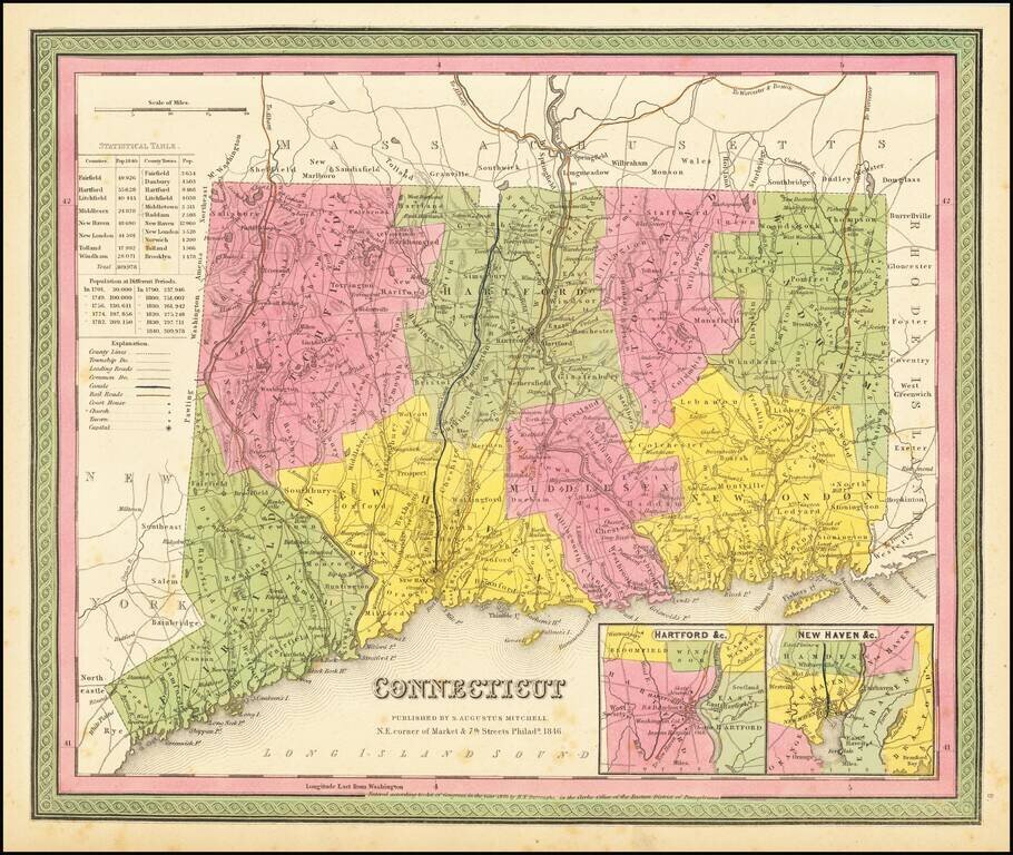
Detailed map of Connecticut from Mitchell's New Universal Atlas, showing early railroads, townships, canals, etc. Hand colored by county. Insets of Hartford and New Haven. Statistical Table shows county populations. Mitchell's pre-1850 maps are...
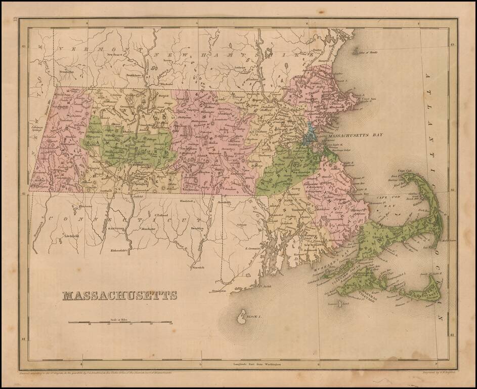
Interesting and detailed map of Massachusetts, from an early edition of Bradford's Comprehensive Atlas. The map is colored by counties and shows towns, rivers, lakes, bays, harbors, islands and other important places. Bradford's Comprehensive Atlas...
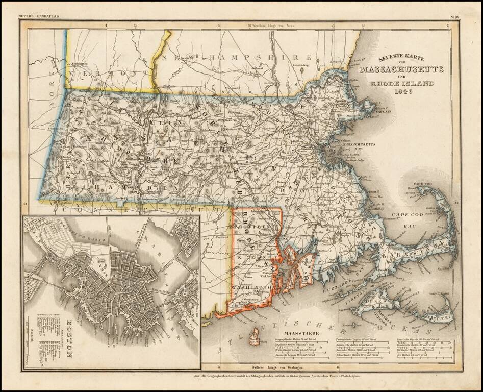
Scarce German map of Massachusetts & Rhode Island, etc. Elegantly engraved & detailed map of Massachusetts and Rhode Island, with a large inset plan of Boston, based upon Tanner's work in the early 1840's. Shows counties, towns, roads,...
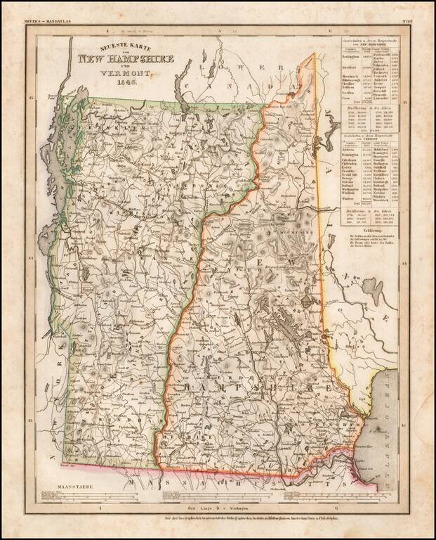
Elegantly engraved & detailed map, taken based upon Tanner's work in the early 1840s. Shows counties, towns, roads, rivers etc.
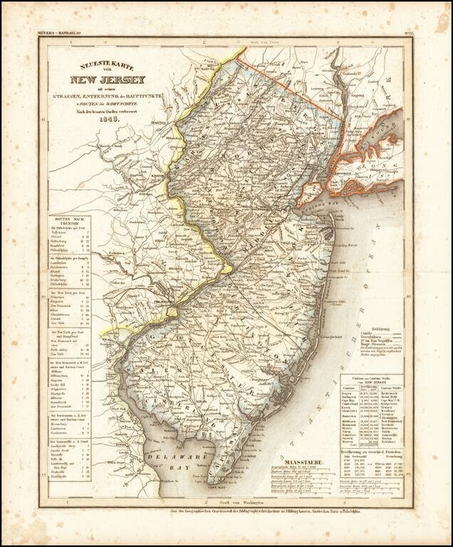
An elegantly engraved and highly detailed map of New Jersey, based upon Tanner's work in the early 1840s. Shows counties, towns, roads, canals, lakes, etc.
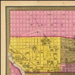
Detailed and interesting map of Philadelphia, published by SA Mitchell in 1846 and engraved by Burroughs. The map is hand colored apparently by Wards, although curiously so. Includes an index of public buildings, hotels, churches (including a Jewish...
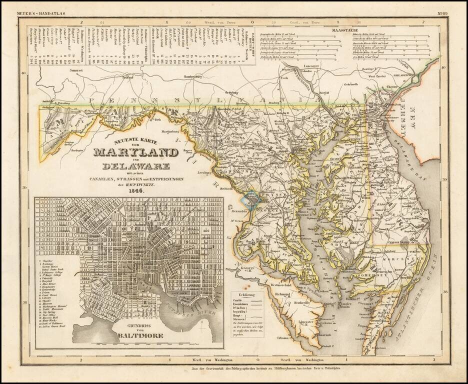
An elegantly engraved and highly detailed map of Maryland and Delaware, with a large inset plan of Baltimore. The map is based upon Tanner's work in the early 1840s. Shows counties, towns, roads, canals, lakes, etc. While often referred to as the...
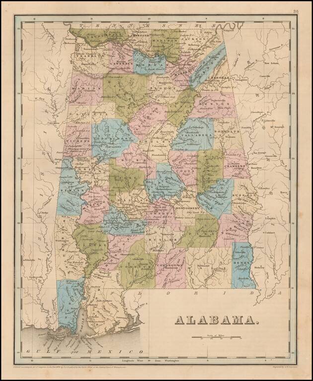
Nice example of Bradford's early map of Alabama. The map is hand colored by counties and shows very early railroads, towns, rivers, forts, post offices and other details. The second edition can be distiguished easily from the first edition by the use...
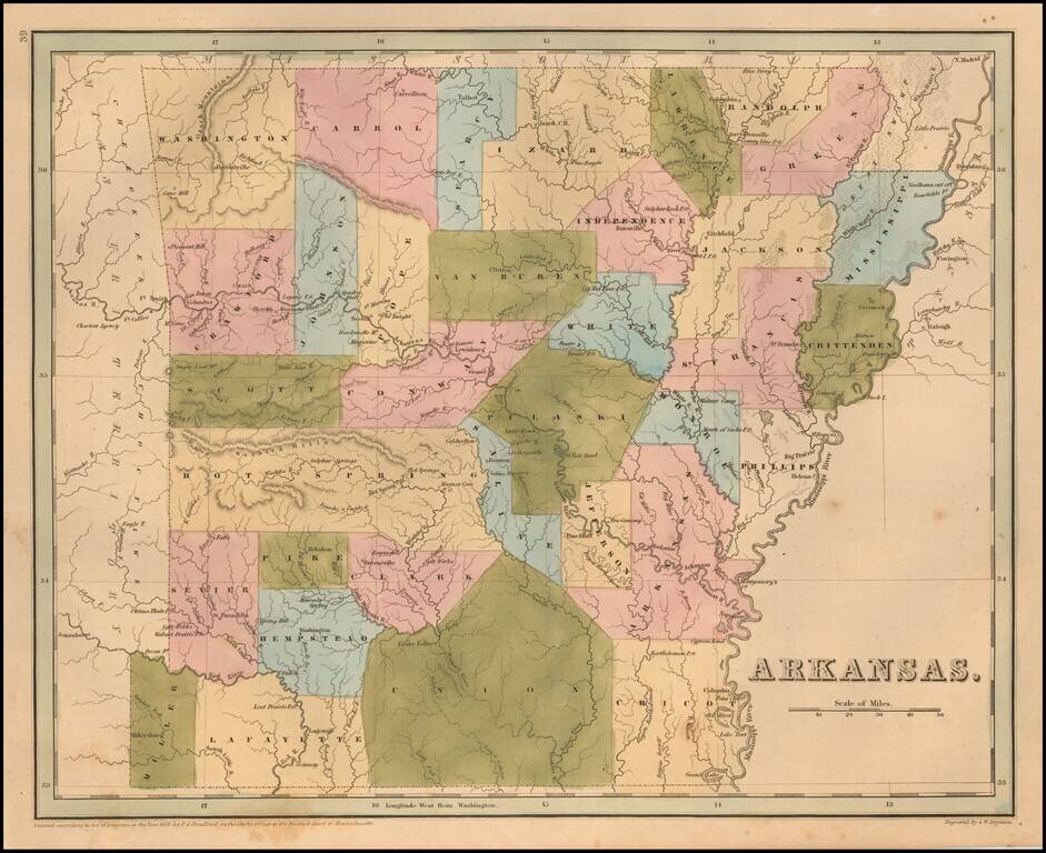
Rare late edition of Bradford's map of Arkansas. The map is hand colored by counties and shows very early railroads, towns, rivers, forts, post offices and other details. Bradford's atlas was a departure from other atlases of the period. Along with...
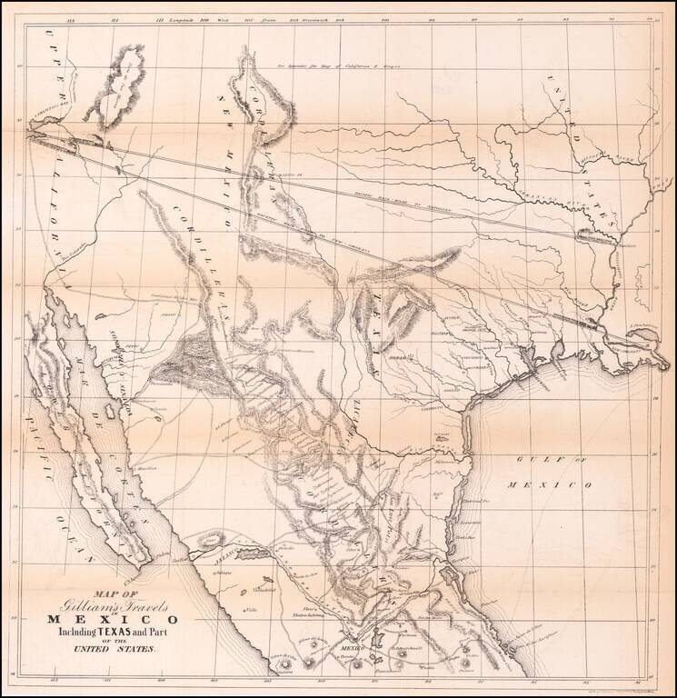
Transcontinental Railroad Routes To San Francisco in 1846! Scarce map of Texas, Upper California, Mexico and the Southwestern United States, prepared for Gilliam's Travels over the Table Lands and Cordilleras of Mexico during the Years 1843 and 44....

A German Map of the Republic of Texas Detailed map of the Republic of Texas at the start of the Mexican War. The massive stovepipe configuration is shown here, extending to Wyoming in the north, the Rio Grande in the west and the Red River and...