
Including Manuscript Additions of the Overland Route To California and Other Important Points. Nice example of Mitchell's seminal map of Texas, Oregon, Upper California, Missouri Territory and a massive Indian Territory (covering most of Kansas and...
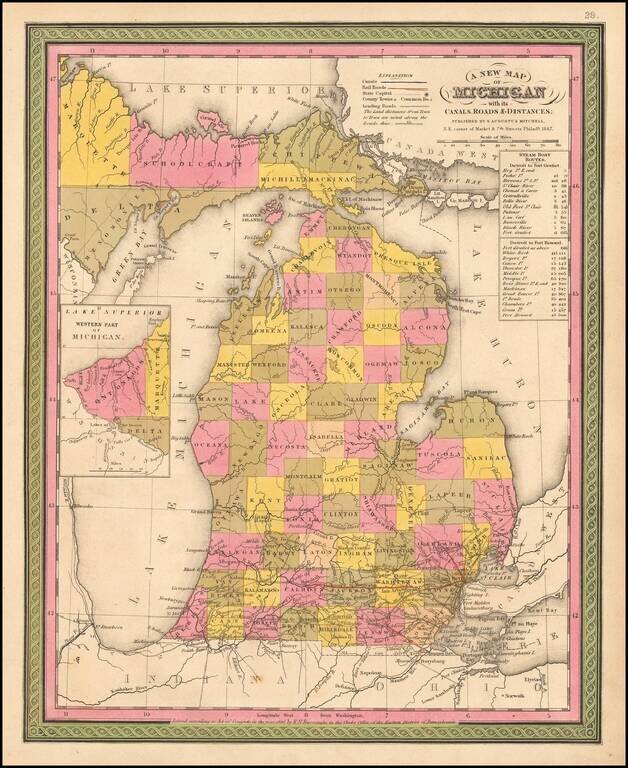
Detailed and interesting map of Michigan from Mitchell's New Universal Atlas. It is hand colored by counties and contains towns, rivers, canals, railroads, roads, etc. Inset shows the Western Part of Michigan. Statistical Table shows steam boat routes....
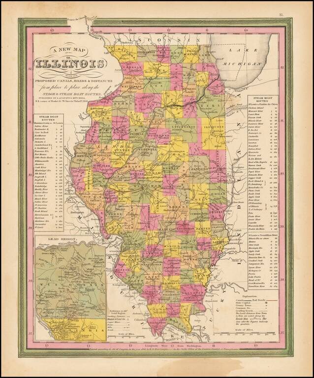
Interesting detailed map of Illinois with an inset of the Lead Region showing Northwestern Illinois and Southwestern Wisconsin. Shows canals, rivers, towns, roads etc. Counties are hand colored. Statistical tables show steam boat routes. Very good...
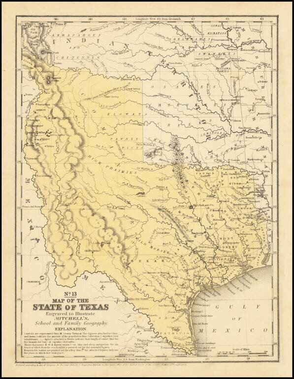
An interesting map of Texas published the year after the state's admission to the Union. In the North, several Indian Districts are shown, including the Comanches, Kiowas and Pawnee-Picts. A region named Wild Horses is shown, this nomenclature derives...
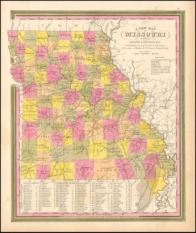
Detailed and interesting map from Mitchell's New Universal Atlas. Hand colored by county and showing towns, rivers, lakes, railroads, roads, etc. Table of Steam Boat routes and distances. Nice wide margins. Mitchell's pre-1850 maps are becoming...
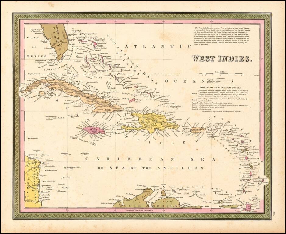
Nice example of Mitchell's map of the West Indies from an early edition of Mitchell's New Universal Atlas.
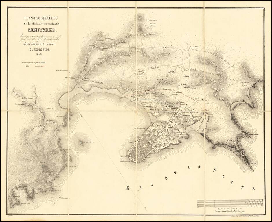
Rare early plan of Montevideo, in the midst of the Great Siege of Montevideo between 1843 and 1851, during the Uruguayan Civil War. The map illustrates in Red and Blue the lines of the enemy (red) and defensive forces (blue) protecting the city in...
![[European Russia] Гидрографическая Карта Европейской Россіи. Составлена Департаментом Проэентовъ И Смѣтъ Главнаго Управления Путей Сообщения и Публичныхъ Зданій | Hydrographical Chart of European Russia Compiled by the Project and Estimate Department of](/map/small/61005.jpg)
An Empire Connected by Rivers. Large-format Russian-language map of European Russia, focusing on the ever-expanding project to connect all of European Russia through its navigable rivers and canals. From the 18th to the 20th centuries, the primary...
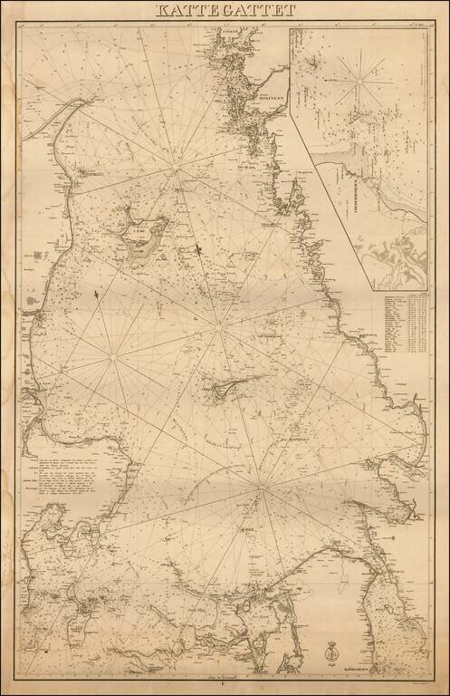
Extremely rare first edition of this separately issued Danish sea chart of Kattegat Sea, published by the Kongelige Danske Sokort Archiv (Royal Danish Nautical Chart Archive). Includes a large inset of the area around the Danish town of...
![Asia [with large inset of Australia]](/map/small/67619.jpg)
Detailed map of Asia, including part of Polynesia and a large inset of Australia. Includes color key noting the colonial possessions of Britain, France, Spain, Portugal, Holland and independent islands. Decorative border. An excellent map from the...
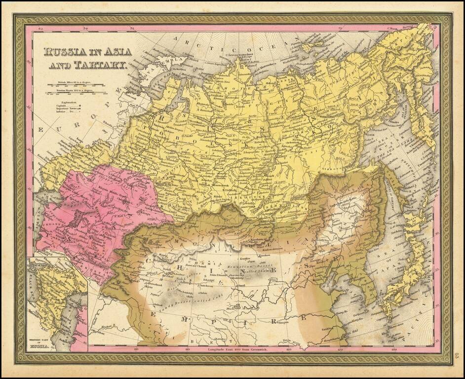
Detailed map of Russia, Tartaria and China, extending to Corea and Japan. Decorative border. An excellent map from the leading American mapmaker of the mid-19th Century.
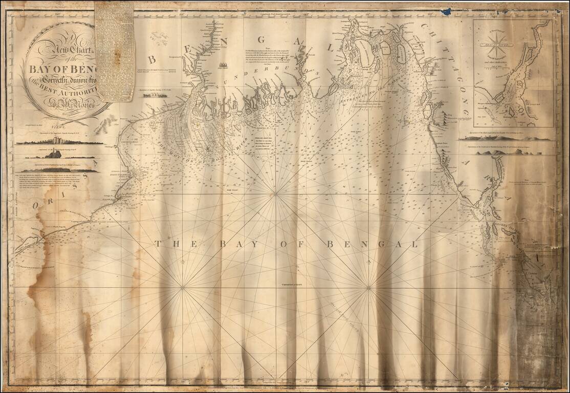
Detailed sea chart of the Gulf of Bengal, from Chatrapur to Ramree Island in Myanmar, published by Norie. Includes a number of profile views, including: Jaggernaut Pagoda Black Pagoda Point Palmiras Ingellee Culpe Marks High Land behind...
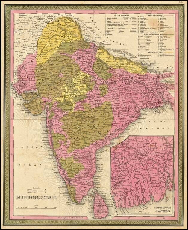
Detailed map of India and Ceylon, extending to the Himalayas. Shows towns, islands, rivers, mountains, gulfs, bays, etc. Large inset of the Delta of the Ganges. Tables show British, French, Portuguese and Danish Possessions and Independent States....
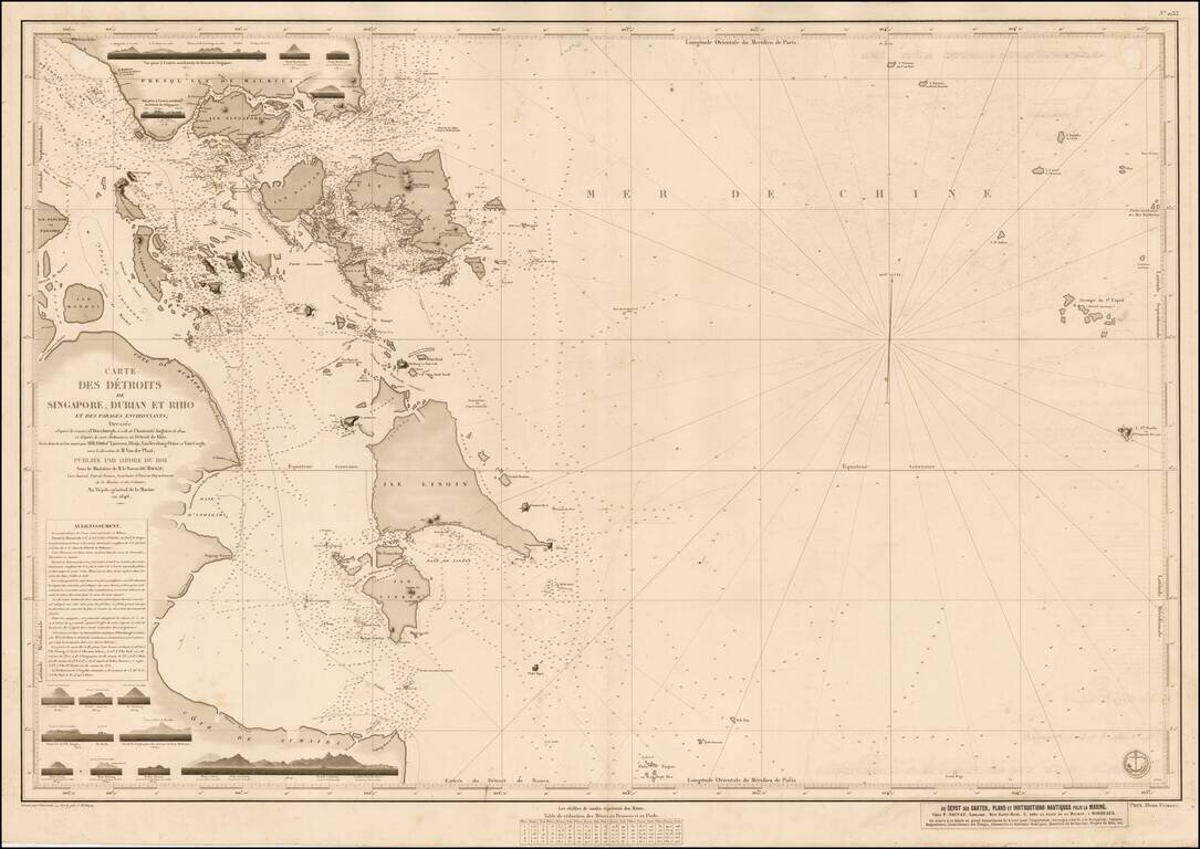
Second state of this rare sea chart of the Singapore Straits and environs, published by the Depot de la Marine. The map is one of several charts prepared in the mid-1840s by Urban Dortet de Tessan, for the Depot de la Marine, utilizing contemporary...
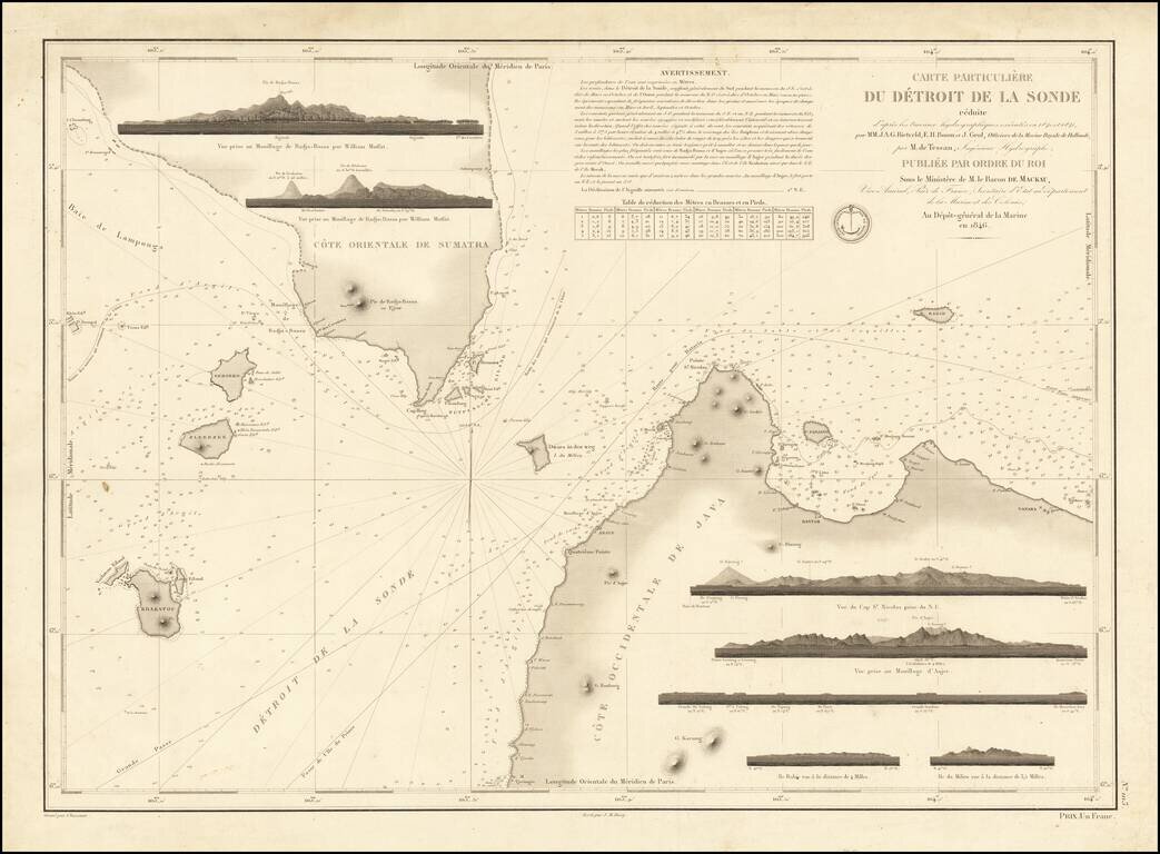
Fine early sea chart of the strait between Java and Sumatra, published by the Depot De La Marine in 1846. The chart includes 7 recognition profile views, soundings, sailing directions, and other important details. The routes to Batavia and China...
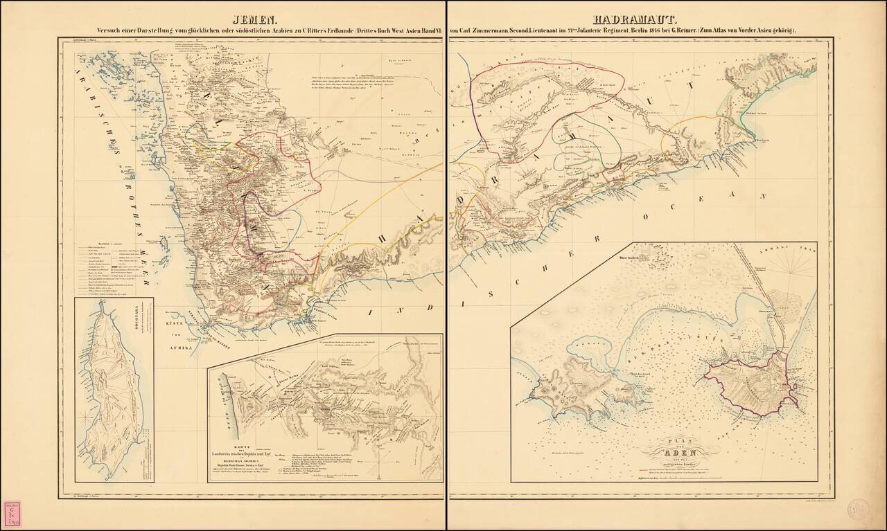
Fine large format map of the southern portion of the Arabian Peninsula. Includes a large inset plan of Aden, and smaller inset maps of the island of Socotara and a smaller map of the routes to Mecca. Illustrates the indigenous peoples, towns,...