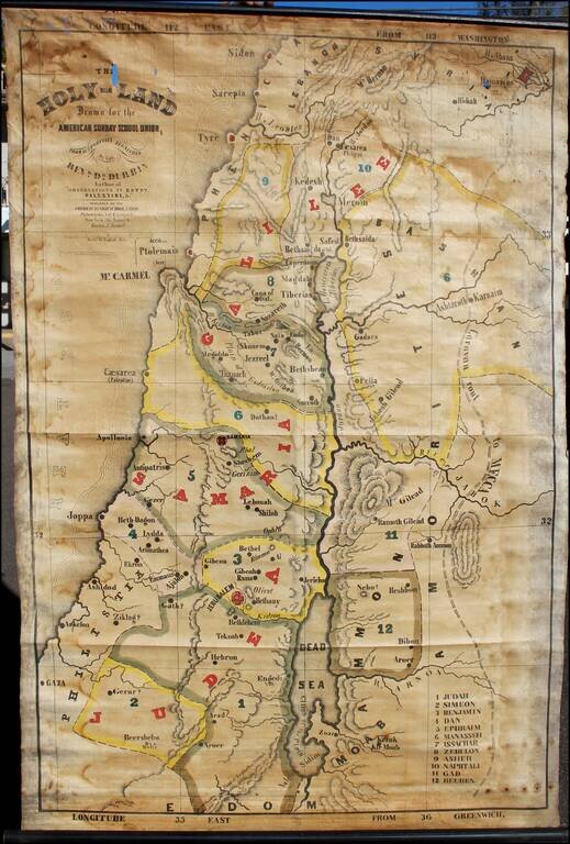
Interesting large format map of the Holy Land, printed on linen. Covers Palestine, western Jordan, and Damascus region. Relief shown by shading. "Entered according to Act of Congress in the year 1846 by the American Sunday-School Union ......
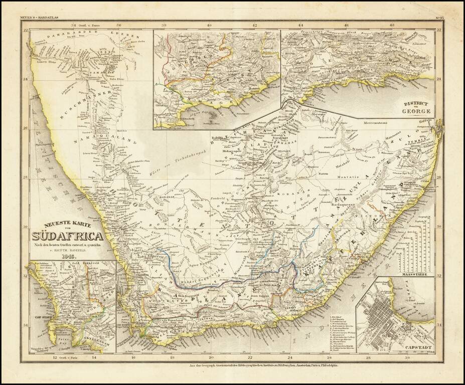
Detailed regional map of South Africa, with 4 inset maps. From Meyer's Hand Atlas. Extremely detailed regional map. A marvelous example of the fine, precise German engraving style of the mid-19th Century.
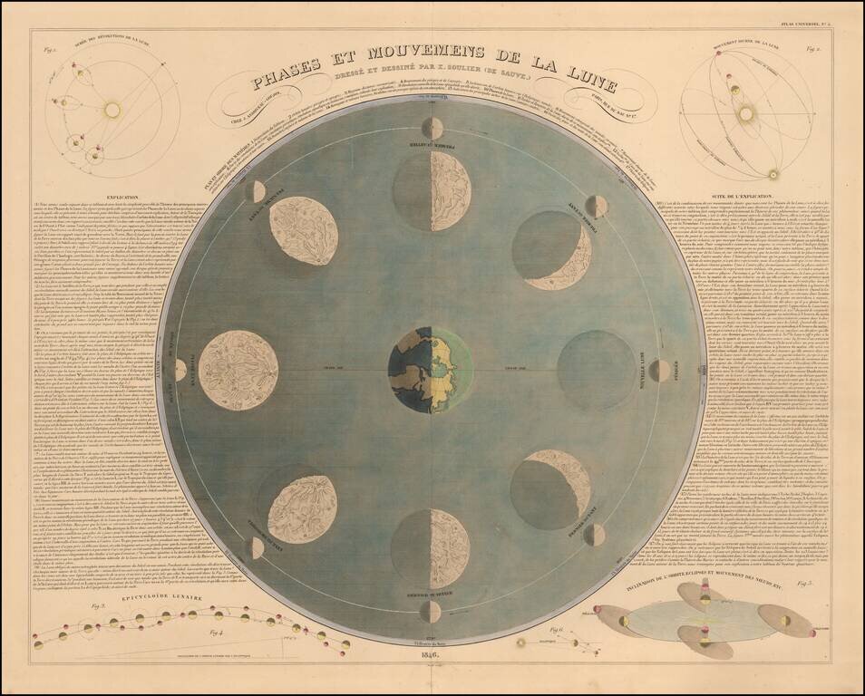
Nice example of this highly decorative chart showing the 8 phases of the moon as it orbits the earth, with 6 smaller diagrams showing various Lunar phenomena. A wonderful decorative large celestial diagram. Only Andriveau-Goujon, among his...