
Unique Stencil Color Example of Morse & Breese's Cerographic Atlas of the United States, bound with Morse's Cerographic Bible Atlas. The Cerographic Atlas of the United States was the first printed atlas to employ the use of cerography, a printing...
![[French Composite Sea Atlas Focusing on Colonization in Southeast Asia]](/map/small/68228.jpg)
Composite Atlas of French Sea Charts Chronicling Jean-Baptiste Cecille’s Attempts to Extend the French Empire in Asia. 35 engraved or lithographed charts mounted on tabs, all but one double-page. Large folio (26x20 inches). Contemporary...
![Etats-Unis par Th. Duvotenay…1843 [Republic of Texas]](/map/small/67926.jpg)
The United States & Republic of Texas on the Eve of the Mexican War Charming map of the United States and the Republic of Texas. Includes a fascinating depiction of the United States' Western Territories, including Oregon District, Mandanes...
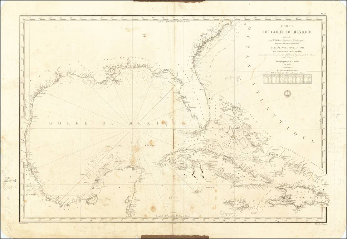
A Well Used Sea Chart of Florida, Gulf Coast and the Caribbean French Sea Chart of Florida, the Gulf Coast, Mexico, Yucatan, the Bahamas, Cuba and the western Caribbean, published in Paris in 1843. The chart was used as sea, with what appears to be a...
![Mexique par Th. Duvotenay…1843 [Republic of Texas]](/map/small/67925.jpg)
Detailed map of Texas, Upper California, the Plains and Mexico, published in Paris. The map prominently shows the Republic of Texas, a mythological Lake Teguayo and pre-Fremont Western United States. Western border of Texas includes an odd eastern...
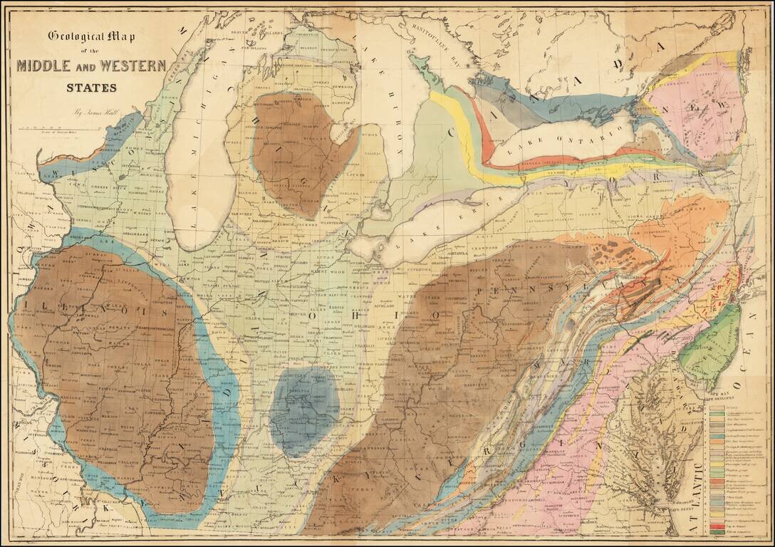
Finely executed geological lithograph map of the Midwest and contiguous regions, published by American geologist James Hall. The map is color coded by 23 geological formations for which there is a key in the lower right. Hall’s map is one of the...
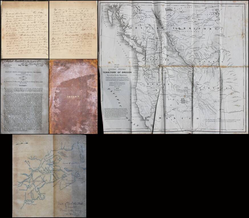
Interesting small archive relating to the Oregon Question, Involving Significant British and American Characters. The present offering consists of the following A letter from Sir George Augustus Wetherall (Deputy Adjutant General of Canada) to Sir...
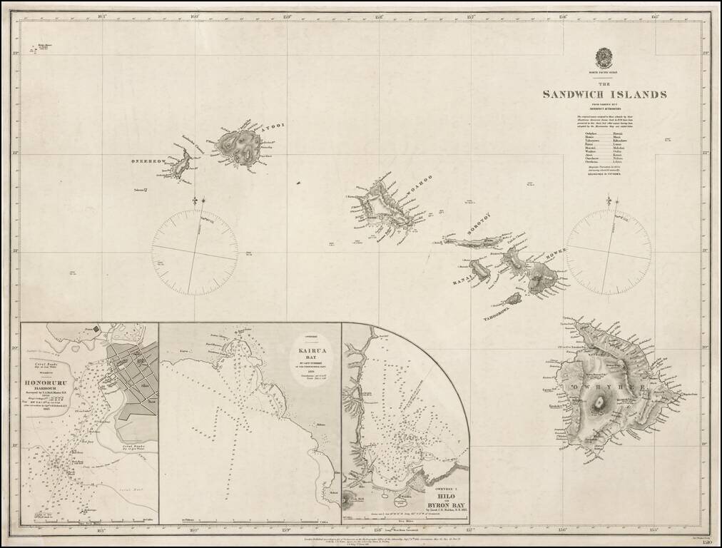
Highly Detailed and Scarce Admiralty Chart of Hawaii Fine, thorough chart of Hawaii first published in 1843 and revised to 1871. The present chart includes inset maps of "Hilo or Byron Bay" by C.R. Malden in 1825. It also includes Kairua Bay...
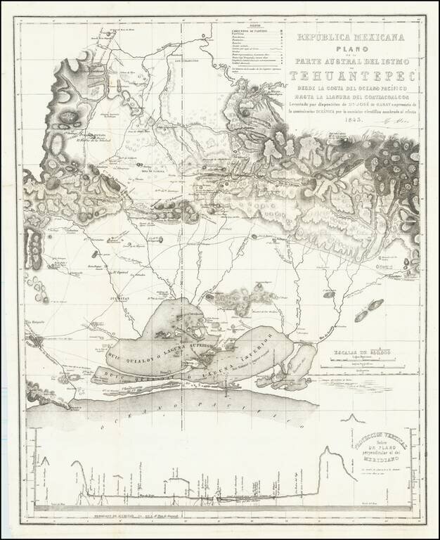
Rare map of the southern portion of the Isthmus of Tehuantepec, with Laguna Superior abutting the Pacific Ocean. At bottom is a profile showing elevations across the isthmus. The map is the result of the surveys undertaken by Don Jose de Garay,...
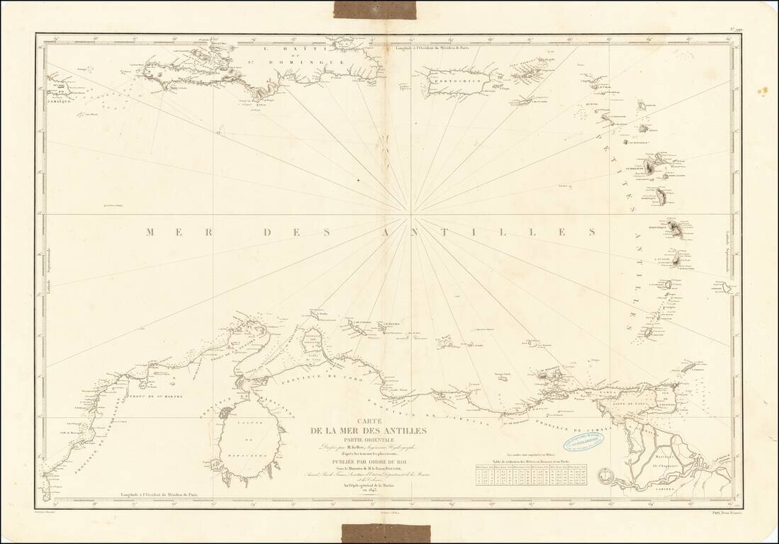
Chart of the Caribbean Used By French Navigator Nice example of the general Depot de la Marine sea chart of the Caribbean and coast of Venezuela, published in 1843. The chart extends from Jamaica and Santa Domingo to the Lesser Antilles, with Puerto...
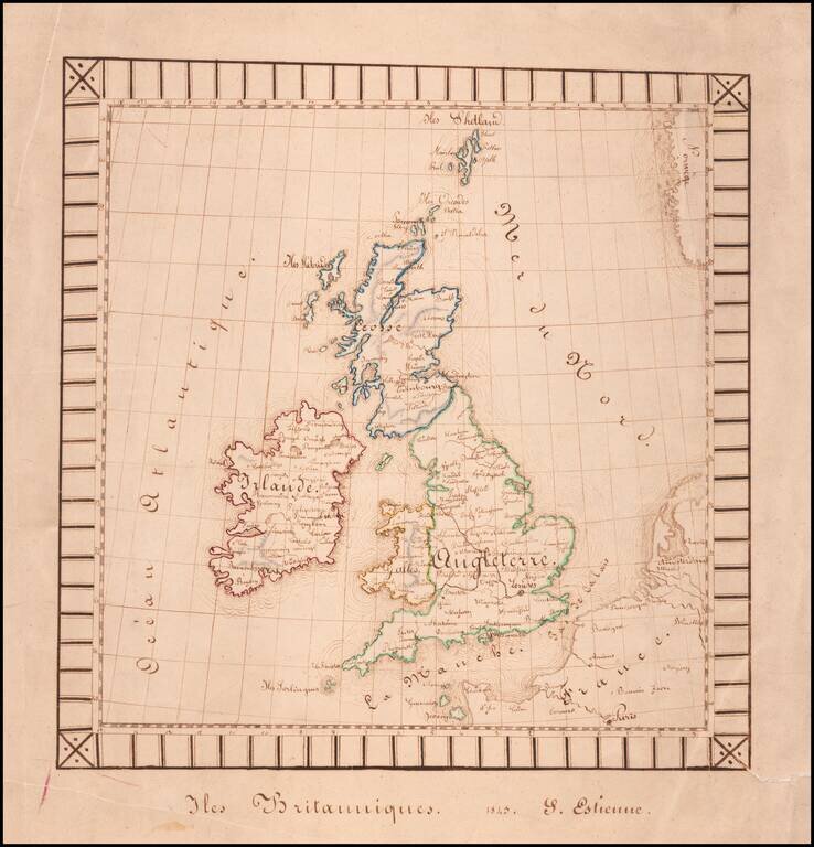
Finely executed hand drawn map of the British Isles by S(?) Estienne. The map was likely drawn by a school-aged child and is well executed for the period. The decorative border is unsual for a school project map.
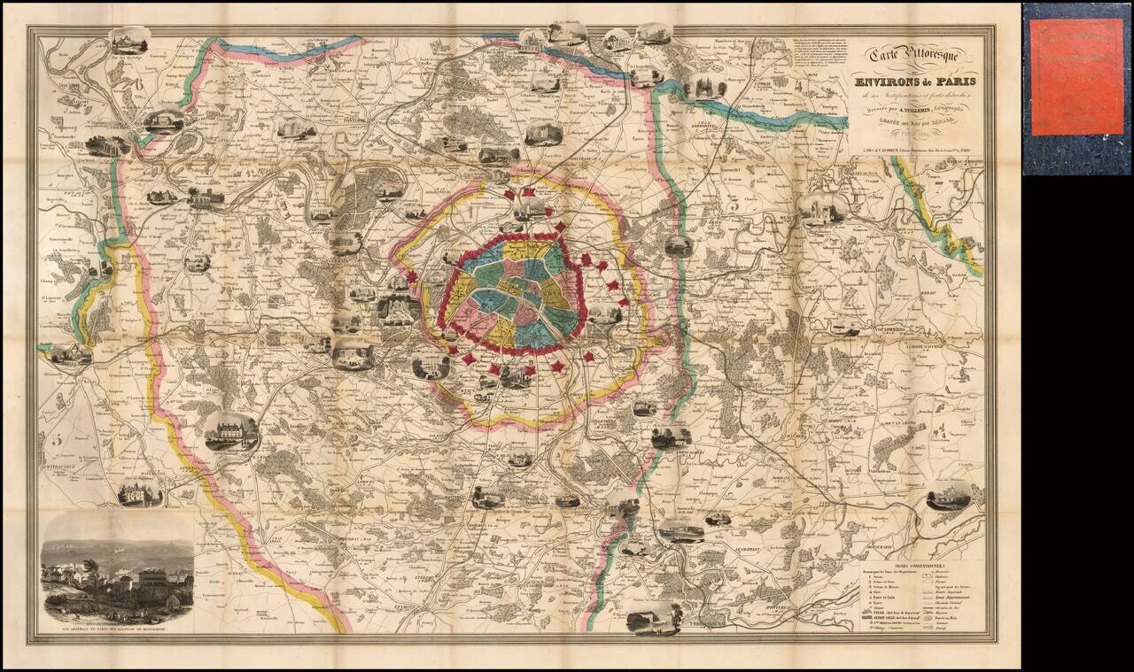
Fine decorative map of Paris and environs, embellished with a number of vignettes showing important landmarks around the City and beyond. Includes a key at the bottom, identifying hundreds of streets and second table locating important places within...
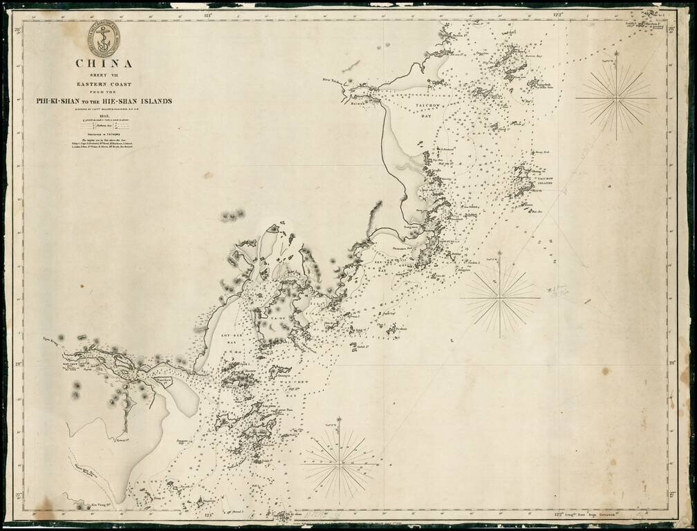
Rare early sea chart of the coast of China, from Taizhou to Wenzhou. Detailed chart, with extensive soundings and other sailing information. Includes pencil notes showing contemporary charting.
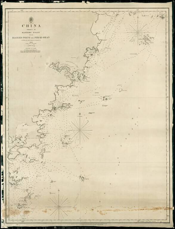
Rare early sea chart of China, showing the coast from Pingyang to Huangqiwan. Detailed chart, with extensive soundings and other sailing information. Includes pencil notes showing contemporary charting.
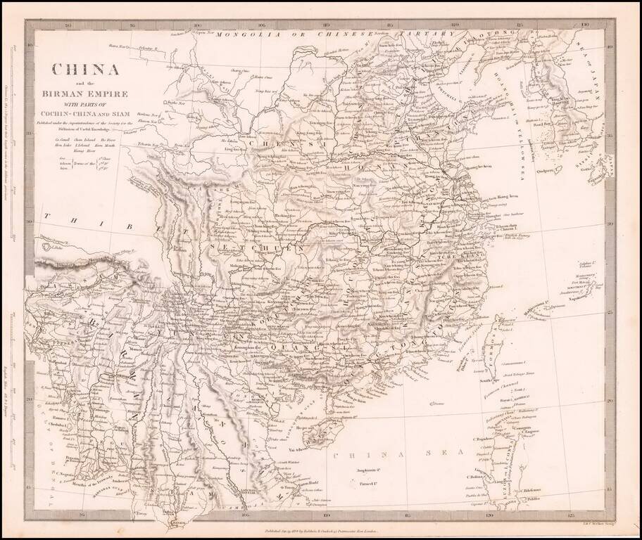
Detailed map of China, Formosa (Taiwan), Korea and the northern part of Southeast Asia. The Society for the Diffusion of Useful Information (SDUK) was created to provide the British public with reasonably priced printed information. The 2 volume atlas...
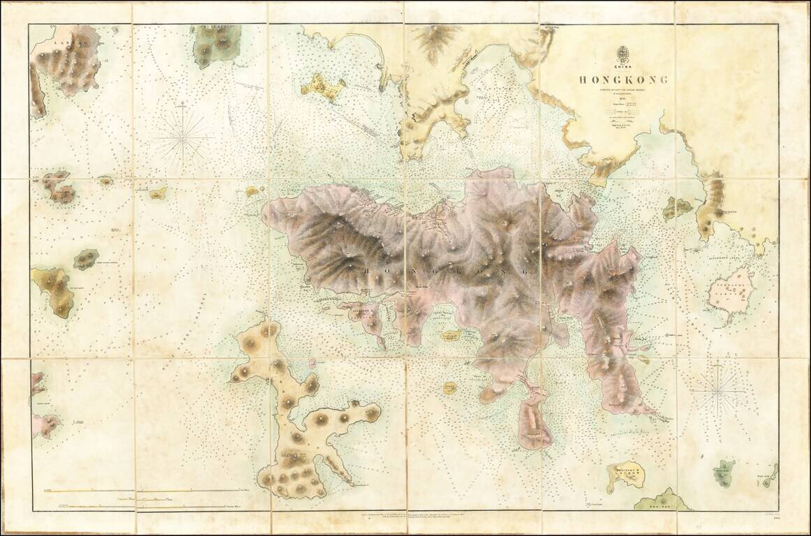
The First Printed Map of Hong Kong Early edition of the first printed map of Hong Kong, first published in 1843 by the British Admiralty Chart of Hong Kong, based upon the surveys of Sir Edward Belcher. Belcher's survey is the first large format map...